

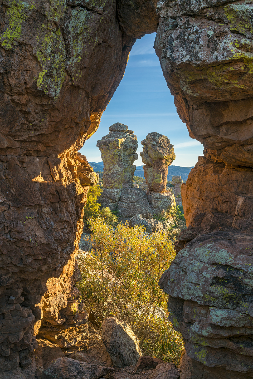
A rock arch frames Punch and Judy, two hoodoos that resemble a bickering couple, near the Heart of Rocks Loop. The loop itself is 7.3 miles in length, but some additional hiking on one of a few connector trails is required to reach it.
Laurence Parent
SONY ALPHA 7R II, 1/13 SEC, F/16, ISO 100, 40 MM LENS
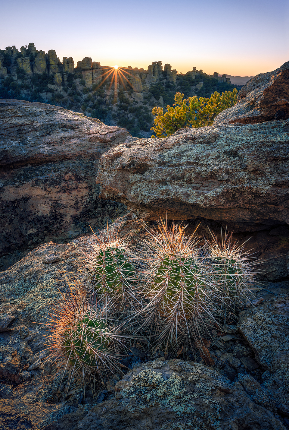
Rock pinnacles cradle the low sun as a hedgehog cactus grows in a crevice between volcanic rocks. The rhyolite at the monument formed in the aftermath of a volcanic eruption in the area some 27 million years ago.
Wayne Suggs
NIKON D850, 1/15 SEC, F/11, ISO 64, 20 MM LENS
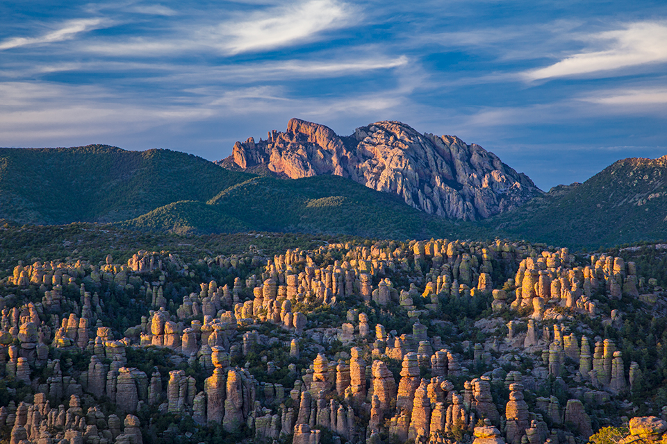
The day’s last light illuminates Cochise Head above a hillside of hoodoos in a view from the Heart of Rocks Loop. The formation is said to resemble a skyward-gazing Cochise, a Chiricahua Apache leader who played a key role in the Apache Wars of the 1800s.
Laurence Parent
CANON EOS 5D MARK II, 1/2 SEC, F/16, ISO 200, 105 MM LENS
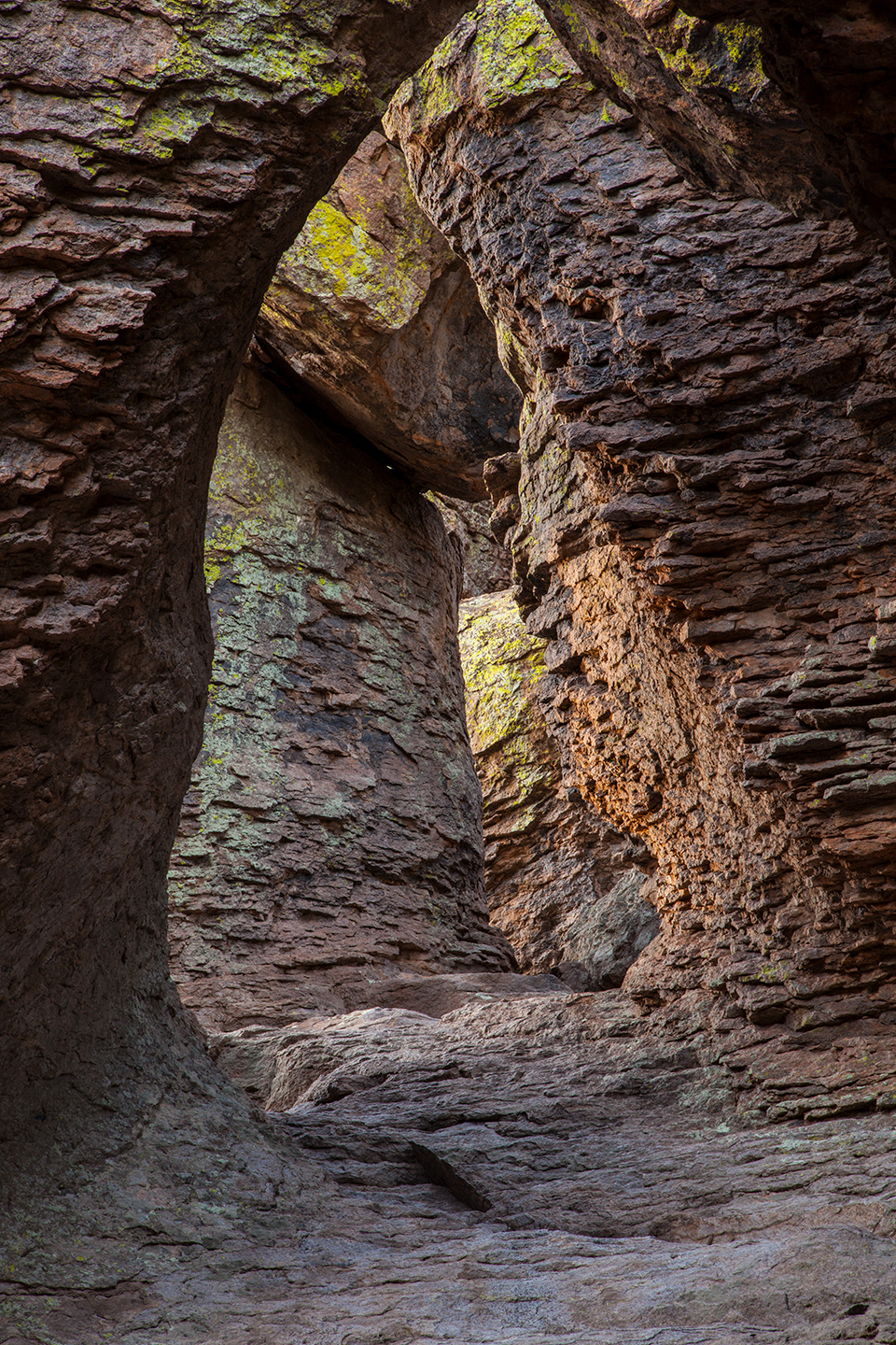
Hoodoos form a labyrinthine attraction known as the Grottoes along the Echo Canyon Loop. This short route, which consists of the Echo Canyon, Hailstone and Ed Riggs trails, is an excellent hike for first-time visitors to the monument.
Laurence Parent
CANON EOS 5D MARK II, 3.2 SEC, F/22, ISO 200, 92 MM LENS
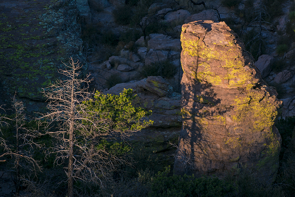
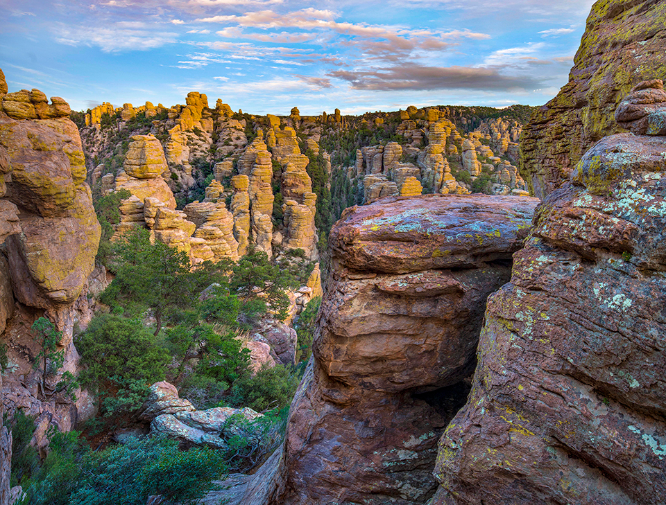
Evergreens cast their shadows on a lichen-stained pinnacle visible near Massai Point. This overlook is the endpoint of Bonita Canyon Drive, the main road into the monument.
Paul Gill
CANON EOS 5D MARK III, 1/80 SEC, F/11, ISO 400, 330 MM LENS
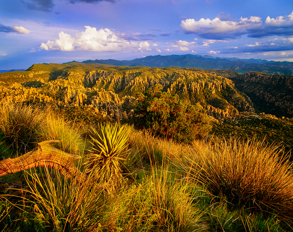
A yucca and tall grasses anchor a view of hoodoos and distant peaks from Sugarloaf Mountain. This 7,310-foot summit, accessible via a moderate hiking trail, is one of the highest points in the monument.
George H.H. Huey
PENTAX 6X7, FUJICHROME VELVIA, 2 SEC, F/22, ISO 50, 75 MM LENS
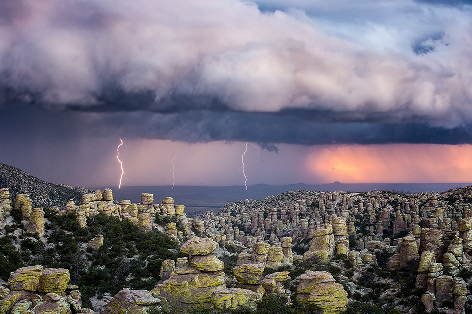
Lightning bolts from a monsoon storm strike the distant Sulphur Springs Valley, as seen from Massai Point. A short nature trail at the point is a good way to see the surrounding rock formations from different perspectives.
Sean Parker
CANON EOS 6D, 3.2 SEC, F/11, ISO 100, 70-200 MM LENS
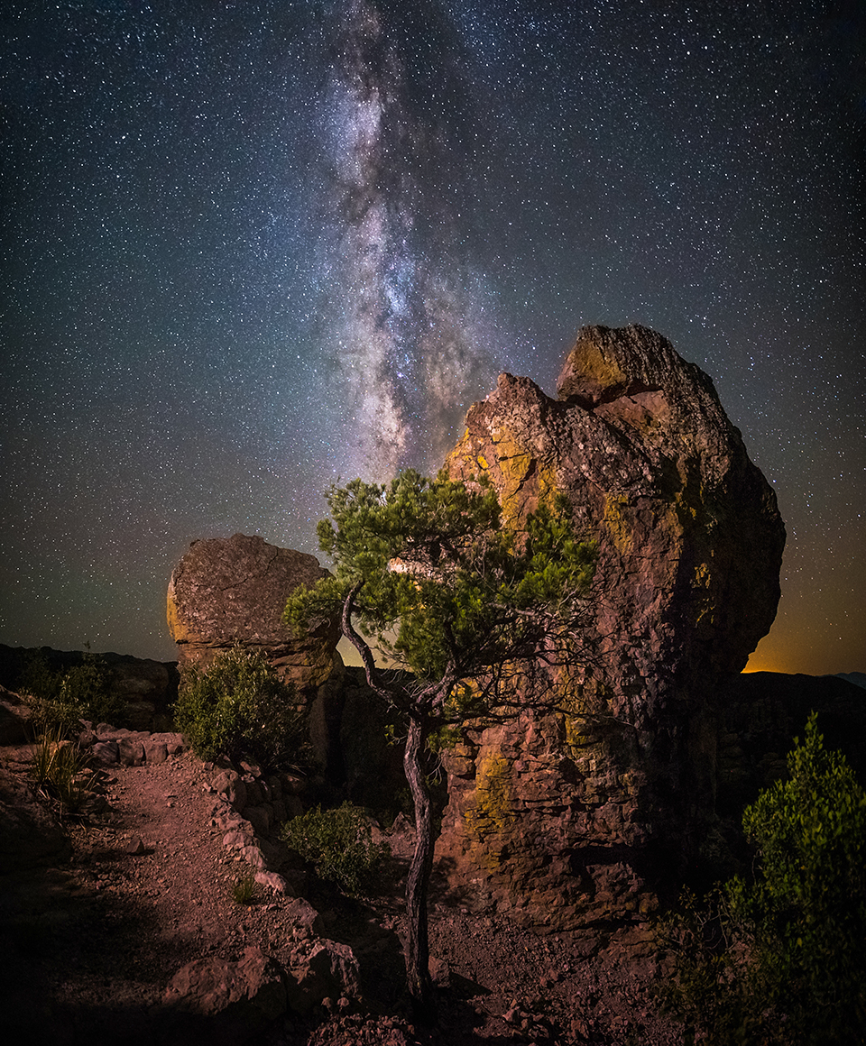
The Milky Way stretches across the night sky in another view from Massai Point. The paved road to the overlook is open 24 hours a day but sometimes closes due to inclement weather.
Sean Parker
SONY ALPHA 7S II, 20 SEC, F/2.8, ISO 12800, 15 MM LENS
Hoodoos congregate at sunset along the Echo Canyon Loop. A process known as frost wedging — in which water repeatedly fills cracks in rocks, then freezes and expands the cracks — played a vital role in sculpting these pinnacles.
Tim Fitzharris
SONY ALPHA 7R II, 0.4 SEC, F/11, ISO 80, 21 MM LENS
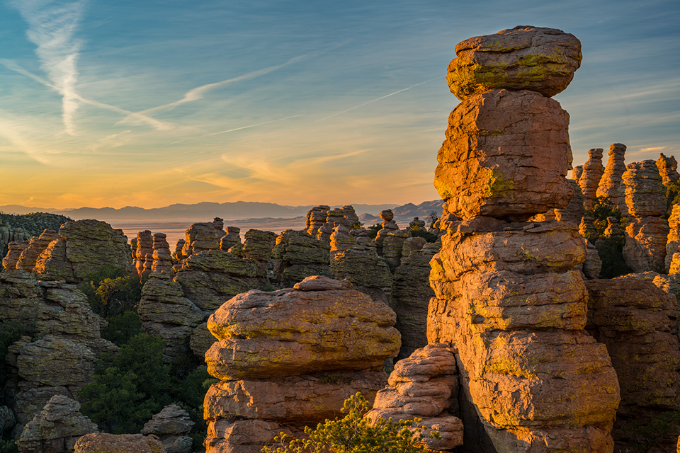
Rhyolite hoodoos reach toward a sky full of wispy clouds and the colors of sunset along Chiricahua National Monument’s Heart of Rocks Loop. This challenging hiking route offers views of some of the monument’s best-known rock formations.
Laurence Parent
SONY ALPHA 7R II, 1/5 SEC, F/16, ISO 100, 61 MM LENS