HIKE OF THE MONTH
Five Trails Reveal a Diversity of Trees at Hualapai Mountain Park
HUALAPAI MOUNTAIN PARK southeast of Kingman offers hikers five interconnecting trails within a 10-mile trail system. Mohave County established the park in 1937, and the Civilian Conservation Corps built the first cabins and trails. The trail system has been improved and expanded ever since. The Hualapai Mountains are as ancient as the rock formations found in the Inner Gorge of the Grand Canyon -1.7 billion years old. The summit is Hualapai Peak, elevation 8,417 feet.
The Hualapai Indians (their name translates as “pine tree folk”) considered the nuts of the single-leaf piñon pine common to the mountains to be an important food source. Eventually, the name of the people became the name of the mountains.
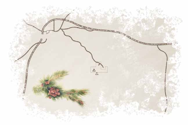
The trailhead for Hayden Peak South Trail, like all trails in the park, lies at the main trail junction, elevation 6,750 feet. On the trail system map available at the ranger station, this location is marked number 4, which corresponds to the trail information that comes with the map. The markers along the trail coincide with the map and information, so it's a good idea to have one with you. This is a strenuous hike, so you'll find a hiking stick a valuable companion. There are benches and storm shelters along the trail.
At location number 6 on the map, the Potato Patch Loop Trail junction, elevation 7,000 feet, take the right fork. This way leads south and up for a mile to the north end of the Potato Patch where Boy Scouts from the area hold a summer camp. The trail then leads down into the Potato Patch, which was a potato farm around 1910. This is a refreshing interlude before the challenging climb still ahead.
There is a choice to be made when the Hayden Peak South Trail meets the Hayden Peak West Trail. Mount Tipton Overlook, only .3 of a mile farther on the west trail, offers a view of Kingman and of Mount Tipton at the north end of the Cerbat Mountains, 40 miles away.
The Hayden Peak South Trail route yields the true reward less than a mile farther south. Soon you'll ascend through a narrow and shallow canyon that botanists call an interior riparian deciduous forest. A forest fire scorched this part of the mountains more than 50 years ago. Today, that scar has been replaced with pristine aspen trees, their thick, unmarred trunks as white as parchment. The ground is covered with ungrazed grasses and soft foliage called deer's ears.
The trail climbs out of that narrow glade to a wooden bench at Dinosaur Rock Overlook, elevation 8,050 feet, some 200 feet below the summit of Hayden Peak. On this southern exposure, chaparral, cliff rose and pincushion cacti have replaced the forest. In the distance, to the west, the Sacramento Valley lies next to the Black Mountains, and beyond them, sunlight reflects on the surface of the Colorado River, 60 miles away.
When you take this hike, think of Miss Selma Braem. A graduate of Stanford University, Miss Braem arrived in Kingman in the early 1920s to teach bookkeeping and shorthand at the high school. In her spare time, Miss Braem assembled one of the first and most extensive collections of the flora found in the Hualapai Mountains.
The hike is 5.5 miles round-trip, and takes three hours or so, depending on whether you attempt to locate and identify along the way the 23 species of trees found in the Hualapais. After all, Miss Selma Braem did. AH GETTING THERE: Take Exit 53 off Interstate 40 in Kingman and proceed south on Andy Devine Avenue for 2 miles. Turn left (east) onto Hualapai Mountain Road, and drive 11.2 miles to the Hualapai Mountain Park ranger station to pick up a trail map. For an alternate route from east of Kingman, take Exit 59 to Hualapai Mountain Road, and then drive east to the ranger station. Continue 2 miles south into the park, bearing right at every junction. There is ample parking below the trailhead.
TRAVEL ADVISORY: Early spring through late fall offers the best hiking conditions.
ADDITIONAL INFORMATION: Hualapai Mountain Park, (928) 757-3859.
Already a member? Login ».