BACK ROAD ADVENTURE
McNary to Vernon
History, scenery, cool summer breezes... this spectacular route through the White Mountains has it all, including the right amount of peace and quiet. See for yourself.
THE SOUND OF THE SAWMILL that echoed for 60 years through the small town of McNary is just a whisper of a memory the mill was closed more than two decades ago. The once-bustling community in the White Mountains is quiet, too, but it makes an ideal starting point for a journey through a vast forest where early Arizonans contributed to the state's lore. McNary, originally named Cooley, was notable in Arizona's history because much of its workforce was made up of blacks recruited from Louisiana when their employer, James McNary, bought the sawmill in 1925. Blacks, Mexicans, Indians and Anglos worked side by side felling and milling big logs. From the center of McNary on the Fort Apache Indian Reservation, I'm driving north toward Vernon, another small community, 18 miles down the road. No tribal permits are required to travel this stretch, and when I leave the reservation to enter the ApacheSitgreaves National Forests 5 miles later, there's no noticeable change, other than a solitary sign. Lush stands of aspens, oaks and ponderosa pines congregate among fields of black volcanic rocks. Apart from a half-mile of pavement on the reservation, this trip follows good dirt roads. The road unrolling before me, Forest Service Road 224, leads all the way to Vernon.
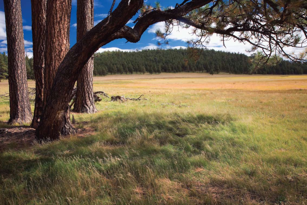
About 7 miles from McNary, signs announce Los Burros Campground to the right. This is a site that's well worth the 1-mile round-trip detour on Forest Service Road 20. Los Burros, built in 1909, sits on the edge of a spectacular, 240-acre meadow. The planksiding and shingle roofs of the two original ranger station buildings still standing show signs of age. Nonetheless, they've earned a listing on the National Register of Historic Places. The adjacent campground features no-charge campsites, tables, firepits and vault toilets, as well as access to the littleused Los Burros Trail, a 13-mile loop of moderate difficulty suitable for hikers, moun-
tain bikers and equestrians. Back on FR 224, I see the fire-lookout tower on Lake Mountain, some 500 feet higher than my 8,000-foot elevation at Los Burros. Until the tower was built in 1926, a ranger rode horseback to the mountaintop every day to check the surrounding forest for fires. This site, too, is listed on the National Register. Just beyond the Los Burros turnoff, a large meadow
Already a member? Login ».