Clifton-Springerville Forest Highway Through Apache National Reserve
Clifton-Springerville Forest Highway Through Apache National Reserve By C. G. MORRISON, Senior Engineer, Bureau of Public Roads
THE Clifton-Springerville forest road, Arizona's most eastern north and south thoroughfare, passes through one of the most scenic spots of the State. The completion of this road, through the Apache National Forest, enables the tourist on June 15 to motor north from Clifton, over the Blue Range of the White Mountains, to a connection with the National Old Trails highway at Springerville, a distance of about 124 miles of ever changing grandeur. The purpose of constructing this road was to develop the vast timber resources of the Apache National Forest and make the forest products available for use at the mines near Metcalf, Clifton and Morenci. It offers its help for the forest fire guards and makes accessible the delightful recreational grounds of the Blue and the Black Ranges of the White Mountains to the residents of the valleys of Southern Arizona and New Mexico. Another very important value is as a connecting link between the National Old Trails highway in Northern Arizona with the Borderland highway in Southern Arizona. This project was approved by the Federal Government in 1916 and the survey was begun April 1, 1917 under the supervision of Robert Stephenson, Chief of Party, and under the direction of O. N. Powell, Highway Engineer for the U. S. Bureau of Public Roads. On June 5, 1917, Mr. Stephenson was relieved by Chief of Party H. H. Mac Pherson, who remained in charge of the location survey until its completion Oct. 29, 1917. The total length of this location was 95.74 miles. Later a relo cation was made between Hannagan Meadows Ranger Station and the Village of Alpine in the fall of 1922 by W. R. Stevens, under the supervision of D. G. Evans, Chief Locator of the Bureau of Public Roads office at Phoenix. The change was made due to the county authorities of Apache county advocating a more open road by way of Tutt's Cienega, Coleman creek and direct into Alpine instead of the original route across Beaver creek and over Middle mountain at a higher elevation. This change was 25.26 miles long, while the former line was 31.1 miles in length.
A SCENIC SPOT ON THE NEW HIGHWAY ARIZONA HIGHWAYS COUNTRY OFFERS DIFFICULTIES
At that time, there was no road going north after leaving Metcalf and the only means of travel at that time between Clifton and Springerville was by pack trail up the San Francisco river to the mouth of the Blue river, thence up the Blue river to Alpine. This trail followed the bed of the river through a box canyon for nearly twenty miles and the topography of the country offered such difficulties of construction that the route was eliminated early in the preliminary investigation, therefore, the country traversed by the survey could be reached by pack trail only.
Project agreements were entered into between Greenlee and Apache counties and the Federal government for the survey, design and construction of this route, but they covered no condition as to the grade, curvature and width, however, the estimate was started on a 14-foot roadway and after review of the cost of the first section the width was changed to a 10-foot roadway where it remained.
An effort was made to hold to a minimum curvature of 100 foot radius on the outside curves and 50-foot radius on the inside curves, however, owing to the rugged nature of the country, it was necessary to reduce the minimum limits a few feet in some cases to avoid excessive excavation. Also, it was desired to use at least 30 feet of tangent between curves but in many cases the slopes were so steep that it was necessary to use reverse curves. Mr. Powell prescribed a maximum grade of eight per cent toward Springerville and five per cent toward Clifton, it being presumed that the heavily loaded traffic would be toward Clifton. The type of road was earth construction throughout and the cross-sections adopted for ten feet of clear roadway plus a two-foot ditch in sidehill, ten feet clear roadway plus two foot ditch on both sides in the through cuts and sixteen feet clear roadway on through fills. Later it has been found that the earth roads remained impassable so long that twenty miles of roadway has been surfaced with crushed rock.
The road was built with co-operative funds from the counties of Greenlee and Apache and the Federal Government. Greenlee county began construction at Metcalf, 7 miles north of Clifton, in April, 1919 and completed its 33.46 mile section, December, 1921. The Bureau of Public Roads called for bids on the next 44.4 miles immediately upon completion of this section and Contractors Cotey and Black began work April 5, 1922. The question came up as to letting this work in sections but the project passed through an absolutely undeveloped section of Arizona. The District Engineer Stating that there was not even a horse trail paralleling or approaching the vicinity of this project. The proposition was comparable to a tunnel and the contractors had to use that portion constructed as a lead to the remaining portion constructed. The contractors ended their section, 31.18 miles, of construction
MAY, 1926
tion Nov. 27, 1925, at Hannagan Meadows. Extension of time was granted them because the quantities removed greatly exceeded the original estimate due to extensive line revisions and on account of the contractors' difficulty in retaining a large force of men in the isolated district of the project and also due to the unsatisfactory weather conditions at the high elevations attained by the road.
APACHE PROTESTS
Under the terms of the Co-operative Agreements, Apache county was to start construction on the north end ninety days after the completion of the Cooperators' project in Greenlee county. However, under date of March 15, 1922, the Board of Supervisors of Apache county made a formal protest against constructing the Apache county section on the survey of 1917. Their arguments for a change, as above stated, by way of Tutt's Cienega and Coleman creek, were that the route would be shorter by five miles, the relocation would be open for winter traffic while the surveyed lina passing over Middle mountain would be blocked by snow; further the village of
ARIZONA HIGHWAYS
Alpine would not be on the highway unless the change was made and by the agreement signed by the Board April 19, 1917, it stated that the northern terminus would be Alpine.
The change in location was made in 1922, and with funds available from Apache county and the Forest Service, bids were called for and the Bureau of Public Roads awarded the construction work between Alpine and the Greenlee Apache county line to Contractor W. M. Tenney, Jr. Work on this 7.51 mile section was begun Aug. 28, 1923, and completed Oct. 19, 1924. The construction on the remaining 17.75 miles between the county line and Hannagan Meadows was begun Nov. 6, 1924, by Contractors Tenney and Hamblin and will be completed this month.
SURFACING PLACED
Five miles of additional surfacing will be placed on the road during 1926. Contractor Hoopes placed surfacing on seventeen miles in the summer of 1925.
Briefly stated, the total cost of the Clifton-Springerville project, 89.9 miles long, beginning at Metcalf and ending at Alpine, on the completion of this season's work will amount to $905,709.41. Maintenance will be under supervision of the Bureau of Public Roads for the next two years starting July 1, 1926. The maintenance of the project for the two years after completion of construction will enable the Bureau to detect and remedy such weaknesses in construction as inevitably develop after a project is put in use, and will make it possible to turn over to the counties of Greenlee and Apache at the end of this maintenance period, a project that can be maintained at a reasonable sum. In fact, the Bureau of Public roads and Forest Service have recognized the merits of the two-year Federal Maintenance feature. Money for this work comes out of the Forest Highway and Forest Development funds.
13
at Alpine, on the completion of this season's work will amount to $905,709.41. Maintenance will be under supervision of the Bureau of Public Roads for the next two years starting July 1, 1926. The maintenance of the project for the two years after completion of construction will enable the Bureau to detect and remedy such weaknesses in construction as inevitably develop after a project is put in use, and will make it possible to turn over to the counties of Greenlee and Apache at the end of this maintenance period, a project that can be maintained at a reasonable sum. In fact, the Bureau of Public roads and Forest Service have recognized the merits of the two-year Federal Maintenance feature. Money for this work comes out of the Forest Highway and Forest Development funds.
At various times, this route has been logged by the motorist, but the traveler must not fail to note the coloring of Chase Creek canyon as he departs north from Clifton, the magnitude of scenery from Grey's Peak and Rose Peak and (Continued on page 23)
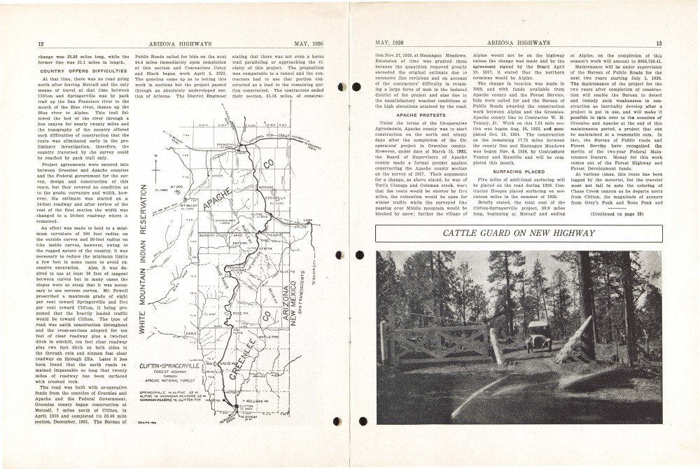
CATTLE GUARD ON NEW HIGHWAY
Already a member? Login ».