Greenlee Roundup
Continued from page 12 One of Clifton's best-known reminders of the past is its famous old jail. Surely this must have been one of the most unusual of all the West's old hoosegows. It is no longer in use but is kept open for the benefit of tourists.
Its two rooms were blasted from a solid rock wall with a resulting security that would have been envied by San Quentin. Upon its completion its ingenious creator was highly impressed with himself as the world's greatest jail builder. He shot up the town in his exuberance which promptly earned him another distinction; he became the first inmate of the new jail!
Clifton is situated along the banks of the San Francisco River (called locally "the Frisco"). Northeast of Clifton the river has cut an imposing canyon. This will someday be the route followed by a portion of the Coronado Trail. The realignment, necessitated by future copper mining operations, will open a new scenic bonanza to its travelers. However, this project is not likely to be completed soon, and the canyon remains one of Greenlee's seldom experienced scenic thrills. The present Frisco Canyon Road is reached from Clifton via Frisco Street and follows the river upstream for many miles. The venturesome driver who would travel the full length of the canyon must be prepared to ford the "Frisco" over fifty times. This is a feat not recommended for passenger cars.
Fortunately the first four miles of this exquisite canyon are easily passable. The only river crossing has recently been built up, and the graveled roadway is normally high and dry.
Just east of the crossing is a swinging footbridge whose convenient aerial pathway over the river can be used even during periods of exceptionally high water.
The canyon road traverses some of the most beautiful miles in Greenlee. The waters of the San Francisco, always within a camera's easy view, hurry past soaring, sculptured cliffs and red-tinged buttes. Occasionally the river pauses long enough, from its haste to keep its eventual appointment with the Gila, to form excellent fishing holes. These are well-known and appreciated by the area's anglers.
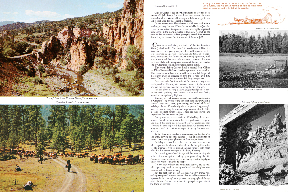
Far up canyon, several ancient cliff dwellings have been found. It would seem obvious that their prehistoric occupants had a most discerning eye for either beauty or protection, each of which the canyon provided in abundance. Or perhaps it was both a kind of primitive example of mixing business with pleasure.
Today there are a number of modern canyon dwellers who also enjoy carrying out their business that of raising cattle or crops amid the scenic pleasures of their canyon home.
Probably the most impressive time to view the canyon or take its portrait is when it is decked out in the golden robes of late afternoon with its rugged features brought into sharp relief by that master arranger of shadows, Evening. Its rippled, golden-hued image will be seen painting the surface of several quieter looking glass pools along the San Francisco, then breaking into a myriad of golden highlights where the water quickens its tempo.
It is not easy to leave this enchanting retreat, and its spell will linger long after its towering walls and peaceful glens have become only a distant memory.
But the next item on our Greenlee County agenda will make parting much sweeter sorrow. For we will visit now what is probably the country's most pronounced geographical change since Coronado's time, the mammoth open-pit copper mine at the town of Morenci.
Steeple Rock
An excellent viewpoint of the pit area is provided for visitors by the Phelps Dodge Corporation. From here can be seen one of the most amazing sights in Greenlee. It has been said concerning the county that "copper is king." And certainly this "home of the king" - an awesome mile-wide kaleidoscope of color is appropriately impressive. Its reclining circular wall, composed of fifty-foot terraces stacked over 1300 feet high, makes it resemble a vast stadium carelessly painted in shades of purple, pink, and lavender.
The pit's far-flung dimensions represent the space occupied by over 800,000,000 tons of ore and waste material that have been removed since stripping operations began in 1937.
Day by day, blast by blast, the process continues. And as the front edges of the terraces are individually removed the mine pushes with glacier-like slowness ever farther into its mountain of copper.
The average day's yield is about 140,000 tons of orebreaking rock. This is loaded by electric shovels into trains and diesel trucks that can be seen moving along the colorful ledges. These are full-size vehicles but appear almost toylike against the vast perspective of their environment.This gigantic operation produces annually over 100,000 tons of copper for the world; more than one million dollars in taxes for the state; and jobs for nearly 2000 of the 12,000 inhabitants of the county. It is certainly little wonder that "King Copper" is revered so highly.
Morenci's settlers took the high road, locating their town about 1200 feet higher than nearby Clifton.
As though not to be outdone by this municipal neighbor with its Frisco Canyon, Morenci is also the gateway to a very important link in Greenlee's amazing chain of scenic adventures, the canyon of Eagle Creek.
This is one of the least known of them all, which to me is astonishing. Only six easily traveled miles from Morenci, it offers a blending of scenic grandeur and undisturbed seclusion that is seldom found anywhere. And yet I have rarely met anyone outside Greenlee County who has even heard of it.
The gravel-surfaced Eagle Creek Road, while not marked as such, is easily located with the help of local directions. It leaves Morenci in an abrupt climb, and soon affords an outstanding view of the town, picturesquely distributed over the mountainous slopes nearest its great mine.
Like Clifton it had its roots in the rowdy days of the West, and many of its buildings still serve as historical reminders. A new and completely modern town, aptly named Plantsite, is being built nearby in an area that will provide more available space for future growth. This is the location of the new Phelps Dodge offices, and many of Morenci's businesses and residents are scheduled to relocate there.
Shortly after reaching the crest of the hill the road passes the old Morenci Cemetery. The years have been many since it was last used. And as though in tribute to early Morenci's settlers and miners buried here, the desert has decorated the graves with arrangements of cacti and wild flowers.
Before beginning its rapid descent to Eagle Creek the road treats us to an exceptionally colorful scene. Material from the Morenci mine has been spilled down a nearby mountainside creating a huge cone, strikingly colored with multi-hued streaks.
Frequently along the increasingly downward way to the canyon an endless silver caterpillar can be seen crawling over the sharp undulations of the extremely rugged terrain. This is the metal pipeline which carries water for Morenci smelter operations from its pumping station on Eagle Creek.
The road reaches the stream near the station, and from here Eagle Creek Canyon explorers must go on two feet instead of four wheels. Wet feet, that is, because the creek must be waded frequently. However, it represents more fun than difficulty, as shallow crossings can be easily found.
The rewards for this splashing progress, whether up or down canyon, may be reasonably described as out of this world. For the narrow canyon in its serene isolation between towering, buff-colored rhyolite walls is a world of its own. It is a scenic world of weathered stone monoliths, intriguing side canyons, flowered grottos, and the crystal waters of Eagle Creek. This is a combination that will fill the treasure chest of any camera prospector to overflowing.
The fisherman will also find it a worthy area, as blue catfish weighing up to fifteen pounds have been taken from the stream.
The creek received its name because several eagles' roosts were found in the canyon's high bluffs by army scouting expeditions which were frequently in this area in the early 1880's.
This was also the scene of at least one violent episode of the region's early history. Three deputy sheriffs, Jack Campbell, Albert Munguia, and Dutch Keppler, had been searching for
The Coronado Trail leaves the forests to wind along the canyon cliffs and the river route
A cattle rustler named Arviso. But Arviso was a treacherous quarry. He sent a messenger to tell them he had been seen staying in a cabin on Eagle Creek. At dawn the following morning they rode their horses into the narrow canyon where Arviso waited in ambush behind a large boulder. As they passed by he shot and killed Campbell and Munguia, taking the latter's horse for his escape into Mexico. Keppler was not killed, although he sustained a broken shoulder when thrown from his frightened runaway horse.
Along the Coronado Trail, beginning just north of Clifton, is the colorful canyon of Chase Creek, often referred to as the old mining district.
This unbelievably rugged piece of real estate is a repository not only of superlative scenery but many memories of the past as well. In the early 1870's gold and copper were discovered in the vicinity, and by 1910 the mining town of Metcalf supported a population of nearly 5,000. Now little more than a few decaying walls of adobe remains as mute testimony to a story of exhausted gold reserves and declining copper prices.
There is still some visual evidence of the old inclines whose tracks carried empty ore cars up to be filled at various mines in the mountains surrounding Metcalf. At least two of these, the Coronado and Shannon, claimed to be the steepest in the world.
One of Metcalf's early problems was the difficulty of transporting ore to the smelter eight miles away in Clifton. The wagons used for this purpose were never safe from marauding bands of Indians that plagued the area.
This helped lead to the construction of Arizona's first railroad. Its first locomotive was named "Little Emma." And after its components were brought six hundred miles by oxen from La Junta, Colorado, in 1878, it began its ore hauling duties over the 20-inch narrow gauge track along Chase Creek.
Today, in honor of her historical service, she is on permanent display at the Heard Museum in Phoenix. Her bell has been retained and may be seen in the town hall.
One of the unique features of Chase Creek Canyon is its green mineral-colored pools held in a number of deep rock depressions. Looking like flawless emeralds cleverly displayed against the jagged-textured background, they are very remindful in color of many of the world-famous lakes of Western Canada.
In places even the flowing creek has been given a mineralized beauty treatment that has transformed it into a stream of liquid turquoise. Actually, this effect is created by a soft precipitate deposited on the rocks and bed of the creek, but the result is striking to the eye and never fails to amaze first-time visitors.
Incidentally, this canyon is the almost inevitable course followed by smelter smoke from Morenci in the afternoon. So if you wish to see or photograph it at its best, morning is definitely the recommended time.
Another interesting area north of Clifton is Mulligan Peak in Limestone Canyon. Here nature has provided rock collectors with one of their richest legacies, an agate bed which is among the largest ever to be discovered. Of course she has been generous throughout the county, and many other peaks, canyons, and mesas contain unusual quantities of precious stones.
Beyond Metcalf the Trail starts us up its seldom-relenting climb to the top of the county. Passing at first through a reddishhued region dotted with junipers and oaks, it soon reaches the first of the pines.
Shortly after entering the Apache National Forest we come to Granville, a recreation area with picnic tables and campsites provided by the U. S. Forest Service.
At one time Granville was the site of a small community that owed its existence partly to its own mines and partly to the mines at Metcalf for which Granville residents cut and supplied timbers. Also, its blacksmith shop provided a handy shoeing station for the ore-pulling teams which passed this way.
Farther north, at the 6000 foot level, is the Juan Miller Campground, another fine Trail-side camping and picnicking area. A mile or so beyond, some twenty miles from Clifton, is our turnoff to Honeymoon Recreation Area on Upper Eagle Creek, twenty-four miles to the northwest.
This country is not of the spectacular breed we have found on previous off-Trail ventures. But the trip is enjoyable.
The Valley of Upper Eagle Creek is reached after a steady descent of several miles. Here the countryside is generally flat or rolling, being eventually circumscribed by a more mountainous terrain.
This is excellent cattle-raising territory, and the white faces of the Herefords are seen often throughout the trip.
At times, when conditions are favorably inclined, the valley unrolls exquisite yellow-flowered carpets for its visitors. These are so plentiful and bright in places that they look like a shimmering golden mirage reaching for the far horizon.
Because of its remoteness, Honeymoon is among the least used of the Apache National Forest's recreation sites. This fact is attested to by the green center stripe of grass which grows confidently in the middle of the road where it nears its terminus at Honeymoon.
This very remoteness is part of its charm, however. Uncrowded and peaceful, it invites us to camp or just relax under wide-spreading sycamores, where the music of softly rustling leaves blends with the murmur of Upper Eagle Creek in a soothing background harmony.
But this is no place of relaxation for the fisherman. Eagle Creek and its population of rainbows are too inviting. The water is cold, and the trout are spoiling for a good fight.
The reason for Honeymoon's unusual name is attributed to a young forest ranger, Johnny Wheatly, who once stayed with his bride in a nearby cabin.
Beyond the Honeymoon turnoff, U. S. 666 continues its upward inclinations. Using its greater heights to good advantage, it presents a series of increasingly far-reaching vistas.
At Rose Peak, an 8,550-foot-high vantage point, the Forest Service maintains a strategically located lookout tower. Its excellent construction and facilities qualify it as one of the finest in the country. And the view it affords of the endless succession of mountain ranges frozen waves in a pine-green sea is superb.
Several miles farther and 1000 feet higher, after a last switchbacking, upward surge, the Trail reaches the Mogollon Rim. This great state-dividing escarpment, upon whose broad shoulders rest the White Mountains, includes the northernmost portion of Greenlee County.
At Blue Lookout Point there is a final, breathtaking view to the south of a tremendous stretch of country falling away rapidly into the blue-shrouded distance.
From here northward, at an average elevation of between 8000 and 9000 feet, the Trail penetrates Greenlee's beautifully forested highlands. These form an important part of Arizona's White Mountains. They also have the distinction of containing a significant portion of the nation's largest stand of Ponderosa pine.
Mixed in eye-pleasing proportions with the more dominant Ponderosas are white-barked aspens and decorative blue spruce. Here and there, preventing any possibility of treeful monotony, are flowerful grassy meadows which break irregularly into the otherwise uninterrupted forest. These are the natural dining areas for many of this vast woodland's creatures, and a sharp eye and quick camera will often catch them at mealtime.
In the fall, after Autumn's first frosty touch, the aspen groves become masses of flame, blazing brightly within the forest's dark furnace.
K. P. Cienega offers an ideal place to enjoy this country at its finest. It can be reached quickly by a short side road just north of Blue Lookout. This magnificent forest retreat features a huge meadow that is almost as popular with deer and wild turkeys as it is with campers and picnickers.
A few timber-lined miles up the Trail is Hannagan Meadow. On its green stage elk often make their appearance, receiving top billing over their lesser forest contemporaries in morning and evening wildlife shows that always seem to please their "tame-life" human spectators.
The area takes its name from Robert Hannagan, a New Mexico cattleman, who camped here during one summer in the middle 1880's.
Modern Trail followers can use any of several Forest Service campgrounds in the vicinity and also have available facilities provided by a service station and lodge.
A monument has been erected here as a reminder that construction of this section of U. S. 666 (dedicated in 1926) completed the nation's first ocean to ocean highway.
Beaverhead Lodge, near the county's northern boundary, is at an important crossroad. The competency of this statement might be challenged by the strictly accurate-minded, and I must concede that this actually is not a crossroad, but two separate roads which meet the highway from opposite points.
In regard to its importance, however, I refuse to budge. Oh, I'll admit that the flow of traffic over these unpaved byways is much closer to a trickle than a flood. But any intersection able to point one gravel finger toward Black River and another toward the fabulous canyon of the Blue is certainly in the highest rank of importance to Greenlee's scenic explorers, at least.
The road leads through fourteen miles of typical White Mountain Country, an esthetic blend of abrupt forested knolls and grass-covered valleys where cattle and deer share the good life along small clear-watered creeks.
At Buffalo Crossing trout can be caught in Greenlee's boundary line. Black River forms the natural border for the country's rounded northwest corner and is one of the finest stretches of trout-fishing water in the Whites. The stream combines beauty with sport and is as highly worthy of the camera as it is the rod and reel.
For fortunate stay-awhiles there are several campgrounds close by. This is a wonderful place to spend a day or a vacation, and each year many enthusiastic returnees choose the latter.
East of Beaverhead lies the Blue River Country, our final, delicious helping from Greenlee's overflowing kettle of scenery.
Shortly after leaving Beaverhead, at an elevation slightly over 8000 feet, the road really gets down to business. And I mean down! Being on a quick, altitude-reducing diet of steep grades and sharp curves, it manages to lose nearly 2500 feet in its twelve miles to the Blue. An along-the-way barometer of its success is the rapid pine-to-juniper-to-cottonwood change.
Many of the frequent turnouts offer exceptional views of a vast blue-hazed panorama of parading mountains interspersed with deep gullies and shallower valleys.
Blue River, heading in the Sierra Azul, or Blue Mountains, is a high born, lively watered stream justly deserving of its beautiful canyon home.
Trout thrive in great abundance in its fast-moving currents. However, some of its lazier lunkers prefer the quiet ponds created by those stream tranquilizers called beavers.
About six miles downstream from where our approach road encounters the river at Blue Crossing Campground is the small town of Blue. This remote canyon village must be one of the most unlikely sites in the country for a U. S. Post Office. But there, slot-in-door and flag proudly flying, it is.
Originally established in 1894 under the name of Whittum, it became "Blue" four years later. Its location in the canyon was changed several times in early years but has remained permanent since 1932.
Despite its early start, Blue was not the first human settlement in the valley. A number of ancient Indian cliff dwellings have been discovered, and there is evidence that several small pueblos existed in the valley floor.
More modern Indians, the Apaches, also had a hand in the valley's history, having participated in several bloody battles with early white settlers.
From Blue the canyon road will take us north along the river for about twelve miles. There it leaves the river, soon crossing into Apache County, where it eventually rejoins the Coronado Trail at Alpine.
These last scenically dramatic miles of Greenlee will not be soon forgotten. The landscape seems to have become a quick-change artist, with its red canyon walls, spire topped and deeply weathered, giving way abruptly at times to more valley-like grass and sagebrush areas.
In summer many of these become colorful wild flower palettes. The Blue Country's most prominent floral decorators are the tall-stemmed sunflowers which line the road in encasements of gold. And like a delegation of Greenlee County ambassadors, present in honor of our departure, they wave breezy goodbyes as we climb slowly from the canyon.
We have left much unseen in our county tour of inspection. But this was inevitable. For no matter how many times you come, you will always find something new, something unexpected in Greenlee County's "Land of Scenic Surprises."
Already a member? Login ».