Twelfth in a Series: The Hacienda of San Ignacio del Babocomari
CAVALCADE Twelfth in a Series of Historical Paintings by Bill Ahrendt THE HACIENDA OF SAN IGNACIO DEL BABOCOMARI
On the northern frontier of New Spain, in what is now southern Arizona, Spanish settlers of the 18th century were increasingly denied use of the land by Apache hit-and-run attacks. Cattle were stolen and ranchos were plundered. Years of bloody effort to crush the elusive marauders proved vain.
Then, in 1786, Bernardo de Galvez, viceroy in Mexico City, formulated a pragmatic Indian policy of peace toward the Apaches. The natives were to be treated kindly and encouraged to become dependent upon the Spanish for food rations and supplies. Although a vigorous campaign against nonconsenting Indians continued, by 1788 several Apache bands had offered peaceful behavior in exchange for meat, corn, tobacco, and alcohol. Plentiful supplies of the latter were deliberately calculated to weaken the native culture. The Galvez plan was successful, and the ensuing period of peace allowed the rancheros to develop impressive herds in this fertile region of New Spain.
In 1789 the Spanish military commander at Tubac, Don Nicolas de Erran, issued title to the first Spanish land grant in Arizona. Grants along the Santa Cruz River from Tucson south to today's international boundary were issued in the years that followed, and after Mexico achieved independence in 1821, the new government continued the practice, issuing grants elsewhere.
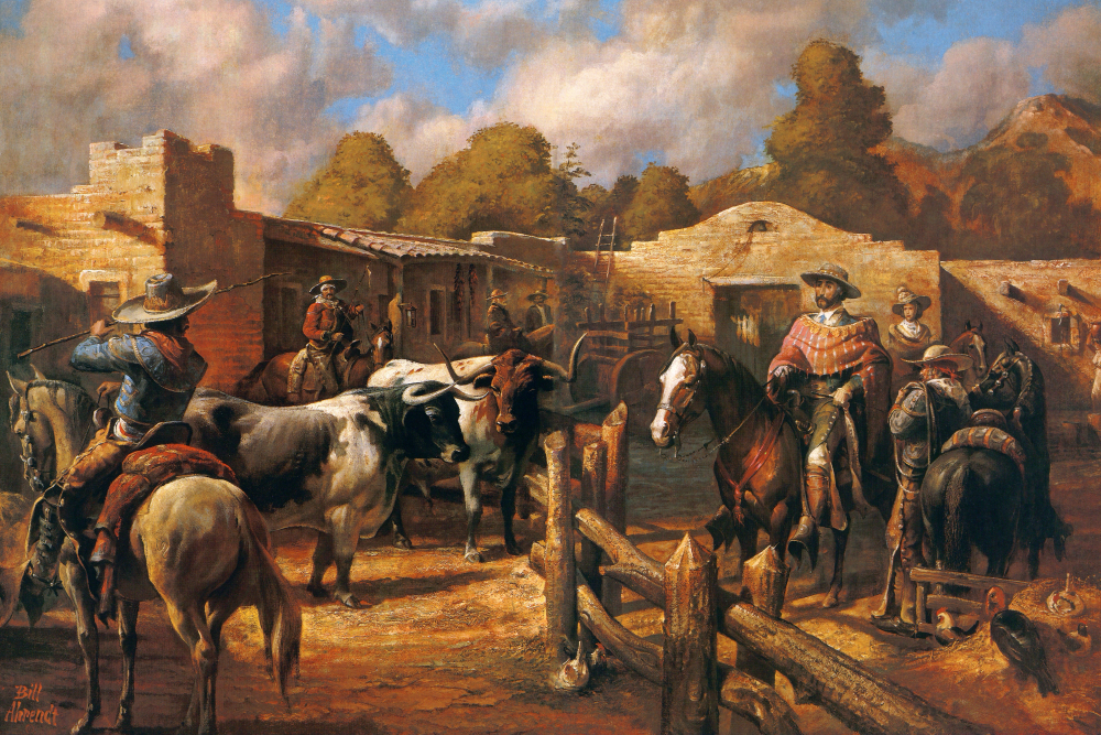
The largest of such Mexican land grants was San Ignacio del Babocomari. In 1832 Don Ignacio Elias Gonzalez and Doña Eulalia Elias Gonzalez established a hacienda atBabocomari and began raising both cattle and horses. The cattle herd grew steadily until the great estate was abandoned possibly as early as 1835-the result of a resurgence of Apache hostilities after Mexico City abandoned the policy of supplying rations to the Indians.
The Babocomari property extended more than 20 miles, reaching east and west from the boundary that today separates Santa Cruz and Cochise counties.
Situated at an elevation of about 4,000 feet, the area enjoyed good rainfall and a luxuriant growth of grass. Verdant willows and large cottonwood trees grew along the creek from which the land grant took its name.
A glimpse of the hacienda is found in the record of Capt. James H. Tevis, who camped at the old Babocomari ranch headquarters in the mid-1850s. He described adobe buildings covering about an acre of ground and encircled with a 15-foot wall. Lookout posts were located at the corners; a single entrance, which was large enough for wagons, led into the compound. Clearly it was designed as a fortress against marauding Apaches.
When, after the long interlude of peace, the Apaches again rose in rebellion, they attacked and plundered throughout northern Sonora. Some families held out for almost 20 years, but in the end, even fortress-like structures like those at Babocomari could not prevail. With several landowners killed, their vaqueros murdered, and their cattle driven off, the stubborn rancheros finally left their haciendas.
Already a member? Login ».