Greenlee County
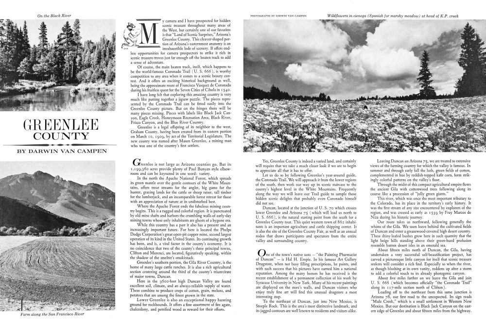
My camera and I have prospected for hidden scenic treasure throughout many areas of the West, but certainly one of our favorites is that "Land of Scenic Surprises," Arizona's Greenlee County. This cleaver-shaped portion of Arizona's easternmost anatomy is an inexhaustible lode of scenery. If offers endless opportunities for camera prospectors to strike it rich in scenic treasure-troves just far enough off the beaten track to add a sense of adventure. Of course, the main beaten track, itself, which happens to be the world-famous Coronado Trail (U. S. 666), is worthy competition to any area when it comes to a scenic beauty con test. And it offers an exciting historical background as well, being the approximate route of Francisco Vasquez de Coronado during his fruitless quest for the Seven Cities of Cibola in 1540.
I have long felt that exploring this amazing country is very much like putting together a jigsaw puzzle. The pieces represented by the Coronado Trail can be fitted easily into the Greenlee County picture. But on the fringes there will be many pieces missing. Pieces with labels like Black Jack Canyon, Eagle Creek, Honeymoon Recreation Area, Black River, Frisco Canyon, and the Blue River Country.
Greenlee is a legal offspring of its neighbor to the west, Graham County, having been created from its eastern portion on March 10, 1909, by act of the Territorial Legislature. The new county was named after Mason Greenlee, a mining man who was one of the country's first settlers.
Greenlee is not large as Arizona counties go. But its 1,199,360 acres provide plenty of Paul Bunyan style elbowroom and can be keynoted in one word: variety.
In the north the Apache National Forest, which spreads its green mantle over the gentle contours of the White Mountains, offers trout streams for the angler, big game for the hunter, grazing lands for the cattle or sheep raiser, tall timber for the lumberjack, and an incomparable forest retreat for those with an appreciation of nature at its undisturbed best.
Where the Apache Forest ends the fabulous mining country begins. This is a rugged and colorful region. It is punctuated by old mine shafts and harbors the crumbling walls of early-day mining towns whose only inhabitants are ghosts of a bygone era.
While this country has a past it also has a present and an increasingly important future. For here is located the Phelps Dodge Corporation's great open-pit copper mine, second largest operation of its kind in the United States. Its continuing growth has been, and is, a vital factor in the county's economy. It is no coincidence that two of the county's three principal towns, Clifton and Morenci, are located, figuratively speaking, within the shadow of the smelter's smokėstack.
Greenlee's southern portion, the Gila River Country, is the home of many large cattle ranches. It is also a rich agricultural section centering around the third of the county's triumvirate of major towns, Duncan.
Here in the 3600-foot high Duncan Valley are found excellent soil, climate, and an always-reliable supply of water. These combine to produce crops of cotton, grain, melons, and potatoes that are among the finest grown in the state.
Lower Greenlee is also an exceptional happy hunting ground for rockhounds. It offers a fine assortment of fire agate, chalcedony, and petrified wood as reward for their efforts.
Yes, Greenlee County is indeed a varied land, and certainly will require that we take a much closer look if we are to begin to appreciate all that it has to offer.
Let us do so by following Greenlee's year-around guide, the Coronado Trail. We will approach it from the lower regions of the south, then work our way up its scenic staircase to the county's highest level in the White Mountains. Frequently along the way we will leave our Trail guide to sample those hidden scenic delights that probably even Coronado himself did not see.
Duncan, located at the junction of U. S. 70 which crosses lower Greenlee and Arizona 75 (which will lead us north to U. S. 666), is the natural starting point from the south for a Greenlee County tour. This quiet western town of 862 inhabi tants is an important agriculture and cattle shipping center. It is also the site of the Greenlee County Fair, as well as an annual rodeo that draws participants and spectators from the entire valley and surrounding country.
One of the town's native sons "the Painting Pharmacist of Duncan" is Hal H. Empie. In his famous Art Gallery Drugstore, when not busy filling prescriptions, he paints, and with such success that his pictures have earned him a national reputation. Among the many honors he has received is the recent establishment of a permanent collection of his work by Syracuse University in New York. Many of his recent paintings are displayed on the store's walls, and Duncan visitors who enjoy truly fine art will find this unusual drugstore a most interesting stop.
To the northeast of Duncan, just into New Mexico, is Steeple Rock. This is the area's most distinctive landmark, and its jagged contours are well known to residents and visitors alike.
Leaving Duncan on Arizona 75, we are treated to extensive views of the farming country for which the valley is famous. In summer and through early fall the lush, green fields of cotton, complemented in hue by reddish-topped kafir corn, form strikingly colorful patterns on the valley's floor.
Through the midst of this compact agricultural empire flows the ancient Gila with cottonwood trees following along its course like a procession of "jolly green giants."
This river, which was once the most important tributary to the Colorado, has its place in the territory's early history. It was the first stream of any size encountered by explorers of the region, and was crossed as early as 1539 by Fray Marcos de Niza during his historic journey.
Our route takes us northward, following generally the whims of the Gila. We soon leave behind the cultivated fields of Duncan and enter a greasewood-covered high desert country. These shiny-leafed bushes grow here in such quantity that the light beige hills standing above their green-hued profusion resemble barren desert isles in an emerald sea.
About fifteen miles north of Duncan, the Gila, having undertaken a very successful self-beautification project, has carved a picturesque little canyon for itself that scenic treasure seekers will consider a rich find. Especially so when the river, as though blushing at its own vanity, reddens up after a storm to add a colorful touch to its already photogenic canyon.
About five miles farther on we leave the Gila and join U. S. 666 (which becomes officially "the Coronado Trail" along its 117-mile section north of Clifton).
Leading off to the northeast from this same junction is Arizona 78, our first road to the unexpected. Its sign reads "Mule Creek," which is a small settlement in Western New Mexico. But our destination is Black Jack Canyon on the eastern edge of Greenlee and about fifteen miles from the highway.
After a few miles of pavement the road reverts, in expected back country fashion, to gravel. However, it is well maintained and should cause no difficulty.
The road climbs through a series of foothills sprinkled with cacti and sometimes bright with wild flowers. Gradually a sweeping view begins to open up to the west. It becomes, with increasing altitude, a far-flung panorama obscured only by an occasional rocky formation.
Mountains blued with distance punctuate the far horizon. Off to the northwest a tiny, graceful white plume against the blue of the sky marks the location of the smelter smokestack at Morenci. Soon an obstructing range of mountains causes the road to climb more sharply. Very quickly Black Jack Canyon appears on the right, growing spectacularly deeper as the road contours its way along the northern rim. At one point a large hole blasted through a rock obstruction permits passage of the road. A short distance farther the summit is reached. Here is an excellent place to view this truly impressive gorge.
As you gaze into the rugged isolation of its depths you will find it easy to understand its choice as a hideout by Black Jack Ketchum. This famous Old-West desperado was responsible for the canyon's name. But even his near-perfect hideaway could not save him from justice. He was eventually caught, and hanged in Claypool, New Mexico, in 1901.
After returning to the highway we cross several deeply cut desert washes before reaching Clifton. The largest is called Rattlesnake Canyon, a most appropriate designation whether for its serpentine route through the hills or its abundance of rattle-tailed denizens.
Clifton, at an elevation of 3464 feet, is snuggled among the cliffs that gave it its name (a condensed version of "Cliff Town"). It is Greenlee's county seat and the picturesque home of 4191 residents.
The town's origin is traced to Bob Metcalf, an army scout who was with a party in pursuit of Apaches in 1870. Scouting alone, he discovered rich copper deposits which quickly led to establishment of the camp that became Clifton.
Today's version of this famous mining town is a considerably modernized residential and business community. It manages to retain, however, a distinctive flavor of the Old West.
Visitors, for example, can still drive down famous old Chase Creek, the narrow, saloon-lined main street of Clifton back in its rip-snortin' days of the 1880's and 1890's. It was known then as "the second wildest camp in the West."
And its wild ways continued well into the 1900's. Matt Danenhauer, who is the present comptroller of Greenlee County, recalls that as a young boy in about 1915 he would go downtown occasionally to his father's office on Chase Creek. He was under the strictest instructions to always walk down the middle of the street, which his father, who was police judge, considered much safer than passing through the rough crowds filling sidewalks outside the saloons.
Already a member? Login ».