
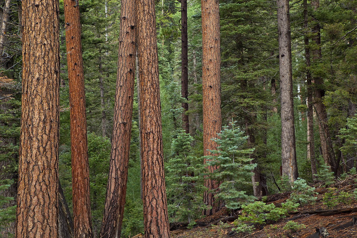
Remembering gives a place life. Think back to plum-colored storms in summer and the sound of thunder booming through the woods. Ferns uncurl around fallen grays of aspen trees. The bright whites of live aspens lead to leafy canopies that sound like running water when the wind blows. The sun-warmed bark of old, yellow-bellied ponderosa pines smells of honey and vanilla. It’s not the smell of desert. This is different country.
The average elevation in Arizona is about 4,000 feet, which is high-desert scrubland — the midrange. Above that stand the cooler, moister highlands leading to the highest point in the San Francisco Peaks, above Flagstaff, at 12,633 feet. In this greener upper zone, mushrooms come up through pine needle duff. Autumn sounds like whales singing in the distance, bull elk bugling across their herds.
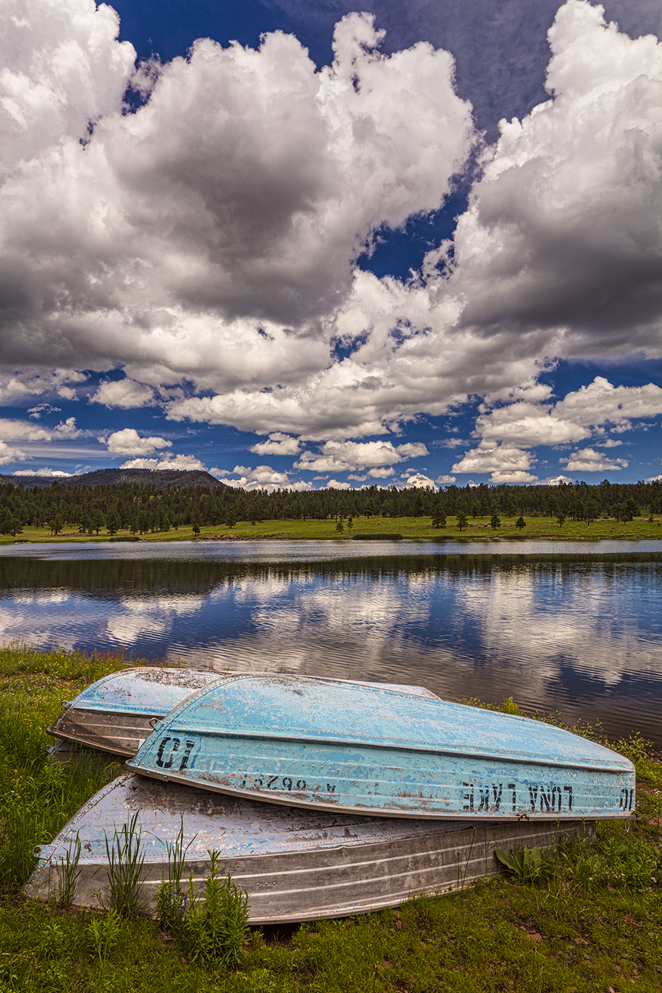
In the White Mountains near the New Mexico line, light bulbs once flashed for a sign in the shape of an arrow at the Luna Lake Bar. That was where you’d turn to get to where I lived the summer I was 9. It was 1976, and my mom had quit her job so we could move from the city into my grandparents’ kit log cabin near a nine-hole golf course where a ball knocked into the rough was as good as lost. The small kitchen that summer smelled thick with tart syrup, wild raspberries boiling into jam in big pots on the stove. I got a job swatting flies and collecting range balls at the Alpine Country Club down the road. Instead of walking the dirt road, which I remember as hot and dusty in the long weeks between rains, I took the woods and walked alone. Old, cut stumps became familiar as I picked up elk bones and flew them around like spaceships.
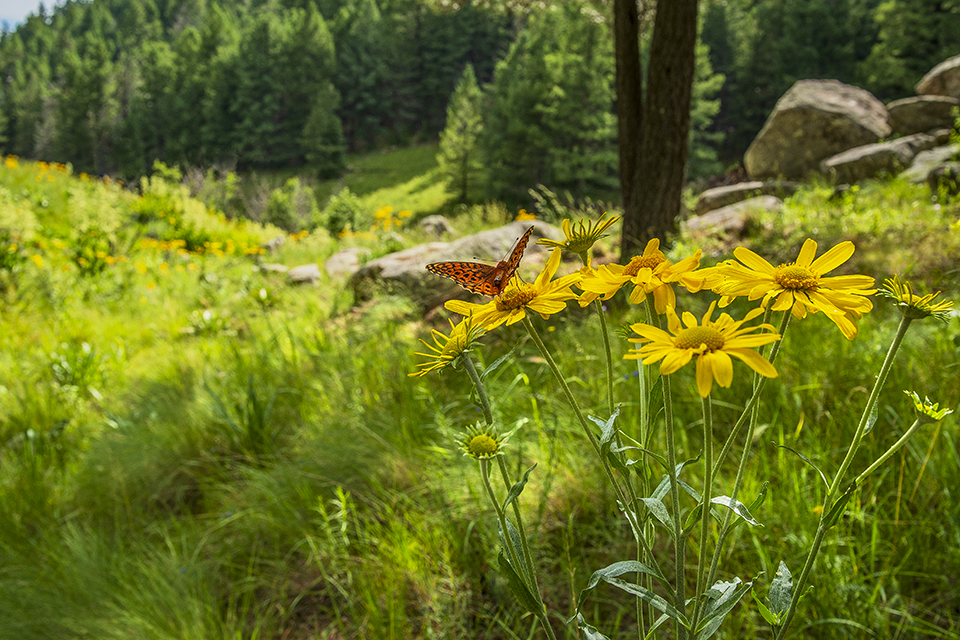
My mother would set up her painting easel in meadows, with colorful, astringent-smelling oils smeared on a board, canvas at eye level and murky turpentine in a glass jar. While she spent hours in a floppy sun hat, rendering abandoned barns in all their splintery decay, I found frogs and let garter snakes coil around my wrist. I came upon a pair of enormous elk antlers dropped side by side, and they felt like evidence of a God. This place had wild and powerful beings. I didn’t know bear scat from morels at that age, but I was viscerally aware of biomass and diversity. This place was alive. When we visited nearby Hannagan Meadow, an impression was made indelible: cool evening breeze, emerald grasses bending, air that smells like rain.
At the end of summer, we packed up and drove to Denver, where my mom had found a job. I remember her looking through the windshield as the sprawl of the city came into view; she had tears in her eyes. On weekends, she’d sell her art in malls in the suburbs where we lived, setting up a folding chair and waiting with all those paintings of high Arizona: old barns drowning in summer grass, pine shade, tiny creeks, tall white aspens with coal-black eyes. If you looked closely, you’d see these weren’t renditions of Colorado. The mountains here are gentler, and meadows roll like ocean waves.
Some of these forests spread across the state, from one horizon to the next. A fire lookout atop the Mogollon Rim sees nothing but green for a hundred miles or more, the canopy washing in and out of canyons, up the flanks of buttes and ridges. The only exceptions to the green, besides cliff bands and rimrock, are golden patches of beetle-killed trees and swaths left naked by wildfires.
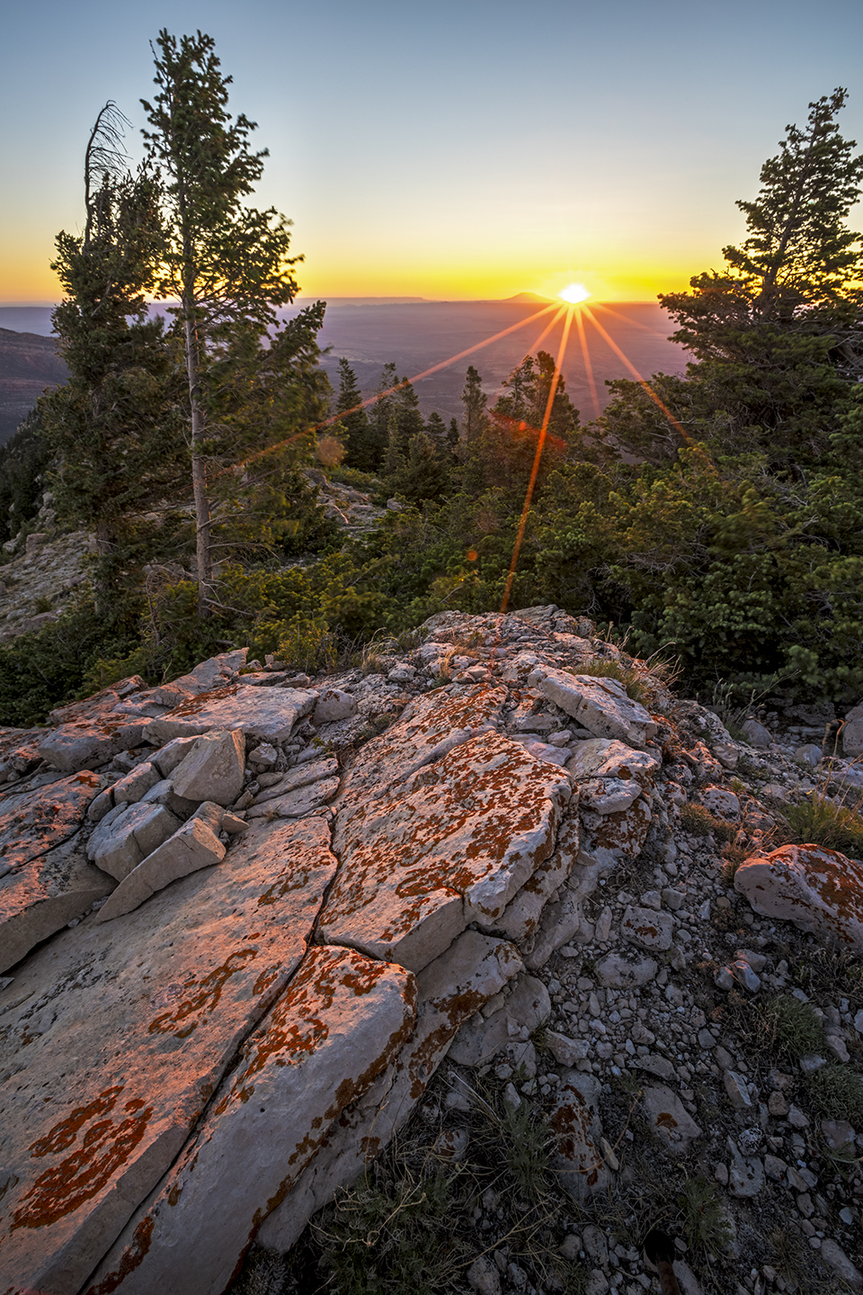
This is known as the Central Arizona Highlands, and it stretches about 300 miles from the town of Alpine — make that Luna Lake and the bar that once was there — through Sedona and Flagstaff to the tail end of the Grand Canyon. The climate cycle tends to consist of winter precipitation, spring drought, summer precipitation, fall drought. Some years it’s four seasons of drought, which has you waiting in the summer as if holding your breath for the sound of thunder and a softness to the air. Precipitation averages 20 inches a year around Alpine. (Phoenix, in contrast, gets 7.5.) When snow and rainfall are low, trees weaken, the beetles kill, and wildfires rise. That is also part of this place: resilience, adaptation and collapse. For more than half the year, the fire tower looks onto spouts of smoke that blow up like surfacing whales. A spotter aligns the circular map that takes up most of the windowed cab and sights across this green expanse where another fire has started.
In different parts of the state, high country comes in isolated patches perched atop lonely mountain ranges, and the desert blazes all around as if made of lava. At a high point in the Pinaleño Mountains of Southeastern Arizona, a fire tower stands just shy of 10,000 feet. Its windows look across not only the verdant Pinaleños, but also an expansive and arid country 7,000 feet below. These ranges look like tall people in a crowd, and on their heads they wear aspen groves and shrouds of evergreens. Water cascades in steep, silvery creeks, and from the fire tower these forests appear to flow down the slopes like rivers, adding color to the mustards and dun-colored bajadas in the desert below.
“Sky islands,” as these ranges are known, are genetic refuges. Plants, animals and mushrooms have been alone on each range long enough to have become their own endemic species: a kind of yucca, a tiny spring snail, a glistening dust-colored salamander. The Pinaleños have a red squirrel, Tamiasciurus hudsonicus grahamensis, that lives on no other mountain range or anywhere else in the world. It was left here when the most recent ice age retreated and was replaced by desert all around, which kept the squirrel from mating with any other squirrel of its kind. These squirrels live in the denser stands with higher seedfall on the ground, where they can dig holes and cache food. In the 1950s, this squirrel — called the Mount Graham red squirrel — was thought to be extinct, and then, 20 years later, a tiny surviving population was found — enough to hold the species at the edge of disappearance. Their numbers peaked between 500 and 600 in the 1990s, and now, after recent fires, they are an estimated 100 or 150 — not many for an island-dwelling species hanging by a thread.
An exchange of birds, plants and land animals through the highlands has been happening for more than a million years. Sky islands form genetic steppingstones for alpine species crossing from the Mexican Sierra Madre into Arizona and back. If something like the Mount Graham red squirrel were to reach another ice age and hurry across to the Central Arizona Highlands in the coolness, it’s a hop, skip and jump from there to the southern Rockies and points beyond. This is how living diversity happens, how ecosystems strengthen themselves, making this one of the vital organs of the Northern Hemisphere. These highlands are part of the continent’s breathing apparatus.
I got lost from my kids in one of these forests, a big one that goes to the horizon. The three of us were backpacking off trail on the Kaibab Plateau, above 8,000 feet in elevation near the North Rim of the Grand Canyon, and I got turned completely around. One of my kids was elementary age, 9 years old, and the other was in middle school. We were apart for a harrowing five hours until we found each other again and I smiled through tears to see them and they tripped over their words telling me what they’d seen and done, how the older would stop and read out loud from the book we’d been passing back and forth to keep the younger’s spirits up. They breathlessly told me about a beast they’d heard moving through the brush, which sounded like a bison.
I’d gone to scout our next route, mixed up which ridge I was following and failed to come back. If they’d been lost themselves, they knew to stay put, but I was the one who disappeared, so they did the right thing by backtracking to get help. I can’t speak for them, but I will not forget the panic of endless ponderosa pines and big rounds of old growth cut down a century ago and left behind because they were too big to haul out. I was crazy with worry, stripping raspberry brambles and stuffing clusters into my mouth. Constant thickets of thorny locust trees, native to the area, left my skin crisscrossed with blood streaks because half the time I was running.
This isn’t desert travel, not for someone accustomed to grand vistas and open skies where you can see where you’ll be at the end of each day. Woods in a state known for being parched and spare can be surprisingly crowded, trees covering the sky as if you’re walking through catacombs. You expect this in the East, where deciduous stands obscure the sun and the directions all look the same. Here it is alien, enchanting, easy to get turned around as if a wisp is calling your name.
This was a few miles, at most, from the North Rim, and it felt like being lost at sea. I kept thinking of the two of them walking the wrong way, slipping down into draws that grow steeper and darker, tangled with aspens and brooms of Douglas-fir. Those draws go deeper until the Canyon opens like an impossible stone mouth. But they wouldn’t go that way. They’d learned better, knowing to go back the way they came.
Finding each other again felt like a miracle. I made an arc of miles and got out ahead of them, flagged down a couple of drivers on a rutted four-wheel-drive road, and had them cruise back and forth until the kids popped out. I crumbled when I saw them, as if the forest had given my children back. We camped that night in our sleeping bags at the timbered edge of the Canyon. A brazen moon filled the slots and holes below. A strong wind blew all night, and the ponderosas roared as the cool, resinous air of pines plunged off the North Rim.
Years later, an experienced backpacker named Clifton Beck got off trail near the North Rim and missed the date he was due back. For five days he was lost until he appeared on a dirt road, torn up and parched. Nine ground crews, along with a helicopter and an airplane, had been looking for him. I happened to see him a week after he emerged and heard his account. He goes by Cliff, and he knows the Canyon well. I’d heard the news that he was lost in the vastness of the national park, but I didn’t know where. He was wearing shorts when I met him, and his legs were crosshatched with fresh red scabs. It looked as if he’d been attacked by house cats. “North Rim?” I asked. “Kaibab,” he replied. Narrowing it down, I realized we’d been lost in the same general location, a Bermuda Triangle of ponderosas going on for a thousand square miles.
I shared with Cliff my experience of fumbling in the same forest, losing my kids for most of a day, and he understood. Like us, he would never forget that place, the forest an entity in itself.