Before You Go
Each of these drives includes travel on unpaved roads that sometimes don’t see a lot of traffic, so make sure you have the right vehicle and are aware of weather and road conditions before hitting the road. Carry plenty of water, don’t travel alone, and let someone know where you are going and when you plan to return.
Norma Jean Gargasz
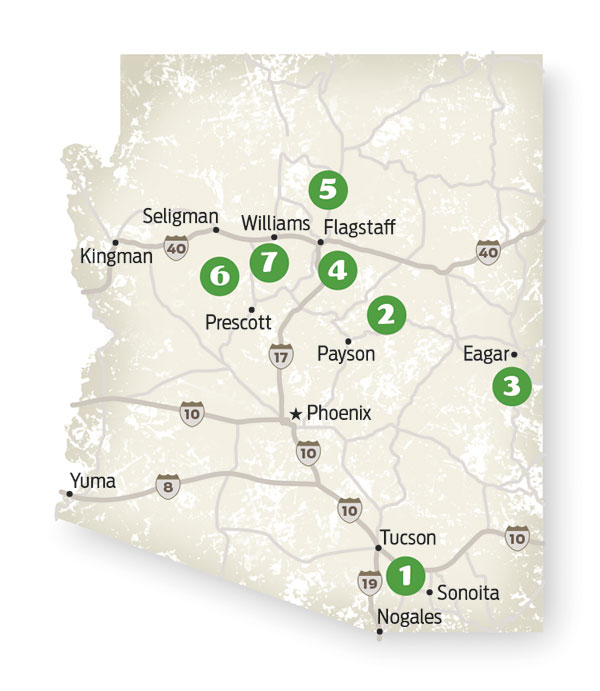
1. GARDNER CANYON ROAD
Santa Rita Mountains
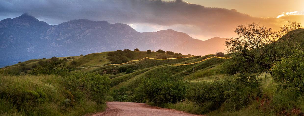
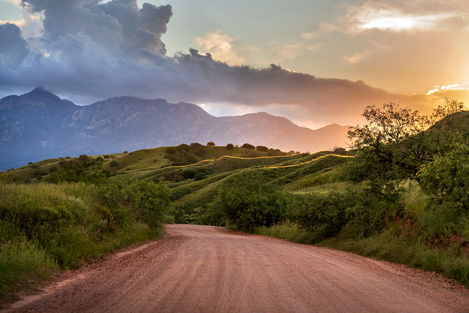
Named for a family who homesteaded there in the 1870s, Gardner Canyon is just off State Route 83, and this short, rugged forest road is an excellent way to explore it. Early on, mesquites and alligator junipers line the road, and after that comes a turnoff, on the right, for Kentucky Camp, a restored mining camp and access point for the Arizona Trail. Stay straight to remain on Gardner Canyon Road, which begins to climb into the mountains as it passes some primitive campsites and unspoiled grasslands. Apache Springs Ranch, a guest ranch at the site of the former Gardner homestead, is next up; a half-mile past the ranch, the road gets rockier as it drops to the canyon floor, then climbs again. At a subsequent intersection, stay on the road by following the signs for the Cave Canyon Trail. Around Mile 7.5, ponderosa pines begin to appear, and a mile after that, you’ll bump across a creek. From there, it’s a quarter-mile to the end of the road at the Cave Canyon Trailhead, where you can take a challenging hike for more mountain views — or just picnic amid the pines and tall Arizona sycamores near the trailhead.
— Noah Austin
Length: 8.7 miles one way (from State Route 83)
Directions: From Sonoita, go north on State Route 83 for 4 miles to Gardner Canyon Road (Forest Road 92). Turn left (west) onto Gardner Canyon Road and continue 8.7 miles to the Cave Canyon Trailhead.
Vehicle requirements: A high-clearance, four-wheel-drive vehicle, such as an SUV or truck, is required.
Information: Nogales Ranger District, 520-281-2296 or fs.usda.gov/coronado; Apache Springs Ranch, 520-455-9263 or apachespringsranch.com
2. FOREST ROAD 300
Mogollon Rim
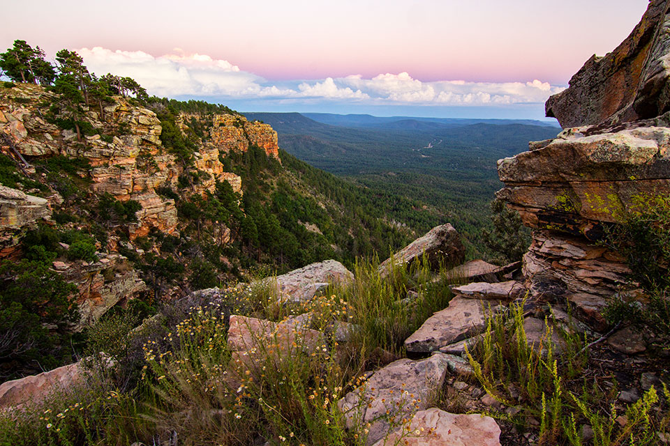
The vistas from atop the Mogollon Rim steal the show, but there’s a lot to see along Forest Road 300, which can be approached from the east, near Woods Canyon Lake, or from the west, just north of Strawberry. From the west, the road begins with an uphill climb through a thick ponderosa pine forest, then intersects what used to be the General Crook Trail, a historic wagon route from the 1800s. From there, the gravel road winds downhill to an area of grassy meadows crowded with tall evergreens. Hardwoods and spruce start mixing in after that, and you’ll start seeing the first of several worthwhile side trips, including Potato Lake, Lee Johnson Spring and Kehl Springs Campground. Past a burned area, you’ll cross an unspoiled landscape that includes Crackerbox Canyon, an Arizona Trail crossing and turnoffs for Lost Lake and Knoll Lake. About 25 miles in, the Rim Road, as it’s known, crosses from the Coconino National Forest into the Apache-Sitgreaves National Forests. A few miles later, you’ll see the turnoff for Bear Canyon Lake, one of Rim Country’s premier recreation areas. Aspens, evergreens and panoramas mark the homestretch to Woods Canyon Lake, where this drive comes to an end. Not that you’ll want it to.
— Robert Stieve
Length: 43.3 miles one way (from State Route 87)
Directions: From Payson, go north on State Route 87 for 28.5 miles to Forest Road 300. Turn right onto FR 300 and continue 43.3 miles to State Route 260.
Vehicle requirements: None in good weather.
Information: Mogollon Rim Ranger District, 928-477-2255 or fs.usda.gov/coconino; Black Mesa Ranger District, 928-535-7300 or fs.usda.gov/asnf
3. EAGAR TO BIG LAKE
White Mountains
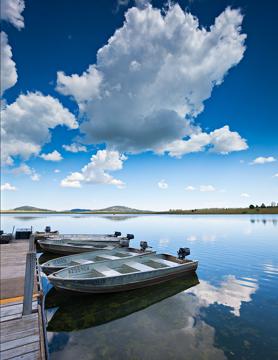
This route to one of the largest reservoirs in the White Mountains begins in Eagar, and the route’s main road is Forest Road 285, a well-maintained dirt road that quickly climbs to an elevation of about 9,000 feet and enters the Apache-Sitgreaves National Forests, where ponderosa pines, smaller evergreens and spindly aspens dominate the roadside. Take your time around the many blind corners — you never know when an elk might saunter across the road — before the forest gives way to the first of several large meadows about 10 miles in. The uninterrupted horizon to the southwest offers a good view of Mount Baldy, the White Mountains’ highest peak. Pull off the road, silence the sedan and enjoy the mountain air; if you’re lucky, you might see an animal — ungulate, turkey or other — taking a drink at one of the many ponds near the roadside. The last few miles of FR 285 plunge back into heavy forest, although you’ll see a few areas where the 2011 Wallow Fire left its mark. Then, a right turn onto Forest Road 249 takes you about 2 miles to Big Lake, a reservoir known for trout fishing — and, in the summer, a perfect place to pitch a tent at one of several campgrounds.
— Noah Austin
Length: 21 miles one way (from Eagar)
Directions: From the intersection of State Route 260 and Main Street in Eagar, go south on Main Street for 1 mile to Forest Road 285 (Water Canyon Road). Turn left onto FR 285 and continue 18 miles to Forest Road 249. Turn right onto FR 249 and continue 2 miles to Big Lake Recreation Area, where FR 249 becomes State Route 273. To return to SR 260, either retrace your route or continue north on SR 273 to State Route 261, which intersects SR 260 near Eagar.
Vehicle requirements: None in good weather.
Information: Springerville Ranger District, 928-333-4301 or fs.usda.gov/asnf
4. STONEMAN LAKE ROAD
South of Flagstaff
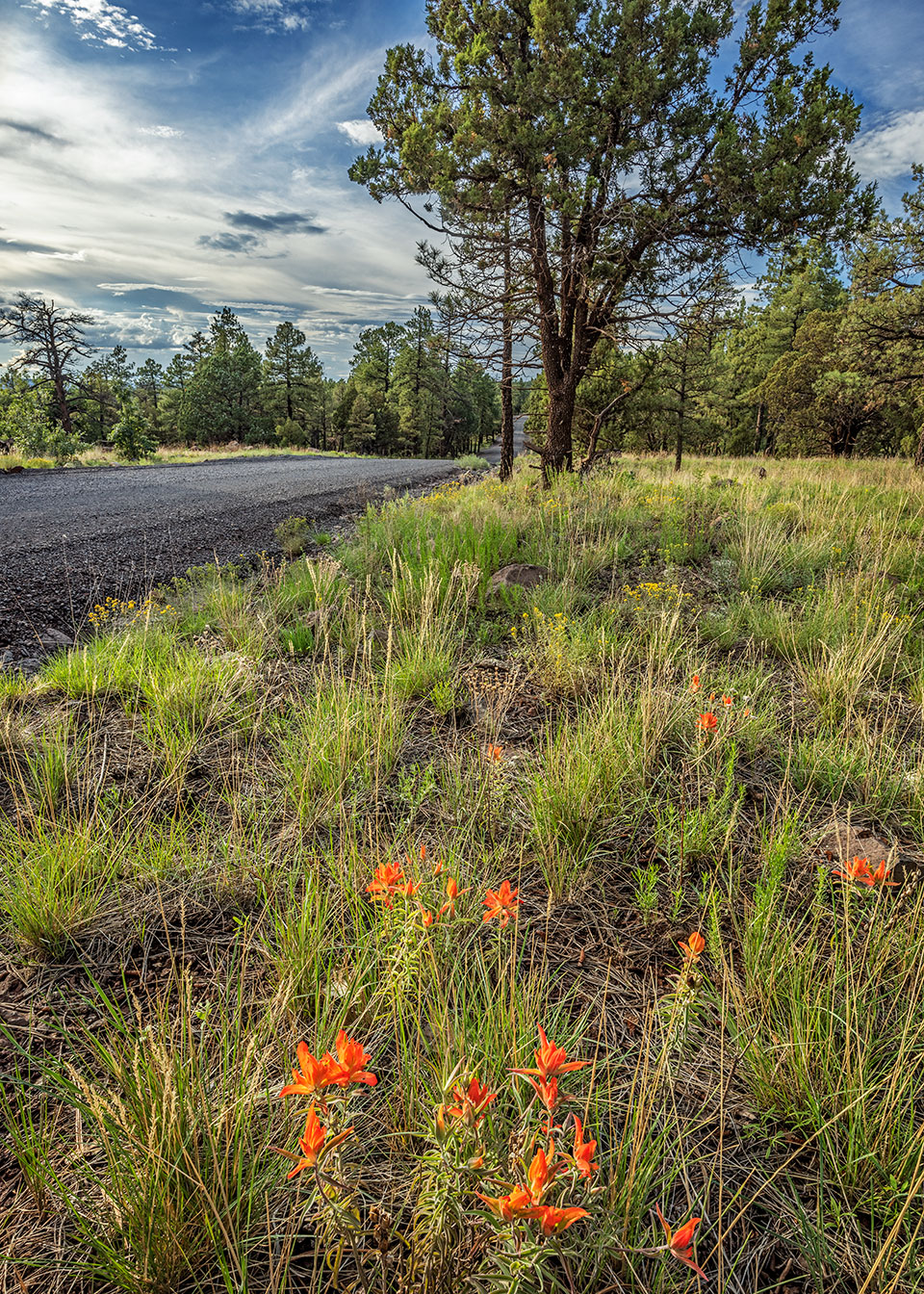
If you’re headed from Phoenix to Flagstaff and looking for a quieter route, Stoneman Lake Road (Forest Road 213) is the perfect byway to connect to Forest Highway 3, a back road into town. This 14-mile trip begins off Interstate 17, and the first 6 miles, lined with junipers, are paved; the rest of the route is well maintained and easily driven in a passenger car in good weather. A side trip to Stoneman Lake, created more than 8 million years ago by a volcanic depression, offers a look at the lake’s yellow perch and northern pike, along with Steller’s jays, bald eagles and other birds in the surrounding trees. If you’re interested in a leisurely picnic before hitting the road, make use of one of the shaded picnic tables or pick a pretty place on the lakeshore. And after you explore Stoneman Lake, return to FR 213 and continue on as the road rambles in and out of private land, through pine and aspen forests and past a smattering of wide-open meadows and public campgrounds. Near the end of the road, you’ll reach a junction with Forest Road 230, which leads to the base of Apache Maid Mountain. If you’ve had enough scenic detours for one day, continue directly to FH 3, a paved road that leads to Flagstaff.
— Kelly Vaughn
Length: 14 miles one way (from Interstate 17 to Forest Highway 3)
Directions: From Phoenix, go north on Interstate 17 for 106 miles to Stoneman Lake Road (Exit 306). Turn right onto Stoneman Lake Road (Forest Road 213) and continue 6 miles until the pavement ends. Bear left to stay on FR 213, then continue 2 miles to the Stoneman Lake day-use area or 8 miles to Forest Highway 3 (Lake Mary Road).
Vehicle requirements: None in good weather.
Information: Red Rock Ranger District, 928-203-2900 or fs.usda.gov/coconino
5. SP CRATER
North of Flagstaff
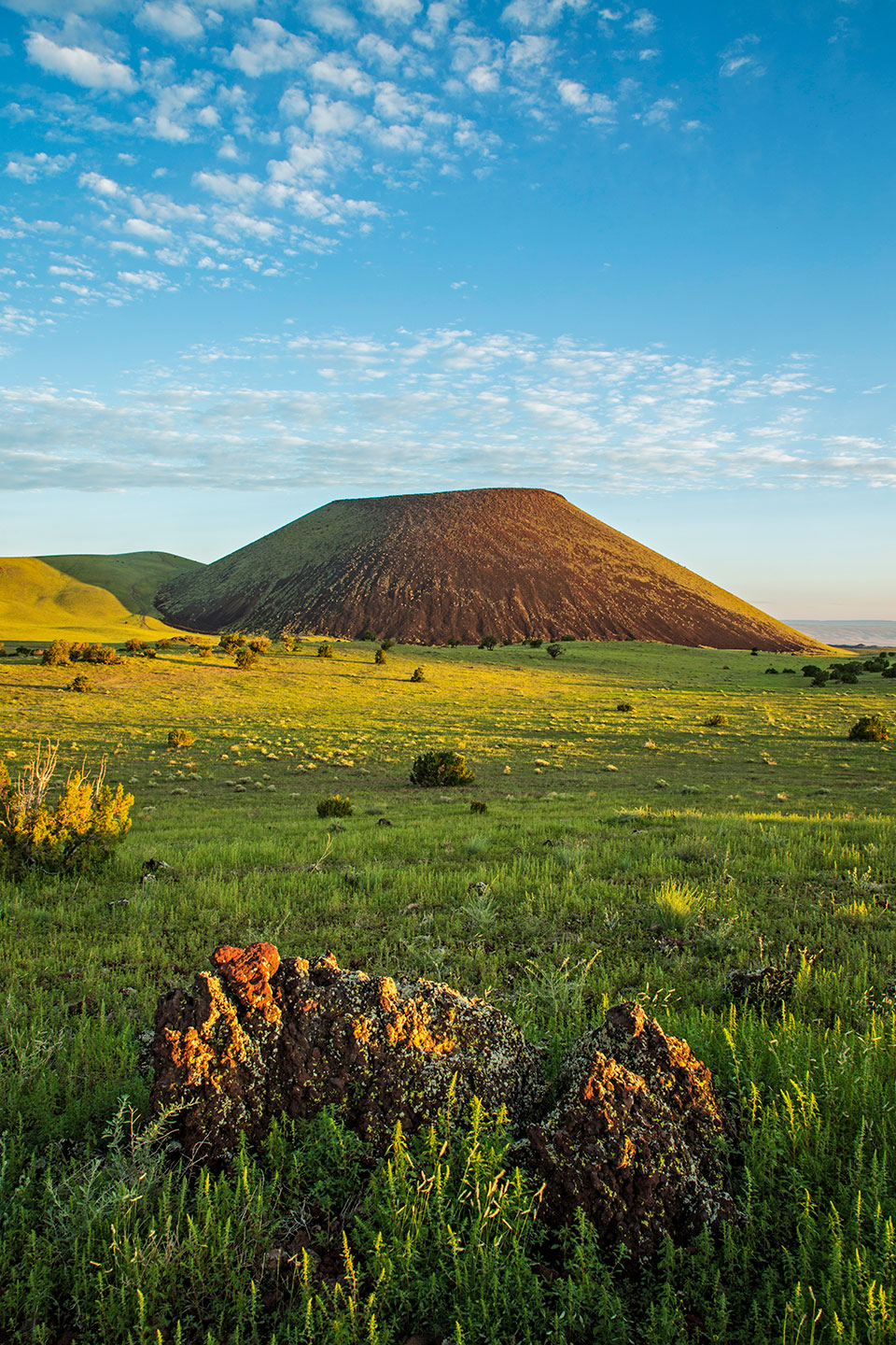
SP Crater, a cinder cone volcano with an extensive lava field, is the focus of this drive on Babbitt Ranches land north of Flagstaff. From U.S. Route 89, an unmarked dirt road leads west toward the volcano, which supposedly got its name from its resemblance to a spilled chamber pot — as the story goes, mapmakers shortened 19th century rancher C.J. Babbitt’s more vulgar version of that description to “SP.” You’ll get excellent views of the surrounding grassland and the San Francisco Peaks to the south, and after about 5 miles, you’ll dip through a thistle-lined wash and make your closest approach to the south face of the cinder cone, which erupted thousands of years ago but has resisted erosion because of the composition of its rim. About a mile later, you’ll notice Colton Crater, an older, wider cinder cone, to the south. The route then loops around to the north side of SP Crater, and you’ll cross the volcano’s distinctive lava flow, which extends some 4 miles to the north and is 100 feet thick in places. From there, it’s another 7 miles east to U.S. 89, where you’ll find yourself back on pavement about 2 miles north of where you started the drive.
— Noah Austin
Length: 19 miles one way (from U.S. Route 89)
Directions: From Flagstaff, go north on U.S. Route 89 for 27 miles to an unmarked road on the left (it’s just before Milepost 446 and Hank’s Trading Post). Turn left (west) onto the unmarked road and continue 0.5 miles to a fork. Bear left at the fork and continue 4.2 miles to another fork. Bear right at this fork and continue 3.5 miles to yet another fork. Bear right at the fork and continue 2.2 miles to one more fork. Bear right at the fork and continue 0.1 miles to a wider road. Merge onto the wider road and continue 8.5 miles back to U.S. 89.
Vehicle requirements: A high-clearance vehicle, such as an SUV or truck, is recommended, but the route is passable in any vehicle in good weather.
Special consideration: The route is open to the public but is on Babbitt Ranches property. Please be considerate, and do not take lava rocks or other souvenirs.
Information: Babbitt Ranches, 928-774-6199 or babbittranches.com
6. WILLIAMSON VALLEY ROAD
Prescott to Seligman
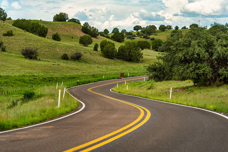
On its winding 70-mile path, this road takes you back to Arizona’s rowdy Territorial days. Early attractions include the jagged profile of Granite Mountain and trails into the wilderness area of the same name, along with the site of a once-popular, long-gone 1860s pit stop called American Ranch. At Mile 20, you’ll descend into the lush Williamson Valley and pass the former site of the tiny hamlet of Simmons, where a stage stop and post office once operated. Then, you’ll climb into juniper-covered hills as the paved road turns to gravel. The panoramic views to the east include the glowing red rocks of Sedona on the horizon and Bill Williams Mountain to the north. And at Mile 35.8, you come to a steel-truss bridge that once was part of a seven-span bridge constructed across the Gila River in 1912; it was washed out by floods in 1916 and relocated here in 1936. Soon, the appearance of 7,162-foot Picacho Butte to the north signals that you’re approaching Seligman, and the final stretch crosses the broad tableland of Big Chino Wash. After that, ease back into the modern world with a ramble down Historic Route 66 in Seligman and a chocolate shake from Delgadillo’s Snow Cap Drive-In.
— Annette McGivney
Length: 70 miles one way (from Iron Springs Road)
Directions: From Courthouse Square in Prescott, go north on Montezuma Street, which becomes Whipple Street and then Iron Springs Road, for 3 miles to Williamson Valley Road. Turn right onto Williamson Valley Road and continue 70 miles to Seligman.
Vehicle requirements: A high-clearance, four-wheel-drive vehicle, such as an SUV or truck, is recommended, especially in wet conditions.
Information: Chino Valley Ranger District, 928-443-8000 or fs.usda.gov/prescott
Tom Bean
7. BILL WILLIAMS MOUNTAIN LOOP
Southwest of Williams
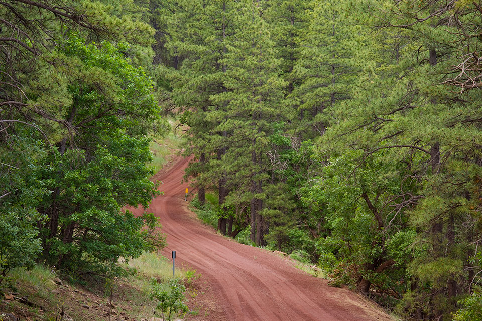
This short, easy drive passes through some of the most beautiful ponderosa pine forest in Northern Arizona, with opportunities to see wildlife and learn a little area history. Heading out of Williams on Perkinsville Road, you’ll pass the Santa Fe Dam, built in the early 1890s to hold water for steam engines traveling through town. After about 6.5 miles, turn right onto Forest Road 108, a wide, well-maintained red-cinder road that winds through a lovely stretch of ponderosas. Tall, well-spaced pines punctuate a lush carpet of grass, giving way to expansive, high-mountain meadows and occasional rocky outcroppings. Soon, you’ll come to Coleman Lake, a marshland that makes a great place for wildlife viewing — elk, deer and Merriam’s turkeys are common. A few miles down the road, mule deer might run across the road as part of their visit to MC Tank, a small stock pond at the side of the road. Later, the forest dips into juniper grasslands, opening up views of Bill Williams Mountain. And after a little more than 18 miles on FR 108, you’ll hit the pavement and take Interstate 40 back to Williams.
— Kathy Montgomery
Length: 30-mile loop (from Williams)
Directions: From the Williams Visitor Center (200 W. Railroad Avenue), go west on Railroad Avenue for 0.1 miles to Fourth Street. Turn left onto Fourth Street, which turns into Perkinsville Road (County Road 73), and continue 6.6 miles to Forest Road 108 (Bill Williams Mountain Loop Road). Turn right onto FR 108 and continue 18.3 miles to Interstate 40. Turn right onto I-40 and continue 5 miles back to Williams.
Vehicle requirements: None in good weather.
Information: Williams Ranger District, 928-635-5600 or fs.usda.gov/kaibab

