
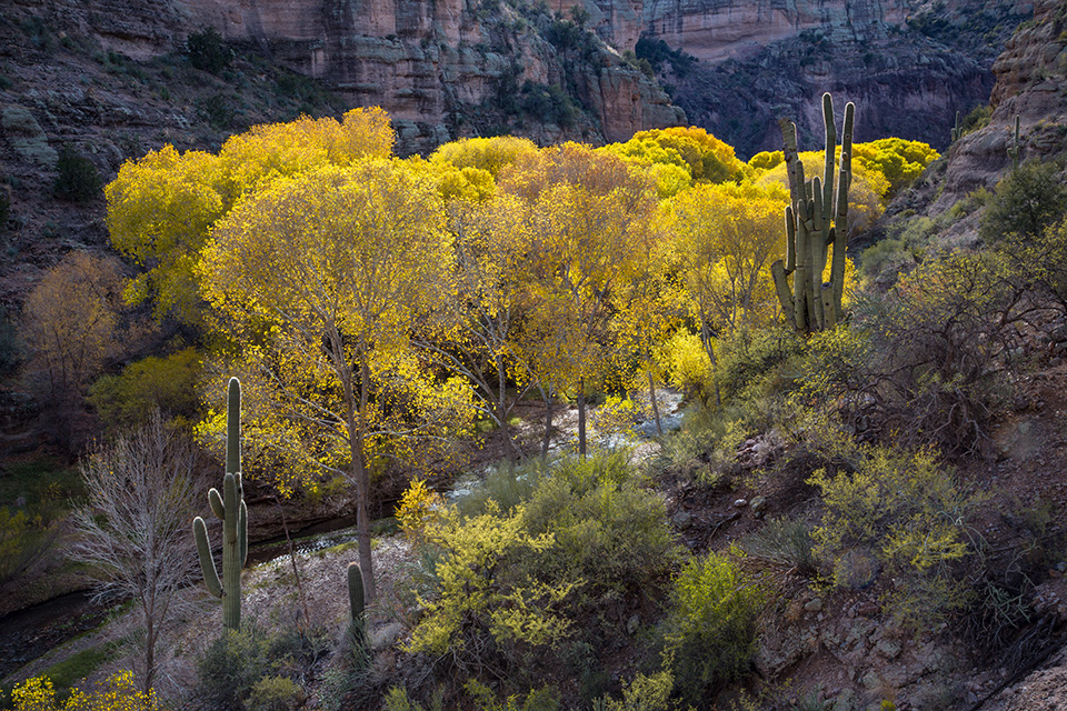
Aravaipa Canyon
Paul Gill
Mature cottonwoods display their fall yellows amid tall saguaros along Aravaipa Creek. The canyon is the centerpiece of the Aravaipa Canyon Wilderness, which is managed by the Bureau of Land Management. A permit is required for entry, and no more than 50 people — 30 via the West Trailhead and 20 via the East Trailhead — are allowed in the permitted area per day.
PEAK COLOR: November
DIRECTIONS (TO WEST TRAILHEAD): From Tucson, go north on Oracle Road (State Route 77) for 55 miles to Aravaipa Road. Turn right onto Aravaipa Road and continue 13 miles to the Aravaipa Canyon West Trailhead. Aravaipa Road is unpaved but suitable for most vehicles in good weather.
INFORMATION: Safford Field Office, 928-348-4400 or blm.gov/arizona (general information); recreation.gov/permits/251864 (permits)
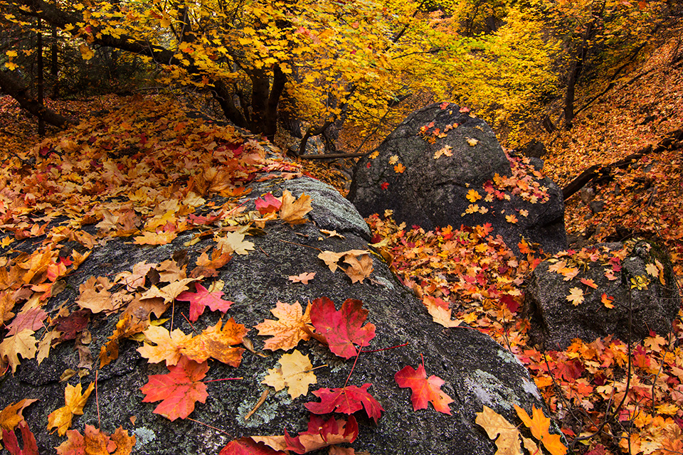
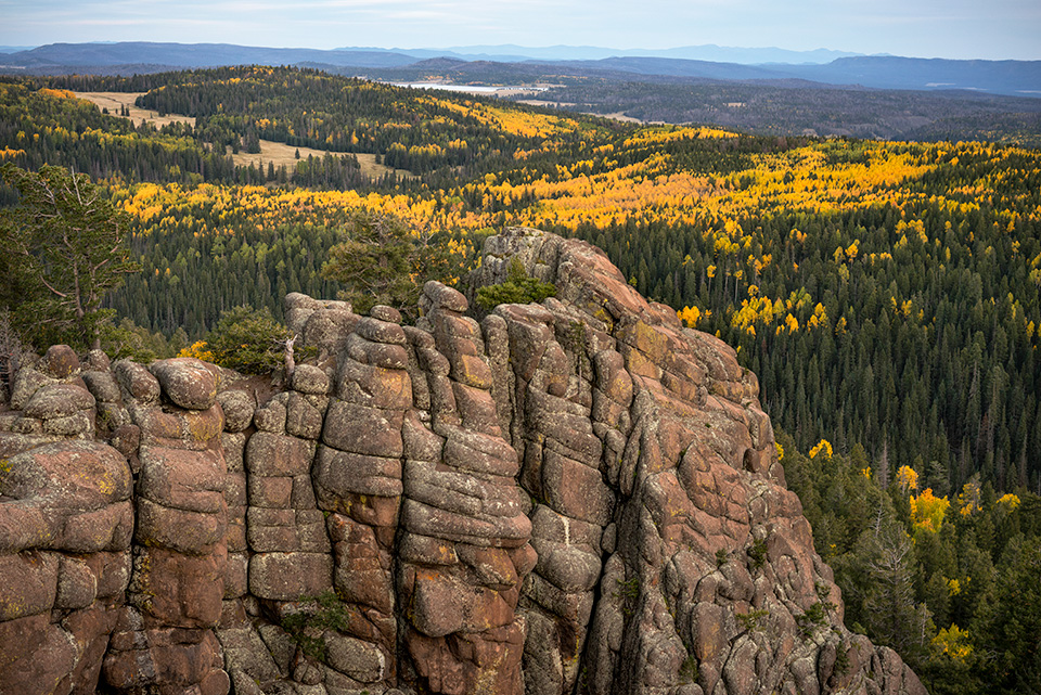
Mount Lemmon
Gurinder Singh
The leaves of maple seedlings begin to turn orange and red in early fall at Bear Wallow, a forested glade high in the Tucson area’s Santa Catalina Mountains. It’s unlikely you’ll see a bear at Bear Wallow, but this site, located in a shallow canyon, offers plenty of leaf-peeping, hiking and wildlife-watching opportunities.
PEAK COLOR: Late October to early November
DIRECTIONS: From Tucson, go north on the Catalina Highway for 22 miles to Bear Wallow Road (just past Mile Marker 22). Turn right onto Bear Wallow Road and continue less than a quarter-mile to an area where you can park on the side of the road. There is no official trail, but the area is easy to explore on foot. Bear Wallow Road is unpaved but suitable for most vehicles in good weather; it closes during the winter.
INFORMATION: Santa Catalina Ranger District, 520-749-8700 or fs.usda.gov/coronado
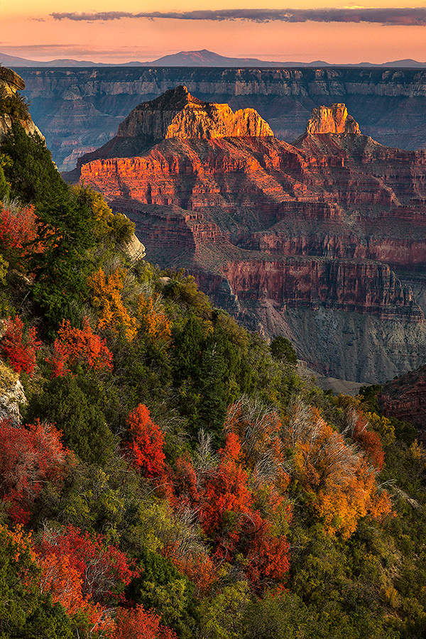
Grand Canyon North Rim
Larry Lindahl
Fall color below the rim anchors a sunset view of Brahma and Zoroaster temples, along with the San Francisco Peaks to the distant southeast. This view is from the Transept, a picturesque side canyon west of Grand Canyon Lodge. Because the road to the North Rim is not plowed, this section of Grand Canyon National Park is fully open only between mid-May and mid-October.
PEAK COLOR: Late September to early October
DIRECTIONS: From Jacob Lake, go south on State Route 67 (North Rim Parkway) for 43.5 miles to the North Rim developed area. The entire route is paved. National Park Service fees apply.
INFORMATION: Grand Canyon National Park, 928-638-7888 or nps.gov/grca
East Baldy Trail
Bill Hatcher
A 100-foot granite wall rises from a landscape of evergreens and aspens above the East Fork of the Little Colorado River. The East Baldy Trail, a strenuous 6-mile hike, climbs to near the summit of Mount Baldy, the highest point in the White Mountains. The actual summit is on White Mountain Apache Tribe land and off-limits to non-tribal members.
PEAK COLOR: Late September to early October
DIRECTIONS: From Show Low, go southeast on State Route 260 for 36 miles to State Route 273. Turn right onto SR 273 and continue 11.7 miles to the East Baldy Trailhead, on the right. The entire route is paved.
INFORMATION: Springerville Ranger District, 928-333-6200 or fs.usda.gov/asnf
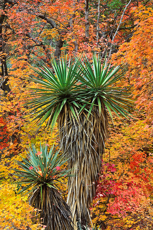
Huachuca Mountains
Claire Curran
Maple leaves form a colorful backdrop for a trio of healthy yuccas in Miller Canyon, on the northeast flank of the Huachucas. The Miller Canyon Trail, a 3.5-mile hiking route, offers excellent views of autumn maple leaves, along with a riparian area and glimpses of the canyon’s mining history.
PEAK COLOR: Mid- to late October
DIRECTIONS: From Sierra Vista, go south on State Route 92 for 8.5 miles to Miller Canyon Road (Forest Road 56). Turn right onto Miller Canyon Road and continue 2.5 miles to the trailhead parking area. Miller Canyon Road is unpaved but suitable for most vehicles in good weather.
INFORMATION: Sierra Vista Ranger District, 520-378-0311 or fs.usda.gov/coronado
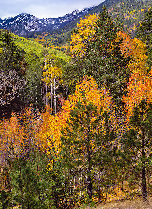
San Francisco Peaks
Paul Gill
Aspens mingle with evergreens in the Inner Basin beneath the snowcapped summits of Arizona’s highest mountain range. Topped by 12,633-foot Humphreys Peak, the Peaks are the remains of an eroded stratovolcano. The Inner Basin Trail, which begins at Lockett Meadow Campground, is among Arizona’s best autumn hikes.
PEAK COLOR: Late September to early October
DIRECTIONS: From downtown Flagstaff, go north on U.S. Route 89 for 16 miles to Forest Road 552, across from the turnoff for Sunset Crater and Wupatki national monuments. Turn left onto FR 552 and follow the signs for Lockett Meadow Campground. A high-clearance vehicle, such as an SUV or truck, is recommended.
INFORMATION: Flagstaff Ranger District, 928-526-0866 or fs.usda.gov/coconino
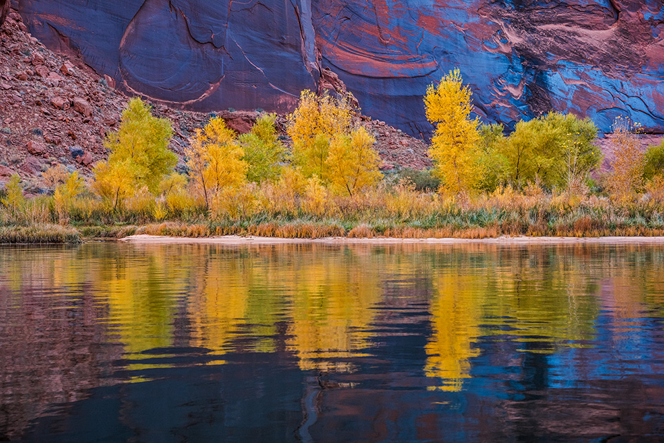
Glen Canyon
Gary Ladd
Vegetation along the Colorado River dons its autumn dress at Hidden Slough, a site downstream from Glen Canyon Dam. This spot is several miles upstream from Lees Ferry, a convenient place to reach the Colorado by car.
PEAK COLOR: Late November to early December
DIRECTIONS (TO LEES FERRY): From Page, go south on U.S. Route 89 for 23 miles to U.S. Route 89A. Turn right onto U.S. 89A and continue 14.3 miles to Lees Ferry Road. Turn right onto Lees Ferry Road and continue 4.4 miles to Lees Ferry. The entire route is paved.
INFORMATION: Glen Canyon National Recreation Area, 928-608-6200 or nps.gov/glca
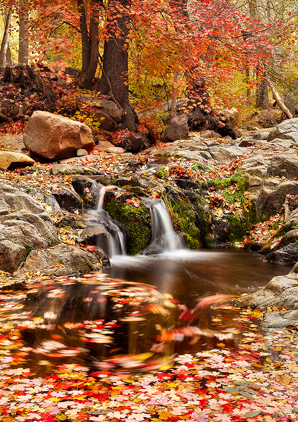
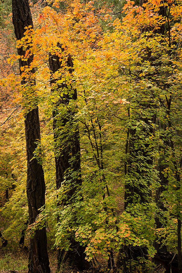
Workman Creek
Derek von Briesen
Bigtooth maple leaves adorn the pouroffs and reflecting pools of this waterway in the remote Sierra Ancha, part of the Tonto National Forest. Workman Creek, a biodiverse waterway in these mountains, is an easy drive north of the Globe-Miami area and is best known for 200-foot Workman Creek Falls.
PEAK COLOR: Late October to mid-November
DIRECTIONS: From U.S. Route 60 in Globe, go north on State Route 188 for 14.7 miles to State Route 288. Turn right onto SR 288 and continue 25.5 miles to Workman Creek Road (Forest Road 487). Turn right onto Workman Creek Road, which parallels the creek, and continue 3 miles to Workman Creek Falls. Workman Creek Road is unpaved; a high-clearance vehicle, such as an SUV or truck, is recommended.
INFORMATION: Payson Ranger District, 928-474-7900 or fs.usda.gov/tonto
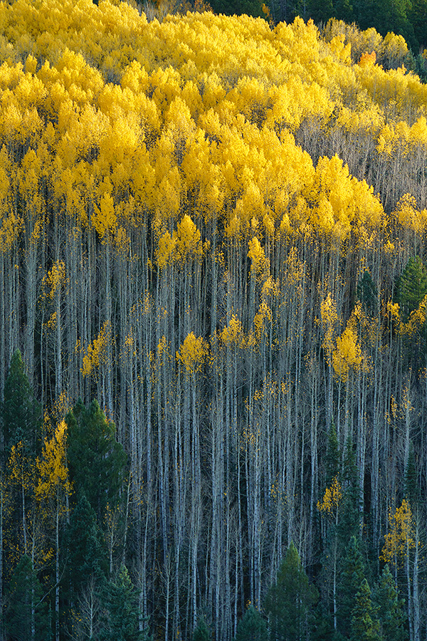
White Mountains
Rusty Childress
Tall aspens display their golden crowns on White Mountain Apache Tribe land near Mount Ord. This spot is near Ord Creek, which empties into the North Fork of the
White River. Recreation on the tribe’s land requires a permit.
PEAK COLOR: Late September to mid-October
DIRECTIONS: From Payson, go east on State Route 260. Several paved and unpaved roads along this highway offer spectacular opportunities to view fall color.
INFORMATION: White Mountain Apache Tribe, wmatoutdoor.org; Black Mesa Ranger District, 928-535-7300 or fs.usda.gov/asnf