
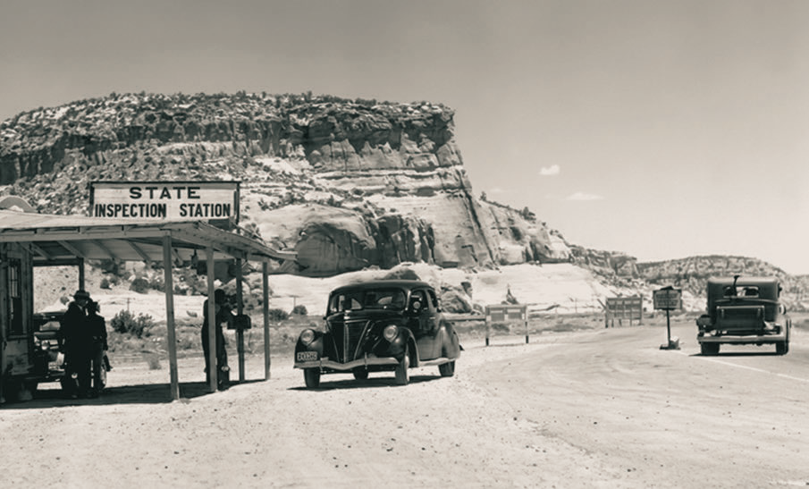
Beneath the Painted Cliffs, travelers stop at an inspection station in Lupton, just across the Arizona-New Mexico state line, in 1938. A nearly identical shot appeared in John Ford’s 1940 film adaptation of John Steinbeck’s The Grapes of Wrath, which depicted the Joad family’s journey to California on Route 66. Today, Lupton is perhaps best known for the Tee Pee Trading Post, an attraction along Interstate 40.
NORMAN G. WALLACE/ARIZONA HIGHWAYS ARCHIVES
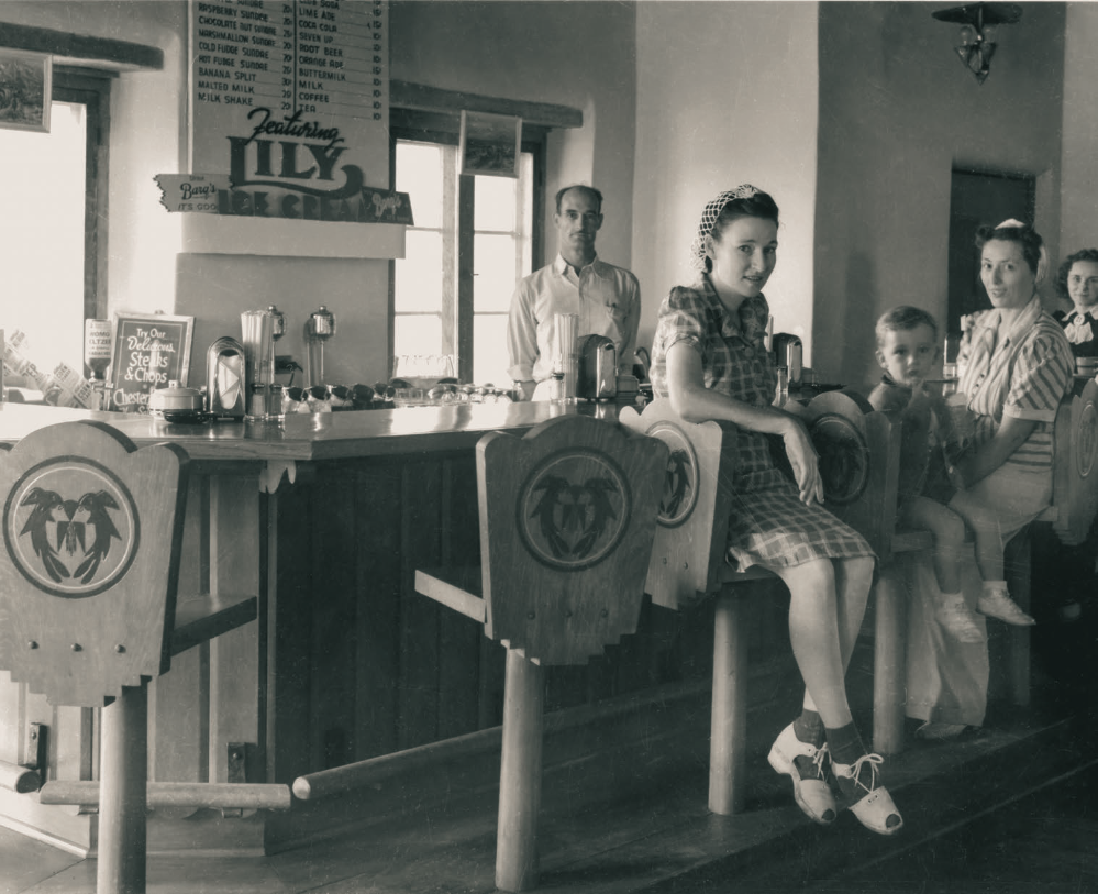
Patrons and an employee pose for a photo at the lunch counter of the Painted Desert Inn, a lodging destination at Petrified Forest National Park, in 1947, the year Fred Harvey became the inn’s concessionaire. The inn was built of local petrified wood and other stones in the 1920s; it no longer welcomes overnight guests, but an ice cream parlor is open seasonally. Notably, Petrified Forest is the only national park that contains a section of Historic Route 66, marked by a line of weathered telephone poles.
COURTESY OF NATIONAL PARK SERVICE
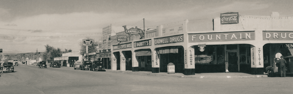
Shops and restaurants line Navajo Boulevard, the local designation for Route 66 in Holbrook. This view, looking north, shows Campbell’s Coffee House, which opened in 1924 and moved to a neighboring location around 1940. Known for its bottomless cups of coffee and plates emblazoned with camels, Campbell’s also served as a depot for tour buses taking sightseers to Petrified Forest National Park and other Northeastern Arizona attractions.
COURTESY OF NEWBERRY LIBRARY
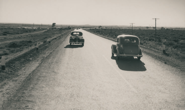
This photograph, made in 1944, shows the view west from Route 66 about 4 miles east of Winslow. Just six years earlier, the federal government had finished paving the entire highway, which ran for 2,448 miles from Chicago to Santa Monica, California. Arizona was home to 401 miles of the Mother Road, which became a vital route for moving troops and military equipment during World War II.
NORMAN G. WALLACE/ARIZONA HISTORICAL SOCIETY
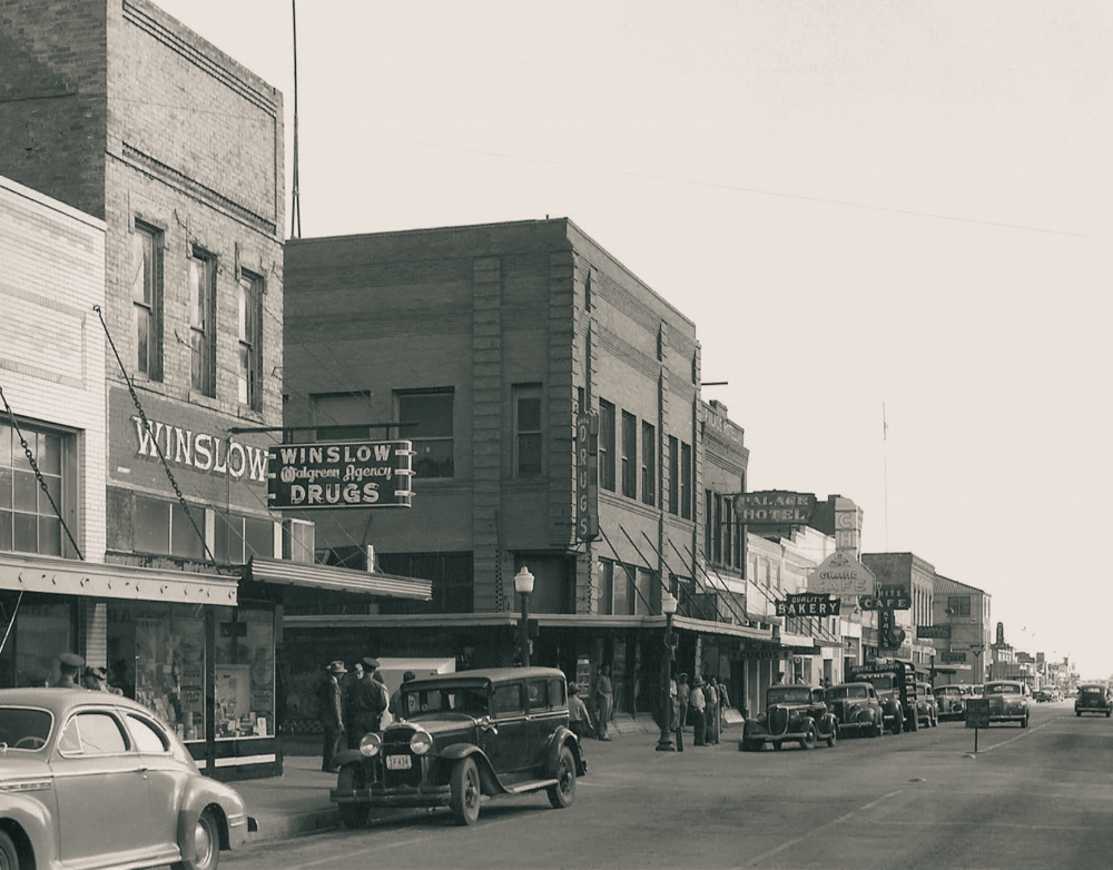
In the 1940s, Route 66 served as a lifeline for many Northern Arizona towns, including Winslow — which was still decades away from being made famous by Jackson Browne and Glenn Frey. Visible in this photo, looking east on Second Street, are the Palace Hotel and several other businesses. Many of these buildings are still standing today, but the site of the drugstore on the left has been redeveloped as Standin’ on the Corner Park, complete with a flatbed Ford.
COURTESY OF NEWBERRY LIBRARY
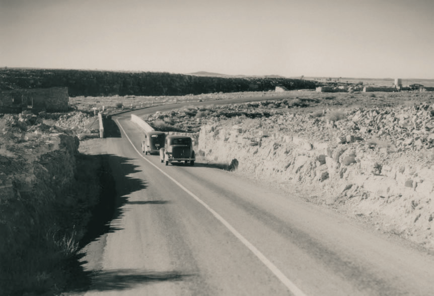
Motorists approach the Canyon Diablo Bridge, completed in 1915 and listed today on the National Register of Historic Places. A 146-foot Luten arch bridge, this structure carried the Mother Road across its namesake canyon, which had posed challenges for travelers in the area for centuries. Visible just past the bridge is a trading post that was among the attractions at Two Guns, a thriving tourist stop. This alignment of Route 66 was bypassed when a new bridge was built in the late 1930s.
NORMAN G. WALLACE/ARIZONA HISTORICAL SOCIETY
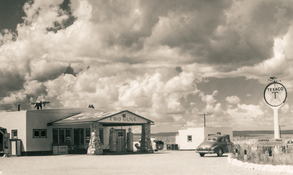
Dramatic clouds fill the sky over the Two Guns service station. This photo is undated, but the Texaco logo on the sign was used from 1936 to 1966. Some sources indicate that Henry MiIler, the site’s longtime proprietor, named it Two Guns after a nickname he coined for himself; others say he was paying homage to silent film star William “Two Gun” Hart, with whom he claimed to have worked. Regardless, Two Guns was home to a trading post, a restaurant and a makeshift zoo that housed mountain lions and other Arizona creatures.
NORMAN G. WALLACE/ARIZONA HISTORICAL SOCIETY
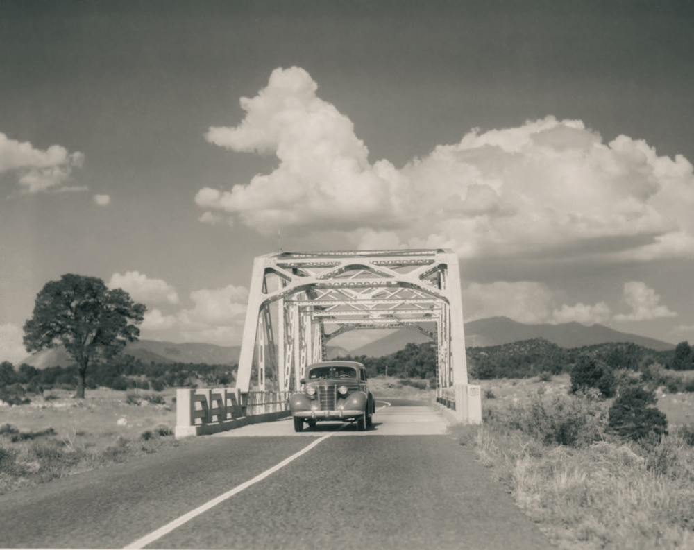
A car crosses the Walnut Canyon Bridge, just northwest of Winona. Completed in 1924, this 101-foot steel truss bridge is typical of the designs of its time, but it represents a rare surviving example of such a bridge on Route 66’s original alignment. It was bypassed in 1947 and now is listed on the National Register of Historic Places; a recent visit found its “Road Closed” sign had been defaced with competing “Do What U Want” graffiti.
NORMAN G. WALLACE/ARIZONA HISTORICAL SOCIETY
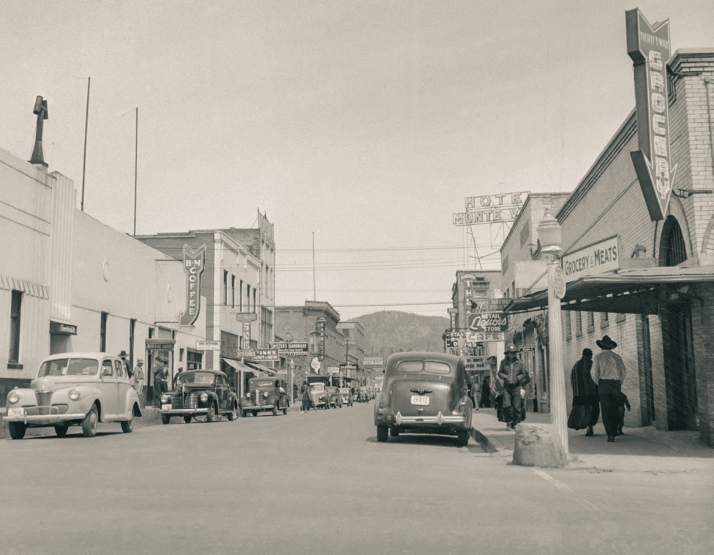
Cars and pedestrians line Flagstaff’s San Francisco Street in a view north from its intersection with Route 66. As have numerous other towns along the Mother Road, Flagstaff has maintained many of its historic buildings, although most of them have different tenants today. One exception is the Hotel Monte Vista, whose sign is visible in the background of this photo. Originally named the Community Hotel in honor of the citizens who invested in it, the Monte Vista will celebrate its 100th birthday in 2027.
JACK DELANO/LIBRARY OF CONGRESS
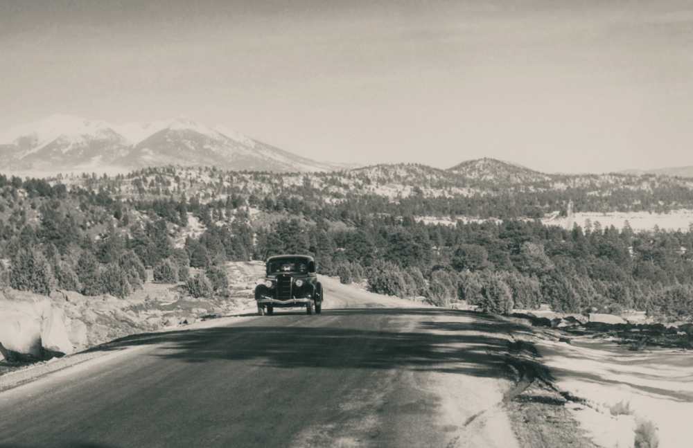
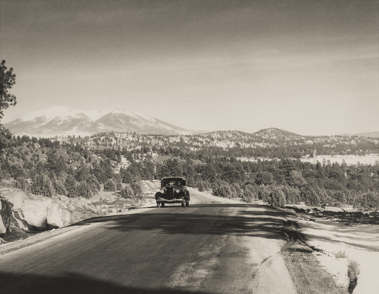
With the snowy San Francisco Peaks in the background, a motorist heads west on the stretch of Route 66 between Williams and Parks, likely in the 1930s or ’40s. This stretch of the Mother Road, shown here with old-fashioned oil pavement, was realigned multiple times during the route’s history. Scattered sections of the original alignment can still be seen from the modern roadway, which now is designated Historic Route 66.
NORMAN G. WALLACE/ARIZONA HISTORICAL SOCIETY
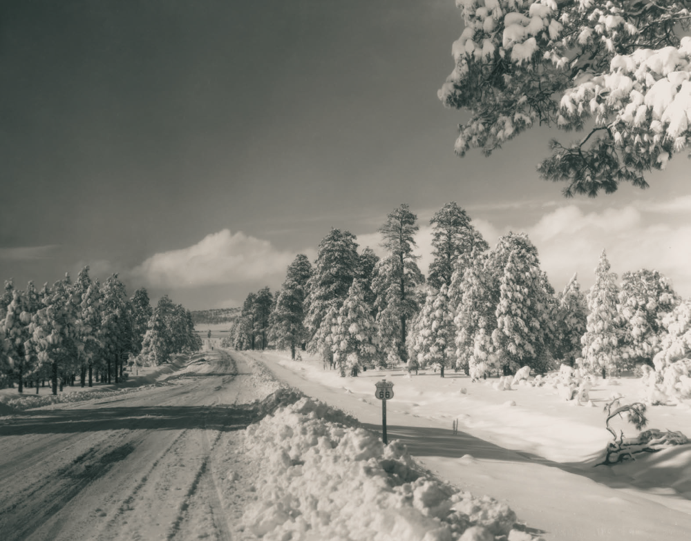
This photograph of snow-cloaked evergreens along Route 66 was made near the Grand Canyon junction, and it merited selection as the cover photo for the January 1934 issue of Arizona Highways. “Even in sunny Arizona there are times when and places where it snows,” the caption noted. “In the higher altitudes, 550 miles of highways require snow removal equipment during certain periods of the winter.”
NORMAN G. WALLACE/ARIZONA HISTORICAL SOCIETY
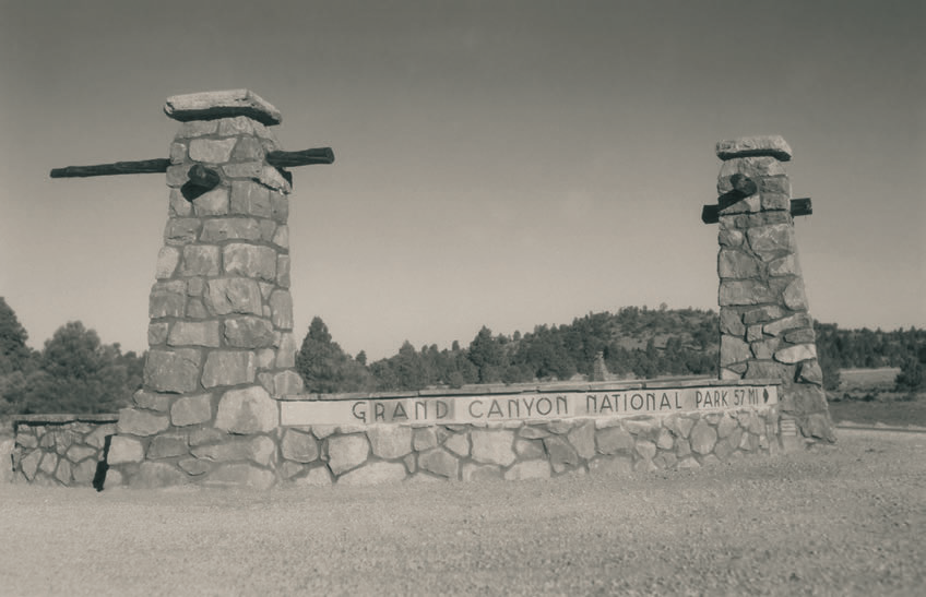
For decades, the Mother Road helped motorists navigate to the South Rim of the Grand Canyon, as evidenced by this marker at the intersection of Route 66 and State Route 64 near Williams. This photo was made in 1933, a year in which 105,000 people were recorded entering Grand Canyon National Park; today, about 4.5 million people visit the natural wonder every year. Sadly, they don’t see this marker, which no longer exists.
NORMAN G. WALLACE/ARIZONA HISTORICAL SOCIETY
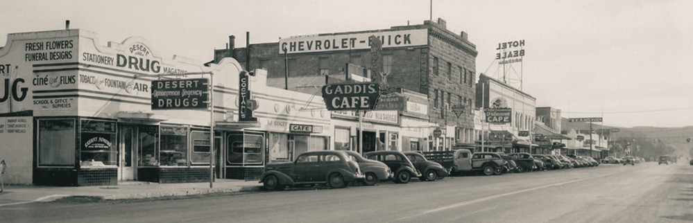
Cars fill the parking spaces along Front Street (now Andy Devine Avenue), Kingman’s stretch of Route 66, likely in the 1940s. The drugstore in the foreground has since been demolished, but the Old Trails Garage, which dates to 1915, is still standing, as is the 1909 Brunswick Hotel, the tall brick structure in the middle ground. Behind that is the now-shuttered Hotel Beale, whose neon sign was relit this year for the first time in more than four decades.
COURTESY OF NEWBERRY LIBRARY
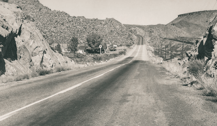
Among the lesser-known Route 66 towns in Arizona is Valentine, a tiny community northeast of Kingman. In this undated postcard photo, looking northeast from the outskirts of town, the railroad tracks that parallel the route can be seen on the right; those tracks are still in use today, and this stretch of the Mother Road is designated State Route 66 and maintained by the Arizona Department of Transportation. Just west of Valentine is Hackberry, home to a general store that once was operated by prolific artist Bob Waldmire.
COURTESY OF NEWBERRY LIBRARY
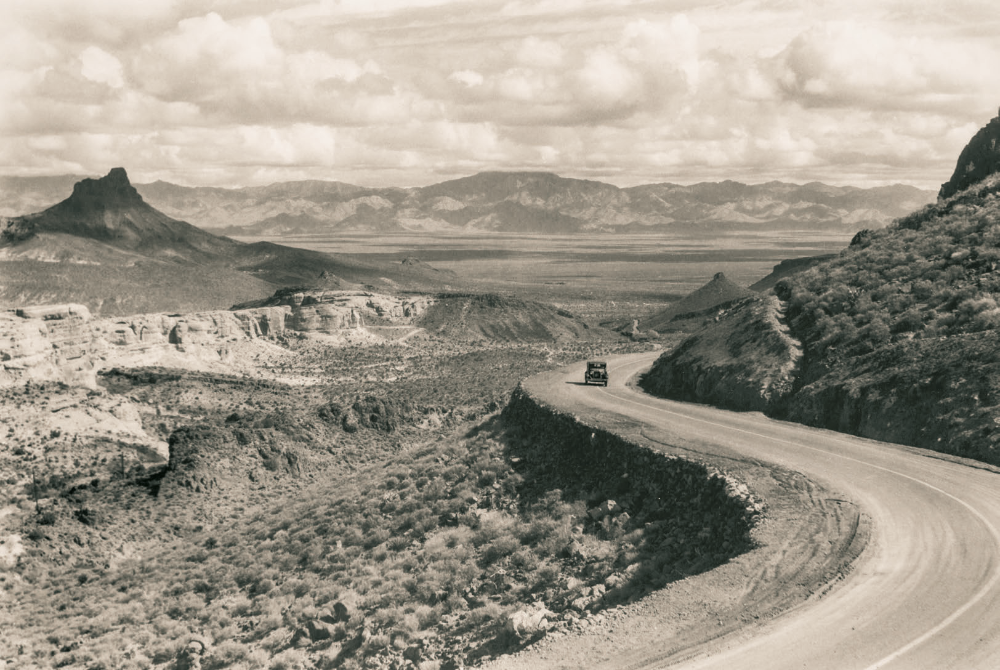
The westward climb into the Black Mountains from Kingman was arduous for vehicles of the Mother Road’s early days, as seen in this 1934 photo. The trek over Sitgreaves Pass was treacherous enough that Route 66 was rerouted around the mountains, and through the town of Yucca, in the 1950s. That realignment was disastrous for Oatman, which quickly declined before eventually reinventing itself as a tourist destination. Landmarks visible in this photo include Thimble Butte (left) and the distant Hualapai Mountains.
NORMAN G. WALLACE/ARIZONA HISTORICAL SOCIETY
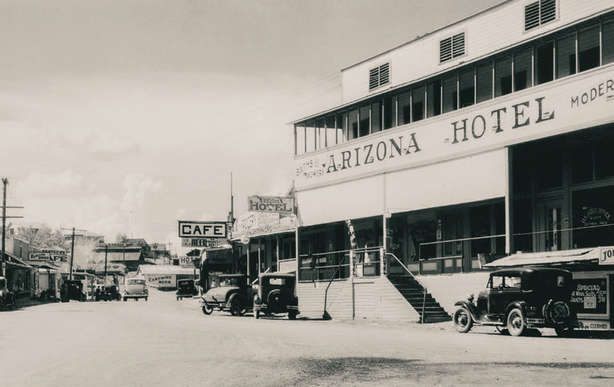
One of the westernmost stops on Historic Route 66 in Arizona is Oatman, an old mining town nestled in the Black Mountains. This photo shows the Arizona Hotel, one of several hotels that operated in Oatman during the town’s mining heyday. It was torn down in the 1950s, and today, all that remains of it is a concrete vault, a few crumbling walls and a historical marker. These days, Oatman is best known for the burros that wander the town’s streets; these animals descend from the pack burros once used by miners.
COURTESY OF NEWBERRY LIBRARY
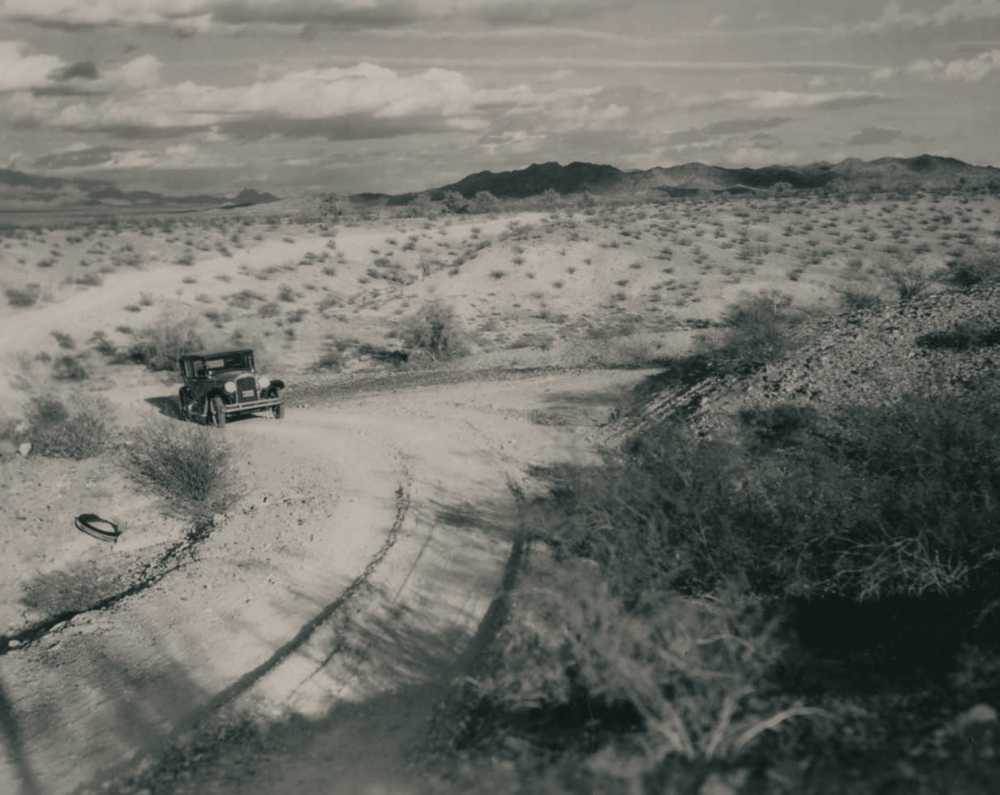
A car navigates an unpaved stretch of Route 66 in the Black Mountains, circa 1930. This spot appears to be southwest of Oatman, looking south toward a mountain range across the Colorado River in California. Most of Route 66 between Kingman and Topock, the route’s westernmost point in Arizona, was paved by the mid-1930s, making the journey through the Black Mountains less daunting for drivers.
NORMAN G. WALLACE/ARIZONA HISTORICAL SOCIETY
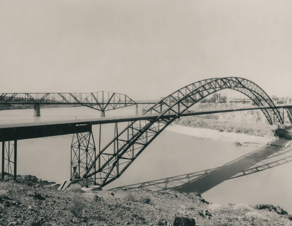
The Old Trails Bridge (foreground), the western terminus of Arizona’s stretch of Route 66, spans the Colorado River near Topock. This view is from the California side of the river, looking north and upriver. This bridge carried Route 66 traffic until 1947, when the Red Rock Bridge (background), previously a railroad bridge, was modified for car traffic. That bridge was dismantled in 1976, but the Old Trails Bridge endures and now carries a natural gas pipeline across the river.
NORMAN G. WALLACE/ARIZONA HISTORICAL SOCIETY