NAVAJO NATIONAL MONUMENT
By Robert Stieve
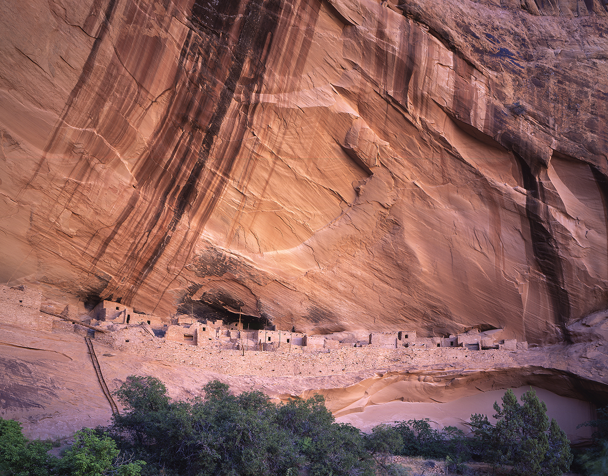
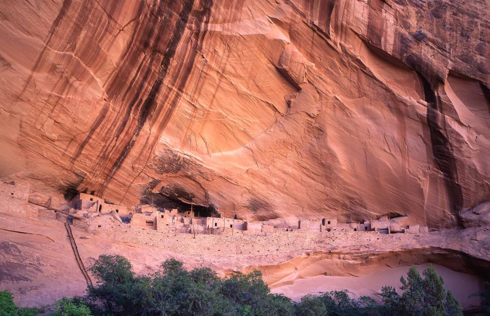
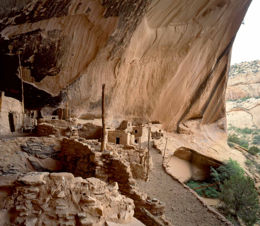
For the first time in four hours, Rick was at a loss for words. I couldn’t come up with anything, either. Even the wind dwindled to a whisper, and the piñon jays lowered their voices, as if out of respect for what was happening. Everything was quiet as we stared through the cottonwoods — a huddle of venerable sentries that separated us from prehistory. I don’t know what I was expecting in that moment, but I wasn’t expecting Keet Seel. I’d passed beneath so many steep canyon walls to that point, I guess I was expecting just another steep canyon wall. But there it was, as it had been for seven centuries, an unimaginable monument embedded in the Navajo sandstone.
There wasn’t anything to say. So we stood there. Speechless. In awe of the hallowed ground just beyond the big trees.
I HAD NO IDEA I'D BE SPENDING THE DAY WITH RICK. Until that morning, we were strangers — a couple of solo hikers destined to become comrades, despite the very different routes we’d taken to get there. What we had in common was a desire to see the ancient ruins, even if it meant dodging quicksand, flash floods, rattlesnakes and the threat of West Nile virus. It was 5:41 a.m. when we shook hands for the first time, on the second-to-last day of the season — Keet Seel is open only for a few months in the summer, when the searing high sun deters all but the most determined.
I should have met Rick the day before, during the mandatory orientation, but daylight saving time tripped me up. Arizona is one of the few places in our country that doesn’t adjust its clocks. The Navajo Nation, however, does. I remembered that somewhere between Tuba City and Tonalea. When I did, I kicked myself. I knew I’d be an hour late, and my reservation would likely be given to some lucky hiker on a waiting list — only 20 people a day get the privilege of hiking to the ruins. I tried calling the ranger station, to offer a plea, but AT&T was nowhere to be found. When I finally pulled up, the ranger at the front desk looked at me as if I weren’t the first to beg for mercy. “It’s understandable,” she said, politely, as she handed me a stack of consent forms. It took about 10 minutes to fill out the paperwork. In return, I was handed permit No. 4261 and sent to a small, dimly lit auditorium, where Nolan Caudell was tasked with giving me the lay of the land.
The National Park Service has any number of reasons for requiring the orientation. The most important being the protection of the ruins. Another reason is to scare hikers just enough to give them a healthy respect for what’s ahead. The warnings are thorough and foreboding. I listened and asked a few questions. Then Nolan started talking about quicksand.
“Has anyone ever been sucked completely under?” I asked, flashing back to Gilligan’s Island. “It’s not like that,” he said, “but one guy did go in up to his thighs.”
Nolan discussed quicksand with a tone you’d use when warning your kids about the dangers of drinking liquid Drano. He had my attention, and then he explained what to do if I started sinking. I practiced the maneuver (you rock back and forth) and made mental notes of the other warnings. When the lesson was over, I went outside to find the Sandal Trail. There are a couple of short trails near the visitors center. The Sandal winds for a half-mile to a point that overlooks Betatakin, which is another ruin that can be explored in Navajo National Monument — a third site, Inscription House, has been closed to the public since 1968.
I'M NOT A MORNING PERSON. I wake up incrementally, like I did when I was 15, and the last thing I want to do before sunrise is get to know someone. So, when I saw Rick loading his backpack at the trailhead, I wasn't sure. It was too early to be conversational. And the thought of trekking 17 miles with a stranger wasn't exactly what I had in mind. Still, I was relieved to know that I wouldn't be out there alone - Nolan had told me that 18 of the 20 permits weren't being used. It was just Rick and I.
I introduced myself, and he said he recognized me from my photo in the magazine. I must have had a doubtful look on my face. "I'm serious," he said. "I'm a subscriber. In fact, I'm out here because of Arizona Highways. I read the story about 'rare opportunities' in your January issue."
That's cool, I thought. We were off to a good start.
THE ROUTE TO KEET SEEL BEGINS as a narrow jeep road, and for the first three-quarters of a mile, it overlaps the trail to Betatakin. It was chilly when we hit the road. Fifty-three degrees. Ideal hiking weather.
About 10 minutes in, we slipped through a weathered gate that leads to a small dirt parking area. Five minutes later, we came to a second gate, one that marks the boundary of the Navajo Nation. The jurisdiction at this monument is unique. Dissertations have been written about it, but here’s the gist of what you need to know: The ruins are on federal land; the space in between is Navajo. Be respectful. Leaving the designated trail without a tribal permit is illegal. Nolan will tell you the same thing.
SEE IT FOR YOURSELF
LENGTH: 17 miles round-trip
DIFFICULTY: Strenuous
ELEVATION: 7,298 to 6,210 feet
TRAILHEAD GPS: N 36°40.983', W 110°32.528'
DIRECTIONS: From downtown Flagstaff, go north on U.S. Route 89 for 66.1 miles to U.S. Route 160. Turn right onto U.S. 160 and continue 62.7 miles to State Route 564. Turn left onto SR 564 and continue 9 miles to the Navajo National Monument entrance. From there, continue another 0.3 miles to the visitors center.
SPECIAL CONSIDERATION: National Park Service fees apply. Reservations are required.
VEHICLE REQUIREMENTS: None
DOGS ALLOWED: No
HORSES ALLOWED: No
USGS MAP: Keet Seel Canyon
INFORMATION: Navajo National Monument, 928-672-2700 or www.nps.gov/nava
Despite the change in jurisdiction, the trail itself looks about the same. And along its edges, the rocky sand is dotted with junipers and Mormon tea. I was jotting down the names of the vegetation when Rick and I arrived at Tsegi Point. He was telling me about his home in Southern California. The surfboards and microbreweries seemed a world away as we looked into the infinite space of Navajoland. And that’s when it hit me: Somewhere out there are the ruins of a vanished civilization. And in a few hours, I’ll be standing among the remains. It was still early in the day, but I was wide awake.
From the point, the trail switches downhill for 1,000 vertical feet into the main branch of Tsegi Canyon. On the way down, Rick kept pulling out his map. It was a black-and-white photocopy he’d picked up at the visitors center. “We’re looking for a white post,” he said. “It should have a black arrowhead painted on it.”
Rick’s a good boy scout. We found the marker and veered left. The trail after that turns to beach sand and segues into a second set of switchbacks. Ten minutes later, we were at Laguna Creek, and the start of a long day of sidestepping quicksand.
The creek is about 30 feet wide where the trail first crosses, but it’s not a solid sheet of water. There are patches of wet sand rising up in places. Sometimes, that’s quicksand. There are rocks, too. All sizes. When crossing, you have to plot a course, aiming for the rocks. Rick and I considered our options, like Hannibal assessing the Alps, and made a run for it. We looked at each other when we got to the other bank. One down.
I don’t know if it was the relief of making it to the other side, or the passing of time, but Rick and I were starting to bond. And by the end of the day, we’d be great friends. Tag-teaming through quicksand has a way of doing that.
Because there are several canyons that converge in the early part of the hike, you have to pay attention — Mother Nature works hard to keep her secrets. Before you commit, look ahead for the next milepost, study the map and keep your eyes peeled for quicksand. I got my first taste at the second creek crossing. There weren’t any rocks, just sand. And quicksand. As soon as my left foot started sinking, I started rocking — it was like being stuck in a puddle of oily peanut butter — and popped out. The entire experience lasted about five seconds. OK, I thought. That wasn’t so bad. Rick checked in on me, and then we headed for the “giant boulder” that Nolan mentioned in the orientation. It marks the most important intersection of all: the entrance to Keet Seel Canyon.
From there, it’s hard to get lost. All you have to do is follow the creek and avoid any natural disasters. Although the air was cool, the sky wasn’t threatening. Still, we kept looking for high ground, just in case. Also, we hadn’t seen any snakes yet, and there weren’t any mosquitoes. The only worry was quicksand. And even that faded as the many photographs we’d seen of the beautiful canyon started coming to life.
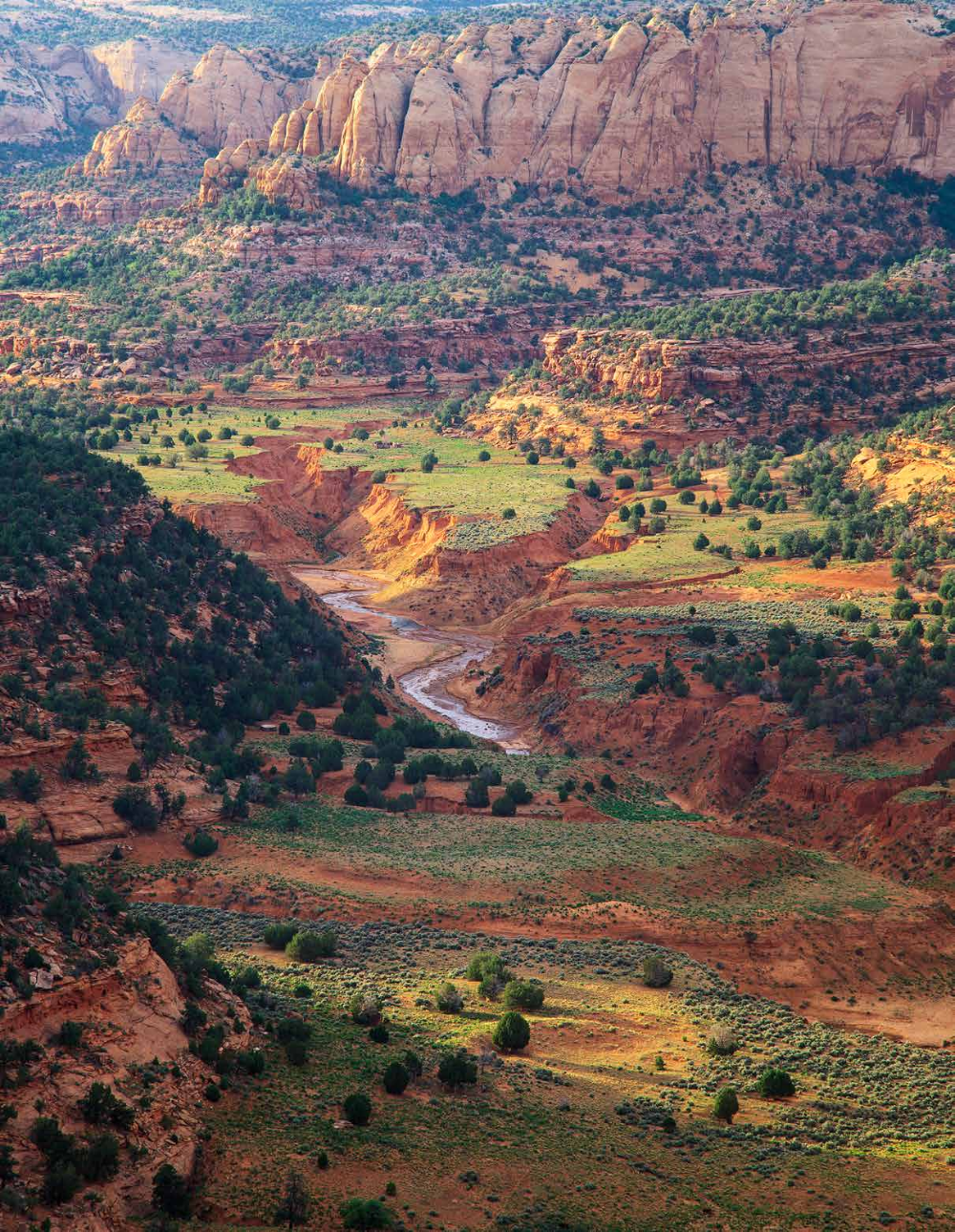
Like all of the great canyons in Arizona, it’s hard to put Keet Seel Canyon into words. Photos struggle, too. It takes all five senses. You have to look out at the recurring canyon walls, hear the screeching of peregrine falcons overhead, smell the sweet scent of penstemons, feel the contrast of rock and sand along the creek, and taste the high-desert air. The words I wrote in my notebook aren’t printable here. Actually, only the second word isn’t. The first word was “HOLY.”
We were still wide-eyed when we met Randall, a solo hiker in his 70s, plodding along the edge of the cold water. He’d spent the night at the ruins — that’s an option if you don’t want to do a marathon day hike. “It’s hard to describe,” he said. “And I didn’t have any issues with snakes or quicksand.” We took solace, said our goodbyes and spent the next hour crossing back and forth across the creek. And along the way, we talked. We talked about politics and science and the role of the National Park Service. We talked about Rick’s corporate background. And mine as a simple woodsman. We talked a lot, and somewhere during that conversation, I lost count of how many times we’d crossed the creek. I’m guessing it was about a dozen. After one of those crossings, we came to the “big waterfall.”
We knew it was coming. It’s in the orientation. Normally, something like a 35-foot waterfall in the desert would stop you in your tracks, but in this canyon, the whole is greater than the sum of its parts. In fact, even if this hike ended at a stop sign, without the prehistoric payoff, it would rank as one of the best routes in the Southwest.
Rick pulled out his map at the top of the falls. We could either stay along the creek, on what Nolan called the “lower trail,” or climb to a terrace and take the “upper trail.” We decided to go up. More shade. No quicksand.
Although we followed the creek on the way out, I’m glad we took the alternative on the way in. The upper trail, which was restored in 2014, adds another dimension to an already multi-dimensional trail. The biggest difference is the trees. After so many miles in the open space, it was nice to brush against some branches. The dominant species are pines and spruce, but there are Gambel oaks, too, which were already showing fall color when Rick and I passed through in early September. The most impressive trees, however, are the Douglas firs. There’s an ancient grove that most likely took root after the Anasazis disappeared. Or, who knows, maybe the two colonies overlapped — those magnificent conifers can live anywhere from 500 to 1,000 years.
Another distinction of the upper trail is that it winds in and around a series of steep side canyons, which makes the route longer than the straighter-line distance along the creek. Napoleon would have built bridges, but we weren’t looking for shortcuts. Just scenery.
We were enjoying the rocks and the trees when we crossed a small creek and came to a wooden sign for Keet Seel Campground. Intuitively, we figured we were getting close, but we didn’t know. Then, a few minutes later, we were looking through the old cottonwoods. Speechless. In awe.
WITH MOST AWE-INSPIRING PLACES, there’s some harbinger of grandeur. At the Grand Canyon, it’s signaled by a queue of cars, buses and RVs. At Walnut Canyon, it’s a set of 240 stairs. At Keet Seel, there’s nothing. And even when you do see it, you don’t. It’s like looking at a wall of rocks along the Bright Angel Trail, and then realizing that one of the rocks isn’t a rock, but rather a bighorn sheep. In this canyon, the ruins loom without looming. Camouflaged by man and Mother Nature. I suspect everyone does a double take when they first see Keet Seel.
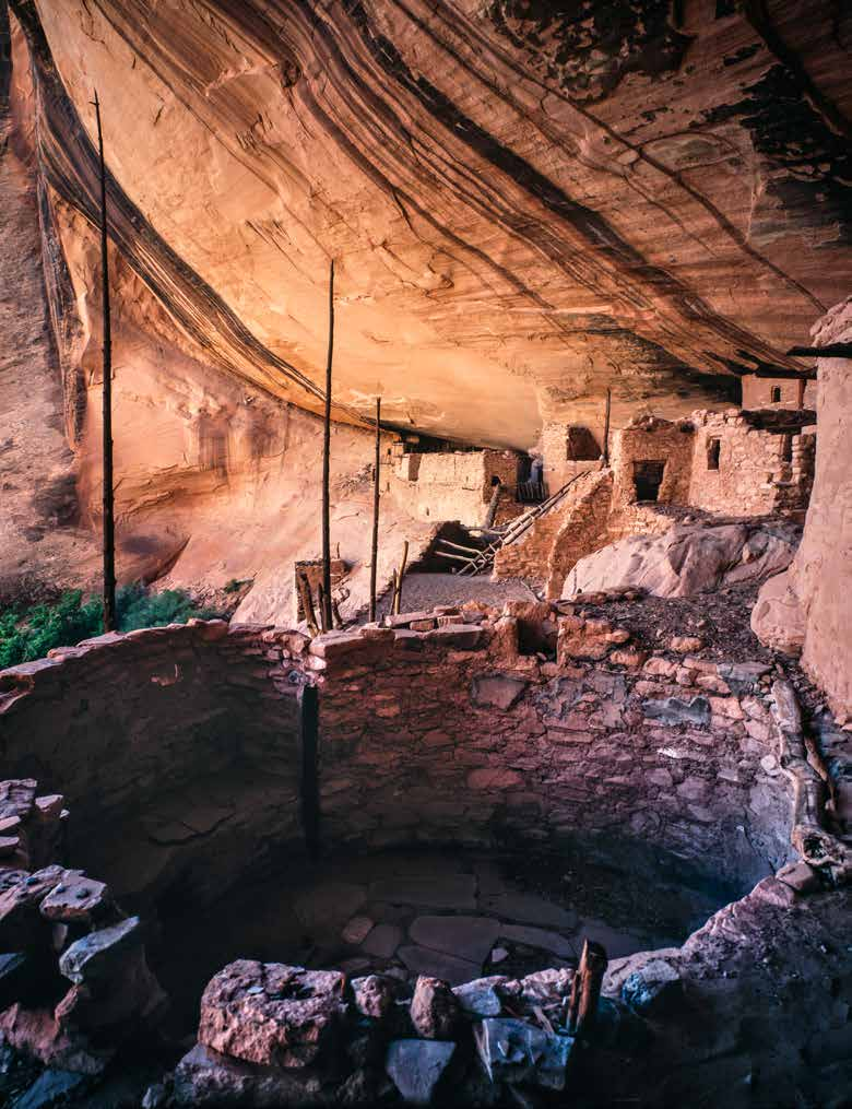
Although thousands had come before me, I felt as if I were the first. It was the Tom Sawyer in me, the dreamer, remembering boyhood stories about Howard Carter’s discovery in the Valley of the Kings. I didn’t learn about the Wetherill brothers until I started exploring the Southwest in my 20s, but I was equally intrigued. And now, having looked through the cottonwoods, I think I have a sense of what Richard Wetherill must have felt in 1894. From the big trees, the ruins are only 500 yards away, but it’s a journey of 700 years. That’s a powerful notion. And it grows stronger as you climb the long wooden ladder into the halls of prehistory.
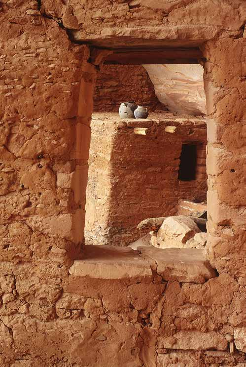
Once there, you see the smoke-blackened walls of dozens of rooms, and the massive crossbeam made from an old Douglas fir. You see well-worn metates, faded pictographs, a granary and multiple kivas. Rick and Caleo John, the ranger on duty, were talking about the scattered pieces of broken pottery. The Kits’iil. Somehow, Rick was doing most of the talking. I was there, too, but I was somewhere else — in my head — trying to imagine what it was like for 125 people to live in this unimaginable monument. That’s when I looked down and saw three ancient corncobs, at least seven centuries old, at the base of an ochre-colored sandstone wall.
Well I’ll be damned, I thought.
There wasn’t anything left to say.
AGUA FRIA CANYON AGUA FRIA NATIONAL MONUMENT
By Annette McGivney
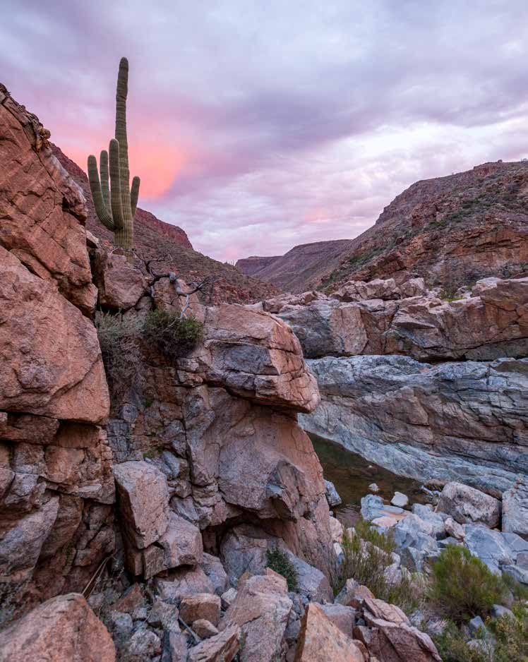
Lying on a white-sand beach in Agua Fria Canyon, thawing my winter-chilled body in the warm sun, I savor the sound of water gurgling over rocks. The soothing serenade is a delicacy here in the Sonoran Desert — as hard to come by as fresh salmon or fall colors. A river that runs through Agua Fria National Monument seems almost too good to be true when this intermittent stream is flush with icy snowmelt from the high country to the north. I can’t help but wonder if the scene surrounding my secluded campsite — a rugged hillside full of saguaros standing guard over a babbling brook — is a mirage.
I’m not the first person drawn to this Central Arizona canyon for its rare supply of water. On my hike to the river, I pondered a petroglyph panel, at the junction of Badger Spring Wash and Agua Fria Canyon, that offered proof of those who had come before. Images etched on the patina-covered cliff of human figures, horned ungulates and swirling geometric designs all seemed to celebrate the bounty and beauty of this desert oasis.
Nearly a millennium ago, the Agua Fria River and Perry Mesa, which rises more than 2,000 feet above the canyon floor, were home to one of the largest concentrations of native people in the Southwest. At its peak in the 1300s, members of what archaeologists call the Perry Mesa Tradition numbered an estimated 3,000 to 4,000 who lived and farmed year-round in the region. The monument is located just across Interstate 17 from Sunset Point Rest Area, and most of today’s weary travelers have no idea that when they gaze upon the panoramic, undeveloped grassland to the east, they’re looking at an archaeological treasure trove.
“The 75-square-mile mesa-canyon complex contains one of the most fascinating groups of ruins in Arizona and some of the most spectacular rock art in the Southwest,” says archaeologist Scott Wood, who recently retired from the Tonto National Forest and has been studying Perry Mesa for nearly four decades. But Wood also points out that the remote location is one of the “most vandal-ravaged sites you are likely ever to see.” While 19th and 20th century archaeologists focused their excavation efforts on better-known ancient population centers like Colorado’s Mesa Verde and New Mexico’s Chaco Canyon, pothunters illegally plundered Perry Mesa.
Finally, in January 2000, the area got the recognition and protection it needed when President Bill Clinton established Agua Fria National Monument. The 70,900-acre monument, located on Bureau of Land Management land, encompasses some 450 prehistoric archaeological sites, including the ruins and rock art of four ancient villages. Adjacent to the monument, on the Tonto National Forest’s Cave Creek Ranger District, are three more pueblos and dozens of rock-art panels that are part of the Perry Mesa complex.
Archaic civilizations that preceded the Hohokam in the early first century lived in small encampments along the bottom of Agua Fria Canyon, where they hunted and gathered. However, around 1100, a far more sophisticated society began to develop as the Hohokam descendants, along with relatives of the Salado culture and others from Central Arizona, moved on top of the mesa and began to farm. Over the next three centuries, the people of Perry Mesa built extensive agricultural terraces across much of the sprawling plateau to dry-farm corn and agave in the moist clay soils. Along the edge of the mesa, overlooking Agua Fria Canyon and its tributaries, they built one-story pueblos containing 80 to 150 rooms. These dwellings had no exterior entranceways, probably for defensive reasons, so the occupants likely climbed the outer walls using ladders.
“Each of the seven established pueblos on the mesa is made up of clusters of large ruins, and the communities are all located a few miles or less from one another,” Wood notes. “We assume that these villages operated as a cooperative unit for farming on the mesa.” Wood also suspects the villages functioned as a collective “castle” to defend the mesa from raiders.
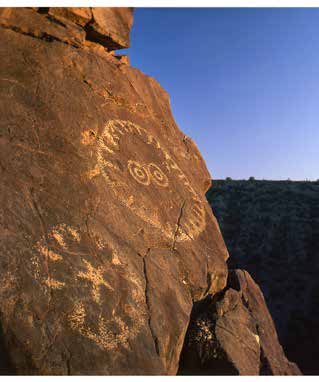
As drought plagued other communities in Central and Northern Arizona in the 13th century, Perry Mesa’s unique geography left it unscathed and the population boomed. “The mesa is in a strategic location from a weather standpoint, because monsoon storms track up Agua Fria Canyon and then stall at the 1,000-foot-tall wall of basalt along Perry Mesa,” Wood says. “Rains replenished springs, and the clay soils held water for long periods. When the Prescott area was drying out, Perry Mesa remained an agricultural oasis.” Wood adds that archaeologists have found evidence of retention ponds, similar to modern cattle tanks, that ancient Perry Mesa residents built to store water.
While it’s possible for an intrepid hiker to scramble up one of the Agua Fria’s tributaries to get on top of Perry Mesa and view the remnants of Arizona’s first successful master-planned community, taking Bloody Basin Road is a much easier option. The most accessible of the seven villages is Pueblo La Plata, located within the boundaries of the monument and at the end of an easy 1-mile trail. The stone and masonry structure once consisted of 80 to 90 rooms, and the residents got their water from nearby Silver Creek.
Today, Pueblo La Plata has been reduced to collapsed rock walls that are 5 to 6 feet tall. Nearby is a graded surface that looks like an old road but is what archaeologists call “the racetrack.” Although its purpose is unknown, the prevailing theory holds that it was a path used for ceremonial processions. And just like the other six villages on the mesa, the view from Pueblo La Plata — as far as the eye can see — is spectacular. From the promontory on the brink of the mesa, Agua Fria Canyon drops away to the south and west, with the Bradshaw Mountains rising on the far western horizon. It’s easy to imagine how 1,000 years ago, someone from this vantage point would have scanned the skies for approaching storms, scouted for enemy campfires or marveled at the sunset.
“The wind howled on the mesa, but it was a good place to be,” Wood says. “They put a lot of work into building all those agricultural terraces that made it possible to live there full time.”
So, why did they leave? As with the disappearance of many ancient communities in the Southwest, the answer is somewhat of a mystery. Wood theorizes that Perry Mesa had become economically dependent on trade relationships with communities throughout Arizona. And when a series of massive floods in the late 1300s devastated tribes in the Salt River and Verde valleys, it set off a system-wide collapse in much the same way that a stock-market crash in the United States or China today causes severe economic repercussions around the world. Wood says the descendants of Perry Mesa now live among the Southwest’s Hopi, Zuni and Pima people.
And even though the urban frenzy of Phoenix is just 40 miles to the south, Agua Fria Canyon and Perry Mesa have remained remarkably unchanged since their last human inhabitants walked away six centuries ago. “It is one of the few archaeological sites in the Southwest that still looks like it did back in the day,” notes Wood. “Some power lines and stock tanks have been added, but it’s pretty much the same landscape as in prehistoric times.”
On the towering flats of Perry Mesa, the view is just as grand. And down in the granite-walled narrows of the river canyon, the sound of water is just as sweet.
SEE IT FOR YOURSELF
DIRECTIONS: There are few established trails in Agua Fria National Monument, but the wide-open mesa and river canyon make for relatively easy cross-country travel. If you want to explore Agua Fria Canyon, go north on Interstate 17 to Badger Springs Road (Exit 256) and hike one-third of a mile down Badger Springs Wash to the river. From there, you can scramble 4 to 5 miles upstream or downstream. Either direction offers equally enjoyable scenery and riverside campsites.
ROCK ART: If it's ruins and rock art you're after, go north on Interstate 17 to Bloody Basin Road (Exit 259), which is also identified as Forest Road 269. To reach Pueblo La Plata, go 8.3 miles on Bloody Basin Road, crossing the Agua Fria River and climbing onto the mesa, to the junction with Bureau of Land Management Road 9023 on the north side of the road. Turn left onto BLM 9023 and continue approximately 1 mile to the signed monument parking area. A high-clearance vehicle is required for this final stretch. Other ruins and rock art can be reached by continuing on Bloody Basin Road and going down Bureau of Land Management Road 9014 (Forest Road 14). Cliff faces in Brooklyn Basin contain extensive petroglyph panels.
SEASON: The Agua Fria River flows in late winter and spring. Flash floods make the canyon dangerous during the summer monsoon season.
INFORMATION: Agua Fria National Monument, 623-580-5500 or www.blm.gov/az; Arizona Site Steward Program, www.azsitestewardprogram.com; Friends of Agua Fria National Monument, www.aguafriafriends.org
CRACK IN ROCK RUINS WUPATKI NATIONAL MONUMENT
By Kelly Vaughn
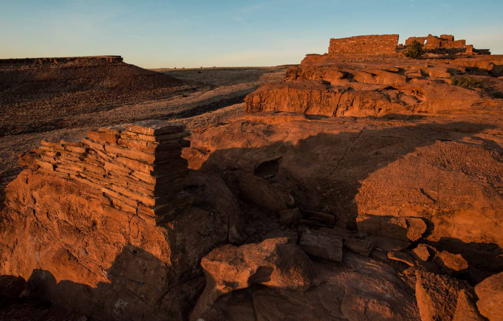
I met the Aura Woman one weekend. Long ago, hands etched her into rust-colored walls, chipped away lines to illustrate her energy and set her like an icon into stone. Hundreds of years later, we came face to face. Mother. Healer. Goddess. She.
And I just a visitor to an ancient ruin.
During the 13th century, people migrated from Crack in Rock pueblo. But on a Saturday evening at sunset, I climbed through one of its hollow halls and up onto a rocky platform.
From there, distant water in the Little Colorado River caught last light, reflecting sky and sandstone and the thousand-year struggles of people in a land with little water. And I wondered if I was hearing things that weren’t really there.
That happens if you listen long enough to the wind. Echoes of songs. Whispers of stories. Silence in the space of waiting. Desertion has a way of conjuring ghosts, I suppose.
Crack in Rock Ruins once was a home. It’s 8 miles deep into what is now Wupatki National Monument, where the Sinagua, Cohonina and Kayenta Anasazi people — collectively, the Hisat’sinom, a Hopi word meaning “those who lived long ago” — built walls and kivas. They grew corn. They raised families and created their stone stories. Later, Hopi and Navajo people moved through.
Today, the pueblo is a remnant, a destination on rare, ranger-led backpacking excursions.
To find the pueblo, photographer Dawn Kish and I met National Park Service rangers in the parking lot at Wupatki’s visitors center. Eight other hikers joined us, eager to explore one of Northern Arizona’s most prized, protected rock-art destinations.
As we loaded our backpacks into Park Service trucks to drive to an unmarked trailhead, I pulled out my reporter’s notebook and began scribbling. When the hike — a 16-mile, rugged, overnight excursion — was through, I realized that the notes had become something more.
SATURDAY, OCTOBER 11, 2014
9:15 a.m. I’m jammed into the back of a Park Service truck that carries five other people. Ranger Janice Richmond, who grew up in Tuba City and jokes about a “long and checkered past” with the Park Service, explains that the portion of Wupatki National Monument that we’ll be visiting is known as “rock art central.” She adds that the Park Service hosts six hikes to the pueblo each year: three in April and three in October. Three rangers oversee a maximum of 12 participants during each outing. Why three rangers? In case someone has to be hiked out.
9:27 a.m. The truck struggles over terrain that’s become increasingly crunchy, and I’m reminded of a long-ago journey into the Pine Mountain Wilderness on a road that made my insides rattle. Junipers provide the only greenery across a landscape that’s otherwise dominated by rock and dirt and distant glimpses of structures that must be ruins. “I feel like I’m in an Indiana Jones movie,” says Amy Linback, a Southern California native and recent graduate of Northern Arizona University who’s joined the trek for a dose of exploration.
9:30 a.m. “We’re here,” Janice says, and the truck eases to a stop on a dirt bluff that overlooks miles of scrub and rock. We unload our packs, and I’m feeling uneasy. This hike requires water, and lots of it — the Park Service recommends at least 2 gallons per person — and that means my 75-liter pack is even heavier than it normally is.
9:36 a.m. Janice’s Leave No Trace presentation ends, and she reminds me that the portion of Wupatki we’re about to enter has been closed to the general public since the early 2000s. Park Service rangers have led regular guided hikes back to Crack in Rock and nearby pueblos since the 1980s, and, for the most part, the landscape we’re about to traverse is pretty pristine. So, too, are the shards of pottery that we’ll likely encounter. With some limitations, Janice tells us, we’re free to pick up and examine the pieces, so long as we put them back exactly where we found them. I’m known to drop things, to be more than a little bit clumsy with breakables — glass and rules and feelings. I’m not sure if I’ll be picking up any pottery.
9:45 a.m. Ranger Bobby Wallace has repaired John Crane’s external-frame pack. One of the straps snapped, but with a little bit of MacGyvering, it should hold for the trip. John, the vice mayor of Carefree, Arizona, has had the pack for decades and seems more than relieved when it’s repaired. As we walk along a sandy wash, a rabbit darts from a patch of brittlebush, maneuvering a slight incline before we do.
Rabbits likely were a common sight back before the people who lived near Wupatki became ghosts. Snakes. Raptors. The hawks and eagles that spirits move into when spirits leave bodies. Ravens. Souls to sky, bodies to dust.
And the dust that remained after the eruption of Sunset Crater Volcano in A.D. 1040 proved life-giving to the people of the pueblo — they could farm in it. Great stalks of corn grew in the cinders that covered the landscape, and the people thrived.
Today, as Janice says, “you have to be an expert to live out here.” Patches of asparagus-colored Mormon tea contrast with the salmon-scaled strata of Moenkopi sandstone, and the occasional burst of Apache plume catches the wind. It and we are the only things moving since the rabbit outpaced us moments ago.
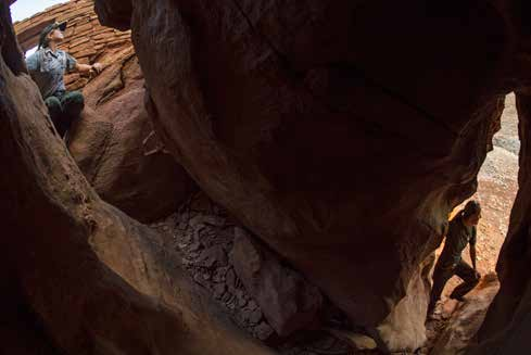
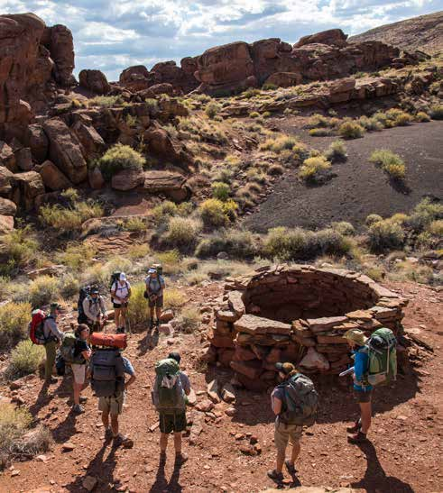
10:25 a.m. After a brief climb, we stop for snacks beneath a sandstone overhang, and my back is grateful for the reprieve. Bobby explains that there are more than 75 types of pottery in Wupatki. The vast majority in the Crack in Rock area has been traced to the Anasazi in the Four Corners area and traded between people and over great distances. I walk out of the shade and spot a shard. It’s at the base of what the rangers call “wall fall,” which is exactly as it sounds — the remnants of one of the structures that pepper this route. The shard is cream with black markings, and I decide to pick it up, tagging its place in the dirt with my pen so I can return it exactly where I found it. Despite its size, the piece is heavier than I expected, and I imagine that whatever bigger vessel it must have been part of would have been substantial.
Back goes the piece, up goes my pen, and on the group goes. There is more wall-fall rubble at Wupatki Site 2371. Bobby says this likely dates to between A.D. 1100 and the early to mid-1200s. We talk a lot about cobbles, the lovely smooth river stones that have found their way here from the Little Colorado River. There are pieces of petrified wood, scraps of flint. Traces of early weaponry, of fire-starting. Survival.
1:25 p.m. Hiking has become so much a part of me that I crave it, but this journey is more than a hike. It’s a reminder that, as much as I tell myself to look up and around me on the trail, there is so much beauty on the ground — the colors and crumbs of human evolution. Hours pass as we walk past kivas, fragments of Tsegi pottery under rock ledges and Long Lintel House, which park archaeologists believe may have been the center of a very large community. The people who lived there made their entry through the roof, which was constructed from timber beams carried from as far as 30 miles away. The wind blows, and we arrive to our lunch spot late. Here, at Wupatki Site 812, a stone outcropping provides shade, and the rangers tell stories of tourists. One of the hikers eats sardines from a can, and another has packed hummus. I daydream about pizza.
2:30 p.m. We are single file on the trail for a while, passing an old Navajo sweat lodge so small it seems impossible for a person to have nestled inside. The Navajos, of course, lived here long after the Anasazis, but they, too, have moved on. Desert buckwheat blooms in white rosettas, and we catch our first glimpse of Cinnamon Mesa. Named for Steve Cinnamon, a longtime resource manager at Wupatki, the mesa’s rocks look like blocks in a giant Jenga puzzle. We find a thriving tobacco plant at a rock-art site and eventually enter a section of the park composed more of limestone than of sandstone. Rock alignments on the mesas would have related to agriculture, the rangers say, as planned crossways to prevailing winds.
3:50 p.m. This is our first view of Crack in Rock Mesa, atop which the remnants of our destination pueblo lie. Ten minutes later, we arrive at camp. Dawn and I pick a site atop a small plateau, unpack and rest for a while, preparing to trek to the ruins without the burden of our big packs.
Nightfall. We’ve returned to camp for dinner and chatter around a fire. Pack rats scurry. We wait and watch for constellations to brighten against a night sky unblemished by city lights.
You’re probably wondering what happened to my journal. The part at Crack in Rock must be the good part, right? Of course.
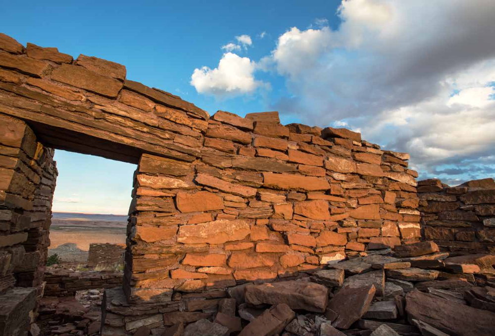
But walking among those ruins can only be described through the lens of experience. There are rocks, naturally. Pottery shards. The outlines of people and animals and astrological symbols scratched into stone. You’ll climb up through the pueblo’s namesake crack and out into sunset, sandstone and the wailing of an ancient wind, and you’ll wonder where the people went. When I ask Janice why the pueblo was abandoned, she reminds me that “abandonment” isn’t the preferred term. Repopulated. Reorganized. But not abandoned. It’s likely that environmental factors drove the people away, but where and how they repopulated or reorganized isn’t exactly clear.
When we walked away from the pueblo that night, I knew I’d dream it, watching satellites arch over its outline in the dark.
SUNDAY, OCTOBER 12, 2014
8 a.m. We’ve broken camp and prepared to begin hiking again. A fitful wind stirred us throughout the night, but Dawn and I awoke before first light to capture the sun rising behind the mesa opposite the ruins. A narrow, black-and-white snake darts beneath a bush, and I remember the pottery I held yesterday. It and the snake share a pattern. The geometry of nature transcribed to man.
8:20 a.m. We arrive at the mesas that neighbor Crack in Rock and drop our packs in preparation for a three-hour tour. I wish I’d brought a daypack and have to balance my notebook, water and a few other small supplies. Within minutes, we’ve climbed to the top of Middle Mesa, scrambling up an incline slick with shattered sandstone. There’s a pueblo here, but we don’t enter it as we did last night.
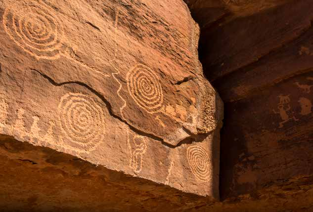
This is where I meet the Aura Woman. “Maybe she’s giving birth,” says John, whose pack has made it without snapping its strap again (we trade emails a year after the hike, and John tells me that JanSport was kind enough to send him replacement straps shortly after the Crack in Rock hike — he’ll use the pack for years to come). For Janice, though, the woman is a message. “Everything is one,” she says. “She blends characteristics of all life. Everything can be related, can become something else.”
8:53 a.m. We round a corner into a wind so vicious it lifts our hats and knocks us sideways. But there are textile glyphs, hunting scenes, conversations about the five-legged animals on one wall.
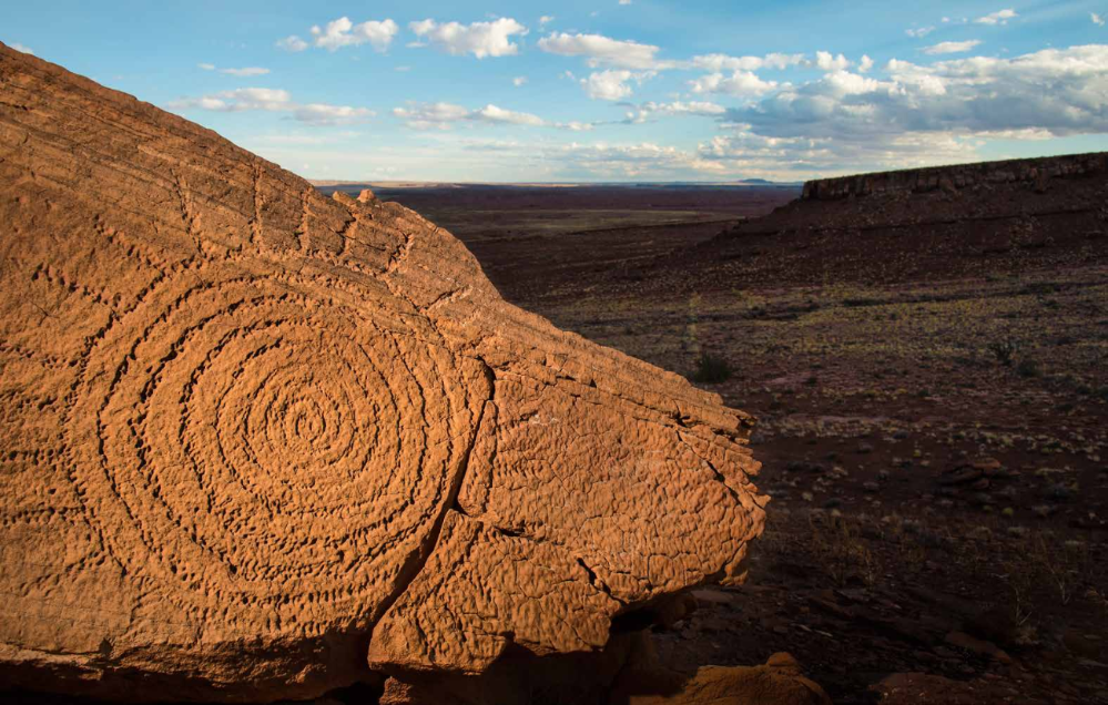
9:45 a.m. The spiral glyph that appears on Crack in Rock T-shirts and patches adorns one of the walls here. It is, the rangers say, an attempt at determining solar alignment.
10:20 a.m. We’ve reached the top of Horseshoe Mesa, “textile petroglyph central,” as Janice calls it. Archaeologists have placed small green flags to designate study sites, and we’re careful to avoid displacing anything. There’s sand in our teeth and dust in our eyes as, minutes later, we approach a panel in four quadrants — a creation story, and the grand finale of our petroglyph tour.
We leave the mesas with the wind at our backs, use juniper trees as landmarks and begin the slow, steady march back to the trucks that took us to the trailhead.
Most of us are quiet as we walk — tired, maybe. Or wrapped up in our own thoughts about the pueblos, the ruins, the mesas. We take a group photo beneath a natural arch within a half-mile of the trailhead, regroup at the trucks, then say our goodbyes when we return to the visitors center. We disperse on a small scale. Some of us will hike to Crack in Rock again someday. Others won’t — leaving for good, as the people of the pueblos did. For me, there’s a certain sadness in it all, but gratitude, too.
The wind picks up again, and, somewhere, an echo. The Aura Woman, maybe, come to call.