
THERE IS A LONE BRISTLECONE PINE that grows above timberline, on a slope of cinders. In winter, the tree emerges and hides with the passing of storm fogs, appearing like a mirage out of the white. My ski partner and I call it the “Spirit Tree.”
When the snow melts beneath this tree in May or June, water seeps and creeps and ping-pongs its way down the mountainside — not on the surface, but just below the loose little lava pebbles. In a meadow below, the subterranean water is squeezed upward, where it nurtures a grove of gnarled old blue spruce.
From that spruce grove, the water makes a decision: right or left. A right turn will take it south to the Gila River, then into the Colorado River near Yuma. Left-flowing water will wend its way north to the Little Colorado River, west through the Grand Canyon and then south, also to Yuma. There, where the waters of the Colorado and the Gila meet, the snowmelt from the Spirit Tree is reunited.
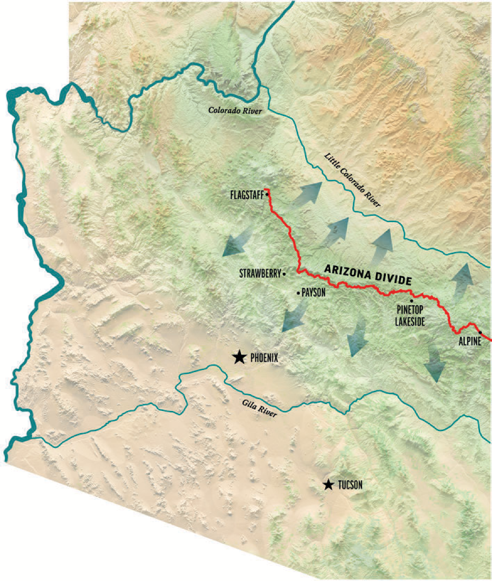
Both journeys cover more than 500 miles. And this splitting of the waters occurs not just at the old spruce trees on the flanks of the San Francisco Peaks, but continuously along a dividing ridge that runs across Arizona and into New Mexico. Raindrops falling to the northeast of the ridge flow into the Little Colorado. On the southwest side, all water goes toward the Gila. This headwater ridgeline is called the Arizona Divide.
The world is made of divides. Some, we’ve all heard of: the Continental Divide, the Pacific Crest. But spurring off of those noble heights are other tentacles of ridge that separate our waterways every which way, but always downhill. Water is mandated to flow with gravity, no matter what direction that might lead. The Arizona Divide splits our two main watersheds — the Little Colorado and the Gila — in opposite directions. Still, nearly all that water ends up, if given the opportunity, in the Colorado River.
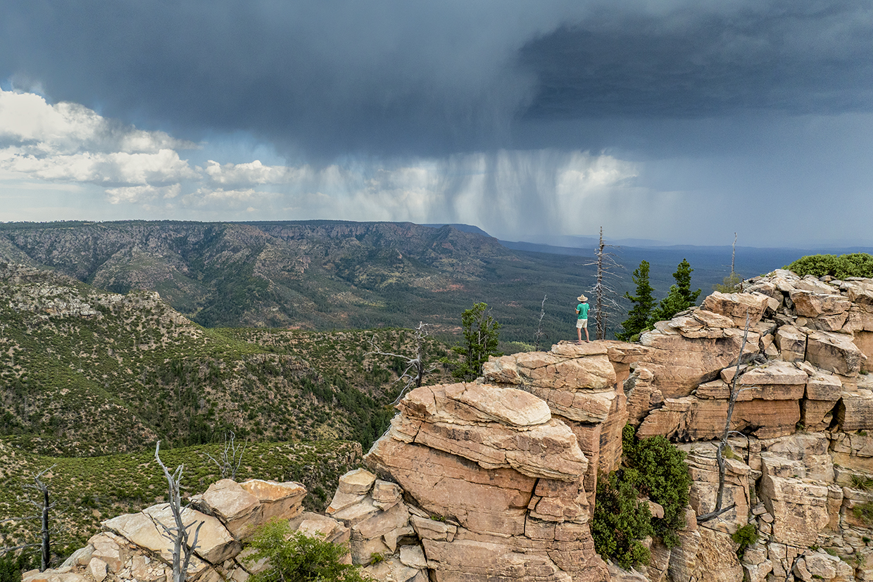
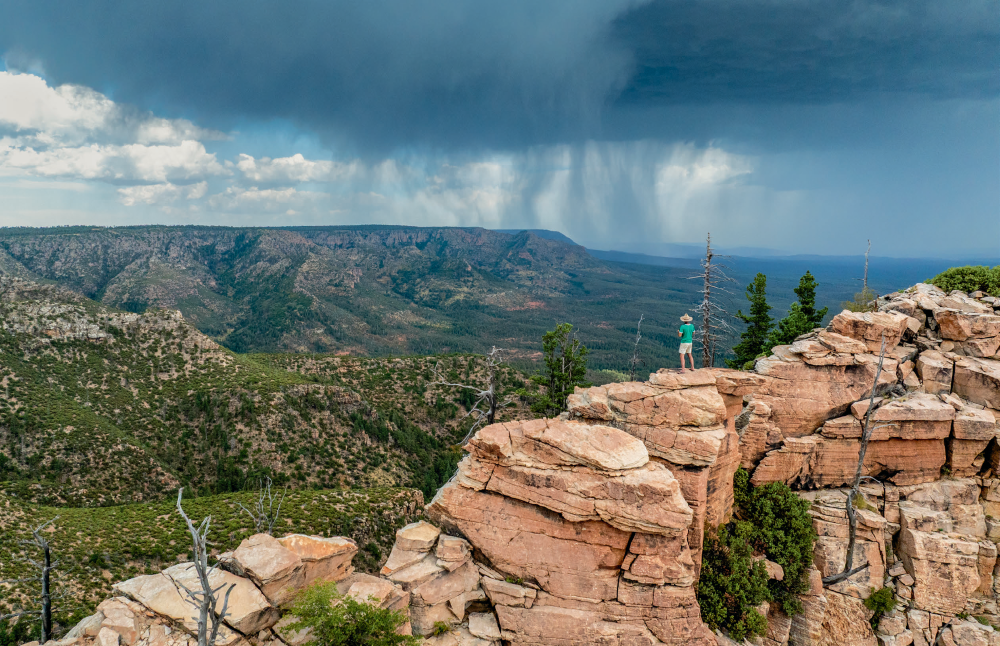
These thoughts wobble through my brain as I stand atop the Mogollon Rim, looking south, surveying wave after craggy wave of blue horizon, each creating a sub-basin of its own, all bound for the Gila. Spinning north, I see the atmosphere is purple, reflecting the colorful tones of the Painted Desert. From my vantage high on the Rim, it’s easy to see the land tilting toward that glow, toward the Little Colorado.
I’m snapped out of my reverie by a crack of thunder. I’m on an exposed ridge. It’s time to go.
Gazing across vast landscapes brings glorious moments such as this while traveling the Divide, but the spaces between are what I find most rewarding: crossing a pass covered in shoulder-high ferns, discovering a giant aspen, finding a perfect campsite beneath arching oaks. Exploring the Divide is a high-country romp down elk trails and dusty roads. I walk. I drive. I ride.
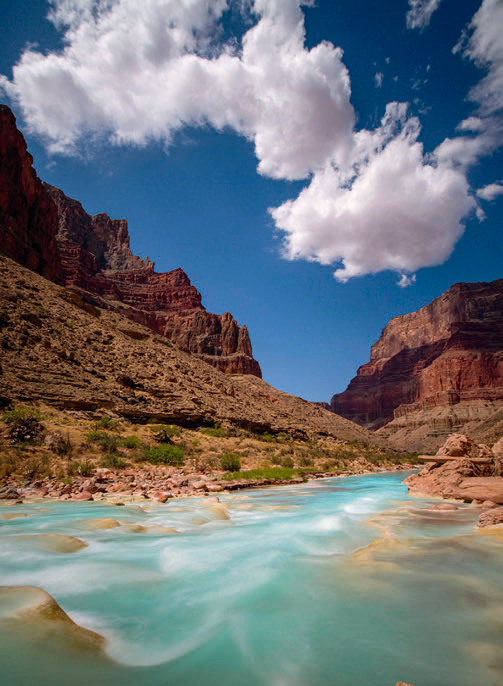
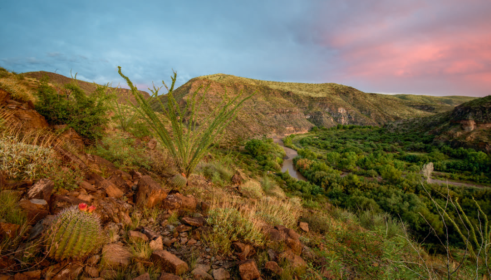
Pedaling my fat-tired e-bike, I’ve found, is the most practical means of travel along the Divide, equally comfortable on gravel roads and rutted two-tracks. It’s not a novel concept. Search for “Arizona Divide,” and you’re likely to find the “Divide Ride,” a bicycle route that follows it for nearly 300 miles. Best time: two days, 14 hours. The cyclists, of course, aren’t tracing every inch of the Divide to each summit cone or rocky rim; they’re staying near it, on rideable roads. To trace the very crest requires hiking, often an easy stroll but sometimes a scramble up bluffs, over deadfall and through spiny locust bushes. Still, routes exist near the Divide for much of its length.
Interstate 40 crosses it west of Flagstaff; there is a sign. Interstate 17 crests the Divide, too, at the exit for Fort Tuthill County Park south of town. If you attend a concert at the amphitheater there, you’ll be standing on the Gila side of things; amble over to the rodeo arena, and you’re in Little Colorado territory. State Route 87 crosses the Divide imperceptibly, along the flat spine of Blue Ridge near Clints Well. East of Payson, on State Route 260, the Divide is more obvious as the pavement finally surmounts the dramatic Mogollon Rim and enters a cathedral of yellow pines.
To follow the Divide in either direction from my vantage point, one can follow Forest Road 300, which has been a route for a long time — from game trail to foot track to horse path to gravel byway. There aren’t really many options; the Rim falls away in cliffs to the south, and a long string of forested draws slash the landscape to the north. The Rim’s edge is the only place to go.
The Rim and the Divide are one and the same here, but the Divide doesn’t always stay on that precipitous edge. South of Flagstaff, the colorful Rim bursts wildly from plateaus of somber pines, but the Divide sits quietly behind the scenes, higher and miles back from the cliff edge. Modest old volcanoes claim the high points, and the Divide traces a winding path from one to the next: Woody Mountain, Mormon Mountain, Hutch Mountain.
From the summit of Hutch, I look out across windswept grasslands and wide mesas — Colorado Plateau country — and down into the deep, cactus-draped valleys of the Sonoran Desert. It seems as if I’m straddling two worlds, and I am. The boundary between the Colorado Plateau and the Basin and Range Province provides the backbone for the Divide, but that border is often muted as solidified lava flows cover the underlying skeleton of the Earth’s surface. In the forests around Hutch Mountain, for example, the Divide is tricky to follow; it might exist amid an indiscernibly flat meadow as much as it might follow a defined ridge or a sheer cliff edge.
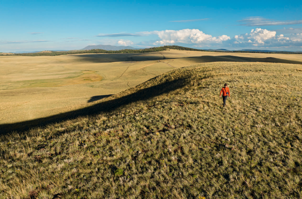
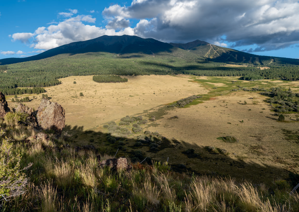
That all changes near Baker Butte, on the very corner of the Colorado Plateau. Here, the Mogollon Rim emerges in full force, and instead of traveling north-south, the Rim and the Divide turn abruptly to the east. There is no doubt where the water is flowing now: north into any number of forested bottoms, such as Barbershop Canyon or Buck Springs Draw, all feeding East Clear Creek and the Little Colorado; south, down the steep face of Mogollon cliffs and into Horton Creek, Tonto Creek, and the Salt and Gila rivers.
Where the Divide and the Rim are one, the geography of the Divide is rather obvious, but it wasn’t always this way. Twenty million years ago, today’s jagged mountains south of the Rim — the Mazatzals, the Sierra Ancha — were high like the Andes and connected to the Rim, which wasn’t a rim at all, just a lower slope of the great ranges. Geologists know this because colorful, smooth stones litter the landscape along today’s Rim. The rounded red and purple rocks make FR 300 a lumpy, bumpy cobblestone affair in some places, and they are the same rocks you’ll find today in the much-reduced Mazatzals. They came from there, so long ago.
Back then, the Divide would have existed high atop a snowy peak of the ancient mountains, south of today’s Mogollon Rim. “One of my favorite Arizona geology stories involves how our topography has inverted in the last 20 million years,” geologist Wayne Ranney says. “At that time, water flowed north from Central Arizona onto the lowlands of the future Colorado Plateau.” In those days, the Little Colorado held a good chunk of geography that now belongs to the Gila. Divides come and go with the weathering of the Earth, like the growing wrinkles of our aging skin. In another 20 million years, the Gila will gain more ground as the Divide creeps north, following the continued erosion of today’s spectacular Mogollon escarpment.
Currently, the low point of the Divide comes south of Show Low, where U.S. Route 60 cleaves a saddle of ponderosa pines on the cusp of junipers, 6,600 feet above present sea level. From here, the Divide runs barely south of Pinetop-Lakeside until SR 260 crosses it just past the border of the White Mountain Apache Tribe’s land. This is no coincidence: The tribal boundary and the Divide are one and the same for about 100 miles in Eastern Arizona.
On a map, the path of the Divide is reminiscent of a river’s course, flowing generally in a direction but always meandering in loops and bends. The most noticeable of these deviations comes at Mount Baldy, in the White Mountains, where a pie wedge is carved out of the Divide from the northeast, capturing a bit of drainage for the Little Colorado. The “Little C” gets the treasured northeast slope of the mountain — the direction that collects snow the best, and the side that held a glacier just 10,000 years ago. Even so, the starved Little Colorado dives underground immediately beyond the foot of the mountains.
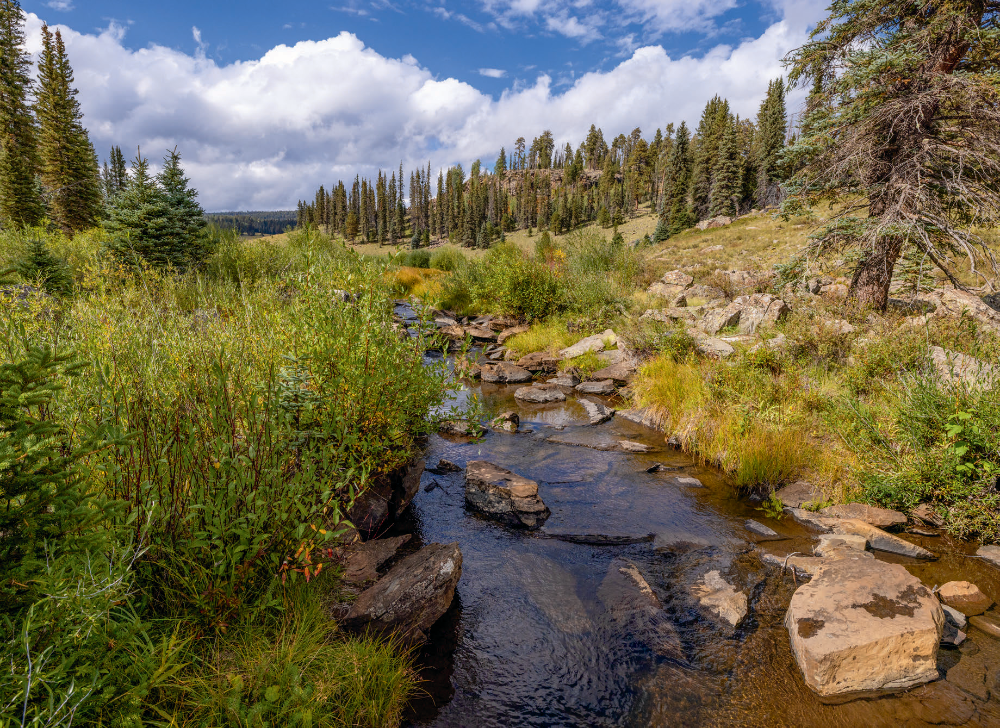
This is not unusual. Most of the water that spills to either side of the Divide goes quickly into the ground, exploring a network of underground channels and reservoirs that sometimes emerge on the surface as puddles, springs, creeks, even rivers. To actually see water flowing in the normally dry ditches and draws coming off the Divide, one must be there on a very special high-water day when the Earth oozes an excess of lifeblood — perhaps a warm afternoon during the spring of 2023, when the snowpack was three times normal, or the winter of 1993, when the Salt was taking out bridges in downtown Phoenix.
From the desert banks of the Salt or Gila or Colorado, down in the lowlands, it’s sometimes difficult to conjure a connection between those thoroughly used waters at your feet and the verdant highlands where the journey began. For a single drop of water to reach the canals of Phoenix or the rapids of the Grand Canyon, it’s quite the odyssey. The Divide is the starting line for that spectacular mission, and the last Arizona high point along that starting line is Escudilla Mountain, near the New Mexico state line.
Photographer John Burcham and I once marched up Escudilla in a disintegrating storm. From the eastern rim of the mountain, the view was so vast that it seemed we were seeing the curvature of the Earth. What we were really seeing was the arc of Southwestern topography. North-tilting mesas gently ramped up to lumpy domes, which in turn dropped southward to a low, hazy land of sharp peaks. On the gentle crest of the arc between worlds, the Divide weaved a winding way east.