
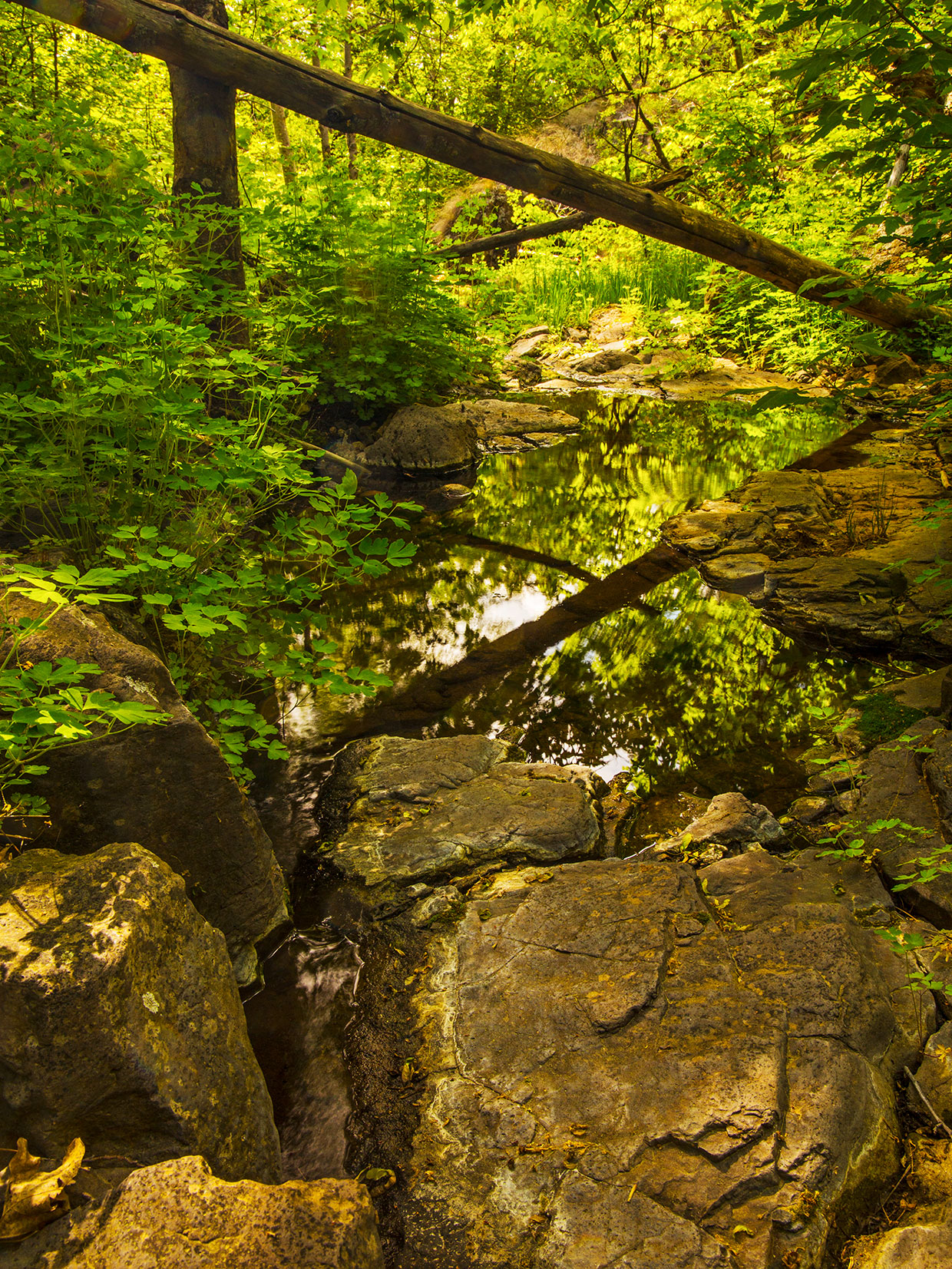
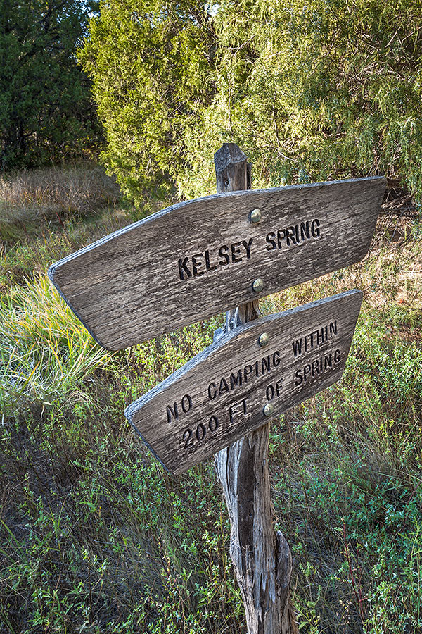
North of Clarkdale, at the end of a long, twisting road that starts out paved and ends as a rough dirt path, you’ll find the Parsons Trailhead. And following the Parsons Trail about a mile into Sycamore Canyon — first down a rocky slope, then along a sandy path, shaded by cottonwoods and sycamores, that parallels the canyon’s namesake creek just north of where it empties into the Verde River — will take you to Summer Spring.
Here, thick, thorny vegetation surrounds the pools where the spring’s water bubbles up from the ground. The only animals visible are spiders spinning elaborate webs on overhangs above the water. The only sounds are the bubbling of the spring, the gentle roar of Sycamore Creek and the snapping of distant branches by some unseen creature in search of water.
A casual visitor to Summer Spring would likely know these things. What they might not know is that in May of 2023, the spring was flowing at 45.74 liters per second; that it supported 608 square meters of spring-related “microhabitats” that were home to at least 13 plants and 26 animals, including yellow warblers and rock squirrels; and that the spring’s water had a pH of 6.99, or almost perfectly neutral.
But these things, and a lot of other things, are known. And the Springs Stewardship Institute (SSI) is the reason why. In 2023, the Flagstaff-based nonprofit launched an effort to catalog the hundreds of springs that sustain the Verde River, of which Sycamore Creek is a tributary, and also provide habitat for native plants and animals. Many of these springs are unmapped, and all of them are at risk due to drought and increased water use by humans. The SSI hopes that by finding, mapping and studying the springs, it can help water managers, along with the general public, understand the importance of saving them — before they dry up without anyone knowing they needed saving.
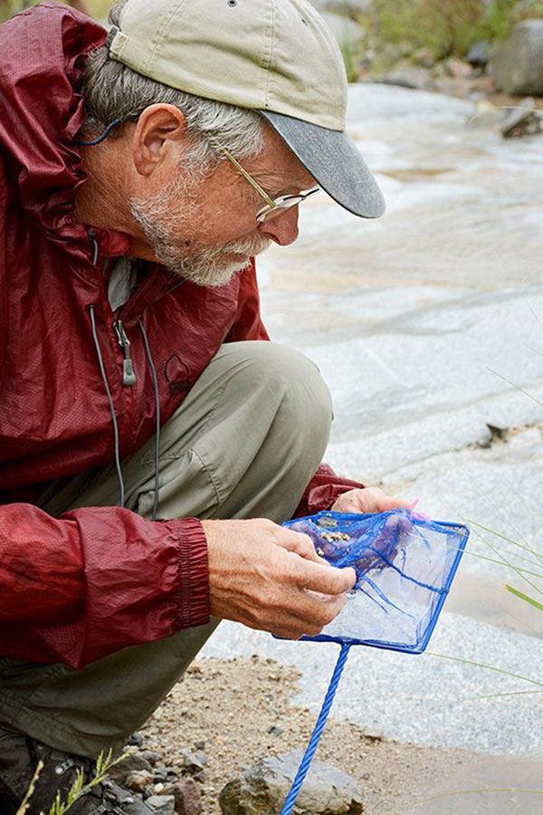
“If we don’t know where the springs are, how much they flow or what their variability in discharge is, we don’t know what we should be protecting,” says Larry Stevens, the SSI’s founder and director. “And if we don’t know what lives at those springs, we don’t understand their biodiversity value.”
Stevens has served as staff ecologist at Grand Canyon National Park, as a guide on more than 350 river trips in the Canyon and as an instructor at Northern Arizona University and Prescott College, and he’s authored more than 150 scientific and general-audience publications. “I’ve always been interested in springs, water resources and the species that live in these habitats,” he says.
That interest led Stevens and his wife, Jeri Ledbetter, to found the SSI in 2012 at the Museum of Northern Arizona, where Stevens also serves as the curator of ecology and conservation. In 2020, the institute became an independent nonprofit group that works to, in Stevens’ words, “try to bring attention to these little points in the landscape. If we can do a better job of understanding and conserving them, we can protect many species.”
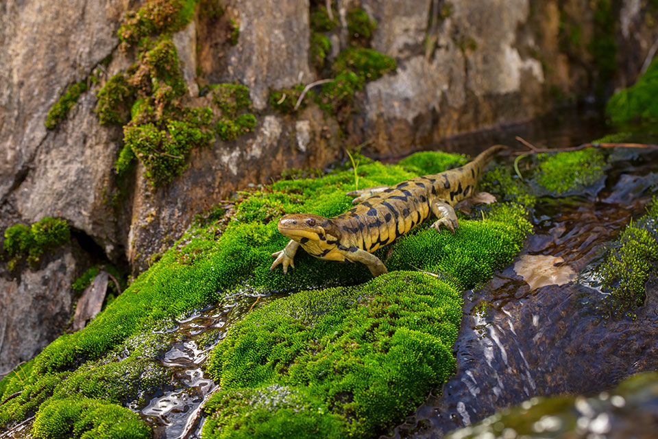
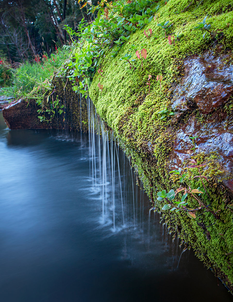
Garnering that kind of attention can be difficult, in part because people don’t know what a spring is — and because in the English language, the word “spring” has so many other meanings. In hydrology, a spring is a place where groundwater emerges and is exposed to air — in other words, Stevens says, it’s “a wet spot on the landscape.” And these wet spots play an important role in how the entire landscape functions. In addition to fueling river flow, they create a haven for native plants and animals, and because they often are disconnected from other water sources, they can protect native organisms from invasive species.
Those factors drove Stevens’ interest in studying the headwater springs that provide the Verde River with its base flow — basically, the portion of the river’s flow that comes from groundwater, rather than precipitation. But in the Verde River basin, as elsewhere, some of the major headwater springs have yet to be recorded, others have been inaccurately mapped, and few have been examined from an ecological perspective. “The lack of basic geographic information makes it difficult for water managers or the public to understand the vast importance and value of groundwater and springs in maintaining the health of the Verde River and other river systems,” an SSI report notes.
With funding from the Nina Mason Pulliam Charitable Trust, the SSI partnered with another nonprofit, Friends of the Verde River, to begin the process of cataloging the Verde’s headwater springs. Tracy Stephens, program director at Friends of the Verde River, says the project was a natural fit for her group’s mission of keeping the river healthy and flowing. “When you’re looking at conserving, protecting and restoring areas within the Verde River, springs are definitely a data gap within the watershed,” she says.
But where to begin, given that there were an estimated 900 such springs to catalog? “The first step for us was ‘winter work’ — going through all the available literature, and calling and talking to people who might know about where springs are,” Stevens says. Because the springs listed on U.S. Geological Survey maps often are in the wrong place or no longer exist, that process was challenging. “First we had to document what knowledge exists and pull it together into a geographic information system,” Stevens says. Ledbetter, the SSI’s program manager, coordinated much of that work.
From there, the team identified the most important springs to visit, given logistical challenges and the limitations of the project’s funding. In some cases, springs were right near a road or, like Summer Spring, within an easy walk. Others were … less accessible.
“There’s some very wild country in the river basin,” Stevens says. “On one of our expeditions, we descended into the headwaters of Wet Beaver Creek, near Apache Maid Mountain. That was one of the worst hikes I’ve done in the past couple of decades — chaparral 3 meters over your head, dense brush. Trying to get in there is just a freaking nightmare.” But he’d been wanting to get there for a long time, and he was able to find the spring — which had been inaccurately mapped but was still flowing.
Members of the public could join the effort by registering as volunteers through the SSI’s website, and Friends of the Verde River helped with volunteer recruitment as well. One volunteer, Lynne Westerfield, shares Stevens’ background in river guiding and now works in habitat restoration for Wild Arizona, so assisting with the Verde springs project was a natural fit. “It’s a similar field, and anytime you can get out there with Larry and Jeri, their knowledge is epic when it comes to springs and ecology,” she says.
Westerfield, Stevens and another participant spent a long day hiking along one of the Verde’s tributaries, and Westerfield says she soon understood why finding springs in this part of Arizona can be a challenge. “I was a mountaineering instructor for a long time, but you start hiking, and you’re like, Wow, I don’t even see where I’m gonna go,” she recalls. Following multiple elk trails, they retraced their steps numerous times to find a way into a canyon, then a way across the creek.
“At one point, Larry said, ‘I’m gonna have to swim this,’ ” Westerfield recalls. “And I and the other woman who works with him were like, ‘OK, if that’s what you want to do! We’ll be here!’ ” Stevens eventually returned soaking wet, but he’d found the spring. “It’s really wonderful to be out there with [the SSI crew], because it’s a great adventure to find these things sometimes,” Westerfield says, adding that she later joined another trip, this one with the SSI and the Arizona Elk Society, to fence off a spring to protect it from elk and cattle.
One of the things she remembers most fondly, though, is Stevens stopping at the end of that long day to point out a hundred-year-old hedgehog cactus and share some facts about it. “Just being able to muster this awe and appreciation for the natural world, even at the end of a day like that, was amazing,” she says.
In all, the study ended up visiting 34 springs, more than double the 16 for which it was funded. Nine of those springs had not previously been recorded, and Stevens says if that trend applies to all the Verde’s headwater springs, there could be more than 1,000 of them — many of them still out there, waiting to be found.
Some SSI expeditions explored headwater springs in upper Oak Creek, a major tributary of the Verde. Participants mapped nine springs, only two of which had previously been mapped, in the Indian Gardens area of Oak Creek Canyon, and they also documented a previously unmapped creek there with the help of a Hopi Tribe member, Georgie Pongyesva, who remembered it from her childhood.
Other findings included the first recorded botanical specimen of non-native bamboo growing wild in Coconino County, along with several populations of a tiny, spring-dependent species of aquatic snail that hadn’t been found in Arizona in nearly half a century. And for each spring that was mapped, the SSI produced a conservation assessment, using factors such as natural resource conditions and human impacts, to recommend steps water managers can take to improve the ecological integrity of these biodiverse locations.
But 34 springs, Stevens notes, is “a drop in the bucket” — and the pun might not be intended, but it’s certainly apt. The study’s funding was for only one year, but the SSI is hoping to find other funding sources to continue mapping the Verde’s springs in 2024 and beyond. Public awareness can only help, and the SSI has made the data from the project available via Springs Online, a free, publicly accessible database of springs and spring-dependent species.
“It would be great to see the public take a more active interest in the health of this landscape,” Stevens says. “We see springs as keystone ecosystems — little points in the landscape that are ecologically highly interactive. … The more word gets out on the beauty and complexity of springs, the more they may be valued and the less likely it is that they’ll be ignored in management planning.”
Stephens, of Friends of the Verde River, notes that while the project’s findings are important, its volunteer-based nature is equally vital. “Even with all the work that organizations like [these] have done, we can’t be everywhere,” she says. “Having this community of volunteers is such a benefit, and it really gives those ‘community scientists’ ownership in this type of work.” For example, she says, if participants monitor and become familiar with a specific spring system, they can document changes they notice from visit to visit.
At least one volunteer is hoping the project continues so she can participate again. And while Westerfield doesn’t know if she’ll be joining Stevens for a swim across an ice-cold creek, she’s ready for another adventure — and some enduring mystery. “It’s so neat to get back in there,” she says. “There are so many springs that we haven’t found. And maybe there will be some we never find. Wouldn’t that be cool?”
To learn more about the Springs Stewardship Institute and future efforts to map the Verde River’s headwater springs, visit springstewardshipinstitute.org. To view the Springs Online database, visit springsdata.org.