
Cochise is buried in the Dragoon Mountains. That’s the conventional wisdom, but no one knows for sure where he was laid to rest. He was interred secretly by his followers, and only one white man, Thomas J.
Jeffords, knew the exact location. Knowing or not knowing the whereabouts of the chief’s remains won’t affect your ability to enjoy this hike, but the mystery does add intrigue to an already alluring place that served as a refuge for the Apache warrior during his 12-year battle with the United States Army.
The trail begins at Cochise Stronghold Campground. That’s where the primary trailhead is located. However, there’s an alternate trailhead about a mile to the east — you’ll see a sign for it as you’re driving in. The first trailhead was established to accommodate horse trailers, but if you’d like to add 2 miles (round-trip) to the overall hike, park with the horses and hit the trail there. Otherwise, continue into the campground.
From the wooded parking lot, the first half-mile of the hike parallels an established nature trail that offers a great introduction to the area. Among other things, you’ll learn about the mesic vegetation that thrives on the cooler, moister north-facing slopes of what’s known as Cochise Stronghold, including silverleaf oaks and red-trunked madrone trees. Another tree you’ll see a lot of is the border piñon. It’s a beautiful pine that grows primarily in the grassy piñon-juniper woodlands of Southeastern Arizona, as well as parts of Southwestern New Mexico.
Where the nature trail ends, the Cochise Trail officially begins. It climbs gradually at the outset, then levels off a little where it enters a field of granite boulders, some of which are as big as a kindergarten classroom. A few minutes later, Arizona sycamores enter the picture. Although the creek bed they line is normally dry, in February, there could be water, so be aware of flash floods. Also, keep your eyes peeled for equestrians. It’s been said that comely lone riders, looking like something from a Ralph Lauren magazine ad, appear out of nowhere.
Just beyond the sycamores, the trail arrives at a gate, and shortly thereafter, it intersects the Middlemarch Canyon Trail, which veers left. Keep going on Cochise and pay attention as you make your way to the top of a large, flat-topped boulder. The trail disappears briefly on the bare rock, but if you keep heading south, you’ll quickly regain the route.
In the shadow of the big rock, about 200 yards south, you’ll come to Cochise Spring, which is surrounded by grass and shaded by a canopy of sycamores. From that unexpected Eden, the trail begins another gradual climb to Halfmoon Tank. The watering hole was built by the Green brothers on June 15, 1952, and it, too, is unexpected.
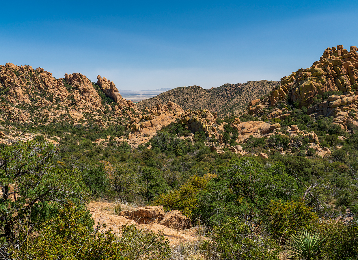
After a slight detour around the water, the trail climbs to the summit of a small ridge that offers excellent views in all directions. This is a good place to stop, turn around and look to the east, where the Chiricahua Mountains dominate the horizon. From there, it’s about 10 minutes to the Stronghold Divide, which separates the east and west sections of the Dragoons. Although the Cochise Trail continues for another 1.75 miles to a lesser-used west trailhead, the divide makes an ideal turnaround point. Looking around, you can’t help but wonder where the remains of Cochise might be buried. They’re out there somewhere, but it doesn’t matter where. It’s enough to know that you’re walking in the footsteps of the greatest Apache warrior of them all.
trail guide
Length: 6 miles round-trip (to the divide)
Difficulty: Moderate
Elevation: 4,784 to 5,968 feet
Trailhead GPS: N 31˚56.087', W 109˚57.54'
Directions: From Tucson, go east on Interstate 10 for 72.5 miles to U.S. Route 191. Turn right (south) onto U.S. 191 and continue 17.3 miles to Ironwood Road. Turn right onto Ironwood Road and continue 9.1 miles to Cochise Stronghold Campground.
Special Consideration: An $8 day pass is required.
Vehicle Requirements: None
Dogs Allowed: Yes (on a leash)
Horses Allowed: Yes
USGS Map: Cochise Stronghold
Information: Douglas Ranger District, 520-364-3468 or fs.usda.gov/coronado