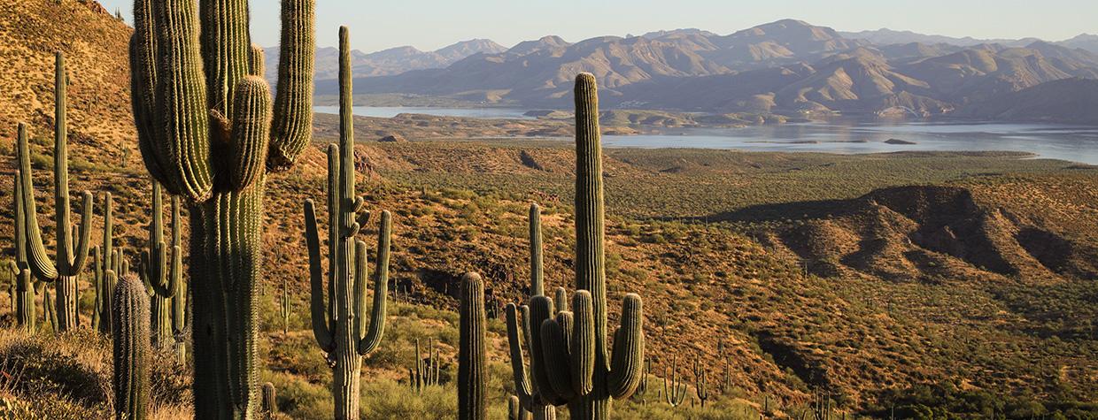
For a reservoir that once was among the world’s largest, Theodore Roosevelt Lake doesn’t get a ton of attention — possibly because it’s been surpassed by, among other human-made bodies of water, Lake Mead and Lake Powell. But while Arizona shares those reservoirs with Nevada and Utah, respectively, Roosevelt remains the largest body of water located entirely in Arizona. A-Cross Road, which runs along the north side of the lake, offers a little-seen perspective of it, along with plenty of Sonoran Desert scenery.
Start this drive along State Route 288, which connects the Globe-Miami area to Pleasant Valley and the Mogollon Rim. At the point where SR 288 transitions from pavement to gravel, head west on A-Cross Road (Forest Road 60), a wide Tonto National Forest path that has several rough stretches but is navigable in any SUV. To the north is the Sierra Ancha, a rugged mountain range known for its isolation and numerous archaeological sites.
Early on, the road traverses a landscape of healthy saguaro cactuses, along with smaller paloverde trees, creosote bushes and prickly pear cactuses. Within a mile, you’ll get a look at the reservoir and the Four Peaks straight ahead. A mile after that, the road crests a hill before gently descending — a pattern you’ll repeat several times on this drive. You’ll also encounter numerous side roads for exploring the area; the first is Forest Road 88, at Mile 2.5. To stay on
FR 60, though, bear right.
Before long, you’ll come to the first of several expansive panoramas of the lake, which was created when Theodore Roosevelt Dam was completed in 1911. When full, the reservoir is 22.4 miles long and has 128 miles of shoreline, and its dam is one of five on the Salt River, which supplies much of the Phoenix area’s water supply. Pull over at the hairpin curve at Mile 5.2 to get an excellent view of this vital body of water.
The road next curves around Bull Mountain, a low-slung butte studded with tall saguaros, before descending into a canyon and passing a quiet ranch property. After crossing a wash and climbing a steep, rocky slope, you’ll come to a smoother section and get a look at the Sierra Ancha’s Dutchwoman Butte on the right. You’ll enjoy intermittent views of the lake for the next several miles, and at Mile 15, you’ll come to the Salome Canyon Trailhead, from which the Jug Trail leads into the adjacent Salome Wilderness.
A section of prickly pears and yuccas is next, followed by another area dominated by tall saguaros along the road and on the hillside to the right. After a few more lake panoramas, the road continues downhill and enters a rocky, less-vegetated landscape of layered buttes that look like distant cousins of those in Northern Arizona’s Painted Desert. By Mile 21, you’ll be back among creosote bushes, teddy bear chollas and a few saguaros, and it’s an easy descent from there to a “T” intersection and a return to the pavement.
Turning left would take you to the lake’s Indian Point Recreation Site, but you’ll turn right to remain on A-Cross Road for a mile or so. The road’s Tonto Creek crossing is now permanently closed, so at the “Y” intersection at Mile 24, bear right onto Cline Boulevard, which crosses the normally dry creek just before ending at State Route 188 in Tonto Basin. Turn right to reach Payson or the Phoenix area, or turn left for another look at a lake that always has more to see.
tour guide
Note: Mileages are approximate.
Length: 27.7 miles one way (from State Route 288)
Directions: From the intersection of U.S. Route 60 and State Route 188 in the Globe-Miami area, go north on SR 188 for 14.6 miles to State Route 288. Turn right onto SR 288 and continue 12.7 miles to A-Cross Road (Forest Road 60). Turn left onto A-Cross Road and continue 24 miles to a “Y” intersection. Bear right, onto Cline Boulevard, and continue 3.7 miles to SR 188 in Tonto Basin.
Vehicle requirements: A high-clearance vehicle, such as an SUV or truck, is required, but four-wheel-drive is not necessary in good weather. The route crosses several washes and Tonto Creek, so do not attempt it after recent heavy rain or if rain is in the forecast. (If the creek crossing is flooded, use the recently completed Tonto Creek Bridge farther north.)
Warning: Back-road travel can be hazardous, so be aware of weather and road conditions. Carry plenty of water. Don’t travel alone, and let someone know where you are going and when you plan to return.
Information: Tonto Basin Ranger District, 602-225-5395 or fs.usda.gov/tonto
Travelers in Arizona can visit az511.gov or dial 511 to get information on road closures, construction, delays, weather and more.

