
Twice, it looked as if the route would not go, but a careful scramble to the edge always revealed a stairway through, perfect little steps hidden amid spires of limestone. Soon, we found ourselves in a creek bed leading in half-circles toward the main canyon. Once there, we still didn’t find water, so we trudged into early evening, settling on a sandstone ledge that held two small basins of rainwater — enough for morning coffee.
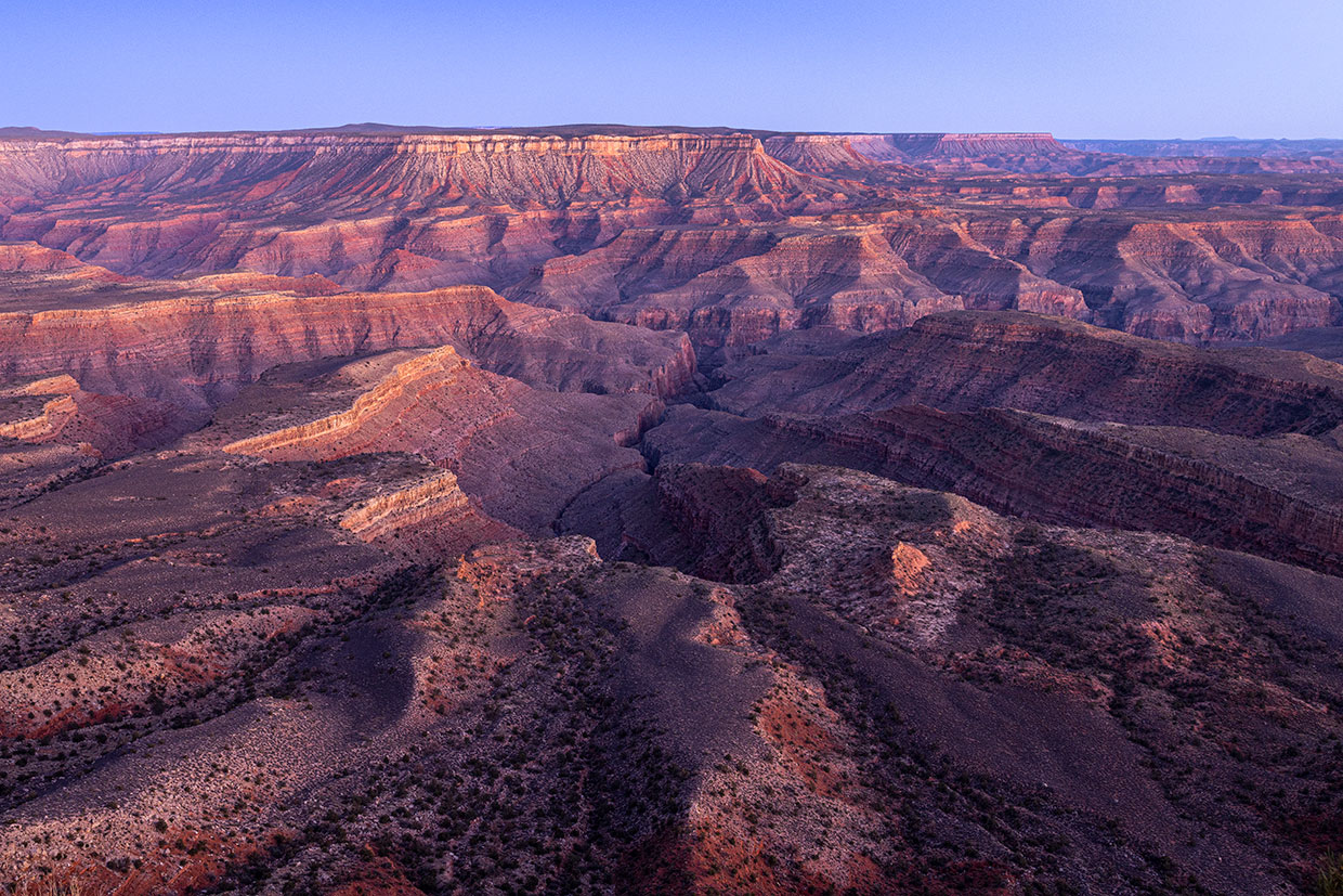
We knew water would be scarce out here on the Sanup Plateau, in the far western reaches of the Grand Canyon. We didn’t know the place would seem so foreign. Nearly 100 miles removed from the busy South Rim, the Sanup region hardly seems like the same Canyon at all. While the South Rim hosts some 5 million visitors annually, the Sanup sees maybe 50. Paved highways lead easily to the South Rim; to reach the Sanup, photographer John Burcham and I traveled a full seven hours from Flagstaff, the last three on dirt roads heading south from St. George, Utah.
An hour past the state line, we impatiently sped out of juniper woodlands onto rolling prairies, slowing again as the road narrowed into unexpected pine forests. Finally, the rim came into sight, glowing beyond the edge of the woods. We stopped. The view was even more exotic than the standard Canyon surreal. Snowcapped mountains shone in the west, their craggy black foothills stepping forward until disappearing behind horizontal bands of familiar plateau rock that fell, colorfully, into the abyss.
The Sanup is hemmed by deep, dark canyons that carve away from the Colorado River, creating several vast, bulbous peninsulas of plateau that we collectively call “Sanup.” It’s an elusive word — type it into your web browser, and you’re likely to get the latest news on a Nepali pop singer; look it up in language translations, and the answer will probably be “married man.” Married it is — to the rimrock above, to the canyons and springs and grottoes below, even to the river at its base that keeps the whole perfect landscape in methodical, inexorable motion. The Sanup of the Grand Canyon, however, is named after the sap of the piñon pine, many of which grow in the plateau’s nooks. Daniel Bulletts, cultural resource director of the Southern Paiute Tribe, explains: “We pronounce it ‘SUE-nupp,’ our word for pine pitch. You can use it as a glue or a skin salve.”
The piñon pines surrounding the Sanup are a little different from those found in the rest of the Canyon, where two-needle piñons (Pinus edulis) are most common. Here on the Sanup, you’ll find the one-needle variety (Pinus monophylla), a tree of Nevada. The two species overlap and hybridize in this part of the Canyon, just one example of the botanical shifts occurring in Sanup country. There’s an aster from Mexico that finds its northwestern limit here, along with a buckwheat of Oregon that’s at its southeastern extent.
This far west, the Canyon is in transition. The sharp, rocky stair steps found upstream begin to relent to wider benches and rounder rims. It’s still the Canyon, but it looks markedly different. In geographical texts, the Canyon ends abruptly at the Grand Wash Cliffs, where the Colorado Plateau Province suddenly cedes to Basin and Range topography. But there’s a more subtle shift happening within the Canyon before the Grand Wash Cliffs demarcate its final and unequivocal end, and this last face of the Canyon is dominated by the wide, empty Sanup.
On the south side of the river opposite the Sanup, the Kaibab Limestone through Hermit Shale — the first four of the Canyon’s major layers — are gone, eroded away to allow softer, more reasonable topography to take shape. To the north of the river, where the Sanup sits, the layers are mostly still there, but their character is different from the central Canyon. “When you move to the west,” geologist Wayne Ranney explains, “some layers become more gray and full of lime, which speaks to the ocean that was there. They are essentially the same layers as upstream, but their change in appearance documents the changes that were occurring at that time.” That was 300 million years ago. Back then, this was the beach, the edge of the continent. Now, it’s the boundary between two geographical provinces. The juxtaposition is illogical. Sheer rims lead straight into rolling grasslands. Rumpled, juniper-covered hills shear abruptly on the brink of the void.
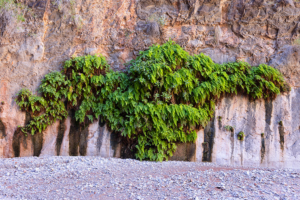
Our rain-filled potholes were almost empty and transferred into our coffee pot by the time morning sunshine beamed onto a cliff above camp. I sat in the warmth, soaking it up like a smug lizard, before following John’s footsteps into a narrowing maze of limestone. First there was a low gray wall, then a polished and smooth corner, then overhanging bends, one after another, where the intermittent stream had carved under the cliffs. A clear trickle seeped out of gravel underfoot, luring us onward with its sound of tinkling bells. A forest of yellowing hoptrees arched overhead, making it hard to imagine that just above lay the parched, unforgiving Sanup.
Despite the arid emptiness, people have been using this place for a long time. Ranchers once steered their cattle onto the Sanup, seeking patches of grass that gleam at sunset like reflected ponds of water. They made little catchments for the bovines, channeling water from the same meager springs the Paiutes had sought on their travels through this spacious land. Moments before John and I found our first seep of reliable water, I paused at a narrow spot in the canyon to gaze at the ribbon of sky above, but my eyes instead found the wall at my side. Figures of sheep emerged there, etched into the hard limestone, telling a story in a language and from a time that I do not know. A few feet above the petroglyphs were shallow drill holes, perhaps part of an old cow gate prudently placed at this natural portal.
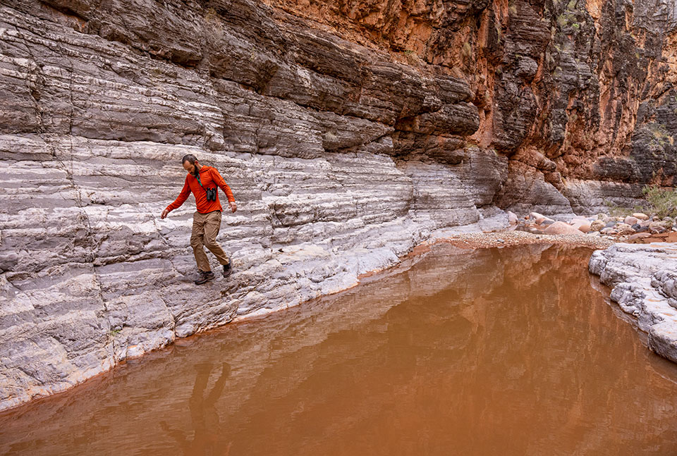
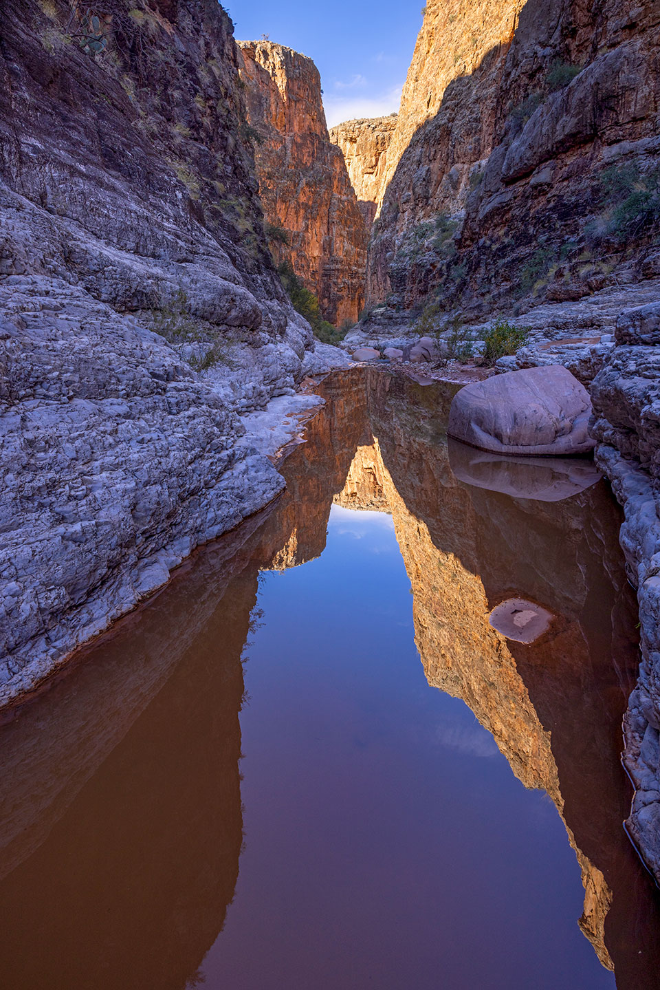
Now it was our turn to pass this place, have our own story and strive to record those brief experiences while, at the same time, cogitating the deep timelessness of it all. John stopped to wait for the perfect light to capture a canyon-reflecting pool. I dropped my pack and continued downstream, splashing through a section of canyon that the map said was dry.
It was an unexpected discovery. Many springs in the Canyon have been drying up and even disappearing in recent years. Dutton Spring, more than 100 miles upstream, once was a gusher that launched out of the cliff like a fire hose. Now, it’s completely dry. Vasey’s Paradise, which John Wesley Powell named after botanist George Vasey in 1869, was a standard stop for river trips to fill their 5-gallon jugs. Now, it runs over the rocks in a sheen, too shallow to get your lips in it without touching bottom.
Maybe the stream I followed was residual flow from the recent rain, poised to sink back into the cobbles within a week. Maybe a landslide had shifted the water table. In any case, the little creek urged me onward, past green lawns of wild grass and shallow caves of limestone and boulders washed smooth by the waters of the millennia. The trees relented to terraced bedrock. It was time to turn back, but each bend of the canyon called me in farther — another waterfall, another amphitheater of perfect polished stone. I finally returned to camp when proceeding would have meant wading belly deep into cold, mud-stained water trapped between vertical whitewashed walls.
It took most of a day to get back out of the Canyon — habitually hopping between rocks and walking in sandy washes to avoid soft cryptobiotic soils, dodging copses of piñon, detouring around small buttes of pale red sandstone, step by slow step up a crumbling mountainside before cresting the last platform of rock on the rim of the world. Another hour of weaving through juniper woodlands had us at the car, clean clothes and cold beer.
Our intent was to drive to a place called Snap Point, the North Rim’s westernmost overlook. Here, the platform of the Sanup squeezes down and turns north, around the point. It’s no longer the Sanup, just a narrowing bench above the Grand Wash Cliffs. The spur road leading toward Snap Point, however, was nothing more than an eroded chute of mud and snow.
We reconnoitered. On the map, Tincanebitts Point curves into the Canyon like a backward comma, more of a peninsula than a point, but it seemed to offer rim views overlooking the Sanup. There would be no water out there, so we each loaded a big jug into our packs and set off on foot once again, weaving around prickly pear cactuses and banana yuccas and juniper limbs, hoping to arrive at the most perfectly desolate campsite in all of the Grand Canyon.
We never found it. A building breeze forced us to pitch tents in the shelter of the piñons, back from the full force of the high-desert blow. John, the rock climber, scrambled into the precipices, looking for the perfect photographer’s perch. I set off for the farthest point south, at the end of the peninsula.
Down a draw, across a slope and past the bleaching antlers of a mule deer, I raced the setting sun. The narrow point of Tincanebitts hung suspended over the Canyon, connected by an airy spine of crumbling, sharp rimrock. Before talking myself out of it, I delicately traversed the rock pile to the end of an eroding knob. There I sat in afternoon sunshine, the cold wind — which would freeze our coffee pot into a solid chunk by morning — strangely absent.
Across the river was Grand Canyon West, where Las Vegas tourists arrive by the busload or drop straight in by helicopter to catch a glimpse of this strange slice of the Canyon. It’s another odd contrast of Sanup country: a desperately far-flung place with good cell coverage, an empty quarter where a toilet-bowl-shaped skywalk is visible through binoculars, an intensely quiet backcountry where helicopters sometimes whine like mosquitoes across the void.
In the context of the vastness, all that far-off infrastructure and activity provided scale to the Canyon, a place so overwhelming and ancient that it made all the bustling feel especially impermanent. As the sun settled over Nevada ranges to the west, the Sanup seemed to balloon larger, a vast plain festooned with saucer-dome hills, protected from the outside world by the great, dark depths of the Canyon.