
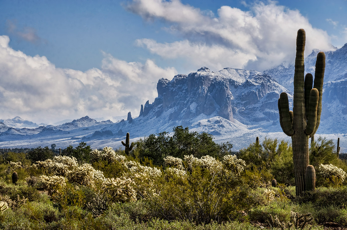
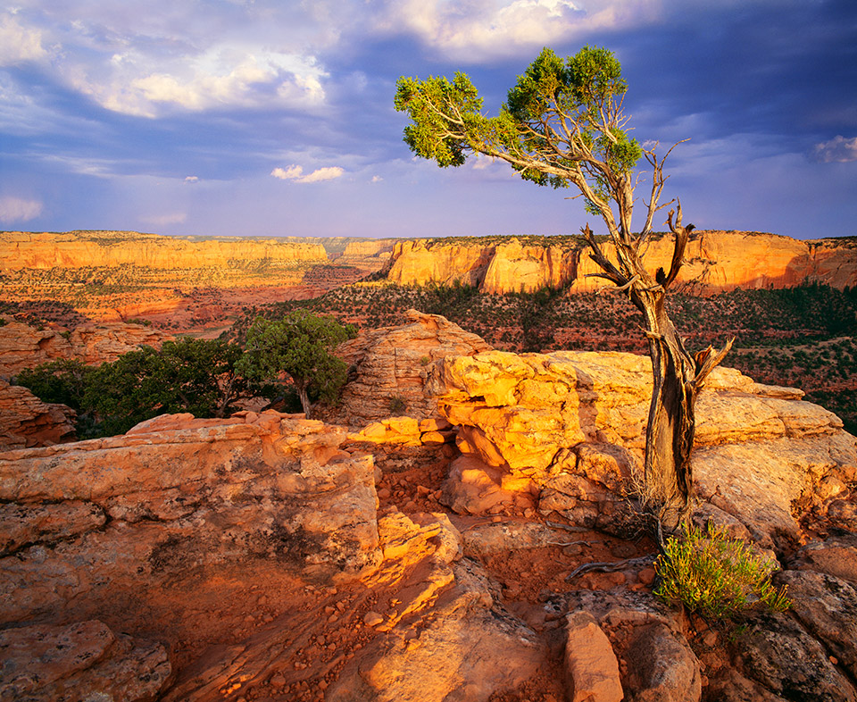
When it comes to public lands, Alaska is the most privileged state in the union. With more than 325 million acres of state and federal jurisdiction, there’s an endless stream of recreational opportunities up there. At the other end of the spectrum is Delaware, which has less than a thousand acres. Somewhere in between is Arizona — we rank fourth, behind Alaska, Nevada and California. Our 35 million-plus acres of public lands include state parks, national forests, wilderness areas, national monuments, national parks, national conservation areas and more. As a whole, they provide Arizonans and visitors from around the world with opportunities to hike, bike, camp, fish, hunt or string a hammock. Last year, our state parks alone attracted nearly 3 million visitors to their 64,413 acres. And in 2016, Grand Canyon National Park approached 6 million visitors for the first time in history. But more than people passed through the turnstiles. According to a federal report, those 6 million people at the Canyon spent $648,170,900 in the communities near the park. And that spending supported 9,779 jobs in the local area and had a cumulative benefit to the economy of $904,315,700. That’s just one national park. Almost a billion dollars. Indeed, public lands are good for the economy, and they’re good for Arizona Highways, too. Our mission, which was mandated by the state Legislature in the early 1920s, is to promote travel and exploration in the state. Public lands are a big part of that. Thus, this month’s cover story. As you’ll see, we’ve left out some of the obvious sites — places we feature on a regular basis — and focused instead on some of the lesser-known destinations. These are your public lands. Here’s hoping you find something to do this weekend.
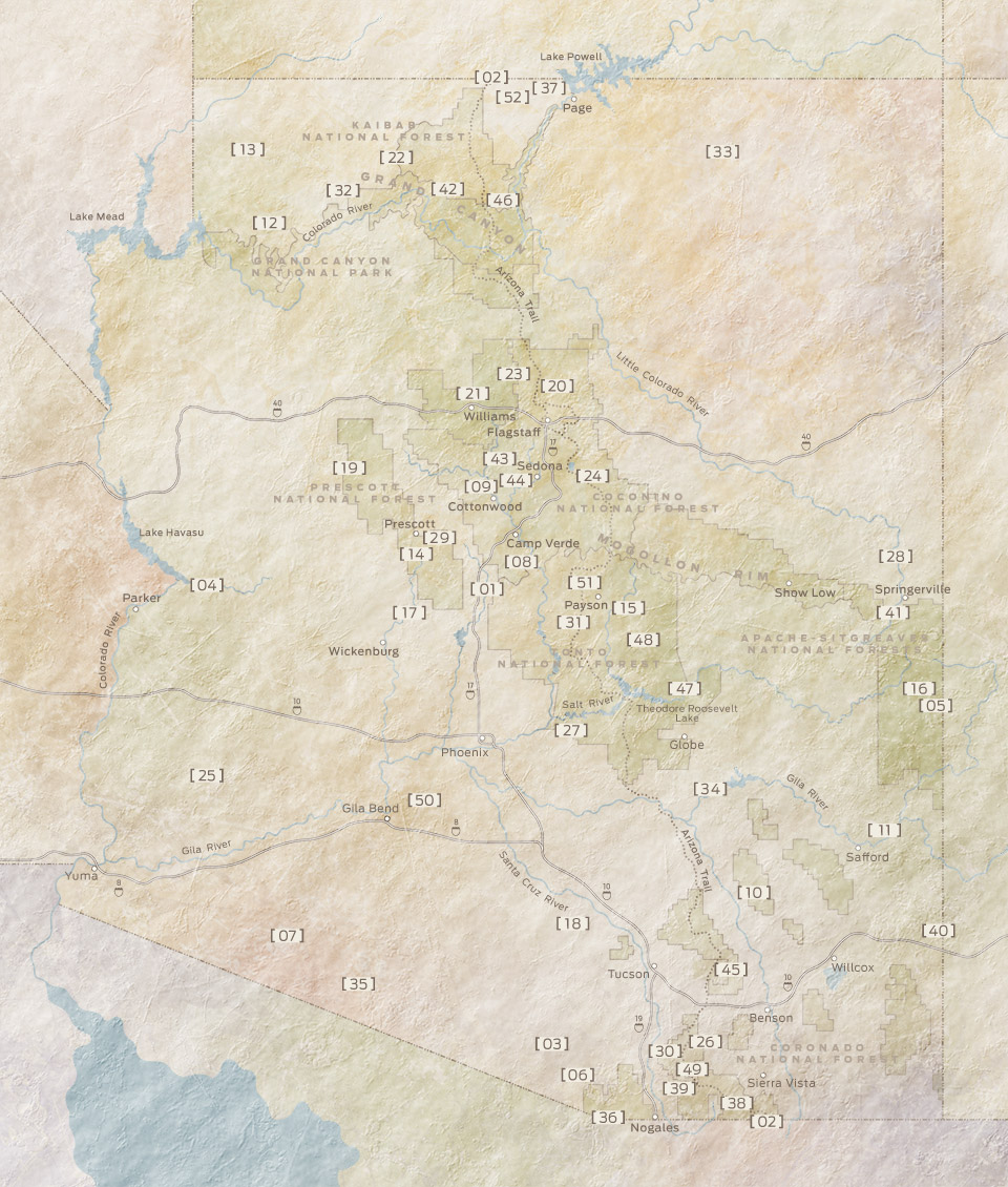
[ 01 ]
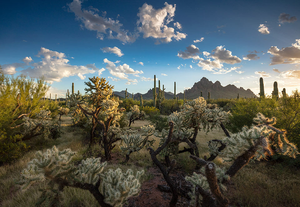
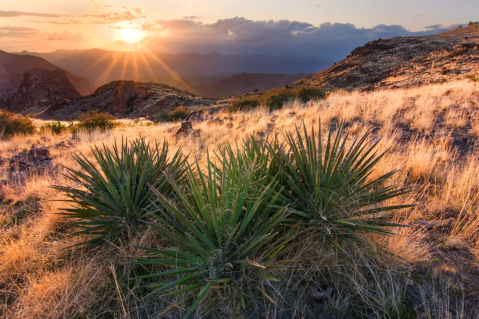
AGUA FRIA NATIONAL MONUMENT
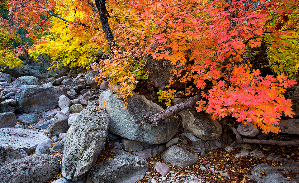
The Agua Fria River runs intermittently for 120 miles, from just northeast of Prescott to the Gila River west of Phoenix. Its course includes Black Canyon, Lake Pleasant and the monument that’s named for it — which, in addition to providing a home for the river, contains 71,000 acres of stunning desert landscape, ancient petroglyphs and swaths of riparian habitat. One of the best ways to experience the monument is via a hike along the Badger Springs Trail. From the Badger Springs Road exit off Interstate 17, it’s just a short drive down a forest road to the trailhead. Really, though, this path just follows the river — or, in dry seasons, the riverbed. That means you can walk it for as long as you’d like to explore the cottonwoods, sycamores, willows, bobcats, coyotes, pronghorns and more than 175 bird species that call the monument home.
Nearby Town: Phoenix
Information: Hassayampa Field Office, 623-580-5500, www.blm.gov/visit/agua-fria
[ 02 ]
ARIZONA NATIONAL SCENIC TRAIL
There are many ways to hike what’s commonly known as the Arizona Trail, which runs for about 800 miles from the Utah state line to the U.S.-Mexico border. Some hikers tackle each of the trail’s 43 segments individually, often taking several years to cover the entire distance. Those who do it all in one shot, known as “thru-hikers,” usually start on the southern end, at Coronado National Memorial, and hike north in the spring, but some go from north to south in the fall. The whole trek typically takes a month or two, but it’s been done much faster: In 2016, Arizona native and long-distance runner Michael Versteeg completed the route in just under 16 days. Most people, though, will want to take their time and enjoy the sights, which include the Grand Canyon, the San Francisco Peaks, the Mazatzal Mountains and Saguaro National Park.
Nearby town: Statewide
Information: Arizona Trail Association, 602-252-4794, www.aztrail.org
[ 03 ]
BABOQUIVARI PEAK WILDERNESS
The centerpiece of Arizona’s smallest wilderness area (2,040 acres) rises dramatically out of Southern Arizona’s Altar Valley. Some have likened its massive, bare-rock summit, the remnant of a magma bubble, to a shark’s tooth. To the Tohono O’odham people, it’s the bottom of an hourglass where the sands of time pass unseen from the upper half in the spirit world. It’s also where the Tohono O’odham deity I’itoi lives. Oddly, the eastern half of Baboquivari Peak was excluded from the tribe’s land in 1916, and it became a Bureau of Land Management wilderness area in 1990. Scaling the summit requires technical skill and rock-climbing equipment. Robert Forbes and Jesus Montoya made the first recorded ascent in 1898. From Thomas Canyon, their route to the summit is considered the easiest. Hikers can get as far as Lion’s Ledge. The views there aren’t as grand, but there is a rare perennial spring.
Nearby Town: Sasabe
Information: Tucson Field Office, 520-258-7200, www.blm.gov/arizona
[ 04 ]
BILL WILLIAMS RIVER NATIONAL WILDLIFE REFUGE
Open water, verdant marshes, riparian woodlands, dramatic cliffs ... they’re all on display at this wildlife refuge, which protects a section of its namesake waterway just before it empties into the Colorado River at Lake Havasu. The 6,100-acre refuge’s diverse terrain attracts an equally diverse animal population, which features more than 350 documented bird species, including endangered Southwestern willow flycatchers and Yuma clapper rails. Desert bighorn sheep reside on the refuge’s steep cliffs, and in the water, nearly 200 aquatic species have been spotted. There’s no fee to visit the refuge, and visitors can enjoy it via two short hiking trails, a 3.5-mile scenic drive or a 2.5-mile paddle on the river in a canoe or kayak. You also can cast for catfish, bluegills, smallmouth bass and other fish via lighted shoreline fishing facilities, which are open 24 hours a day.
Nearby Town: Lake Havasu City
Information: U.S. Fish and Wildlife Service, 928-667-4144, www.fws.gov/refuge/bill_williams_river
[ 05 ]
BLUE RANGE PRIMITIVE AREA
The Blue Range remains the country’s only primitive area. All the others have been upgraded to wilderness areas, such as the contiguous Blue Range Wilderness in New Mexico. The reasons are complicated. Even so, this 173,762-acre preserve is as untamed as any in the state. Home to bears and wolves, it extends from high-country forests and meadows near Alpine to the high deserts around Clifton. Like a connecting artery, the Blue River’s riparian woodlands run north and south through both. Summer is the best time to explore the higher elevations. The 12-mile Bonanza Bill Trail runs along the high ridge that separates the Blue River and San Francisco River canyons on the remote eastern side; it also dips into the New Mexico wilderness area. Lower elevations are more enjoyable in cooler months. The slot canyons, pools and hot springs that line the southernmost stretch of the 17-mile Blue River Trail are simply wild.
Nearby Towns: Alpine, Clifton
Information: Alpine Ranger District, 928-339-5000; Clifton Ranger District, 928-687-8600; www.fs.usda.gov/asnf
[ 06 ]
BUENOS AIRES NATIONAL WILDLIFE REFUGE
Photographer Jack Dykinga, a longtime Arizona Highways contributor, says the grasslands of Buenos Aires National Wildlife Refuge remind him of Africa’s Serengeti — but with mule deer instead of Thomson’s gazelles. The 117,464-acre sanctuary, located near Baboquivari Peak southwest of Tucson, offers myriad opportunities to spot wildlife. More than 330 bird species have been documented there, and the refuge covers most of the U.S. range of the masked bobwhite, an endangered quail species. There are pronghorns, too, and Pronghorn Drive, a 10-mile loop that starts and ends near the refuge’s visitors center, is a good place to see them. Buenos Aires also protects Brown Canyon, a pristine example of a “sky island” ecosystem. Guided hikes into the canyon are held on the second and fourth Saturdays of each month from November to April. The cost is $5 per person, with a maximum of 12 people per hike.
Nearby Town: Arivaca
Information: U.S. Fish and Wildlife Service, 520-823-4251, www.fws.gov/refuge/buenos_aires
[ 07 ]
CABEZA PRIETA NATIONAL WILDLIFE REFUGE
Endangered Sonoran pronghorns and lesser long-nosed bats are among the animal species protected by this refuge, which is located along the U.S.-Mexico border between Yuma and Ajo. In fact, despite its harsh desert climate, the 860,000-acre refuge is home to more than 275 kinds of wildlife, along with 400 Sonoran Desert plant species. Here, Gila woodpeckers carve holes in saguaro cactuses to build nests that later are reused by elf owls and other animals. And after a wet winter, more than 30 wildflower species put on a spectacular spring display. Almost all of the refuge is federally designated wilderness, meaning motorized vehicles are prohibited, but old roads there are open to hiking. For the best photography and wildlife-watching opportunities, you should visit early in the morning or late in the evening. The refuge’s visitors center in Ajo offers interactive nature displays and an interpretive trail that features bird blinds and a desert pupfish pond.
Nearby Towns: Yuma, Ajo
Information: U.S. Fish and Wildlife Service, 520-387-6483, www.fws.gov/refuge/cabeza_prieta
[ 08 ]
CEDAR BENCH WILDERNESS
You’re forgiven if you haven’t heard of the Cedar Bench Wilderness. Despite its central location near Camp Verde, it’s one of the least-visited areas in the Prescott National Forest. The trails are not well documented, well maintained or well marked, and most are rated as difficult. The area takes its name from a ridge, below Tule Mesa on the Verde Rim, that separates the Agua Fria River and Verde River drainages. Early pioneers mistook the Utah junipers for cedars. A federally designated Wild and Scenic River stretch of the Verde runs along the wilderness area’s eastern boundary, while the Chasm Creek Trail accesses the upper third of the wilderness. It’s rocky and steep, climbing more than 1,500 feet along its 6-mile course. Expect to be rewarded with sweeping views of the Verde Valley in perfect solitude. Just don’t expect the trail to be forgiving.
Nearby Town: Camp Verde
Information: Verde Ranger District, 928-567-4121, www.fs.usda.gov/prescott
[ 09 ]
DEAD HORSE RANCH STATE PARK
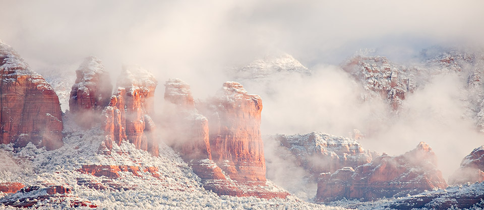
The first time Calvin “Cap” Ireys’ children visited a property Ireys was thinking of buying, they noticed a dead horse lying in a field. Later, after the family looked at some other properties, Ireys asked his kids which one they liked best. “The one with the dead horse,” they answered, because they were kids. And so, in 1950, the place became Dead Horse Ranch. Ireys owned it until 1973, then sold it to Arizona State Parks; it opened as Dead Horse Ranch State Park in 1977. The 320-acre park, located on the Verde River just northeast of Cottonwood, now attracts anglers, canoeists and kayakers, along with hikers who enjoy more than 20 miles of trails in and around the park. If you’re in Old Town Cottonwood, you can reach the park via the Jail Trail, an easy 1-mile hike that starts near Pizzeria Bocce. And these days, spotting a dead horse at the park is extremely unlikely.
Nearby Town: Cottonwood
Information: Dead Horse Ranch State Park, 928-634-5283, www.azstateparks.com/dead-horse
[ 10 ]
GALIURO WILDERNESS
Historically, not many people lived in what later became the Galiuro Wilderness. Those who did were as obstinate as the land. The Power family eked out an existence ranching and mining before a 1918 shootout left four people dead and triggered a massive manhunt. A lesser-known “sky island,” the Galiuro Mountains are unusual, with two parallel ridges separated by a pair of canyons. The preserve’s irregularly maintained and sometimes hard-to-follow trails get little use. It’s far more common to see bears than to see people, and old-growth trees, naturally inaccessible to loggers, also populate the canyon in abundance. Primary trails line both ridgelines. A backpackers’ dream, the West Divide Trail runs along the western ridges, dipping past the Powers’ cabin and mine. To the east, Bassett Peak makes a fine autumn day hike, with sycamores, aspens and oaks decked out in fall finery — and views from the summit that just won’t quit.
Nearby Town: Willcox
Information: Safford Ranger District, 928-428-4150, www.fs.usda.gov/coronado
[ 11 ]
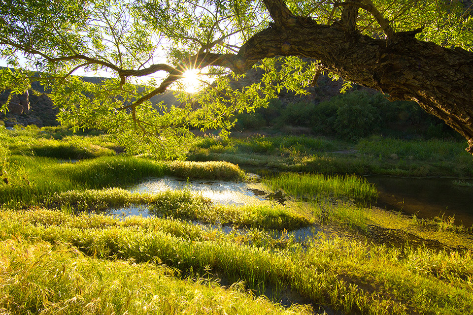
GILA BOX RIPARIAN NATIONAL CONSERVATION AREA
Water is life. And in Gila Box Riparian National Conservation Area, four waterways — the Gila and San Francisco rivers, and Bonita and Eagle creeks — create a lush, biologically diverse oasis in the desert. During spring, kayakers are especially lucky to float the Gila, which, depending on runoff, can be a moderately challenging course to paddle. Regardless, exploring the conservation area by kayak, canoe or inflatable raft is a wonderful way to experience prehistoric and historic structures, more than 100 bird species, rock art and — if you’re lucky — desert bighorn sheep.
Nearby Town: Safford
Information: Safford Field Office, 928-348-4400, www.blm.gov/national-conservation-lands/arizona/gilabox
[ 12 ]
GRAND CANYON-PARASHANT NATIONAL MONUMENT
When it comes to solitude, Grand Canyon-Parashant National Monument might have cornered the market. The National Park Service and the Bureau of Land Management jointly manage this monument, which contains more than a million acres of rugged, remote terrain. There are no paved roads or cellphone reception there, but there are plenty of stars in the night sky, as well as a number of opportunities for backcountry exploration. The best way to experience the monument is to venture into its wilderness areas, of which there are four: Grand Wash Cliffs (see below), Paiute, Mount Trumbull and Mount Logan. For a bird’s-eye view of the region, hike to the top of Mount Trumbull itself. With an elevation of 8,029 feet, it’s the highest point within the monument. And although there are no designated campsites near the trailhead, dispersed primitive camping is allowed throughout Grand Canyon-Parashant.
Nearby Town: St. George, Utah
Information: Grand Canyon-Parashant National Monument, 435-688-3200, www.nps.gov/para
[ 13 ]
GRAND WASH CLIFFS WILDERNESS
Nature writes its history on the land. And in few places is that more evident than in the Grand Wash Cliffs in Northwestern Arizona. Marking the transition from the Colorado Plateau to the Basin and Range Province, the 12-mile-long cliffs step down from the Shivwits Plateau to the Mohave Desert in two Brobdingnagian steps of between 1,000 and 2,000 feet. Above the cliffs, an 11-mile trail traverses the length of the wilderness area. The Colorado River once shaped these impressive formations, although today the river flows 20 miles to the south. The only water you’re likely to find now is in natural pools after a rain. Nor are you likely to find people. You might, however, find desert bighorn sheep, as well as opportunities for canyoneering and the chance to write an intriguing chapter in your own story.
Nearby Town: St. George, Utah
Information: Grand Canyon-Parashant National Monument, 435-688-3200, www.nps.gov/para
[ 14 ]
GROOM CREEK RECREATION AREA
Camping, picnicking, hiking, mountain biking, bouldering, horseback riding … there are many recreational ops at this refreshing nook in the Prescott National Forest. What’s more, it’s a quick getaway — just 10 minutes from Courthouse Square in Prescott. It’s the pines that make it so refreshing, no matter what time of year you visit. The many trails, which are open year-round, include the Wolf Creek Loop (5.5 miles round-trip) and the Groom Creek Loop (8.7 miles round-trip). The latter climbs to the top of Spruce Mountain. That name, by the way, is a misnomer. There aren’t any spruce trees in the area. What the early settlers thought were spruce are actually firs. There are picnic areas, however, including the Spruce Mountain Picnic Site at the summit of the mountain — at 7,700 feet, it’s the highest recreation site on the Prescott National Forest. Another great option for kicking back is the Groom Creek Schoolhouse Group Picnic Site. Built in 1902, the historic schoolhouse and adjacent picnic area can be reserved in advance for groups of up to 50 people. Visitors without reservations can utilize the outdoor accommodations when groups aren’t present.
Nearby Town: Prescott
Information: Bradshaw Ranger District, 928-443-8000, www.fs.usda.gov/prescott
[ 15 ]
HAIGLER CANYON RECREATION SITE
Fishing is the main attraction at this recreation site, which is located just below the Mogollon Rim, not far from the isolated community of Young. The creek of the same name is rugged and flows through a transitional vegetative zone that ranges from ponderosa pine forest to chaparral habitat. Although the creek offers some intense hike-in fishing opportunities, the easiest place to drop a line is at Fisherman Point, which is located about 2 miles north of Haigler Canyon Campground. If you’re not interested in fishing, some of the chiseled canyons in the area make wonderful swimming holes. And just west of the site is Colcord Lookout, an 83-foot steel fire tower that’s listed on the National Historic Lookout Register. Regardless of what you do in the daytime, at night, you’ll want to pitch your tent at Haigler Canyon Campground. Surrounded by trees, the campground offers two day-use sites and two campground areas with 14 overnight sites.
Nearby Town: Young
Information: Pleasant Valley Ranger District, 928-462-4300, www.fs.usda.gov/tonto
[ 16 ]
HANNAGAN MEADOW RECREATION AREA
Named for Robert Hannagan, a carpetbagger who did some cattle ranching in the area, Hannagan Meadow ranks as one of the most beautiful places in Arizona — had Robert Frost ever walked by, he surely would have written something about the experience. The recreation area is composed of a couple of forested campgrounds, access to the Blue Range Primitive Area (see page 21) and the historic Hannagan Meadow Lodge, which stands alone in the middle of the Apache-Sitgreaves National Forests, a place generally off-limits to commercial development. The history of how that happened dates to 1926, when the U.S. Forest Service issued a rare permit for a store to be built. Later, a service station was added, along with cabins, a restaurant and the main lodge. Today, the Shangri-La of the White Mountains offers modern conveniences such as hot meals, running water, electricity and four-star service, but there are no televisions or telephones, and cell service is nowhere to be found. In their place is an expansive front porch that looks out on a meadow that attracts elk, mule deer and other wildlife. Think of it as reality TV.
Nearby Town: Alpine
Information: Alpine Ranger District, 928-339-5000, www.fs.usda.gov/asnf; Hannagan Meadow Lodge, 928-339-4370, www.hannaganmeadow.com
[ 17 ]
HASSAYAMPA RIVER CANYON WILDERNESS
The Hassayampa River runs underground for much of its 100-mile course. But it surfaces like a mirage along the southeastern portion of this Sonoran Desert preserve, supporting as many as 280 species of birds, a native fish called the longfin dace and an unusual shrub, flannelbush, with tiny yellow blooms. Most visitors enter the wilderness area northeast of Wickenburg, via Constellation Road. The adjacent Williams Ranch runs cattle along the river. The trails here are poorly marked, so it’s easiest to hike along the river, following cattle trails that lead into the side canyons. The western section, via Fool’s Canyon, offers more solitude and fewer livestock, with cross-country access to the upper elevations — including Sam Powell Peak, at just above 4,000 feet, and a dramatic rock formation called the Needle.
Nearby Town: Wickenburg
Information: Hassayampa Field Office, 623-580-5500, www.blm.gov/arizona
[ 18 ]
IRONWOOD FOREST NATIONAL MONUMENT
This 190,000-acre monument safeguards its namesake trees — Olneya tesota, formally — which are among the longest-living trees in the Sonoran Desert. In addition to its diverse and significant plant life, the monument is also home to several desert mountain ranges — Silver Bell, Waterman and Sawtooth — as well as cultural and archaeological sites that date back 5,000 years. Ragged Top, an appropriately named mountain, is the crown jewel of the monument in terms of biological and ecological diversity: It’s home to several endangered species, including the lesser long-nosed bat and the Nichol’s echinocactus. Primitive camping, mountain biking, hiking and horseback riding are the best ways to explore this wild landscape, but a 33-mile drive through the monument is an option as well.
Nearby Town: Tucson
Information: Tucson Field Office, 520-258-7200, www.blm.gov/visit/ironwood
[ 19 ]
JUNIPER MESA WILDERNESS
The drive along Williamson Valley Road to this remote wilderness area, in the northwest corner of the Prescott National Forest, is reason enough to visit. Once you’re there, seven maintained trails lead into the small preserve, which is marked by an ancient upwelling of the Colorado Plateau. Named for the area’s predominant geological feature, the 5.5-mile Juniper Mesa Trail runs east and west along the mesa’s broad, juniper- dotted surface, overlooking the Apache Creek Wilderness and Granite Mountain. It terminates at a junction with the Oaks and Willows Trail, which descends the mesa’s southwestern edge through George Wood Canyon’s thick stands of junipers, ponderosa pines and oaks. That trail also features the north fork of Walnut Creek and views of Aztec Pass, an early pioneer route.
Nearby Town: Prescott
Information: Chino Valley Ranger District, 928-777-2200, www.fs.usda.gov/prescott
[ 20 ]
KACHINA PEAKS WILDERNESS
Altitude is everything in this wilderness area, which encompasses the San Francisco Peaks’ summits, including Humphreys Peak. At 12,633 feet, Humphreys is Arizona’s highest point, and it’s also the centerpiece of the state’s only tundra region. The Peaks are the only place on Earth where the San Francisco Peaks groundsel, a small flowering plant, blooms each September. The Peaks are sacred to 13 tribes, and the wilderness area’s name acknowledges the Hopi spirits who dwell in the Peaks for half the year. If attaining the highest heights is your goal, the 5-mile Humphreys Trail, which starts at the Arizona Snowbowl parking lot, will get you there. For a lower-key approach, the Kachina Trail is superlative in its own way, passing ancient pines, massive firs and the biggest bracken ferns you’re likely to ever see — plus aspens so lovely, they’ll leave you quaking.
Nearby Town: Flagstaff
Information: Flagstaff Ranger District, 928-526-0866, www.fs.usda.gov/coconino
[ 21 ]
KAIBAB LAKE
There’s a good chance you’ve blown past this wooded lake without even knowing it — it’s located just off State Route 64 between Williams and the South Rim of the Grand Canyon. Although swimming isn’t allowed in the lake, fishing is. And the fishing is good. Because the lake averages a depth of 37 feet, the deepest of the Williams-area lakes, it’s known for having some especially large rainbow trout. Largemouth bass, channel catfish and sunfish are found in the 45-acre lake as well. In addition to fishing, the area makes a great picnic spot. That is, if you like nature. The lake, which sits at an elevation of 6,800 feet, is lined with pines and wild grasses. And in late spring and summer, wildflowers add a splash of color to the landscape. Kaibab Lake has a campground, too, which offers individual, double and group campsites with picnic tables and campfire rings. Tents, trailers and motor homes up to 40 feet can be accommodated. If you need more than that, the South Rim is an easy day trip away.
Nearby Town: Williams
Information: Williams Ranger District, 928-635-5600, www.fs.usda.gov/kaibab
[ 22 ]
KANAB CREEK WILDERNESS
Located north of the Grand Canyon, this 68,000-acre wilderness area is a land of extremes, prone to flash floods and radical elevation changes. Summer temps can reach 120 degrees, while the creek’s water can be numbingly cold. But it’s also a land of dramatic beauty. From its origins in Southern Utah, Kanab Creek carves a labyrinth of canyons and gorges, one that features fins, knobs and stunning vertical walls. Landmarks with enchanting names such as Scotty’s Castle and Whispering Falls contain grottoes, hanging gardens and, in some seasons, waterfalls and effervescent pools. Sowats Point is one of five trailheads that access more than 90 miles of primitive trails in the wilderness area, which is managed by the U.S. Forest Service and the Bureau of Land Management. Backpackers generally spend several days working their way along minimally marked and maintained trails to the Colorado River and back.
Nearby Town: Fredonia
Information: North Kaibab Ranger District, 928-643-7395, www.fs.usda.gov/kaibab
[ 23 ]
KENDRICK PARK WATCHABLE WILDLIFE TRAILS
There are two trails at this beautiful site, which is about 20 miles northwest of Flagstaff in the Coconino National Forest. One is a short, paved loop (a quarter-mile round-trip) that’s wheelchair accessible, and the other is a longer loop (1.5 miles round-trip) that’s made of smooth dirt. Both are easy and feature interpretive signs, which add an educational element to the experience. In addition, the park sits at an elevation of 7,900 feet and bridges the habitats of forest and grassland, making it an ideal place to see northern flickers, red-tailed hawks, mule deer, porcupines, pronghorns, elk, Abert’s squirrels, badgers and coyotes.
Nearby Town: Flagstaff
Information: Flagstaff Ranger District, 928-526-0866, www.fs.usda.gov/coconino
[ 24 ]
KINNIKINICK LAKE PICNIC AREA
There are a few lakes on Anderson Mesa in the Coconino National Forest. Some are busier than others. One of the quieter options is Kinnikinick, a spring-fed, 126-acre lake on a rocky high prairie that attracts pronghorns, elk and bald eagles. And because the lake has some good-sized brown and rainbow trout, it attracts anglers, too. Although camping is no longer allowed at the day-use area, the lake is still a great place to launch a kayak or canoe. And, of course, as the name implies, the area is ideal for a picnic. In addition to the wildlife you might see, you’ll have some great panoramic views of the San Francisco Peaks on the horizon, with open grasslands and old junipers in the foreground. By the way, in case you’re wondering, the unusual name of the lake comes from kinnikinnick, which is spelled slightly different and is another name for the bearberry plant. Kinnikinnick also refers to a Native American mixture of tobacco, dried sumac leaves and bark.
Nearby Town: Flagstaff
Information: Flagstaff Ranger District, 928-526-0866, www.fs.usda.gov/coconino
[ 25 ]
KOFA NATIONAL WILDLIFE REFUGE
The rugged canyons of the Kofa Mountains, located northeast of Yuma, harbor one of Arizona’s rarest sights: California fan palms (Washingtonia filifera), the only species of palm tree native to the state. The trees grow only in narrow side canyons that get the right amounts of sunshine and moisture. You can explore these microclimates via Kofa National Wildlife Refuge’s Palm Canyon Trail. From U.S. Route 95, a dirt road leads 7 miles east to a parking lot and a half-mile hike into the canyon. If you visit at midday, there’s a short time period when the trees are in the sun and easily photographed; the rest of the day, they’re in the shade. But the palms aren’t the refuge’s only attraction. Other plants you might see include ironwoods, paloverdes and rare Kofa Mountain barberries, found only in a few Southwestern Arizona mountain ranges. And along the way, you might spot desert bighorn sheep or hear the yelp of a coyote.
Nearby Town: Quartzsite
Information: U.S. Fish and Wildlife Service, 928-783-7861, www.fws.gov/refuge/kofa
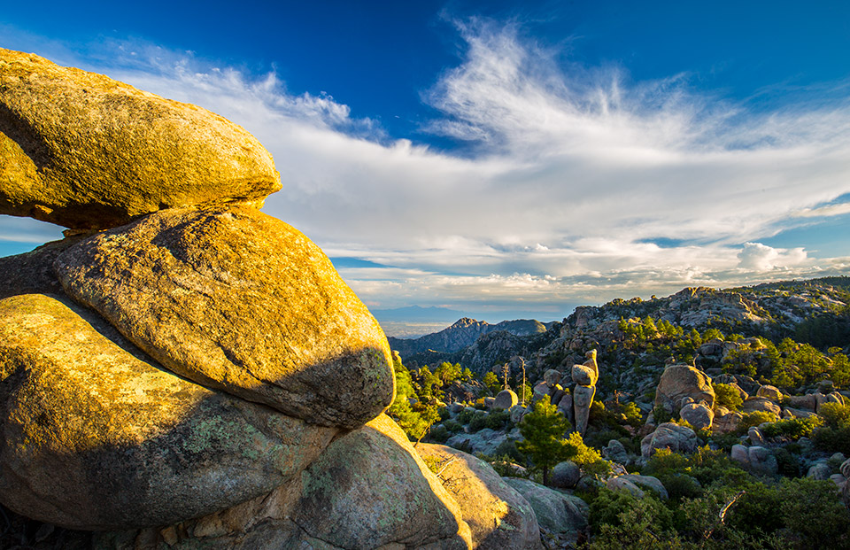
[ 26 ]
LAS CIENEGAS NATIONAL CONSERVATION AREA
Tucked into a transitional zone between the Sonoran and Chihuahuan deserts and fed by perennial Cienega Creek, Las Cienegas National Conservation Area protects one of the most significant riparian zones in Southern Arizona. Whether you choose to hike or bike to experience this NCA, you’ll have a place to stay. While dispersed camping is allowed along the back roads of Las Cienegas, there also are two designated campgrounds. Set camp, then consider a hike along the Heritage Discovery Trail at the NCA’s Empire Ranch headquarters, or connect to the Arizona Trail via Oak Tree Canyon. You can also choose your own path — responsibly, of course. Many of the back roads make great hiking trails, too.
Nearby Town: Sonoita
Information: Tucson Field Office, 520-258-7200, www.blm.gov/visit/las-cienegas
[ 27 ]
LOST DUTCHMAN STATE PARK
The Dutchman was actually German, not Dutch. You probably knew that. You probably also knew that Jacob Waltz’s fabled gold mine has never been found — turning his treasure into one of Arizona’s most enduring myths. Lost Dutchman State Park, located east of the Phoenix area, celebrates Waltz’s legacy, but it’s tough to get lost on its well-marked hiking trails, most of which begin in the park before heading into the Tonto National Forest and the Superstition Mountains. The park’s 134 campsites are popular most of the year, but wildflower hunters like to visit in February and March, when brittlebushes, chuparosas and globemallows bloom. For the best wildflower viewing, the park recommends the Siphon Draw and Jacob’s Crosscut trails. If you’re looking for a leisurely morning hike, though, try the Treasure Loop Trail, which climbs toward the Superstitions and offers spectacular views of the Phoenix area to the west.
Nearby Town: Apache Junction
Information: Lost Dutchman State Park, 480-982-4485, www.azstateparks.com/lost-dutchman
[ 28 ]
LYMAN LAKE STATE PARK
Lyman Lake has been a state park since 1961, but the human history of this site, near St. Johns in Northeastern Arizona, goes back much further. Several large Ancestral Puebloan ruins, which date to the 1300s, are located near the reservoir, and the park’s Peninsula Petroglyph Trail offers views of Hopi rock art. The lake itself is one of the few in the area without restrictions on watercraft size, and boats can be launched from two paved ramps. In addition to big boats, Lyman Lake attracts eagles, ospreys, hawks and a variety of waterfowl. If you’d like to stay overnight, you can choose from the park’s 56 campsites, most of which have RV hookups, or eight camping cabins, which have bunk beds, climate control and electricity. Picnic tables, restrooms and showers are nearby, and the cabins’ covered porches make great places to watch sunrise or sunset.
Nearby Town: St. Johns
Information: Lyman Lake State Park, 928-337-4441, www.azstateparks.com/lyman-lake
[ 29 ]
LYNX LAKE RECREATION AREA
You won’t be alone at Lynx Lake. More than 90,000 people a year visit this popular recreation area, which is located just southeast of downtown Prescott. But don’t let the crowds discourage you. The scenic 55-acre lake attracts people for many reasons, including the fishing — the lake was built along Lynx Creek specifically for that purpose. Hiking and mountain biking are popular, too. There are seven trails in the area, ranging in length from a half-mile to 7 miles. If you’ve never been, the Lynx Recreation Trail, which winds around the lake, is a good introduction to the area (the west side is paved and accessible to wheelchairs). But keep in mind that the east side of the trail is closed from December 1 to
June 30 each year to protect nesting bald eagles. Other wildlife includes ospreys, great blue herons and mule deer. You can learn more about the critters and their surroundings at the nearby Highlands Center for Natural History, which has a learning center and trail system on 80 acres along Walker Road.
Nearby Town: Prescott
Information: Bradshaw Ranger District, 928-443-8000, www.fs.usda.gov/prescott
[ 30 ]
MADERA CANYON RECREATION AREA
Rare birds make their way to Madera Canyon. And so do many birders. The holy grail for the latter is the elegant trogon, a colorful bird related to quetzals. Seeing one is a big deal, but birds are hardly the only reason to visit this beautiful canyon, which was carved out of the northwest face of the Santa Rita Mountains in the Coronado National Forest. In addition to the birds, Madera Canyon is home to black bears, mountain lions, deer, coatimundis, coyotes, bubbling springs, green grasses, big trees and panoramic views. There are hiking trails, too, including the Bog Springs/Kent Springs Loop (5 miles round-trip), which offers a quick and easy introduction to the area. Another great hike is the Old Baldy Trail (10.8 miles round-trip), which leads to the summit of Mount Wrightson, the highest point in the area. At the end of the day, you can look forward to a quiet night in the canyon. There are three lodging facilities and a campground with 13 campsites suitable for tents or RVs.
Nearby Town: Green Valley
Information: Nogales Ranger District, 520-281-2296, www.fs.usda.gov/coronado
[ 31 ]
MAZATZAL WILDERNESS
Despite its proximity to Phoenix, the Mazatzal Wilderness remains surprisingly wild, perhaps because of its early protection — it was designated wilderness in 1940, then an official wilderness area in 1964 — or its rugged terrain. Today, 240 miles of trails cross more than 250,000 sprawling acres, a diverse swath of Central Arizona that includes 7,884-foot Mazatzal Peak as well as desert and riparian habitats. Two trails highlight the area’s extremes. The 27-mile Mazatzal Divide Trail runs north and south along a ridgeline from Mount Peeley to North Peak before ending near Payson. That route, which doubles as a section of the Arizona Trail (see page 20), passes scenic campsites and springs, along with a succession of long-range vistas. The lightly traveled Verde River Trail crosses its namesake waterway twice, sometimes becoming hard to follow as it meanders 28 miles from the Verde River Sheep Bridge, north of Carefree, to near Strawberry.
Nearby Towns: Payson, Strawberry
Information: Payson Ranger District, 928-474-7900, www.fs.usda.gov/tonto
[ 32 ]
MOUNT TRUMBULL WILDERNESS
Ever wonder what Arizona looked like 100 years ago? This remote, undeveloped land on the road to the Grand Canyon’s Toroweap Overlook probably comes close. Located on the remote Arizona Strip between the Grand Canyon and Utah, the region’s namesake peak is the high point of the Uinkaret Mountains and lies about 40 miles from the nearest paved road. You’re more likely to encounter a wild turkey than another human being. The basalt-topped shield volcano looks more like a mesa than a mountain, rising gently from the surrounding high-desert landscape. But while the Mount Trumbull Trail sounds moderate, climbing about 1,500 feet over 2.5 miles, the climb isn’t without its challenges, including a hard-to-follow trail and a false summit. The persistent find their reward in a stand of pristine ponderosa pines at the summit, which offers 90-mile views of an area where cellphones are as useless as eight-track tapes.
Nearby Town: St. George, Utah
Information: Arizona Strip Field Office, 435-688-3200, www.blm.gov/arizona
[ 33 ]
NAVAJO NATIONAL MONUMENT
Named for the people who now occupy the region, Navajo National Monument protects three ancient ruins: Betatakin, Keet Seel and Inscription House. The latter has been closed to the public since 1968, but the other two can be explored through the National Park Service. Betatakin is the easiest to see — the half-mile Sandal Trail leads from the visitors center to an overlook of the dwelling, the name of which means “ledge house” in Navajo. A more adventurous experience is to make the 17-mile (round-trip) trek to Keet Seel, which is the best-preserved large Anasazi site in the Southwest. Archaeologists believe it was first occupied around 1250 and flourished between 1274 and 1286. By 1300, however, the Anasazis had moved on, leaving behind few clues as to why they split. Today, with a permit, up to 20 people per day get the privilege of hiking to the ruins.
Nearby Town: Kayenta
Information: Navajo National Monument, 928-672-2700, www.nps.gov/nava
[ 34 ]
NEEDLE’S EYE WILDERNESS
The Gila River unspools like a verdant ribbon along the southern boundary of this slender preserve. Bisecting the Mescal Mountains, it threads its way through the narrowest part of the Gila River Canyon, a deep, narrow gorge 8 miles below Coolidge Dam that gives the wilderness its name. River rats have called the stretch from Coolidge Dam to Winkelman one of the most scenic and inaccessible in Arizona. There are no established trails, just cross-country hiking and exploring the path of least resistance. Getting into the wilderness area isn’t as hard as getting a camel (or a boat) through the eye of a needle, but it does involve navigating rough, primitive roads. And because the public land is surrounded by state, tribal and private property, it also requires obtaining permission — and, in the case of the San Carlos Apache Tribe, a permit.
Nearby Town: Globe
Information: Tucson Field Office, 520-258-7200, www.blm.gov/arizona
[ 35 ]
ORGAN PIPE CACTUS NATIONAL MONUMENT
More than just a monument, Organ Pipe Cactus National Monument is also an International Biosphere Reserve, a UNESCO designation that honors a balanced relationship between people and nature. This Sonoran Desert gem, located along the U.S.-Mexico border, features a variety of rare plant species, including its namesake cactuses, desert capers and more. Hike one of the monument’s 16 trails to gain access to some of the desert’s most beautiful scenery. Or, as rangers themselves admit: “Some of the best hiking is off the beaten trails and out in the canyons with a map and compass to guide you.” Regardless of which path you choose, always carry plenty of water and snacks, and avoid hiking during the hottest parts of the day.
Nearby Town: Ajo
Information: Organ Pipe Cactus National Monument, 520-387-6849, www.nps.gov/orpi
[ 36 ]
PAJARITA WILDERNESS
Pajarita means “little bird,” and that’s what 90 percent of visitors come to see at this tiny gem of a wilderness area located near Nogales. Sycamore Canyon, with its year-round stream, draws both birds and birders in search of the jewel-like elegant trogon, the ruby-chested painted redstart and the 160 other avian species documented there. But birds are not the only wealth the canyon holds in abundance. Home to many rare and endangered plants and animals, it’s rich in both biodiversity and beauty. The Sycamore Canyon Trail — which is often the stream — cuts through the canyon, past towering pinnacles, sculpted spires and soaring vertical cliffs that reflect in pools strung along the creek like pearls. At its terminus, a connecting trail runs along the barbed-wire fence that constitutes the Mexican border, passing through the rolling grasslands of the Pajarito Mountains’ foothills. It’s an experience to treasure.
Nearby Town: Nogales
Information: Nogales Ranger District, 520-281-2296, www.fs.usda.gov/coronado
[ 37 ]
PARIA CANYON-VERMILION CLIFFS WILDERNESS
The Paria Canyon-Vermilion Cliffs Wilderness includes much of Vermilion Cliffs National Monument (see
page 41), surrounding the rest of the monument like the iris of an eye. The 3,000-foot cliffs form the southern and eastern crescent of the wilderness, the colors of their ancient sandstone shifting with the light. They also mark the edge of the Paria Plateau. Paria Canyon curves 38 miles along the eastern and northern wilderness boundary, from near Lees Ferry into Southern Utah. The canyon’s Buckskin Gulch, in Utah, is one of the country’s longest and deepest slot canyons. Some of Arizona’s most stunning geology lies within the Coyote Buttes. A 5.5-mile (round-trip) trail leads to an otherworldly formation called the Wave, with swirling, striated sandstone as stretched and smooth as saltwater taffy.
Nearby Town: Page
Information: Arizona Strip Field Office, 435-688-3200, www.blm.gov/arizona
[ 38 ]
PARKER CANYON LAKE
Lakes are an unexpected phenomenon in Arizona. And so are rolling hills and lush grasslands surrounded by rugged mountains. You’ll get all of the above at Parker Canyon Lake, a 132-acre recreation magnet situated in the Canelo Hills, south of Patagonia and west of the Huachuca Mountains of Southern Arizona. Built in 1962, the lake offers a range of recreation options, including fishing (rainbow trout, bass, sunfish and catfish), boat rentals and hiking. The Parker Lakeshore Trail, as the name suggests, winds for 5 miles around the lake, which has an average depth of 82 feet. Whatever you do to pass the time, keep your eyes peeled for bald eagles, ospreys and hummingbirds. You might also see coatimundis, javelinas, roadrunners and Coues white-tailed deer, one of the smallest subspecies of white-tailed deer in the U.S. The recreation area features two campgrounds, a country store and a beautiful, mile-high environment of oaks, pines and grasslands in the Coronado National Forest.
Nearby Towns: Sonoita, Patagonia
Information: Sierra Vista Ranger District, 520-378-0311, www.fs.usda.gov/coronado
[ 39 ]
PATAGONIA LAKE STATE PARK
The fish grow big at Patagonia Lake: In 2014, a Tucson man was fishing for bass there but reeled in a 56-pound flathead catfish instead. The Southern Arizona reservoir, constructed in the 1960s and made a state park in 1975, also features channel catfish, crappies, bluegills and sunfish, along with rainbow trout, which are stocked in winter. Other aquatic-themed activities at Patagonia Lake include boating, via two boat ramps, and swimming, at Boulder Beach. Tent and RV camping is available at more than 100 campsites in the park. Just west of the campsites, a footbridge spans one arm of the 2.5-mile-long reservoir. The bridge is popular with photographers but also with youngsters, who enjoy watching motorboats kick up water as they pass under the bridge. If the water is clear, you might spot a big catfish from up there, too.
Nearby Town: Patagonia
Information: Patagonia Lake State Park, 520-287-6965, www.azstateparks.com/patagonia-lake
[ 40 ]
PELONCILLO MOUNTAINS WILDERNESS
From just south of the U.S.-Mexico border, the Peloncillo Mountains curve north for 100 miles along the Arizona-New Mexico state line. The Bureau of Land Management wilderness area lies in a small northern section of the range, a rumple of ridges and canyons that resemble the sheets of an unmade bed. The Butterfield Overland Mail stagecoach service ran through Doubtful Canyon, near the wilderness area’s southern boundary. The canyon’s name supposedly came from early settlers thinking it doubtful the Apaches would let them make it through alive. A good place for cross-country exploring, West Doubtful Canyon lies a short drive from San Simon, while most visitors access the northern part of the wilderness area from Duncan. The area around Engine Mountain, named for its distinctive profile, draws rock hounds in search of fire agates. Whichever part of the wilderness area you visit, you’ll find immodest rewards — without a doubt.
Nearby Towns: Duncan, San Simon
Information: Safford Field Office, 928-348-4400, www.blm.gov/arizona
[ 41 ]
POLE KNOLL RECREATION AREA
Although it’s best known as a playground for cross-country skiers, this easy-access, four-season recreation area in the Apache-Sitgreaves National Forests is also a great place for hikers, horseback riders and anyone who owns a picnic basket. In all, there are nearly 18 miles of interconnected trails in the area. Many are short and easy, but the Viewpoint Trail (1.3 miles one way) and the Summit Trail (2.1 miles one way) climb almost 800 feet to the top of the knoll, where the views of the surrounding White Mountains are worth the energy it takes to get there. Otherwise, the rest of the routes are easy, and easy to follow, which makes this an ideal destination for parents with young children. Or those who are inherently lazy.
Nearby Town: Greer
Information: Springerville Ranger District, 928-333-6200, www.fs.usda.gov/asnf
[ 42 ]
RAINBOW RIM
There are two good ways to see the Grand Canyon from the seat of a mountain bike. One is to rent a set of wheels from Bright Angel Bicycles on the South Rim. It’s simple, but crowded. The other option is to head to the north side of the Canyon and ride the Rainbow Rim Trail. Although it’s open to hikers and horseback riders, too, it’s become especially popular with cyclists. In all, the trail runs for 18 miles, from Timp Point on the south end to Parissawampitts Point up north. Those are two of the five major points that jut into the Canyon from the western edge of the Kaibab Plateau. The other three are Fence, Locust and North Timp. As you might expect, the views at each point are very different, but equally spectacular. Among the landmarks you’ll see are the Powell Plateau, Steamboat Mountain, Great Thumb Mesa and Tapeats Amphitheater, as well as the Mount Trumbull Wilderness (see page 33) to the northwest. And in between those points are steep side canyons surrounded by aspens and old-growth ponderosa pines.
Nearby Town: Jacob Lake
Information: North Kaibab Ranger District, 928-643-7395, www.fs.usda.gov/kaibab
[ 43 ]
RED ROCK-SECRET MOUNTAIN WILDERNESS
The beauty of this wilderness area is hardly a secret: It includes some of Arizona’s most photographed red-rock cliffs and canyons. If you’ve ever hiked along the West Fork of Oak Creek, you already know the beauty of its landscapes. It’s also one of the state’s most accessible wilderness areas, with plenty of short, easy trails. If you’re looking for solitude, the Secret Mountain Trail is one of the paths less traveled. That’s partly because of rough-and-tumble access roads, and partly because the path is sometimes hard to follow. But it’s worth the effort, with successive canyon views that compete for superlatives. The trail passes the remnants of a homestead that a polygamous Mormon family figured was remote enough to keep their lifestyle private. But, from all appearances, the word got out.
Nearby Town: Sedona
Information: Flagstaff Ranger District, 928-526-0866 (Secret Mountain Trail); Red Rock Ranger District, 928-203-2900 (all others); www.fs.usda.gov/coconino
Sedona. | Derek von Briesen
[ 44 ]
RED ROCK STATE PARK
Red Rock State Park, southwest of Sedona, got its start with Bruce Babbitt, who was Arizona’s governor from 1978 to 1987. In 1980, the story goes, Babbitt was hiking along Oak Creek with friends when someone approached the group, told them they were on private property and asked them to leave. Concerned about a loss of public access to Oak Creek’s scenery and hiking routes, Babbitt worked with Arizona State Parks to acquire the 286-acre property via a land exchange. That deal was finalized in 1986, and in 1991, Red Rock State Park opened to the public. Within the park boundaries, a 5-mile network of trails offers views of red-rock vistas and lush greenery along Oak Creek, which attracts mule deer, javelinas, coyotes and bobcats. Avian species are abundant, too, and the park hosts bird walks every Wednesday and Saturday, year-round.
Nearby Town: Sedona
Information: Red Rock State Park, 928-282-6907, www.azstateparks.com/red-rock
[ 45 ]
RINCON MOUNTAIN WILDERNESS
The Rincon Mountains don’t get a lot of love. But while crowds mob Mount Lemmon in the neighboring Santa Catalinas, the Rincons serve as a welcome alternative, with some of the best hiking in the area. The Rincon Mountain Wilderness surrounds Saguaro National Park East and the Saguaro Wilderness on three sides, like a protective blanket. Three trails cross the wilderness area, all of them serving as connectors to national park trails leading to higher ground: Mica Mountain and Rincon Peak, the highest points in the range, and the Spud Rocks (oddly, there are two). The Turkey Creek and Miller Canyon trails enter the wilderness area from the east, winding through open grassland and a wooded riparian area, respectively. The little-used Italian Spring Trail enters from the west, ending at a seep. All are steep, rocky and reached by long drives on gravel roads. That means solitude. And that’s something to love.
Nearby Town: Tucson
Information: Santa Catalina Ranger District, 520-749-8700, www.fs.usda.gov/coronado
[ 46 ]
SADDLE MOUNTAIN WILDERNESS
Buffalo (or, more accurately, bison) roam this high-country wilderness area, which gets its name from the profile of its highest ridge. Bounded on three sides by deep canyons, it features trails that are steep and difficult, running between the eastern edge of the Kaibab Plateau and House Rock Valley, with trailheads on both ends. The 2016 Fuller Fire burned through the southeastern portion of the wilderness, including parts of the Saddle Mountain Trail, which follows the main ridge for 4 miles. It intersects Grand Canyon National Park’s Nankoweap Trail, a difficult, multi-day route to the Colorado River from the North Rim. The 7-mile North Canyon Trail crosses the northern part of the wilderness area, winding back and forth across a small stream populated by endangered Apache trout. And the 4-mile South Canyon Trail leads through aspen and mixed conifer forests, offering glimpses of Marble Canyon.
Nearby Town: Fredonia
Information: North Kaibab Ranger District, 928-643-7395, www.fs.usda.gov/kaibab
[ 47 ]
SALT RIVER CANYON WILDERNESS
The Boy Scouts and the Sierra Club began organizing rafting trips through Salt River Canyon in the 1950s. They piloted surplus Army rafts through unnamed rapids, flying by the seats of their pants. Since then, a lot has changed. What hasn’t is that rafting season remains as fleeting as desert wildflowers. Lucky for river runners, melting snowpack swells the Salt just as yellow monkeyflowers and other varieties bloom along the river’s edge. More enduring is the canyon itself, with some of the oldest exposed rocks in the Southwest among its stunning layers of shale, quartzite and limestone. High on its cliffs, bald eagles nest in woody fortresses. These days, about 1,800 hopefuls with requisite whitewater skills and equipment apply for an annual lottery of 304 U.S. Forest Service permits to run the river through the otherwise inaccessible wilderness area in the spring. Others employ commercial outfitters. A typical float goes by fast. But memories remain.
Nearby Town: Globe
Information: Globe Ranger District, 928-402-6200, www.fs.usda.gov/tonto
[ 48 ]
SIERRA ANCHA WILDERNESS
The pristine condition of the prehistoric ruins in this wilderness area tells you everything you need to know about how hard it is to get to them. Among the remote cliff dwellings in the canyons of the Sierra Ancha, you’re likely to see pictographs, potsherds and metates. But if Indiana Jones-style bushwhacking, edging behind spectacular waterfalls and squeezing underneath enormous boulders aren’t your style, there are established trails, too. One of them is the 4-mile Coon Spring Trail, which winds through a riparian area, passing an old line shack and pit houses. For a small wilderness area, the nature is surprisingly diverse and spectacular, with geology akin to Salt River Canyon and draped in canyon grapes, orchids and violets. Fall colors are magnificent, thanks to sycamores, bigtooth maples, Gambel oaks and aspens. The only question is, why not go?
Nearby Towns: Globe, Young
Information: Pleasant Valley Ranger District, 928-462-4300, www.fs.usda.gov/tonto
[ 49 ]
SONOITA CREEK STATE NATURAL AREA
Located adjacent to Patagonia Lake State Park, the nearly 10,000-acre Sonoita Creek State Natural Area includes a portion of its namesake, a verdant riparian corridor where cottonwoods, willows and other trees flourish. Created to protect the area’s natural resources, the site is home to hundreds of butterfly and bird species, which visitors can experience on 20 miles of trails — some of which are open to equestrians. The natural area also has three private backcountry camping sites, each of which features three tent pads and a steel fire ring. If you reserve one of them, be sure to keep your food secured to prevent a curious ringtail from making off with it.
Nearby Town: Patagonia
Information: Sonoita Creek State Natural Area, 520-287-2791, www.azstateparks.com/sonoita-creek
[ 50 ]
SONORAN DESERT NATIONAL MONUMENT
If you’ve lived in the Sonoran Desert for decades, saguaros might have started to, well, blend into the scenery a little bit. But visit Sonoran Desert National Monument, and you’ll be blown away by its extensive saguaro forest. What’s more, the monument also contains three congressionally designated wilderness areas, many archaeological and historic sites, and remnants of several important historic trails, including the Butterfield Overland Mail stagecoach route. Basically, it’s a place of incredible environmental, cultural and biological importance, and there are many ways to experience it. To travel deep into the North Maricopa Mountains Wilderness, for example, try the Margie’s Cove Trail. The 11-mile route is best traveled in winter or early spring, because summer temperatures can soar to 120 degrees or higher. Motorized vehicles are not allowed within the monument’s wilderness areas.
Nearby Town: Phoenix
Information: Lower Sonoran Field Office, 623-580-5500, www.blm.gov/visit/sonoran-desert
[ 51 ]
TONTO NATURAL BRIDGE STATE PARK
Tonto Natural Bridge, near Payson, is a relative newcomer to its surrounding landscape. According to geologists, more than 5,000 years ago, precipitation began to seep underground in narrow Pine Creek Canyon, resulting in aquifers full of dissolved limestone. Springs formed, and the dissolved calcium carbonate in the water became a travertine dam in the canyon. Pine Creek then eroded through the dam to create Tonto Natural Bridge, which, at 183 feet high and featuring a 400-foot tunnel, is believed to be the largest natural travertine bridge in the world. It’s been drawing visitors since the 1800s, but it didn’t become a state park until 1991; today, visitors can explore it via four short hikes of varying difficulty. Groups can book overnight accommodations or host weddings at Goodfellow Lodge, built in the 1920s and located above the bridge.
Nearby Town: Payson
Information: Tonto Natural Bridge State Park, 928-476-4202, www.azstateparks.com/tonto
[ 52 ]
VERMILION CLIFFS NATIONAL MONUMENT
Just south of the Utah state line, Vermilion Cliffs National Monument protects its eponymous cliffs, the Paria Plateau, the Coyote Buttes and Paria Canyon. Its more than 293,000 acres are characterized by sweeping vistas, colorful sandstone layers, slot canyons and rare wildlife — California condors soar over the monument. Its beauty alone was enough to warrant panic when the president designated it for review — along with Arizona’s Grand Canyon-Parashant, Sonoran Desert and Ironwood Forest national monuments — with an executive order last April. In addition to its beauty, Vermilion Cliffs is remote and rugged, which means visitors should pay special attention to detail before planning any excursion. Permits are required for hiking in Coyote Buttes North (the Wave) and Coyote Buttes South, and for overnight backpacking trips into Paria Canyon. Deep sand, rattlesnakes, flash floods and extreme temperatures are among other considerations. So, if you’re intrepid, prepared and maybe just a little bit fearless, go — the magnitude and beauty of Vermilion Cliffs will move you.
Nearby Town: Page
Information: Arizona Strip Field Office, 435-688-3200, www.blm.gov/national-conservation-lands/arizona/vermilion-cliffs