
It’s not unusual for serious hikers to drive right past the Bell Rock Vista Trailhead, writing it off as little more than a crowded parking lot where drive-by tourists pile in to make midday photos of one of the most recognizable rock formations in Arizona. And some of that is true. Like Mather Point on the South Rim of the Grand Canyon, Bell Rock is the first stop for many first-time visitors to Red Rock Country, most of whom just stop, click and go. There’s no harm in that, but the trailhead harbors a secret: It’s the launch point for one of the most beautiful day hikes in Sedona. Don’t judge a trail by its trailhead.
From the parking lot, which is located a few roundabouts south of Uptown Sedona, the Courthouse Butte Loop begins by piggybacking the Bell Rock Pathway. After dropping into a wash, the well-groomed track heads east for a few minutes before intersecting the Big Park Loop, one of several trails that crisscross the area. There are many intersections along the way, but you’ll have a hard time getting lost. The U.S. Forest Service has done a great job of marking the way.
Continuing north on the Bell Rock Pathway, you’ll quickly arrive at the starting point for the Courthouse Butte Loop. Like any loop, you can go either way, but the views are more impressive from a counterclockwise perspective. That’s how this listing is written.
The loop begins by heading east through a rocky landscape of piñons and junipers that sprout from the red earth like Asparagus Green Crayolas. Within a few minutes, you’ll come to an intersection with the Rector Connector, a trail that heads south for a half-mile to the Bell Rock Pathway. If you’re short on time or have hikers in your crew with limited endurance, this is a nice alternative to the larger loop. Otherwise, keep straight and continue east around the butte. As you do, the traffic noise slowly fades away, creating the illusion that this hike is miles from civilization.
After passing a second intersection with the Big Park Loop, the trail drops into a shaded wash. If there’s snowmelt, you might see some water. And in the summer, during monsoon weather, you might see a lot of water. As always, be careful when hiking these areas. Flash floods can be deadly.
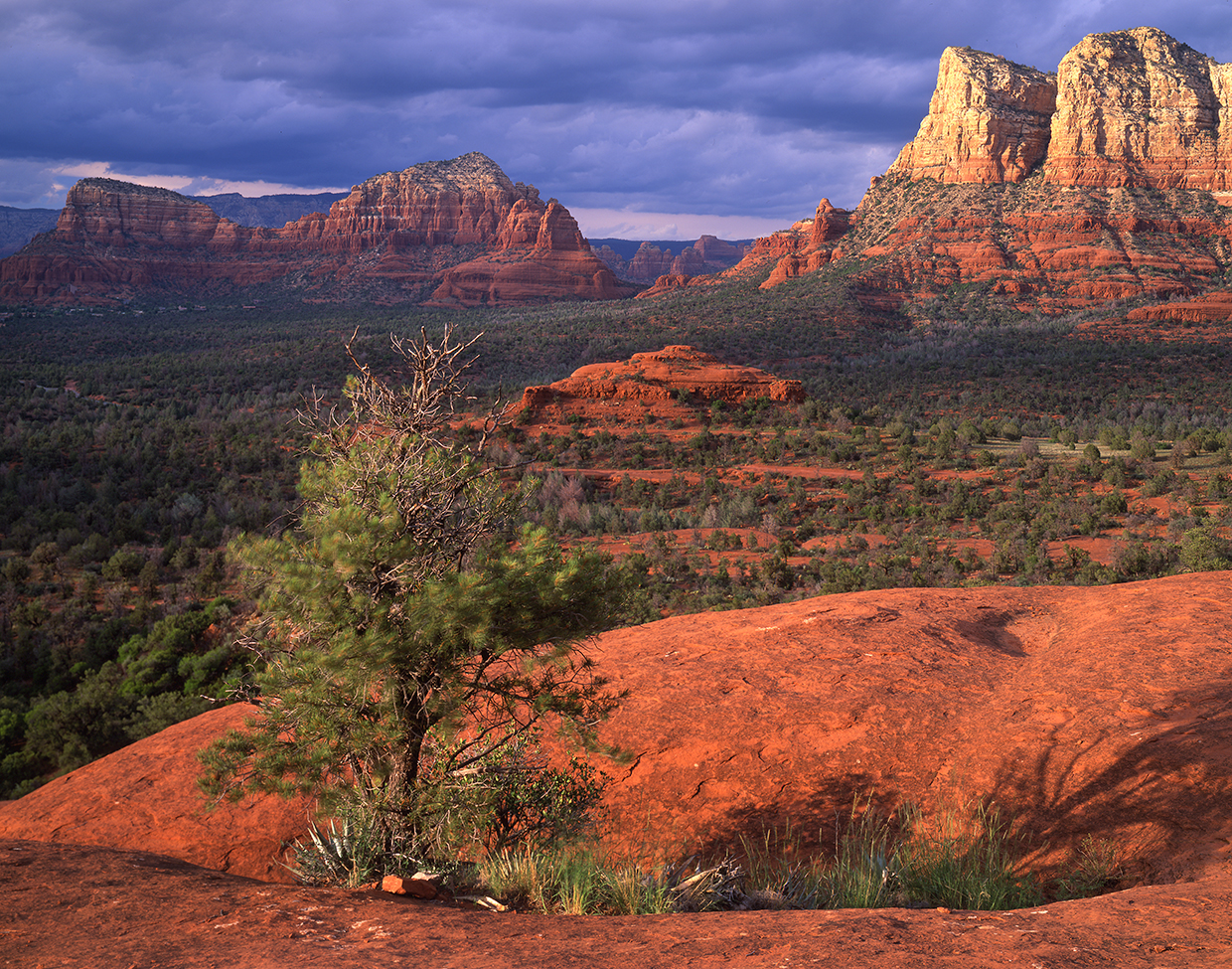
Beyond the wash, the loop passes an intersection with the Middle Trail, crosses a large patio of red rock and veers north along a narrow path on a high bank. Ten minutes later, about 45 minutes into the hike, you’ll enter the Munds Mountain Wilderness, which was established in 1984 and protects Courthouse Butte, Bell Rock, Jacks Canyon, Woods Canyon and other landmarks. Remember, mountain bikes are not allowed in wilderness areas. So, if you’re planning to ride, this is the turnaround point. For hikers, the route continues north onto another flat area of rock, about the size of a soccer field.
On the other side, you’ll arrive at the high point of the hike (4,450 feet) and get your first glimpse of Cathedral Rock to the northwest. This is the best panorama of the day. At one time, Cathedral Rock was also known as “Court House Butte.” According to the Sedona Heritage Museum, John H. Lee and other homesteaders settled a dispute by bringing in a judge and holding court under the rock. Later, a ranger produced a map and labeled it Cathedral Rock.
Moving on, the panorama expands to include the Chapel of the Holy Cross, which was commissioned by local rancher and sculptor Marguerite Brunswig Staude. The route then descends into a wash and out of the wilderness area. Bell Rock re-enters the picture as the loop passes an intersection with the Llama Trail and reconnects with the Bell Rock Pathway.
Several other trails converge in this area, including a short spur that leads to Bell Rock. If you’re looking for a bonus adventure, the challenging scramble to the summit fits the bill. If you’re less intrepid, this crossroad kicks off the homestretch to the trailhead, where you’re certain to see a crowd of drive-by tourists oblivious to what’s beyond the parking lot.
trail guide
Length: 4.5 miles round-trip
Difficulty: Easy
Elevation: 4,186 to 4,450 feet
Trailhead GPS: N 34˚47.510', W 111˚45.699'
Directions: From the roundabout junction of state routes 179 and 89A in Sedona, go south on SR 179 for 6.2 miles to the Bell Rock Vista Trailhead.
Special Consideration: A $15 Red Rock Pass is required.
Vehicle Requirements: None
Dogs Allowed: Yes (on a leash)
Horses Allowed: Horses are prohibited on the Bell Rock Pathway.
USGS Maps: Sedona, Munds Mountain
Information: Red Rock Ranger District, 928-203-2900 or fs.usda.gov/coconino