
Like Papillon’s narrow escape from Devil’s Island, the Inner Basin of the San Francisco Peaks barely survived the catastrophic effects of the Pipeline Fire, which burned more than 25,000 acres in the summer of 2022. The blaze was started by a careless man from Louisiana who ignored the posted fire restrictions and used a white Bic lighter to ignite his toilet paper. That was all it took. His legacy is shameful, but it could have been worse. Hats off to the wildland firefighters who saved one of the most beautiful trails in Arizona.
Scenery, solitude, degree of difficulty ... there are many variables to consider when rating a trail. However, like movies and NFL MVPs, there’s no formula for adding them up and determining “the best.” Nevertheless, by any measure, the Inner Basin Trail ranks right up there — it’s Arizona’s own little version of the Alps. There’s a catch, though. Because of the Pipeline Fire, Forest Road 552 (the road to the trailhead) is closed, which adds 3 miles (each way) to the overall distance. Presumably, that road will reopen someday. In the meantime, the extra miles are a moat that helps quiet the crowd.
From the temporary parking area downhill, it takes about an hour to get to the trailhead at Lockett Meadow, which is home to one of the best campgrounds in the state. When it’s open, the 17 sites are offered on a first-come, first-served basis, and if you’re lucky enough to stake a claim, you’ll be the envy of everyone who owns a tent. Everything about this area is picturesque and peaceful. It’s grassy and green, and if you happen to be in the right place at the right time, you might even see one of the resident porcupines, elk or black bears.
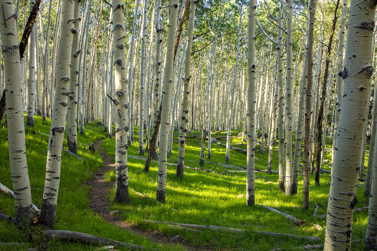
The trail begins just beyond the campground. For the first 10 minutes, it makes a gradual climb through what used to be a thick forest of ponderosa pines and aspens. Now, it’s a burnout area — the only section of the trail affected by the fire. Like many burn areas, this one is experiencing a resurrection of aspens. And those young trees will fill the gap in the years to come.
Beyond the burn, the trail moves into a zone of ponderosa pines, Douglas-firs and mature aspens, many of which are covered with carvings — some old, some new, some hard to tell. The common denominator is that every one of those marks violates the ethics of Leave No Trace.
Continuing on, the forest opens up a little and you’ll see the effects of the fire on the high ridge to the left. Then, after about 40 minutes on the trail, you’ll come to an intersection with Forest Road 146 (Waterline Road). Turn right. Ten minutes later, the road arrives at an old green shed that belongs to the U.S. Forest Service. The trail, which looks like another jeep road, veers left around the shed and quickly arrives at a “Y” intersection. Veer left again and make your way past a log pump house that shields a well that was drilled in 1971. Because the Inner Basin provides water for the city of Flagstaff, there are several wells in the area. This one goes down 485 feet.
From the pump house, it’s less than a half-mile to the Inner Basin, which is surrounded by the remains of a Pleistocene stratovolcano similar to Mount St. Helens. Today, those remains are known as the San Francisco Peaks, with Humphreys Peak being the highest at 12,633 feet. The views are the payoff on this hike, but the Inner Basin itself is very nice. In addition to the prairie grasses and shrubs, such as gooseberry and mountain snowberry, the subalpine environment nurtures an array of beautiful wildflowers, including firecracker penstemons, Richardson’s geraniums and mountain monardellas.
In late summer, you might still see a few flowers as you make your way to a small wooden shelter that marks the turnaround point for this listing. However, if you have some extra energy, the Inner Basin Trail continues for another mile and a half to an intersection with the Weatherford Trail. Unfortunately, most of that beautiful route was obliterated by the actions of a careless man from Louisiana. Remember: Only You!
Trail Guide
Length: 13.5 miles round-trip
Difficulty: Moderate
Elevation: 7,690 (temporary parking area) to 9,792 feet
Parking Area GPS: N 35˚22.433', W 111˚35.951'
Directions: From Flagstaff, go north on U.S. Route 89 for 12 miles to Forest Road 552, which is across from the entrance to Sunset Crater Volcano National Monument. Turn left onto FR 552 and continue 0.5 miles to a “T” intersection. Turn right to stay on FR 552 and continue 1.1 miles to a “Y” intersection, where you’ll find a small, temporary parking area along FR 552.
Vehicle Requirements: None
Dogs Allowed: Yes (on a leash), but only below the watershed cabin.
Horses Allowed: No
USGS Maps: Humphreys Peak, Sunset Crater West
Information: Flagstaff Ranger District, 928-526-0866 or fs.usda.gov/coconino
LEAVE-NO-TRACE PRINCIPLES:
• Plan ahead and be prepared.
• Travel and camp on durable surfaces.
• Dispose of waste properly and pack out all of your trash.
• Leave what you find.
• Respect wildlife.
• Minimize campfire impact.
• Be considerate of others.