
For centuries in the Sonoran Desert, mesquite trees and their byproducts were used for beams in pit houses, fence posts, medicinal salves, paint, hair dye, shampoo and food — the pods, which can be ground into flour, are loaded with protein.
Today, the trees are used for making high-end furniture and flavoring bone-in rib-eyes. In nature, they serve as shade plants for infant saguaros. And sometimes, they’re the centerpiece of a hiking trail. There’s a tree like that in the McDowell Mountains.
In the years before manifest destiny, the McDowells were governed by Mother Earth and Father Sky. In the decades since, they’ve been divided up like Europe after World War I. The city of Scottsdale manages the McDowell Sonoran Preserve, and Maricopa County runs McDowell Mountain Regional Park. The town of Fountain Hills has staked a claim as well. Its preserve borders the other two and features a handful of moderate trails, including Mesquite Hollow.
The trail, which has been open for about a year, begins at the Adero Canyon Trailhead. It’s a nice starting point. There are picnic tables and park benches, restroom facilities and, most days, sufficient parking — on Saturdays and Sundays, the lot fills up.
From the trailhead, the journey begins on the Promenade Trail, which connects to Mesquite Hollow and most of the other hikes in the northern half of the Fountain Hills McDowell Mountain Preserve. There’s a slight ascent at the start, but overall, this trail doesn’t gain a lot of elevation. The total span is less than 400 feet; however, there’s a lot of up and down, so you’ll actually clock more altitude than that. Nevertheless, this is not a difficult hike.
As the name suggests, the Promenade is a wide path designed for leisurely walks — mountain bikes are welcome, too. A few minutes in, you’ll get a glimpse of the Four Peaks to the east. In February, there’s a chance you might see some snow up there — the peaks rise to an elevation of 7,657 feet. Five minutes later, the Promenade intersects the North Leg Trail. Veer left and you’ll come to another intersection, this time with the Western Trail. A minute later, you’ll arrive at Mesquite Hollow.
From this point, the beauty of the Sonoran Desert makes a statement. The McDowell Mountains are home to more than 400 plant species, including saguaros, ocotillos, buckhorn chollas, jojoba, soaptree yuccas, desert senna and velvet mesquites. There are animals, too. Almost 600 species. Desert tortoises, coyotes and mule deer are on the list, and so are several rare birds, such as bald eagles, golden eagles, peregrine falcons, purple martins and gilded flickers.
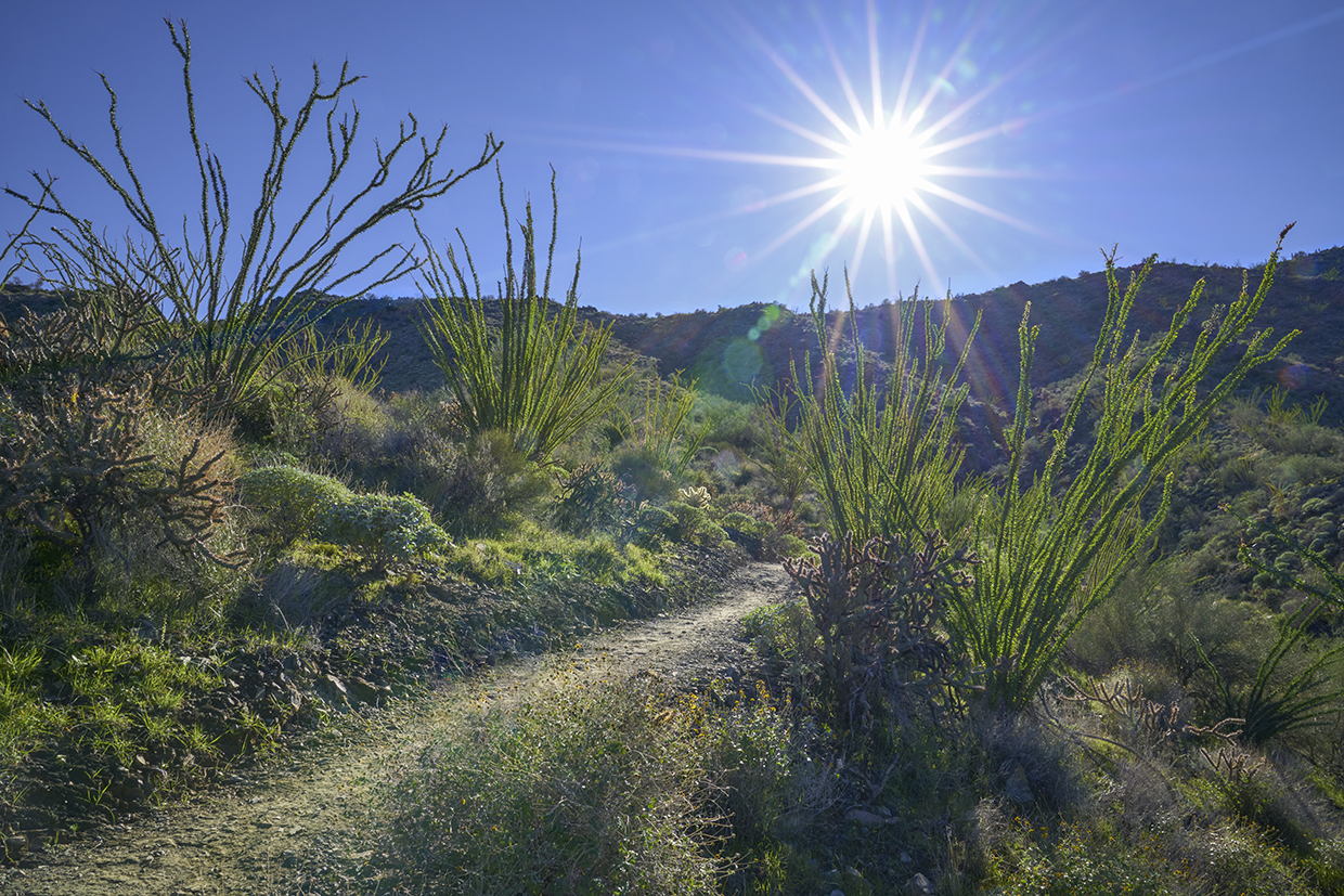
You might see some of them on this trail, which is a well-marked single-track surrounded at the outset by a regiment of beautiful ocotillos. Also known as flaming sword and Jacob’s staff, these large shrubs can reach heights of up to 20 feet. On this trail, some of them are pushing that extreme. They’re a highlight of the hike.
Another highlight is the old mesquite for which the trail is named. It marks a sharp turn just beyond the Mesquite Hollow Spur, about 30 minutes into the overall route. “You know me,” Bob Ross said. “I think there ought to be a big old tree right there.” No one knows for sure how old this big old tree is, but estimates range from 80 to 100 years, either of which is at the upper end of the spectrum. Old mesquites aren’t as impressive as old alligator junipers, but as they get to be granddads, they can reach heights of more than 20 feet with a spread of 30 feet. This one isn’t quite that big, but it’s impressive nonetheless.
From the granddad, the trail winds up and down and past a twisted saguaro — its arms go in every direction, including straight down — to an intersection with the Sonoran Trail. You have two choices at the junction. You can take the Sonoran Trail back to the Promenade, or retrace your steps on Mesquite Hollow. Either way works, but Bob Ross would suggest the rerun. There’s something special about big old trees. Especially in the Sonoran Desert.
TRAIL GUIDE
Length: 4.6 miles round-trip
Difficulty: Moderate
Elevation: 2,461 to 2,831 feet
Trailhead GPS: N 33˚37.267', W 111˚46.605'
Directions: From Shea Boulevard in Fountain Hills, go north on Palisades Boulevard for 1.1 miles to Eagle Ridge Drive. Turn left onto Eagle Ridge Drive and continue 2.3 miles to the Adero Canyon Trailhead.
Vehicle Requirements: None
Dogs Allowed: Yes (on a leash)
Horses Allowed: No
USGS Map: McDowell Peak
Information: Sonoran Conservancy of Fountain Hills, scfh.org
Leave No Trace Principles:
> Plan ahead and be prepared.
> Travel and camp on durable surfaces.
> Dispose of waste properly and pack out all of your trash.
> Leave what you find.
> Respect wildlife.
> Minimize campfire impact.
> Be considerate of others.