
A drive on Painted Rock Dam Road includes attractions that span more than a thousand years of human history, but for those more interested in mountain views and Sonoran Desert flora, there’s plenty to love along this 18.4-mile trek near Gila Bend. And as long as you drive carefully and it hasn’t rained recently, you can complete the route in just about any vehicle.
From Interstate 8 west of Gila Bend, head north on Painted Rock Dam Road, which initially offers views, straight ahead, of the Woolsey Peak Wilderness — a 64,000-acre section of the Gila Bend Mountains known for its pristine desert landscapes. A couple of miles up the road, you’ll also get a glimpse, on the left, of the Painted Rock Mountains, a minor range of low-slung volcanic buttes studded with saguaros.
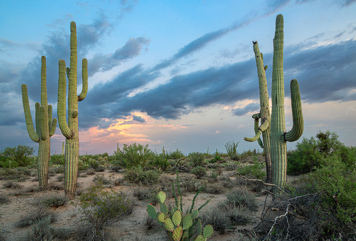
Next, the road curves to the northwest and traverses a section of creosote bushes, paloverdes and other iconic desert plants. By the time you crest a hill at Mile 10, you’ll be headed west, affording you a view of Oatman Mountain, which is topped by communications towers. This peak is composed of numerous basalt flows, just one example of the area’s complex volcanic history.
You’ll soon come to a “Y” intersection. Continuing on Painted Rock Dam Road would take you to the road’s namesake, but instead, bear left, onto Rocky Point Road, and continue a half-mile to Painted Rock Petroglyph Site. Here, a quarter-mile walk provides an up-close look at thousands of Indigenous petroglyphs, some of them 1,400 years old. Interpretive signs detail this place’s history and archaeology, and the site also features picnic tables and a spacious campground.
If you’d prefer to stick to paved roads, your drive ends here. But if you’re up for more adventure, continue west on Rocky Point Road, which runs out of pavement a mile past the petroglyph site but remains a mostly smooth dirt route. You’ll enjoy closer views of Oatman Mountain as you cross the normally dry Gila River; then, at Mile 15.8, the road curves to the north. Just past the curve, turn left onto Oatman Road — look for the “Oatman Flats Ranch” sign — and continue west, winding around an old building and across the Gila again. (Note that this road passes through private property; please contact the ranch at [email protected] to schedule a time to visit. The ranch also has a farm store offering wheat berries, flour, bread mixes and vanilla extract made from its products.)
Before long, you’ll see a bench beneath some large mesquites on the left side of the road. It marks a small cemetery where three children of William Fourr, who settled in this area in the 1860s and ’70s, are buried. As an interpretive document at the cemetery explains, Fourr’s homestead here included a toll road, although some travelers refused to pay — at least initially. “[They] would ask me where my charter was,” Fourr is quoted as saying. “I had charter from [the] Legislature to collect, but the best charter was a double-barreled shotgun.”
For one more dose of history, park at the cemetery and walk a short distance down the road, then less than a mile west along rough, unmaintained ranch roads to a small memorial. Near here, six members of the Oatman family were killed — and two, including Olive Oatman (below), were captured — in an 1851 encounter with Yavapais. (There’s good cell service here, and a smartphone is helpful in finding the site — which is marked, albeit incorrectly, as the Oatman Family Gravesite on Google Maps.) Then, retrace your steps to return to Interstate 8, where the Solana Generating Station, a massive solar power plant completed in 2013, is adding a new chapter to the history along Painted Rock Dam Road.
tour guide
Note: Mileages are approximate.
Length: 18.4 miles one way (from Interstate 8)
Directions: From Gila Bend, go west on Interstate 8 for 13 miles to Painted Rock Dam Road (Exit 102). Turn right (north) onto Painted Rock Dam Road and continue 10.7 miles to a “Y” intersection. Bear left, onto Rocky Point Road, and continue 0.5 miles to Painted Rock Petroglyph Site, on the left. From the petroglyph site, continue west on Rocky Point Road for 4.6 miles to Oatman Road. Turn left onto Oatman Road and continue 2.6 miles to the Fourr family’s cemetery. The memorial to the Oatman family is less than a mile due west of the cemetery and is best accessed on foot.
Vehicle requirements: None in good weather.
Special considerations: A fee of $2 per vehicle, payable at a self-pay station, is required at Painted Rock Petroglyph Site. Oatman Road passes through private property; contact Oatman Flats Ranch ([email protected]) to schedule a time to visit.
Warning: Back-road travel can be hazardous, so be aware of weather and road conditions. Carry plenty of water. Don’t travel alone, and let someone know where you are going and when you plan to return.
Information: Painted Rock Petroglyph Site and Campground, blm.gov/visit/painted-rock-petroglyph-campground