
Maybe this one seems too obvious. Everyone knows about the drive through Salt River Canyon, you might be thinking. But you’d be surprised how many Arizonans have never traveled the steep, winding stretch of U.S. Route 60 between Globe and Show Low. And, unlike many lesser-known drives in the state, this one is fully paved, making it an option in any vehicle.
The drive begins where U.S. routes 60 and 70 intersect in Globe, and you’ll head generally northeast on U.S. 60 through a rolling terrain dotted with scrub vegetation, prickly pear cactuses and assorted yuccas. Early on, you’ll pass the old Apache Drive-In on the left; this theater opened in the 1950s but shut down in 2013 as a victim of the digital age. Later, as you begin to climb, piñon pines and junipers appear before a bend in the road at Mile 12 offers a view of the Sevenmile Mountains to the east.
Next, the road parallels a riparian area that’s rich with cottonwoods and Arizona sycamores. Past Jones Water Campground at Mile 16.2, you’ll see more sycamores on the left, below 6,060-foot Jackson Butte. You’ll then climb steeply for several miles, but keep an eye out at Mile 22.5, when a gap on the left offers a brief glimpse of the Four Peaks, a landmark well known to residents of the Phoenix area.
You’ll soon be in a section of thick piñons and junipers, along with a few ponderosa pines. The latter disappear as your descent into Salt River Canyon begins, and you’ll leave the Tonto National Forest and enter San Carlos Apache Tribe land at Mile 29. Past the ghost town of Seneca, you’ll begin getting spectacular views into the canyon straight ahead.
Don’t let yourself be distracted by those views, though. Instead, take advantage of the numerous pullouts along
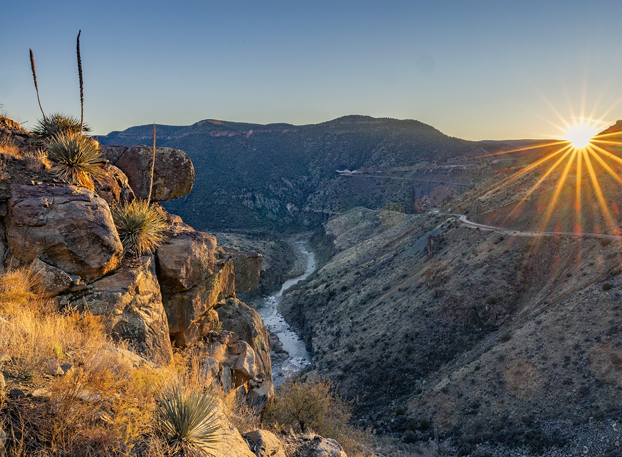
U.S. 60 as it begins switchbacking toward the Salt River. The first of these is at Mile 35.2, and there, you’ll see the river and the stretch of road you’re about to travel beneath the canyon’s imposing cliffs. The turns in the canyon are of the hairpin variety, so low speed and attention to the road are essential. The dramatic views continue all the way to the Salt River Canyon Rest Area, which sits right along its namesake waterway.
Here, a pair of bridges — a newer vehicle bridge, built in 1996, and the historic 1934 bridge, which now is open to pedestrians — span the river as it roars over a series of rapids. And after you cross the 1996 bridge (and cross onto White Mountain Apache Tribe land), keep an eye out for a single palm tree on the right. At this pullout, stairs lead down to an overlook with a lovely view of the river, which is a vital source of water for metropolitan Phoenix.
If you’re pressed for time, you can turn around here and head back to Globe, but for the full experience, continue up the canyon’s north rim, where yuccas and prickly pears cling to steep south-facing walls above the road. The last major overlook is at Mile 42, and its view of the river surrounded by tall cliffs is one you won’t want to miss. Soon, you’ll be back in the piñons and junipers before crossing over Carrizo Creek at Mile 60 and transitioning into a landscape of ponderosa pines and oaks.
You’ll leave tribal land and enter Show Low at Mile 80, a few miles before the drive ends at State Route 260. Perhaps you’ll stop for lunch in town before heading back the way you came — and getting yet another perspective on an “obvious” scenic route.
tour guide
Note: Mileages are approximate.
Length: 83.5 miles one way (from Globe)
Directions: From the intersection of U.S. routes 60 and 70 in Globe, go northeast on U.S. 60 for 83.5 miles to State Route 260 in Show Low.
Vehicle requirements: None in good weather.
Information: Globe Ranger District, 928-425-7189 or fs.usda.gov/tonto