FISHING IS GOOD IN ARIZONA
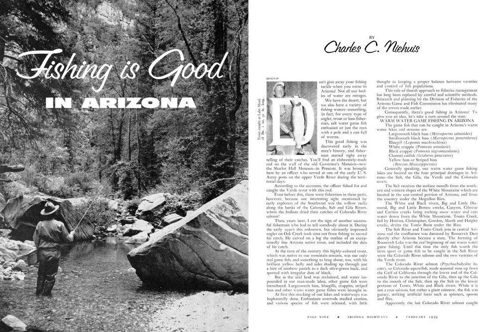
Don't give away your fishing tackle when you come to Arizona! Not all our bodies of water are mirages. We have the desert, but we also have a variety of fishing waters-something, in fact, for every type of angler, trout or bass fisherman, salt water game fish enthusiast or just the man with a pole and a can full of worms.
This good fishing was discovered early in the state's history, and fishermen started right away telling of their catches. You'll find an elaborately-made rod on the wall of the old Governor's Mansion-now the Sharlot Hall Museum-in Prescott. It was brought here by an officer who served at one of the early U. S. Army posts on the upper Verde River during the territorial days.
According to the accounts, the officer fished for and caught the Verde trout with this rod.
Even before this, there were fishermen in these parts, however, because one interesting sight mentioned by early explorers of the Southwest was the willow racks along the banks of the Colorado, Salt and Gila Rivers. where the Indians dried their catches of Colorado River salmon!
Then, years later, I cut the sign of another successful fisherman who had to tell somebody about it. During the early 1930's this unknown, but obviously impressed angler on Oak Creek took time out from fishing to record his catch. He carved on a log the outline of an exceptionally fine Arizona native trout, and included the date of his catch.
At the turn of the century this highly-colored trout, which was native to our mountain streams, was our only real game fish, and something to brag about, too, with his brilliant yellow belly and sides shading up through just a hint of rainbow pastels to a dark olive-green back, and spotted with irregular dots of black.
But as the arid land was reclaimed, and water impounded in our man-made lakes, other game fish were introduced. Largemouth bass, bluegills, crappies, striped bass and other warm water game fishes were brought in.
At first this stocking of our lakes and waterways was haphazardly done. Enthusiasm overrode studied caution, and various species of fish were released, with little thought to keeping a proper balance between varieties and control of fish populations.
This rule of thumb approach to fisheries management has long been replaced by careful and scientific methods. Research and planning by the Division of Fisheries of the Arizona Game and Fish Commission has eliminated many of the errors made earlier.
Consequently, there's good fishing in Arizona! To give you an idea, let's take a turn around the state.
WARM WATER GAME FISHING IN ARIZONA
The game fish that can be caught in Arizona's warm water lakes and streams are:
Generally speaking, our warm water game fishing lakes are located on the four principal drainages in Arizona the Salt, the Gila, the Verde and the Colorado rivers.
The Salt receives the surface runoffs from the southern and western slopes of the White Mountains which are located in the east-central portion of Arizona, and from the country under the Mogollon Rim.
The White and Black rivers, Big and Little Diamond, Big and Little Bonito creeks, Canyon, Cibecue and Carrizo creeks bring melting snow water and rain water down from the White Mountains. Tonto Creek, fed by Horton, Christopher, Gordon, Marsh and Haigler creeks, drains the Tonto Basin under the Rim.
The Salt River and Tonto Creek join in central Arizona and the confluence was dammed by Roosevelt Dam shortly after Arizona became a state. The forming of Roosevelt Lake was the real beginning of our warm water game fishing. Until this time the only fish worth the term sport or game fish to be caught in the Salt River were the Colorado River salmon and the two varieties of the Verde trout.
The Colorado River salmon (Ptychochoheilus lucius), or Colorado squawfish, made seasonal runs up from the Gulf of California through the lower end of the Colorado River to the junction of the Gila, then up the Gila to the mouth of the Salt, then up the Salt to the lower portions of Tonto, White and Black rivers. While it is not a true salmon, but rather a giant minnow, the fish was gamey, striking artificial lures such as spinners, spoons and flies.
Apparently the last Colorado River salmon caught
FISHING WATERS
ARIZONA'S TROUT STREAM COUNTRY In the vast, timbered highlands overlooking the rugged sweep of desert, trout streams and lakes await the angler. Well stocked with creel size fish they open the forest to fun. Unbelievably, in the savage canyons forming the hot desert channel of the Colorado river below hoover and davis dams, near-record-size rainbow trout can be caught year around.
FORT APACHE INDIAN RESERVATION Fishing permit required excellent fishing and campsites maintained by white mountain apaches arizona native trout rainbow trout german brown ONLY A FEW OF THE STREAMS AND LAKES ARE LISTED HERE.
In the Salt was one taken out of Roosevelt Lake by Albert ("Pidge") Pinney, in 1926.
The Verde trout (Gila robusta robusta and the Gila robusta intermedia) is still to be caught in the Salt, lower Tonto Creek and Black and White rivers, as well as in the Verde. This native fish takes artificial flies and lures and is quite sporting.
But of course, with the building of Roosevelt Dam, the movement of these native fishes up and down the Salt was stopped.
Within the next two decades, three other dams were built on the Salt River-Horse Mesa Dam, forming Apache Lake, Mormon Flat Dam, impounding Canyon Lake, and Stewart Mountain Dam to hold Saguaro Lake.
These four lakes-the Salt River chain of lakes-are all within 100 miles of the metropolitan areas of Tucson and Phoenix.
The Gila River, draining the Gila Wilderness Area in the Gila National Forest in western New Mexico, flows into Arizona near Duncan. It is joined near there by the San Francisco River. The confluence of these waters continues west, to be joined by the San Carlos. The Gila River is impounded by Coolidge Dam, to form San Carlos Reservoir.
The Verde River-heading at the base of a huge watershed made up of Big and Little Chino, Lonesome and Williamson valleys-actually begins to flow in a deep lava rock grotto about twenty miles north of Prescott, Arizona. The Verde flows east, picking up water from Granite Creek which runs down out of the Bradshaws, a little more from Hell's Canyon, and some more from Sycamore Canyon, which comes from the Sycamore Canyon Wilderness Area.
The Verde flows near Jerome, Clarkdale and Cottonwood, where it turns south and through Camp Verde. In its course it is joined by Oak Creek, Wet and Dry Beaver creeks and West Clear Creek, all trout streams which come down from the Coconino Plateau.
Further down, the Verde receives more water from another tributary, the East Verde, which in turn has had contributions from Pine, Webber, Dude, Bonito, Myrtle and Ellison creeks.
The lower portion of the Verde River is impounded by Horseshoe and Bartlett Dams to form two lakes bearing the same names.
The Colorado River, flowing across northern Arizona and down the west side, has been dammed a number of times to form other warm water game fishing lakes.
Lake Mead, formed by Hoover Dam, and Lake Mojave, held back by Davis Dam, form the mutual boundary between Nevada and Arizona.
Lake Havasu, which backs up seventy miles from Parker Dam, lies between California and Arizona. Farther down the river is Martinez Lake, backed up by Imperial Dam.
All of these lakes-the Salt River chain, those on the Gila and Verde rivers and the big lakes on the Colorado River-contain warm water game fishes: largemouth bass, bluegills, white and black crappies and channel catfish.
Saguaro Lake on the Salt River is the only body of water that has the yellow, or striped bass. This fish-undesirable from the standpoint of good fish managementwill be eliminated in time, and replaced with a more compatible fish. In the meantime, the "stripey" makes good fishing for many sportsmen.
The development of warm water fisheries in Arizona has been a unique and revealing story of good warm water game fish management. Carl Pleasant Lake, an isolated body of warm water, created by Carl Pleasant Dam on the Agua Fria drainage, is an extremely good example.
The Agua Fria (meaning "cold water") is a stream of periodic flow, filling from bank to bank in spring months with the runoff from melting snows, and drying up entirely in periods of drought. The dam was built to store this seasonal runoff and hold the water for irrigation of farmlands below. This lake is isolated, and therefore serves as a "controlled study" for the fisheries biologists of the game department, since an exact record of numbers and species of all fishes introduced into the lake can be kept.
Carl Pleasant Lake was formed in the early 1930's and immediately stocked with largemouth bass, bluegills and channel catfish. A regulation was established outlaw-ing the use of live bait minnows here, in the hope that non-game fish such as carp, suckers and others would not be introduced. But, in spite of this, such rough fish were released in the form of bait minnows, by unthink-ing fishermen.
Fortunately, however, at times the water level of Carl Pleasant gets so low that the entire fish population there can be destroyed and a fresh start of fish life made.
This phenomenon has occurred a number of times, and each time the fisheries biologists have profited by added knowledge of just what does happen in a warm water game fish lake.
Right now, Carl Pleasant is again one of the top producers of largemouth bass, bluegills and channel cats. And at this writing the game department has on order from one of the warm water game fish hatcheries operated by the U. S. Fish and Wildlife Service, a shipment of white bass for release in Pleasant.
Know-how gained from planting of fish in Pleasant has put Arizona high on the list of efficient managers of fisheries, and has led California and Arizona into agreement prohibiting the use of the Utah chub, the yellow bass and the Mexican banded tetra as live bait minnows on the Colorado River. Arizona has further applied this embargo against importing these three fishes to all fish waters within its boundaries.
So, at present, few of our fisheries, either warm water or cold, are out of balance, or filled with unwanted fish.
The state game department has taken other measures to make fishing better in Arizona.
It was discovered some time ago that one of the principal weaknesses in the production of desirable game
fish is in the food chain, which carries the newly-hatched game fish up through fry and fingerling lengths to catchable size.
In Arizona's created fishing waters, this chain of foods or forage for game fish has been strengthened by the importing and planting of several forage fishes and shellfish.
For example, the Colorado River in its original condition was heavily laden with silt, and therefore almost bare of certain types of plankton, forage fish and insect life which are necessary in good fish water. It used to be said of the Colorado River that it carried so much mud you had to chew the water before you could swallow it. But after Hoover Dam was built, the stored and quieted water began to clear and warm water game fish were successfully introduced above the dam.
Below Hoover Dam, an interesting development occurred, too. The water, drawn from a level of 150 feet below the surface of Lake Mead, came out at a temperature of under 60° ideal trout water! And so, the Colorado below Hoover was stocked with trout.
In time, certain aquatic weeds and algaes began to grow in the clearing waters. Fresh water shrimp and snails were introduced below Hoover Dam. This all resulted in such good trout fishing as to bring nation-wide attention to these waters.
Then, Davis Dam, seventy miles down the Colorado River, was completed, and Lake Mohave began to form. This creation of a lake on a stretch of river which had been trout water caused another ecological change to take place. The lower half of the lake became a warm water fishery, the upper half remained cold enough for trout. But the change in the water from a rapidly flowing river current to a slow-moving lake current destroyed the natural production of fresh water shrimp and snails which had been an important link in the food chain of the rainbow trout, and the quality of the trout fishing suffered a serious decline.
A search was immediately begun for a substitute food. This was found by the biologists-the threadfin shad. This small forage fish, swimming in schools and growing to three or four inches in length, is now found in every part of the lower Colorado River and its lakes, and has replaced the declining fresh water shrimp and snails. And-rainbow trout fishing in upper Lake Mohave and the Colorado River below Davis Dam is booming again!
The largemouth bass and crappie fishing in all of the lower Colorado from Lake Mead down has improved tremendously, too.
A warm water game fish that has received little attention from fishermen as well as biologists is the Kentucky smallmouth bass in the upper reaches of the Verde River and lower reaches of its tributaries. The Kentucky bass was brought into the state in 1941. Releases were made at Perkinsville on the Verde and at the crossing of U.S. 60 over Salt River.
To my knowledge, none of the smallmouth bass in the Salt River have been located, but those in the Verde River, lower Oak Creek and lower West Clear Creek have furnished many days of fine fishing! These fish, distinguishable from the largemouth bass by the red eye and the shorter upper mandible, are difficult to catch. But they are there!
Perhaps the best of warm water game fishing in Arizona is that it can be enjoyed year around.
Wally Blanchard, perhaps the state's most renowned largemouth bass fisherman, begins his angling activity in October, carries it through the winter months, then puts his tackle away in May. Wally has made a phenomenal record for himself as a catcher of prize largemouth bass.
While Wally and many other successful fishermen are active during the winter, others begin fishing for bass in early spring. Winter may be the better time for fishing, but spring and early summer are the best time to go fishing. No finer weather can be found anywhere-soft, balmy days and nights. The crappies are schooling then, and easily caught. The largemouth bass are moving out of the deeps of the lakes and into the shallows. And even the languid channel catfish seem to be just a little bit more eager to take your bait.
Of course, if it's more fishing you want, there's mountain fishing. Trout, for instance. Then you'd better start investigating the condition of roads in the high country. Winter snows are melting in March, April and May, and some of the good trout waters are accessible.
TROUT FISHING IN ARIZONA
The trout that can be caught in our mountain streams and lakes are: Arizona native or yellowbelly (Salmo gila) Rainbow (Salmo gairdnerii) Yellowstone cutthroat (Salmo clarkii lewisi) Kamloops (Salmo kamloops) Brown (Salmo trutta fario) Kokankee salmon (Oncorhynchus nerka kennerlyi) With the exception of upper Lake Mohave and the Colorado River below Davis Dam, all of our trout waters are located in mountainous country. The water of a good trout fishery will be under 65° in temperature. Although trout will tolerate higher temperatures for a few hours during the day if the water is well aerated and flowing, they will do better in colder water.
The trout waters of Arizona are, then, mostly above 4,000-foot elevations, in the headwaters of the four principal drainages: the Salt, the Gila, the Verde and the Colorado rivers.
The Coconino Plateau, a stratum of red sandstone beginning at Flagstaff and holding approximately the same elevation (5,000 to 8,000 feet) as it extends southeasterly toward the eastern border of Arizona, is known as the Mogollon Rim. This higher country seems to divide the trout streams of Arizona. Those heading on the north slopes of the Rim drain into the Little Colorado River, then into the main Colorado. Those heading south of the Mogollon eventually drain into the Salt and Verde rivers.
On the eastern end of the Coconino Plateau there are two peaks, Mt. Baldy (11,459 feet) and Mt. Ord (10,860 feet). These are the second and third highest mountains in the state.
Generally speaking, the area around these high points is known as the White Mountains, and most of the trout fishing streams and lakes are found here. The eastern slopes of the mountains are in the Apache National Forest, and the western slopes in the Fort Apache Indian Reservation.
For the purpose of ready reference to the trout waters of Arizona, we'll take the national forests in order. beginning at the eastern edge of Arizona and working west along the Rim to Flagstaff, Arizona.
The Apache National Forest, which takes in the White Mountain area, lies across the Mogollon Rim and along the eastern boundary of the state. Here, Luna Lake and the Blue River are just inside the New Mexico-Arizona border. Luna is an unusual trout water, because it is primarily a storage of irrigation water for the farm lands lying in New Mexico. For this reason it is often drained to a low level, but nevertheless Luna Lake is a very productive fishery. It has an unusual amount of plankton-small, nearly microscopic water insects-that produce fast-growing trout. In years past it has yielded some nice rainbows and browns. And recently it was stocked with Kokankee, a land-locked salmon that lives almost entirely upon plankton.
The Blue, flowing south just inside the Arizona boundary, joins the San Francisco River, below the Rim. It is a rainbow stream, very picturesque and has considerable prominence in the history of Arizona.
The Little Colorado River, one of the main trout streams of Arizona, is on the Apache National Forest. It has three main branches. The West Fork rises at a little under 10,000 feet on the northeastern slope of Baldy. The East Fork comes around from the east side of peaks Baldy and Ord. And the South Fork develops about four miles southeast of Greer. These three branches join in the vicinity of the little mountain settlement of Greer, Arizona, then continue, as the Little Colorado River, through Springerville, Arizona.
There are, of course, a half hundred or more lesser streams that feed into the Little Colorado, and one of these is Hall Creek. This stream has a place of significance in my memory because of the fine German brown trout it has put into my creel.
One of the places on the White Mountains that will stick in your mind, forever, as it has in mine, is Three Forks.
One of the branches is Boneyard Creek-named so because an early pioneer cattleman who tried to winter his herd in the area lost all his critters to a severe winter. Boneyard has a few Arizona Natives in its upper reaches . . . but below Three Forks the confluence is called the East Fork of the Black River. This stream flows to the south and then to the west, being joined by Coyote Creek. Soon it takes on the West Fork of Black River, which has its beginning south of Baldy. The West Fork of the Black, before joining the East Fork, receives contributions to its flow from Boggy, Centerfire, Wild Cat and Reservation creeks. Just below Buffalo Crossing (where the road from Big Lake crosses to Beaver Head Lodge) the two branches of the Black River come together.
Black River then leaves the Apache National Forest and enters the Fort Apache and San Carlos Apache Indian reservations to form the mutual boundary between these two areas.
In addition to the streams, the eastern slopes of the White Mountains within the Apache National Forest have a number of lakes which are trout fishing waters.
Big Lake is by far the most prominent and important, because of its past history as a producer of good fishing. Like Luna, it has a wealth of plankton, which produces a big trout in a short period of time. Close to Big Lake, just across the ridge, is Crescent. Crescent, too, has a swarm of tiny water insects. These lakes are kept heavily stocked with hatchery produced trout.
The Greer lakes-so-called because they are close to Greer, Arizona-Tunnel, Bunch and River Reservoir,
OPPOSITE PAGE
"THE SPARKLING WATERS OF WEST CLEAR CREEK" BY ALLEN C. REED. 4x5 Speed Graphic camera; Ektachrome; f.10 at 1/50th sec.; Graflex Optar lens; June, bright sunny day; G.E. high scale 4; ASA rating 12. West Clear Creek is east of Camp Verde and flows into the Verde River. This falls on West Clear Creek is accessible by foot or horseback about three miles from the trail head. West Clear Creek offers bass and trout fishing. There is no need to hike into this remote rugged canyon when one can fish at the lower end not far from the highway. Frequent stocking makes this fishing close to the highway better and just a short way from Camp Verde.
FOLLOWING PAGES
"ON THE LOWER SALT" BY ALLEN C. REED. 4x5 Crown Graphic camera; Ektachrome; f.16 at 1/10th sec.; Graflex Optar lens; April, clear sky, mid-morning. Weston 400 meter reading; ASA rating 12. This photograph was taken on a float trip down the Salt River. Location about thirty miles above where Salt River enters Roosevelt Lake. Fishing on this trip was confined to bass.
"A QUIET COVE-LAKE MEAD" BY WM. BELKNAP, JR. 4x5 Speed Graphic camera; Ektachrome; f.12.5 at 1/25th sec.; 135mm. Graflex Optar lens; late afternoon. Shown here are the Paint Pots at the base of Fortification Hill, Lake Mead. Location reached by boat. Experienced anglers find these quiet coves of Lake Mead good bass fishing sites.
"FISHING IS GOOD ON BLACK RIVER" BY NORMAN A. PEDERSEN. 4x5 Linhof camera; Anscochrome; f.16 at 1/100th sec.; 150mm. Schneider Synnar lens; late September; afternoon sunlight; ASA rating 32. Photograph taken on the Black River on the Apache Indian Reservation, south of Maverick Lookout. The Black is one of the important trout fishing streams in the White Mountains.
"YOU LAND BIG ONES IN OAK CREEK" BY BOB BRADSHAW. 4x5 Crown Graphic camera; Ektachrome; f.6.3 at 1/100th sec.; Ektar lens; June; bright sunlight. Photograph taken near U.S. 89A at Oak Creek Bridge, 7.5 miles north of Sedona. Oak Creek Canyon, one of the outstanding scenic areas of Arizona, is a popular summer vacation center. Constant restocking of trout from a nearby hatchery, provides plenty of fishing for everyone.
"A LAZY DAY ON SYCAMORE CREEK" BY CHARLES C. NIEHUIS. 4x5 Speed Graphic camera; Ektachrome; f.8 at 1/50th sec.; Ektar lens in a Supermatic shutter; early June, morning light. The scene was backlighted by a 10 A.M. sun. 12 foot candles, G.E. meter; ASA rating 12. Taken near the junction of Sycamore Creek and the Verde River. This is about twelve miles above or north of Clarkdale, Arizona. The angler was trying out some of his artificial creations on the Kentucky smallmouth bass, bluegills and Verde trout that can be taken here. The sun coming through the overhanging cottonwood trees, made an interesting color shot.
"A MOUNTAIN FISHING HIDEAWAY" BY NYLE B. LEATHAM. Photograph taken on the East Verde, north of Payson. This stream is well stocked with trout and attracts many fishermen during the summer months.
"FISHING NEAR WILLOW BEACH" BY CLIFF SEGERBLOM. Rolleiflex camera; Ektachrome; f.11 at 1/100th sec.; Schneider Xenar 3.5 lens; spring, bright sunlight. ASA rating 32. Willow Beach is a fishing center on the Colorado River between Hoover Dam and Davis Dam. The river here was once a rushing stream formed by waters released from Hoover Dam. Lake Mohave, formed by Davis Dam, now extends almost to Hoover. These waters abound in trout. Some record catches have been made here.
"ON A LITTLE LAKE IN THE WHITE MOUNTAINS" BY DICK CARTER
4x5 Linhof camera; Ektachrome; f.11 at 1/25th sec.; 90mm. Angulon lens; mid-September; bright sunlight; Norwood meter reading of 220. ASA rating 12. Blue Lake is located near Williams Creek fish hatchery in the White Mountains, just out of McNary. Blue Lake is well named. It seems to possess a particular bluish iridescence. It is surrounded by cliffs and trees and photographs can best be taken from 10:00 Α.Μ. το 3:00 P.M. It is well worth a leisurely visit whether to fish or to have a picnic lunch. There are many small lakes in the White Mountains offering fine trout fishing during spring, summer and fall. Regular stocking assures an ample supply of trout.
"SWIRLING WATERS-BRIGHT ANGEL CREEK" BY CHARLES C. NIEHUIS
Rolleiflex camera; Ektachrome; f.11 at 1/100th sec.; Zeiss lens; June, near midday; 20 foot candles on a G.E. light meter with cover closed; ASA rating 32. The photographer says: "Bright Angel Creek is in the bottom of Grand Canyon. My fishing partner and I had been fishing up and down Bright Angel Creek for several days. This big pool between Cottonwoods and the Power House promised to give up a big brown trout. The Bright Angel is full of brown trout, and we never went by without stopping and fishing it and taking at least one or two browns. The picture is backlighted. The reflection of the sun off the white water was hard to handle. At times the bouncing light came right into the lens. I lost at least eight or ten pictures because of over-exposure or under-exposure when trying to outguess the reflection."
"A LUCKY STRIKE-BIG LAKE" BY RAY MANLEY
4x5 Crown Graphic camera; Anscochrome overdeveloped one stop; f.11 at 1/250th sec. The photographer says: "Getting a picture of a fish jumping is no easy job and to be real honest about it if you think the beautiful calendar pictures of action fishing, etc., are the creation of the fisherman-not the photographer, you are naive. First you need a nice large fish, dead but fresh, a three foot glass rod that will not show in the picture, run through the fishes mouth, stuck into the mud or stream bottom and an accurate rock thrower coupled with good timing on the part of the camera shutter. It has been done electrically with a blasting cap (for the effect of the splash) but this means is not permitted in Arizona's streams and lakes so the rock method must suffice. It usually costs about six sheets of film even with a good assistant."
"GOOD FISHING-LAKE MOHAVE" BY CHARLES C. NIEHUIS
4x5 Speed Graphic on a tripod; Ektachrome; f.16 at 1/5th sec.; Ektar lens in a Supermatic shutter-no filter; August; about 7 A.M.; five foot candles on a G.E. meter with cover closed. ASA rating 12. This is Katherine Wash on lower Lake Mohave. The boats on the line belong to people mooring at Lake Mohave Resort. The most of these boats belong to people who leave them there the year around and come up on weekends and holidays for boating and water sports, such as fishing, pleasure and family boating. Katherine Wash, the name of the site, was taken from the old Katherine Mine, which is several miles back up the wash, to the right and in back of the camera. This scene is of the lake looking toward the Nevada side. Davis Dam, impounding the lake, is only a mile and a half to the left.
"ON RIVER RESERVOIR-WHITE MOUNTAINS" BY VELVA E. MILLER
4x5 Graphic View camera; Ektachrome; f.32 at½ sec.; Ektar f.7.7 lens; late May, bright sunshine; ASA rating 16. Approximately thirteen miles west of Springerville, Arizona, on State Road 73, a gravel road turns south four miles to Greer. The road crosses the Little Colorado River about three quarters of a mile north of Greer. Following a trail through the pines along the north side of the river for less than half a mile you reach a point overlooking the upper part of River Reservoir, one of the three Greer Lakes. The bank at this point is probably forty or fifty feet above the water. Greer is one of the popular summer vacationing centers in the White Mountains.
"BASS FISHING-APACHE LAKE" BY CHARLES C. NIEHUIS
4x5 Speed Graphic; Ektachrome; f.8 at 1/50th sec.; Ektar lens; June, mid-morning, clear sky; ASA rating 12. Scene shown here is Alder Creek Canyon on Apache Lake, one of the fine lakes impounded by dams along the Apache Trail in Central Arizona.
These are good producers of trout.
These waters are all well-known and accessible by road, but there are others-many unnamed streams and trout waters-and to tell you where they all are would be to rob you of most of your fishing fun, that of explor-ing the White Mountains for better trout fishing waters!
The trout fisheries of the Fort Apache Indian Reservation on the west side of mounts Baldy and Ord rival the White Mountains' trout waters in excellence. This area, administered by the Apache Indians themselves, has received unusual attention the last few years.
The Tribal Council has a subsidiary, the White Mountains Recreation Enterprises. This division of the council is charged with the development of the recreational facilities on the reservation.
The plan was originated by Silas O. Davis, one of three white men who was given full privileges on the reservation by the Apaches themselves. Si Davis did the basic work in planning and began the development of campgrounds, roads and facilities for the visitors to the reservation. The work is now being carried on by James Sparks, another dedicated outdoorsman.
All the trout streams found on the eastern half of the Fort Apache Indian Reservation head on the slopes of mounts Baldy and Ord.
The main streams developing in this area are: the North Fork of White River, Big Diamond, the East Fork of White River, Bonito Creek and of course the Black River which began on the Apache National Forest and now forms the southern boundary of the Fort Apache Indian Reservation.
The North Fork of White River actually has its beginning in a number of streams heading on the north slopes of Mt. Ord. These are Becker, Snake, Ord, Smith, Snowstake, Paradise, No Name and Trout creeks. Bog Creek, a tributary to the North Fork is the only trout stream of consequence coming in from the north.
Soon after picking up the waters from these mountain creeks, the North Fork of the White begins a southerly course and is soon joined by Big Diamond a few miles above White River, Arizona.
The Big Diamond is the main drainage of the west slopes of Ord and Baldy and has the Little Diamond, Beaver dams, Moon and Star and Sun creeks as tributaries.
The East Fork of White River heads right under the peak of Mount Baldy and flows almost due west to receive waters from Deep Creek, Rock Creek and Fire Box Canyon to join the North Fork of White River near the historic Fort Apache.
Bonito Creek takes most of its waters from the southern slope of Baldy. It too has tributaries with interesting and significant names. Since there is a Big Bonito, then, of course, there must be a Little Bonito Creek. There are others here with lusty western names, Flash, Squaw, Pea Soup and Hurricane Creek. Lower Bonito also receives water from a Tonto Creek (not to be confused with Tonto Creek in Tonto Basin).
The self-governing Apaches have had considerable foresight in the development of recreational facilities on the reservation and have created many additional lakes and ponds that serve as both watering places for the Indians' cattle and horses and trout water for visitors to the reservation.
So, if you're really interested in fishing the waters of the Fort Apache Indian Reservation, then put these names down in your directory: Tonto Lake, Corn Tank, Navajo Pit, Lone Pine #1 and Lone Pine #2, Blue Lake, Smith Park Lake, Bog Tanks. There are a few others, but these are for me to know and you to find!
When you leave the Fort Apache Indian Reservation and travel west along the Rim, you'll get on the Sit-greaves National Forest. This area includes the towns of Show Low, Pinetop, Lakeside; and Concho, Woods Canyon, Cub and Lakeside lakes, as well as Silver Creek, Show Low Creek and East Clear Creek.
You should probably pay particular attention to Woods Canyon, a newly created lake on the head of Chevelon Canyon. While this is yet to be proven as a good fishery, it is now stocked with Kamloops trout. So, keep it in mind!
The Sitgreaves National Forest covers much of the top of the Mogollon Rim country, and Tonto National Forest takes in most of the timbered country under the Rim, and that lying west of the Fort Apache Indian Reservation.
The main streams on the Tonto National Forest are Tonto Creek and the East Verde River. The Tonto heads under the Rim (which is known locally as the Tonto Rim but is actually a part of the Mogollon) and flows almost due south, finally forming the north arm of Roosevelt Lake on Salt River. During its coursing down from the higher country, the Tonto picks up additional water. First from Horton Creek, then a little farther on, Christo-pher Creek which flows out of See Canyon.
Haigler and Gordon creeks rise in Pleasant Valley in the Tonto Basin country and then drop into deep can-yons. They join lower down to form Marsh Creek, and this stream flows into Tonto Creek in Hell's Gate, a for-bidding and remote and extremely rough country on lower Tonto.
The East Verde River, heading farther west and under the Mogollon Rim, receives water from Webber, Dude, Bonito, Myrtle and Ellison creeks. Many of these streams are small and only flow on the headwaters and sink underground. But they do rise at intervals along their courses.
On up and over the Mogollon Rim from Tonto Basin, you'll be in the Coconino National Forest and on top of the Coconino Plateau.
Three main streams of water flow off the plateau: East and West Clear creeks and Oak Creek.
East Clear Creek heads near Lost Eden, and flows in an easterly direction, then turns north to pass near the town of Winslow before emptying into the lower end of the Little Colorado River. In its easterly course north of the Rim it is joined by Miller, Barbershop and Dane creeks.
West Clear Creek, heading at Clover Springs, flows to the west, dropping into a very deep and almost in-accessible canyon. Upper West Clear is one of the more isolated trout streams before it comes out of the deep canyons and joins the Verde River a few miles south of Camp Verde, Arizona.
Oak Creek, one of the most renowned vacation spots in the Southwest, starts at a spring under the Rim south of Flagstaff, Arizona, and develops rapidly into a good flow through a very picturesque canyon. It is joined by the West Fork of Oak Creek, which heads in a canyon to the west of the main stream. Lower Oak Creek is joined by Beaver Creek and then empties into the Verde River below the town of Cottonwood.
On the Coconino Plateau, southeast of Flagstaff, are a number of lakes: Upper and lower Mary, Kinnikinick, Ashurst and Coconino lakes, all of which are stocked with trout.
Not all of the Arizona's high country trout streams and lakes listed here are able to produce their own trout-that is, stream-hatched fish, nor furnish enough food for them to grow to catchable size and still satisfy the fishermen that visit them. Too, some of the waters are considered marginal trout fisheries-they may go dry during periods of prolonged drought or because of a dry winter in the mountains. So, for these reasons-in order to provide good trout fishing-the state of Arizona maintains a number of trout hatcheries and rearing ponds.
Pinetop State Fish Hatchery, near Pinetop, Arizona, is used primarily for hatching of trout eggs and rearing of fish to fry and fingerling sizes. Some of the trout are kept at Pinetop for rearing to creel size for release in White Mountain area streams and lakes. The other fry and small fingerling trout are released in lakes that have a good supply of natural feed.
Williams Creek Hatchery, on the Fort Apache Indian Reservation, is actually a federal fish hatchery and is operated by the U. S. Fish and Wildlife Service. But because of its favorable location and capacity it has been assisted in development by funds provided by the Arizona Game and Fish Commission.
The state game department furnishes a third of the funds, and receives a third of the output from this hatchery and its fine rearing ponds. The other two thirds of the trout reared here go into streams and lakes on the Apache Indian Reservation.
Tonto Creek Trout Hatchery and Rearing Ponds, on the head of Tonto Creek under the Mogollon Rim, is a great producer of trout fry which are hatched from eyed-up trout eggs shipped in from commercial producers. The capacity of this hatchery and rearing ponds has not yet been fully realized.
Page Spring Fish Hatchery and Rearing Ponds, located on lower Oak Creek, below Sedona, Arizona, is one of the main producers of catchable trout for our streams. The trout hatchery itself is located at the head of Oak Creek, at Sterling Springs. The fry and fingerling trout are reared at Page Springs. This facility also produces various species of warm water game fishes and forage fish for stocking the warm water lakes and streams around the state.
In addition to the mountain trout streams and lakes, Arizona has what is probably the most unusual trout water to be found anywhere.. the trout streams down in the Grand Canyon: Bright Angel and Clear creeks and Thunder River, all of which are under the North Rim; and Cataract Creek in Havasupai Canyon under the South Rim.
Because of their remote location these trout streams are hard to reach.
Bright Angel Creek is the most accessible, because it originates under the North Rim, just under Grand Canyon Lodge, flows down through Bright Angel Canyon alongside Bright Angel Trail which crosses the canyon. Even though summertime air temperatures in the canyon go well over 100°, Bright Angel Creek remains cold. This crystal clear trout stream empties into the Colorado River near Phantom Ranch.
Trout fishing at Willow Beach, Lake Mohave
Clear Creek, a very well stocked trout stream, is rarely fished, because it is about ten miles to the east from Bright Angel, over some hardscrabble canyon trails.
Thunder River is farther along the North Rim of the Grand Canyon. It heads under Crazy Jug Point and is off by itself. Thunder River can be reached only by trail, from either Little Saddle Corral in Indian Hollow, or from Crazy Jug Point. Big Saddle Deer Hunting Camp is the staging area for a pack trip into Thunder River.
Bright Angel, Clear Creek and Thunder River are self-sustaining trout streams in that they continue to produce trout with little help from the state's hatcheries. However, once in a while, the trout are replenished in the streams after gully-washing cloudbursts.
Cataract Creek in Havasupai Canyon, however, must be repeatedly stocked with hatchery produced trout fry. Cataract Creek, under the South Rim and on the extreme west end of the Grand Canyon National Park, is also in a class all by itself. as a trout water. The trout that have been released there grow tremendously fast, attaining unusual size in a very short time. But, apparently, they cannot successfully reproduce themselves; therefore, every trout that is caught in Cataract Creek has to be packed in on horse and mule back!
Although I have never fished Cataract Creek, I have been on the packtrips which were made to stock the stream with trout. This experience, alone, was unforgettable. And, I'm still living for one fishing trip in Havasupai Canyon.
The Colorado River flowing through the Grand Canyon of Arizona seems capable of giving no end of surprises. Every winter, along about January and February, the fishermen that embark from Hualapai Wash on Lake Mead, either hear of, or see, or if they are fortunate, themselves catch trout along the rocky, western bank of the wash. For some strange reason - although Lake Mead is considered a warm water game fish lake - trout appear in this cove every winter!
Undoubtedly, when Glen Canyon Dam is finished, the stretch of the Colorado River below and upper Lake Mead will become one of the finest trout fisheries in the world, as upper Lake Mohave is now, or the Colorado River below Davis Dam.
The water below Hoover Dam and below Davis Dam is cold, suitable for trout.
Upper Lake Mohave is between Nevada and Arizona, and both states participate in keeping it adequately stocked with rainbow trout.
A portion of the Colorado River below Davis Dam is the mutual boundary between Nevada and Arizona, and then it becomes the boundary between California and Arizona. All three of these states cooperate in its management and keeping it well stocked with trout fry and fingerlings.
Since the threadfin shad has been introduced into the lakes of the lower Colorado, there has been a phenomenal boom in the trout fishing in these areas. Some extremely nice and heavy rainbow trout have been caught here.
The lower Colorado River, above the city of Yuma, Arizona, can be a very exciting place for an exploring fisherman. Banks of tule line both sides of Martinez Lake and Colorado below. These tules often hide small lakes and waterways in which you can spend a whole day by yourself!
On below Yuma, the Colorado forms a mutual boundary between Arizona and old Mexico, and here is fishing too for the more adventuresome anglers.
This entire section of the Colorado is replete with bird life of all kinds and is a wintering place for migrating ducks and geese.
And, now that we have more or less covered the best of the fresh water game fishing in Arizona, I'll have to admit that I haven't told you of every place where you can make a good catch of bass, or take your best trout. And, I have reason for taking this stand, and I'm sure you'll sympathize with me.
Years ago, I had a very good friend. We went fishing often, sharing many pleasant days together while seeking out and fishing some of these better waters.
Then-one day-after an unusually satisfying trip I wrote an account of our experiences, telling where, how and what we caught. It was published. My friend called me an informer and we've never sat down at the same campfire since.
A fellow hates to lose good fishing partners, so . . .
Already a member? Login ».