

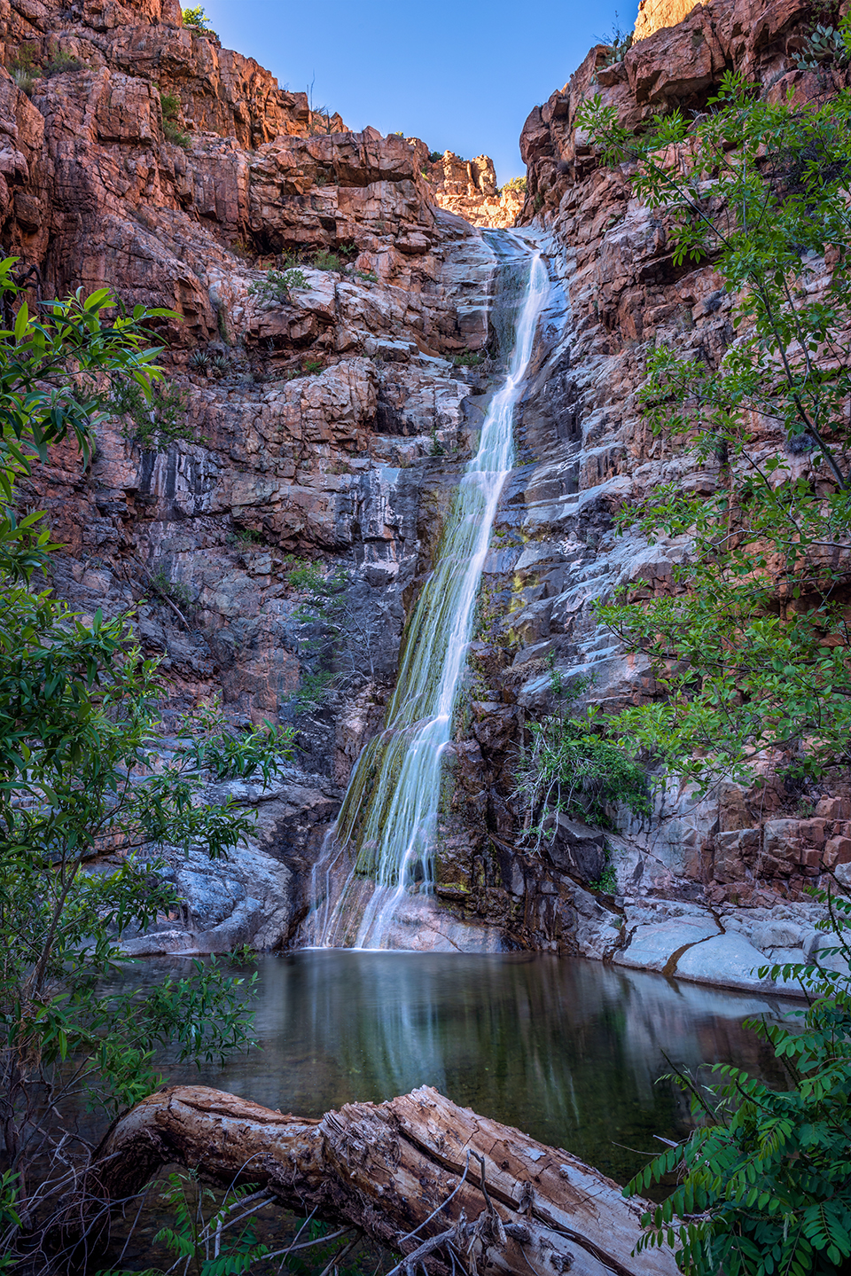
Spring snowmelt fuels an ephemeral waterfall in Gaddes Canyon, south of Jerome, in late-afternoon light. This canyon is on the east side of Mingus Mountain, one of the highest points in the Black Hills.
Theresa Rose Ditson
NIKON D810, 1/5 SEC, F/13, ISO 64, 24 MM LENS
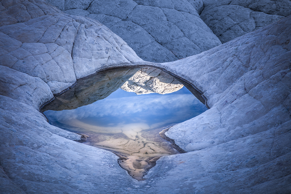
A shallow pool in the textured “brain rock” of White Pocket, in the Vermilion Cliffs of Northern Arizona, mirrors sky and stone in early morning light. A high-clearance, four-wheel-drive vehicle is required to reach this extremely remote site.
Suzanne Mathia
CANON EOS 5DS R, 1/50 SEC, F/11, ISO 100, 70 MM LENS
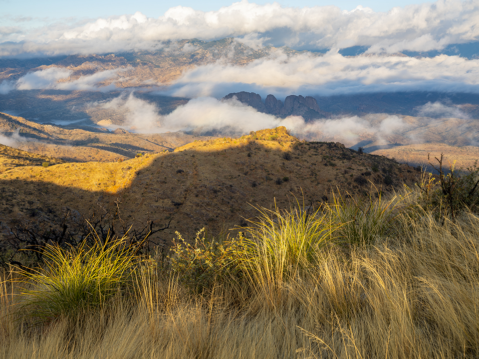
Morning light and low, wispy clouds define a view from the North Santa Teresa Wilderness, northwest of Safford in Eastern Arizona. Located adjacent to the San Carlos Apache Tribe’s land, this 5,800-acre wilderness area protects Black Rock, a landmark that holds spiritual significance to the tribe.
Jonathan Buford
FUJIFILM GFX 50R, 1/4 SEC, F/20, ISO 160, 62 MM LENS
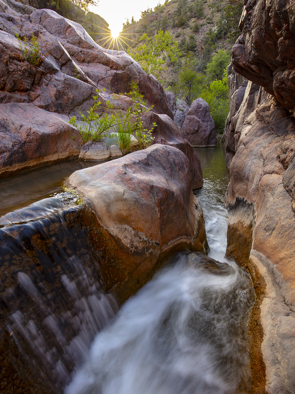
Late-afternoon sun punctuates a view of a slick-rock cascade in a narrow section of Haigler Creek, part of Central Arizona’s Hellsgate Wilderness. Six trailheads provide access to this inhospitable wilderness area, which covers more than 37,000 acres and is managed by the U.S. Forest Service.
Joel Hazelton
CANON EOS 5DS R, 0.3 SEC, F/16, ISO 100, 16 MM LENS
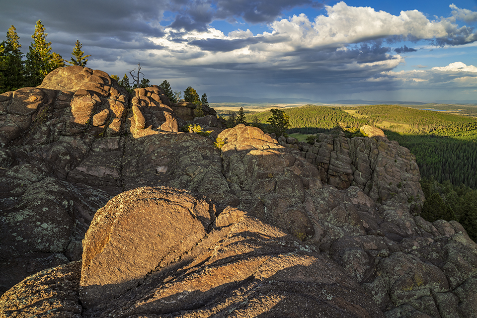
Long shadows fall on volcanic rock formations along the East Baldy Trail, in the White Mountains of Eastern Arizona, as a distant thunderstorm rages. East Baldy is one of two main routes that approach the summit of Mount Baldy, the White Mountains’ highest point.
Laurence Parent
SONY ALPHA 7R II, 1/25 SEC, F/16, ISO 200, 24 MM LENS
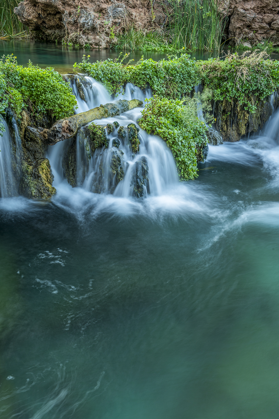
Spring-fed Fossil Creek tumbles over travertine dams and waterfalls amid the greenery of the Fossil Springs Wilderness, near Strawberry. The springs that feed Fossil Creek flow at a rate of about 20,000 gallons per minute, making this area a haven for both wildlife and backpackers.
Laurence Parent
SONY ALPHA 7R II, 2 SEC, F/16, ISO 50, 35 MM LENS
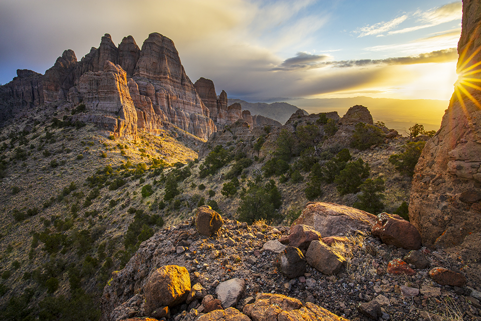
Dramatic formations in the Mount Tipton Wilderness, northwest of Kingman, glow at sunrise as a spring storm passes overhead. This topographically challenging, 31,000-acre wilderness area offers numerous opportunities for hikers, equestrians and photographers.
Joel Hazelton
CANON EOS 5DS R, 1/30 SEC, F/16, ISO 100, 16 MM LENS
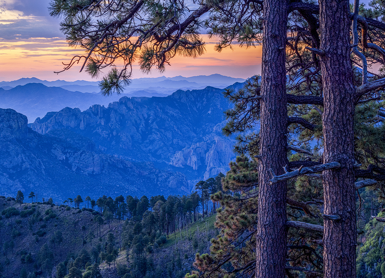
Jagged mountains form a layered panorama at sunrise in a view near Rustler Park, part of Southeastern Arizona’s Chiricahua Mountains. Named for the cattle thieves who once holed up there, Rustler Park is known for its birding and wildlife-watching opportunities.
Jeff Maltzman
CANON EOS R5, 8 SEC, F/16, ISO 400, 100 MM LENS