
This trail is not marked by red-white-and-blue barber poles. It would be nice if it were, but it’s not. In fact, it can be confusing at times. Usually, all you have to do in Arizona is get to a trailhead, throw on a backpack and set forth. You couldn’t get lost if you wanted to. This hike is one of the exceptions.
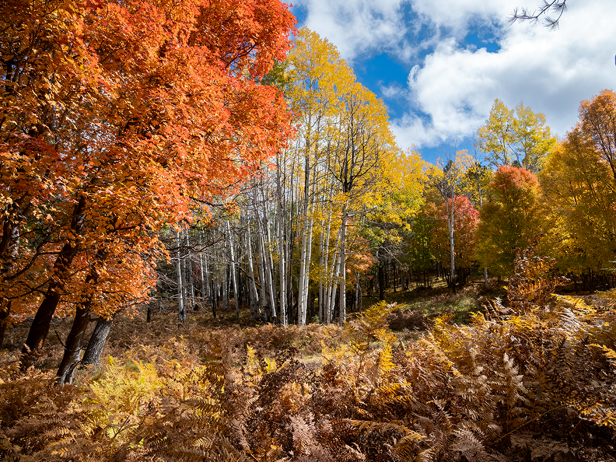
The route begins with a quick descent into a thick forest that’s reminiscent of some other place. The Adirondacks or the Appalachians. It’s the ground cover that stands out. Unlike a lot of other Mogollon Rim hikes, which have limited vegetation underfoot, the Barbershop Trail is lush and grassy, with ferns as high as 4 feet tall.
About 10 minutes in, the trail passes through an old gate that lost its purpose many decades ago. The trees at this point are mostly ponderosas, and two old-timers serve as a gateway to the trail, which is named for a local sheepherder who, allegedly, was as good at clipping his fellow shepherds as he was at shearing sheep. As the trail levels off, it passes Barbershop Spring and arrives at a long meadow that’s bisected by a small stream. The trail eventually crosses the water and switches up the opposite slope toward another old gate and some even older fir trees.
Beyond the gate, the plane levels off for a few hundred yards — it’s a nice respite — as the trail approaches an intersection with Forest Road 145. You’ll start seeing some oaks as you make your way downhill into Dane Canyon. Depending on the weather, the canyon could have water running through it. Water, of course, attracts wildlife, which in this area includes turkeys, mule deer, elk and black bears.
After another quick descent, the rocky single-track climbs up again. Up, down, up, down, up, down … the up-and-down nature of this hike is one of its most pronounced idiosyncrasies. Unlike Fred Haught and the other trails that run north and south along the natural ridges of The Rim, this route goes east and west, which creates a roller-coaster effect that will test your endurance.
Take it slow and steady, and after 45 minutes, you’ll come to a two-lane dirt road. This is where it starts to get tricky. Cairns and tree notches mark the way, but they’re not always obvious. When you’re in one of those situations, don’t move forward until you find the next marker. You don’t want to get turned around in a forest this big.
Continuing on, you’ll come to a large meadow about the size of a soccer field. This is one of those tricky parts. However, if you look diagonally across the meadow — way off in the distance — you’ll see a cairn at the opposite end. From there, the trail parallels a narrow forest road for a few minutes before coming to an intersection that’s marked by a large cairn. Turn right and make your way back into the woods, where you’ll start seeing aspens and maples. Eventually, this segment arrives at Forest Road 321C. But just before that, the trail veers left. Unfortunately, there isn’t a sign, so the turn is easy to miss, even for experienced hikers. If you do miss it, don’t worry. Just turn left onto
FR 321C and walk about 10 minutes to another cairn that marks the trail on the left. From there, the hike winds through the woods and scrambles up a steep bank, onto Dane Ridge.
The rest of the route is an easy stroll that passes Coyote Spring before intersecting the U-Bar Trail. From there, it’s about 10 minutes to the Barbershop’s eastern trailhead along Forest Road 321, which is the turnaround point for this listing. However, if you have time, water and a little more energy, you can continue another half-mile to the Buck Springs Cabin. It’s a great place to catch your breath and gear up for the return trip, which will be a lot easier now that you know where you’re going.
trail guide
Length: 7.9 miles round-trip (to Forest Road 321)
Difficulty: Moderate
Elevation: 7,709 to 7,510 feet
Trailhead GPS: N 34˚26.351', W 111˚11.986'
Directions: From Payson, go north on State Route 87 for 28.5 miles to Forest Road 300. Turn right onto FR 300 and continue 15.9 miles to Forest Road 139. Turn left onto FR 139 and continue 1.8 miles to the trailhead on the right.
Vehicle Requirements: None in good weather.
Dogs Allowed: Yes (on a leash)
Horses Allowed: Yes
USGS Map: Dane Canyon
Information: Mogollon Rim Ranger District, 928-477-2225 or fs.usda.gov/coconino