
“Cow pies and a hangover.” That might sound like the opening line of a joke, but there’s nothing funny about the Hangover Trail. This is a technical route that’s intended for serious hikers only. That said, there are cow pies along the way. And a hangover. Several, in fact.
The hike, which is accessed via two connector trails, begins at the lower end of Schnebly Hill Road. From the well-developed trailhead, the route begins with the Munds Wagon Road Trail, which immediately dips into a wash. It’s a short descent marked by flood-resistant cairns in wire cages as tall as TV trays. About five minutes in, the trail veers left and parallels Schnebly Hill Road, which makes several appearances.
After crossing the road a couple of times, the trail drops into Bear Wallow Canyon. It’s unlikely you’ll see a bear, but you will see an escalation of trees, mostly junipers. Continuing on, the trail passes an old alligator juniper — one of the route’s many elders — and arrives at a lovely grove with a few picnic tables. Ten minutes later, the route intersects the Hangover Trail, which forms a loop with the Cow Pies Trail. You could turn left at this point and hike the loop in a clockwise direction, but it’s more pleasant the other way around. So, ignore this turn and stick to the old wagon road, which veers right and winds down to the creek bed.
From there, the trail pushes out of the canopy and then back in before arriving at an “equestrian bypass.” Here, the horses go right and the hikers go left. That’s unfortunate for those on horseback, because the slick-rock they’re being protected from is one of the most interesting parts of the wagon road, especially when the winter snowmelt and summer rains breed miniature waterfalls.
After crossing the slick-rock, the trail begins to climb. First a zig, then a zag. Then, after another road crossing, it arrives at an intersection with the Cow Pies Trail. Turn left and head north toward the Cow Pies, which are large circular mounds of slick-rock. To get the full effect, you’d have to be in a hot-air balloon, but even at ground level, the formations are striking. That’s why they were used as a set location for so many Westerns, including Angel and the Badman, Broken Arrow and Stay Away, Joe — John Wayne, Jimmy Stewart and Elvis have all stood on the Cow Pies.
Although slick-rock makes for an adventurous landscape — mountain bikers love this loop — it doesn’t allow for an easy-to-follow track, like a well-defined path in the woods. Instead, there are white hash marks to guide the way. They’re a clear violation of Leave No Trace, but without them, you’d have a hard time knowing where to go.
The first set of markers points the way to the base of Mitten Ridge and your intersection with the Hangover Trail — the Cow Pies Trail is only 0.4 miles long. In a place like Red Rock Country, it’s dangerous to dole out superlatives, but the views from this spot are about as good as it gets. Take it all in, and then watch your step. Slick-rock is dangerous, even with Vibram-soled shoes.
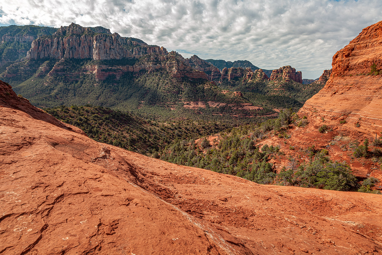
After about 20 minutes of heading west, the trail makes a sharp turn to the northeast. As you carefully descend the steep slope, you’ll get a look at Midgley Bridge, Grasshopper Point and Oak Creek Canyon. You’ll also get a respite from the slick-rock as the trail transitions to dirt and ducks under a canopy of junipers on the north side of the Teapot formation. There are canopies of rock, too — large outcroppings that “hang over” the trail like sandstone awnings. They’re the namesake of this trail, and they’re notable. So is the precipitous drop-off to your right.
After another 20 minutes, you’ll be back on the slick-rock and once again dependent on the hash marks. At this point, the route starts winding downhill, making the already-dangerous slick-rock even more challenging. It goes quickly, though, and soon you’ll be heading south, into the trees. Then, before you know it, you’ll reconnect with the Munds Wagon Road Trail, which winds for another half-hour back to the trailhead, where you’ll make an Instagram post about how you just survived the best hangover of your life. No joke.
Trail guide
Length: 8.5 miles round-trip
Difficulty: Moderate
Elevation: 4,454 to 5,160 feet
Trailhead GPS: N 34˚52.002', W 111˚44.915'
Directions: From the roundabout junction of state routes 179 and 89A in Sedona, go south on SR 179 for 0.3 miles to Schnebly Hill Road. Turn left onto Schnebly Hill Road and continue 0.8 miles to the trailhead, on the left.
Special Consideration: A $5 Red Rock Pass is required.
Vehicle Requirements: None
Dogs Allowed: Yes (on a leash)
Horses Allowed: Yes
USGS Maps: Sedona, Munds Park, Munds Mountain
Information: Red Rock Ranger District, 928-203-2900 or fs.usda.gov/coconino