
In sociology, the dichotomy of East and West is a polarization of ideology, culture and religion. In Saguaro National Park, it’s an alluring cliche: six of one and half a dozen of the other. Both sides of the park — there’s an east district and a west district — offer a similar experience. But there are distinctions.
The Rincon Mountain District (east) is more than twice as big as its counterpart, while the Tucson Mountain District (west) has more than twice as many picnic areas. The highest elevation on the east side (8,666 feet) is higher than on the west side (4,687 feet), but the saguaro density is greater in the west. In regard to hiking, there are 128 miles of trails in the east and 43 in the west, including the Hugh Norris Big Loop. It’s the perfect hike for January.
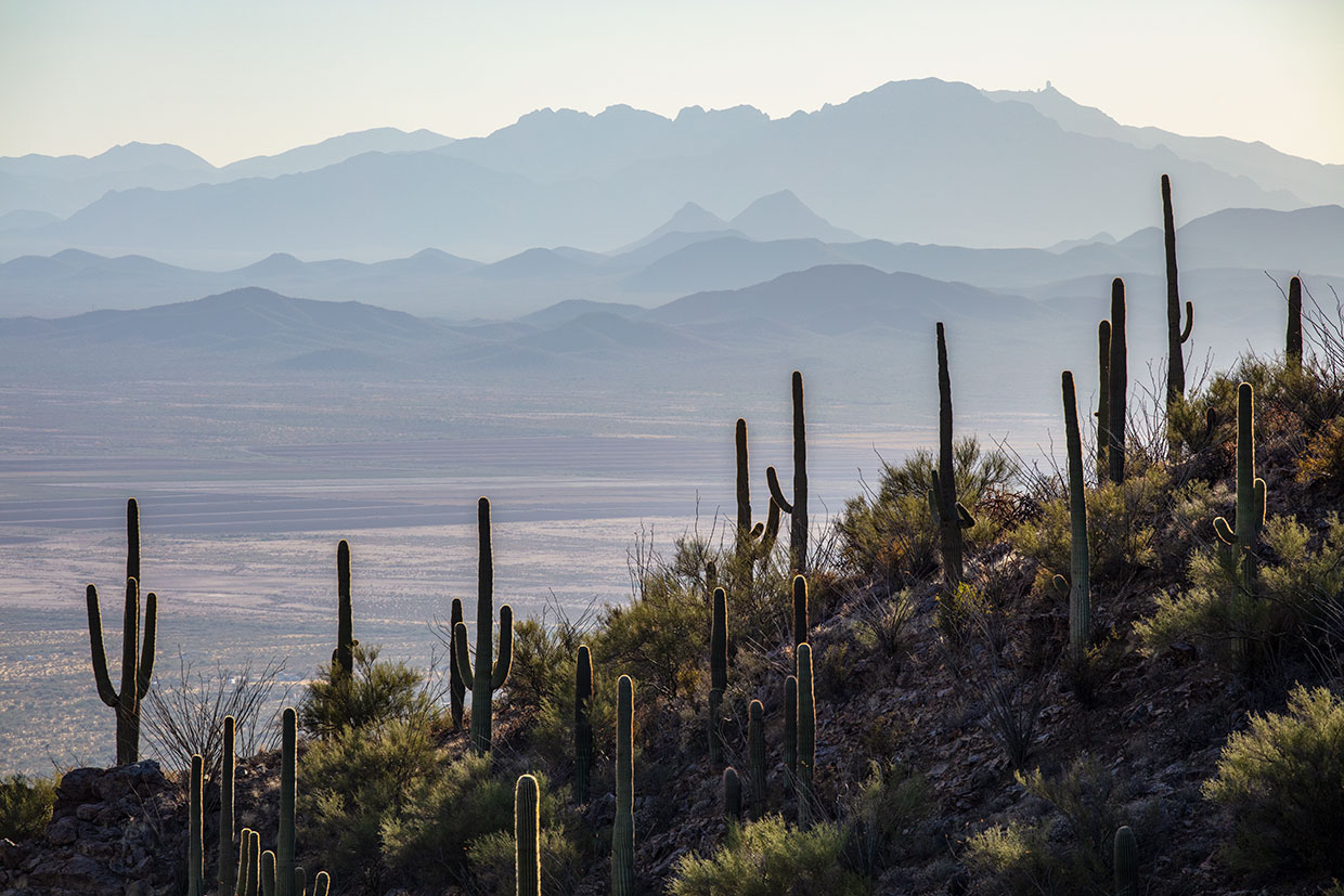
From the trailhead, the Big Loop begins with the Hugh Norris Trail, one of four segments along the way. There’s no warmup. The well-marked trail begins with an immediate ascent through a thicket of saguaros — you won’t forget what park you’re in. In the space between the saguaros are chollas, paloverdes and creosote bushes. The initial climb is steady with a few switchbacks, but it’s never grueling. As you make your way up and look to the west, you’ll see the Roskruge Mountains and Ironwood Forest National Monument in the distance. Enticements for another day.
About 20 minutes in, the trail arrives at a saddle where nice views open up to the east. Intuitively, you’ll think you’re at the top, but you’re not. Half the elevation gain is still ahead. A few more switches will take you even higher. After a brief descent past some large boulders — Don Quixote would have thought them to be woolly mammoths — the climb resumes, and you’ll come to another saddle (elevation: 3,370 feet) with spectacular panoramas to the east and west.
From there, the grade gets steeper as the hike winds around a small outcropping and points in the direction of Wasson Peak, the apex of the district. Then comes another saddle (3,660 feet). Again, it will trick you into thinking you’ve made it to the high point. But, again, you have not. Five minutes later, however, you’ll be there, surrounded by ocotillos, prickly pears and chollas. And saguaros. They’re the common denominator.
The descent begins by passing a fenced-off mine shaft — remnants of someone’s hopes and dreams. Ten minutes later, you’ll arrive at an intersection with the Sendero Esperanza Trail. From this point, Hugh Norris continues another 2.2 miles to the summit of Wasson Peak. That makes a nice day hike, too, if you’d rather. But there’s more variety on the Big Loop. Veer left and enjoy the views, which now include mesquites and even more chollas.
The downhill run on the Sendero Esperanza goes by quickly. It takes about 15 minutes. That’s when it intersects with the Dobe Wash Trail, which veers left, heads northwest and follows a wash toward Hohokam Road. The sand and gravel make the trail hard to follow, but the National Park Service has installed a series of signposts that point the way, like crossing guards. As you plod along, you’ll notice that a lot of the saguaros in the basin have unusual postures — their arms point in all directions, including down.
After about two hours of overall hiking, the Dobe Wash Trail arrives at Hohokam Road, one of the scenic drives in the park. Cross the dirt road and look immediately to the left for the Bajada Wash Trail, the final leg of the loop. It’s not obvious at the outset, but if you keep in mind that the trail parallels the road, you’ll find your way.
Arguably, this is the best part of the hike. The trail itself is narrow, like a single-track carved by wildlife, and it winds through a beautiful riparian area to an intersection with the Wild Dog Trail. Stay on Bajada Wash, which cuts through a landscape of flat rocks, boulders and saguaros. Fifteen minutes later, you’ll come to a small sign that points the way to the Hugh Norris Trailhead. It’s the place where the Big Loop begins and ends. And it’s one of the highlights of the west side, especially on a Saturday morning in January.
Trail guide
Length: 6.7 miles round-trip
Difficulty: Moderate
Elevation: 2,580 to 3,690 feet
Trailhead GPS: N 32˚16.287', W 111˚12.186'
Directions: From Interstate 10 south of Marana, go west on Avra Valley Road (Exit 242) for 5 miles to Sandario Road. Turn left onto Sandario Road and continue 8.8 miles to Kinney Road. Turn left onto Kinney Road and continue 0.1 miles to Hohokam Road. Turn left onto Hohokam Road and continue 0.8 miles to the trailhead, on the right. (Hohokam Road is closed to vehicles from dusk to dawn.)
Special Consideration: National Park Service fees apply.
Vehicle Requirements: None
Dogs Allowed: No
Horses Allowed: No
USGS Map: Avra
Information: Saguaro National Park, 520-733-5153 or nps.gov/sagu