
“One of Arizona’s best trails is in a city park.” The notion is counterintuitive. Yet, despite its urban coordinates, everything about the Tom’s Thumb Trail measures up. The surrounding landscape is like a painting by Charles Russell, the easy-to-follow route is meticulously marked, there’s enough incline to burn off the lingering effects of that second helping of Christmas pudding, and the trail itself is so well groomed that your eyes can wander instead of watching every step. By almost any measure, this hike is hard to beat.
It begins at one of the many impressive trailheads in the McDowell Sonoran Preserve. From there, it begins a slight ascent through a mix of desert vegetation that includes teddy bear chollas, buckhorn chollas, mesquites, jojobas and turpentine bushes. And up ahead, past a hillside covered with thousands of scattered boulders — ancient marbles in a giant’s game of jacks — you’ll see the ridge to which you’re headed. What you won’t see are a lot of saguaros. They prefer south-facing slopes.
After a few minutes of easy climbing, you’ll come to an intersection with the Feldspar Trail, which leads to a network of other trails. At this point, the grade shifts upward and you’ll start feeling the burn in your quads. The trail starts winding, too, but not in the traditional way of switchbacks. That will come a few minutes later. But first, you’ll arrive at an intersection with a spur that leads to Harris’s Hawk Vista. It’s one of many viewpoints along the way.
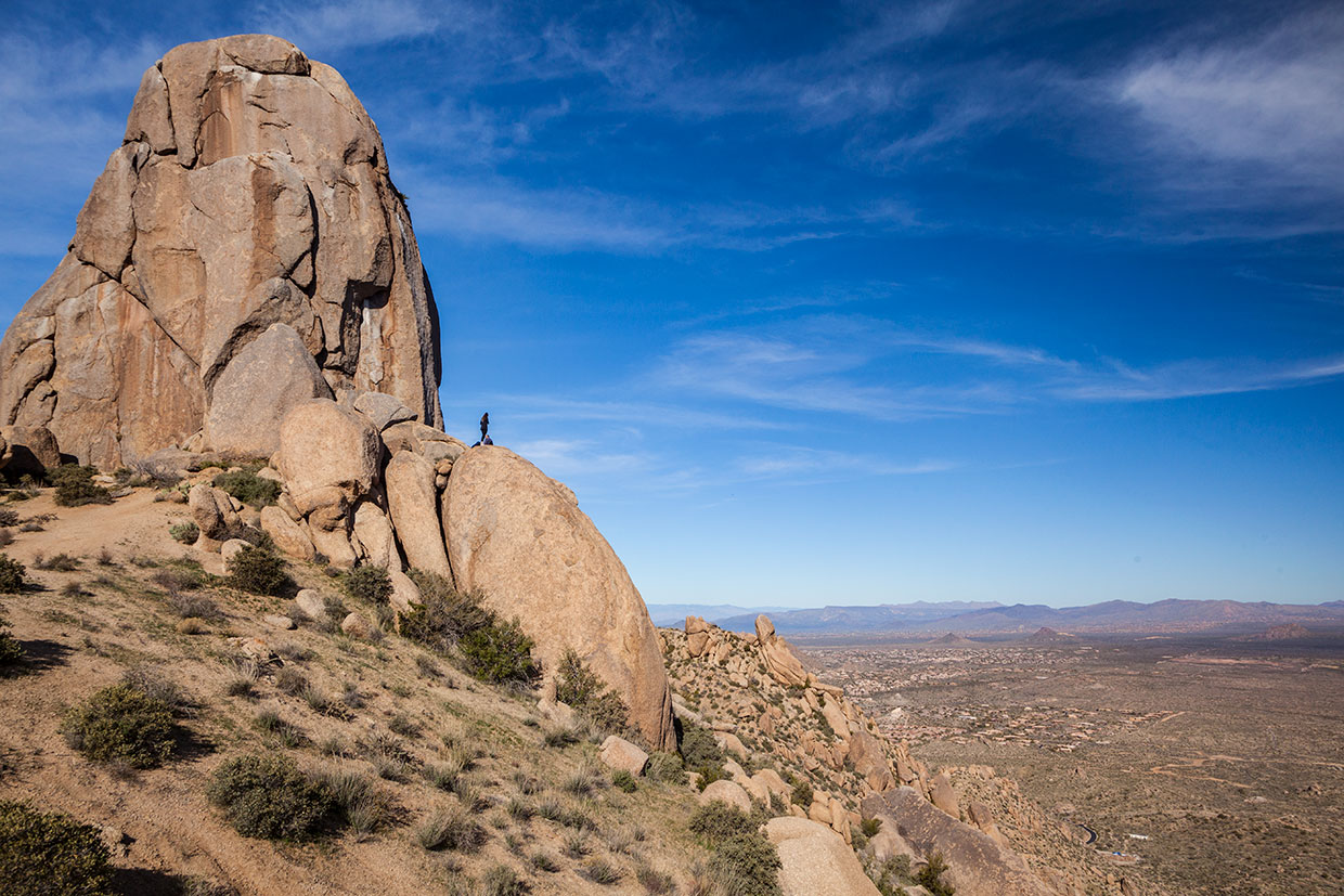
Beyond the spur, the switchbacks move in to help mitigate the climb — this is the steepest part of the hike. Continuing up, the trail passes another scenic viewpoint (Raven Roost) and arrives at a “rock climbing access route.” Long before there were multimillion-dollar homes in every direction, the McDowell Mountains were the distant domain of hardcore rock climbers, including members of the Arizona Mountaineering Club. In 1965, Tom Kreuser, the rock star of that group, pioneered what is now the standard route to the summit of the thumb. Originally known as “The Dork,” the 140-foot plug of granite was renamed Tom’s Thumb in honor of the man who conquered it.
Back on the trail, the huffing and puffing continues for another 10 minutes until the route arrives at a saddle and yet another scenic viewpoint (Vulture View). The elevation is 3,670 feet, which accounts for most of what you’ll accumulate on this strenuous day hike. From the saddle, the trail levels off and leads to the Prairie Falcon Overlook, which is followed by a short descent — about 100 feet in elevation. The next stop is an intersection with the East End Trail, an extremely steep and rugged route that will test even the most aggressive hikers. Add it to your list. Or don’t.
From there, it’s a half-mile of gentle ups and downs to the top, where Tom’s Thumb sticks out like a cliché. But it’s not the only payoff. The summit also offers distant views of downtown Phoenix.
It would be better if there weren’t any signs of civilization, but this trail is an urban trail in the McDowell Sonoran Preserve, which protects thousands of acres of lush desert landscape. The preserve got its start in 1991, when a small group of Scottsdale citizens formed the McDowell Sonoran Conservancy. Their goal was to advocate for the land and persuade the city to protect it. When the first parcel was acquired in 1994, the conservancy became its steward.
Today, the preserve measures 30,580 acres, making it the third-largest city park in the United States. And within its boundaries are 417 plant species and 600 animal species, including desert tortoises, coyotes and mule deer. Rare birds are on the list, too: bald eagles, golden eagles, peregrine falcons, purple martins and gilded flickers. You might see any of those natural wonders on this trail, or on one of the many other routes in the preserve — in all, there are 225 miles of hiking trails.
Tom’s Thumb accounts for just a few, but in that short distance, it covers more ground than most. And by almost any measure, it’s a hike that’s hard to beat. One of the best in Arizona.
Trail guide
Length: 4.25 miles round-trip
Difficulty: Strenuous
Elevation: 2,820 to 3,848 feet
Trailhead GPS: N 33˚69.395', W 111˚80.218'
Directions: From Exit 36 on State Route 101 (Loop 101) in North Scottsdale, go north on Pima Road for 4.6 miles to Happy Valley Road. Turn right onto Happy Valley Road and continue 4.2 miles to Ranch Gate Road. Turn right onto Ranch Gate Road and continue 1.2 miles to 128th Street. Turn right onto 128th Street and continue 1 mile to the trailhead entrance. From there, continue 0.3 miles to the parking lot.
Vehicle Requirements: None
Dogs Allowed: Yes (on a leash)
Horses Allowed: Yes
USGS Map: McDowell Peak
Information: McDowell Sonoran Conservancy, 480-998-7971 or mcdowellsonoran.org