
If you like this hike, you’ll have to write home about it instead of calling, because the “phoneline” (not a real word) for which it’s named no longer exists. In fact, no one seems to know much about it. Not the rangers in the visitors center. Not the tour guide driving the shuttle. Not the volunteers you meet on the trail. No matter. That’s not why you’re reading this. You’re reading this because you like to hike. And this excellent trail ranks high in a playground that’s teeming with spectacular trails.
Like many of the hikes in Sabino Canyon Recreation Area, the Phoneline Trail begins on the heavily trafficked pathway that heads east from the restroom near the visitors center. Technically, that path is the front end of the Bear Canyon Trail, which serves as a connector to the Phoneline Trail.
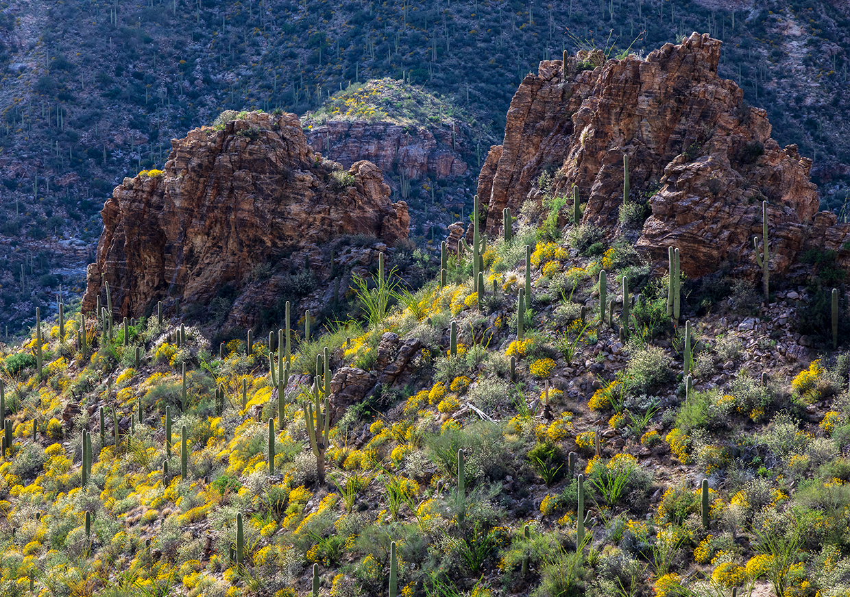
Within a few minutes, you’ll be amid the Sonoran Desert landscape that makes this place so special: saguaros, paloverdes, chollas, prickly pears, mesquites. Ten minutes later, you’ll come to one of the park’s paved roads. You have two options here: hike on the road, or take the trail that veers right just before the road. Either route works.
After another 10 minutes, you’ll come to another park road. Cross it and look for a small sign that marks the Phoneline Trail. To this point, the trail has been mostly horizontal, but this is where it starts to climb. Although the hiking gets a little harder, the huffing and puffing is mitigated by the beauty of the desert, which is especially lush in this area — it’s like walking through a thorny jungle that hasn’t seen rain in a while. The hillside is covered with familiar and unfamiliar plant species. And in March, it’s sprinkled with the colors of Mexican goldpoppies, brittlebushes and other desert wildflowers. But any time of year, this stretch is beautiful.
Moving on, after a half-hour of overall hiking, you’ll arrive at an intersection with the Blackett’s Ridge Trail, which climbs 1.7 miles to one of the most scenic viewpoints in the Santa Catalina Mountains. It’s a strenuous hike that ends with a respectable notch in the proverbial belt. Keep it in mind for another time. Meanwhile, keep left to keep climbing the Phoneline, which shifts to the north-facing wall of Sabino Canyon, below Saddleback Ridge. At the bottom of the canyon, you’ll see the narrow road that’s used by the Sabino Canyon Crawler, an emission-free electric shuttle that offers non-hikers an opportunity to experience the beauty of this lush riparian area.
You’ll catch glimpses of the shuttle as you make a long and steady climb to a precipice that looks into the heart of the canyon. Beware, the drop-off is steep — there’s a cable railing to help prevent catastrophe. A few minutes later, you’ll come to an intersection with a spur trail (0.7 miles) that heads downhill to the shuttle. When you get there, stop and listen. You might hear Sabino Creek from down below. From the spur, the Phoneline levels a little, but it’s rocky — a minefield of jagged opportunists just waiting to grab your ankle and knock you to the ground. Or over the edge. Again, beware.
After a brief downhill into a side canyon, the trail starts climbing again and arrives at an intersection with the Historic Sabino Trail, another short connector (0.7 miles) that leads to the shuttle. Keep right and continue climbing a half-mile to the Sabino Canyon Trail. Technically, this is where the Phoneline ends, but most hikers hang a left on the Sabino Canyon Trail and hike another half-mile down a series of steep switchbacks to Shuttle Stop No. 9. It’s a picturesque place to hang out and catch your breath before retracing your steps to the visitors center. Or, if you’re short on time — or energy — you can buy a one-way ticket ($8) on the shuttle back to the bottom, provided space is available. Either way, you’ll look back on the Phoneline as one of the best hikes on the Coronado National Forest. One to write home about.
Trail guide
Length: 5.25 miles one way (to Shuttle Stop No. 9)
Difficulty: Moderate
Elevation: 2,728 to 3,680 feet
Trailhead GPS: N 32˚18.590', W 110˚49.359'
Directions: From Tucson, go east on Tanque Verde Road to Sabino Canyon Road. Turn left onto Sabino Canyon Road and continue 4 miles to the Sabino Canyon Recreation Area visitors center, which is open from 8 a.m. to 4:30 p.m. daily.
Special Consideration: An $8 day pass is required.
Vehicle Requirements: None
Dogs Allowed: No
Horses Allowed: Yes
USGS Map: Sabino Canyon
Information: Santa Catalina Ranger District, 520-749-8700 or fs.usda.gov/coronado