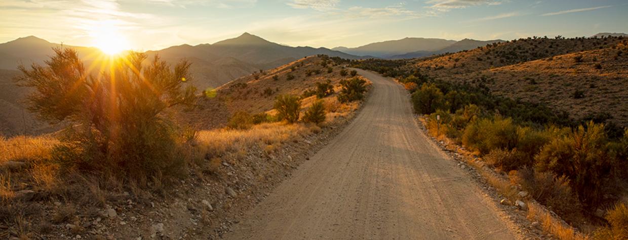
Blake Ranch Road starts and ends on two of Arizona’s busiest roadways, but it’s not unusual to drive this 22-mile road near Kingman on a weekday and not see another vehicle. Those who opt instead for blacktop and 70 mph travel are missing out: Blake Ranch Road offers amazing panoramas and a dose of mining history as it meanders through the eastern foothills of the verdant Hualapai Mountains.
Just about any SUV or truck is fit for this drive, which begins at Exit 66 on Interstate 40. As you travel south, you’ll see the Hualapais to the southwest. They’re topped by Hualapai Peak (8,417 feet) — it’s easily identified by its rounded granite pinnacle. Within 2 miles, the road’s pavement runs out, but other than a few rocky stretches, the dirt road makes for pleasant driving the rest of the way.
The vegetation along Blake Ranch Road is a prime example of piñon-juniper woodlands, which cover about 15 percent of the Four Corners states and Nevada, yet are among the least-studied forest types in North America. Smaller trees and bushes intermingle with desert plants such as prickly pear cactuses, which typically produce colorful blooms in the spring. At Mile 6.5, you’ll pass through a ranch headquarters. After that, the road narrows and gets more rocky. Two miles past the ranch, you’ll get a nice view of the Hualapais to the south and west.
Eleven miles in, you’ll come to a sign, on the right, for the Moss Wash OHV Trail. As the sign notes, this trail is suitable for only the sturdiest four-wheel-drive vehicles, and even in one of those, it’s a challenge. If you aren’t in the mood for an impromptu chiropractic adjustment, park here and hike 1.5 miles west to the trail’s payoff: a striking concrete building now known as the Gold King Mansion. Built around 1930 and originally designed as a bunkhouse for workers at the nearby Gold King Mine, the building later was used to wine and dine potential mine investors. It featured a fishing pond and other luxuries, but after mining operations shut down, it was left to decay. Today, a fireplace and sections of ornate trim are visible on the second floor, and the mansion’s poured concrete roof remains intact.
The route to the mansion also marks the halfway point of this drive. Continuing on, at Mile 13, you’ll crest a hill and turn to the east, opening a spectacular panorama, on the right side of the road, of the Hualapais’ southern half. A half-mile later, the view on the left opens up as well, and you’ll spot the rocky Aquarius Mountains in the distance. From there, you’ll continue on a narrow ridge, with steep drops and unobstructed views on either side of the road, before beginning your descent out of the foothills.
After yet another panorama, at Mile 19 — a view that includes the Mohon Mountains, far to the east — you’ll end your journey at U.S. Route 93, the heavily traveled highway between the Kingman area and Phoenix. And you’ll probably be glad your car is covered in the dust of Blake Ranch Road, rather than whizzing past the scenery that awaits just off the highway.
Note: Mileages are approximate.
Length: 22 miles one way (from Interstate 40)
Directions: From Kingman, go east on Interstate 40 for 17 miles to Blake Ranch Road (Exit 66). Turn right (south) onto Blake Ranch Road (Bureau of Land
Management Road 7163) and continue 22 miles to U.S. Route 93 north of Wikieup.
Vehicle requirements: A high-clearance vehicle is required. The side trip to the Gold King Mansion requires a four-wheel-drive vehicle and technical four-wheel-drive experience, but that route is equally enjoyable as a hike.
Warning: Back-road travel can be hazardous, so be aware of weather and road conditions. Carry plenty of water. Don’t travel alone, and let someone know where you are going and when you plan to return.
Information: Kingman Field Office, 928-718-3700 or blm.gov/office/kingman-field-office

