
Copper mining has fueled Arizona’s economy since the 1800s, and the state is full of towns rooted in the ongoing search for that precious mineral. This paved drive connects two of those towns, Globe and Winkelman — and while you won’t see much mining activity from the road, you will encounter mountain vistas, a desert river and a dash of American history.
From U.S. Route 70 just east of the Globe area, head south on State Route 77, also known as the Copper Corridor Scenic Road — an Arizona Department of Transportation designation that also applies to State Route 177 to the west. Yuccas and mesquites dot the roadsides early on, and you’ll see the Hayes Mountains to the southeast, on San Carlos Apache Tribe land, as you roll through the foothills of the Pinal Mountains.
Within a few miles, the road begins a steep climb, and 8.4 miles in, you’ll reach the literal high point of the drive (4,983 feet) at El Capitan Pass, where there’s a large overlook with shaded picnic tables. As a historical marker there explains, the Army of the West, commanded by Stephen W. Kearny and guided by Kit Carson, traversed the pass en route to California in 1846, during the Mexican-American War. Today, it offers panoramas of the surrounding mountains and distant Globe and Miami.
The road begins a gentle descent after the pass, eventually dipping into prickly pear cactuses and other high-desert vegetation. The cliff walls around you get higher as you descend farther, into El Capitan Canyon, which runs between the Pinals to the west and the Mescal Mountains to the east. At Mile 13, you’ll get an excellent view of the Pinals on the right; a mile later, on the left, a long, exposed cliff looms over a landscape of agaves and ocotillos.
The next couple of miles are a steeper descent — steep enough that two runaway-truck ramps are provided. Saguaros quickly appear as you lose elevation, and to the south, layers of mountain ridges stretch to the horizon. You’ll keep descending, but not as severely, until Mile 23, when you’ll cross a bridge over Dripping Springs Wash and turn sharply to the right.
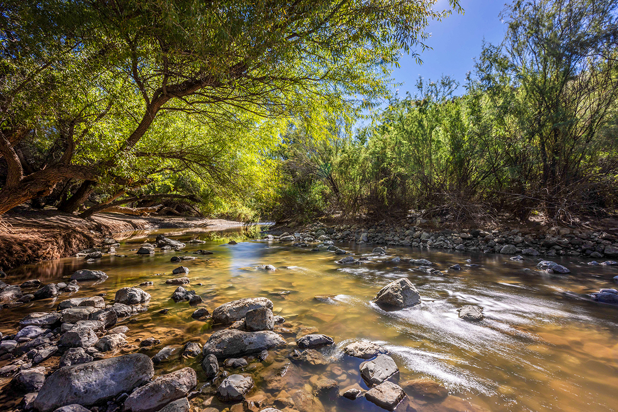
This turn marks the final stretch of the drive, which parallels the Gila River, one of the longest waterways in the American West, on the left. From the road, it’s difficult to see the river itself, but you’ll see the thick riparian canopy along it and the healthy saguaros on the nearby canyon walls. Starting around Mile 27, the road does offer a good look at tall cottonwoods nourished by the Gila.
For a view of the actual river, pull off at the Shores Recreation Site, managed by the federal Bureau of Land Management, at Mile 29.4. At this minimally developed site, gravel roads lead to several primitive campsites along the Gila; the easy access makes it a haven for anglers in search of warm-water fish, including channel catfish, carp and largemouth bass. Even if you didn’t pack a rod and reel, the sights and sounds of a running river in this arid land are worth a quick stop.
From there, it’s only a few miles to the end of this drive, at SR 177 in Winkelman. You can take that road north to Superior and the Phoenix area, or continue south on SR 77 to Tucson. Either way, the views are as good as gold. Or, in this case, copper.
Tour Guide
Note: Mileages are approximate.
Length: 32.5 miles one way (from U.S. Route 70)
Directions: From U.S. Route 70 east of Globe, go south on State Route 77 (the Copper Corridor Scenic Road) for 32.5 miles to State Route 177 in Winkelman.
Vehicle Requirements: None
Warning: Back-road travel can be hazardous, so be aware of weather and road conditions. Carry plenty of water. Don’t travel alone, and let someone know where you are going and when you plan to return.
Information: Globe Ranger District, 928-402-6000 or www.fs.usda.gov/tonto; Tucson Field Office, 520-258-7200 or blm.gov/arizona