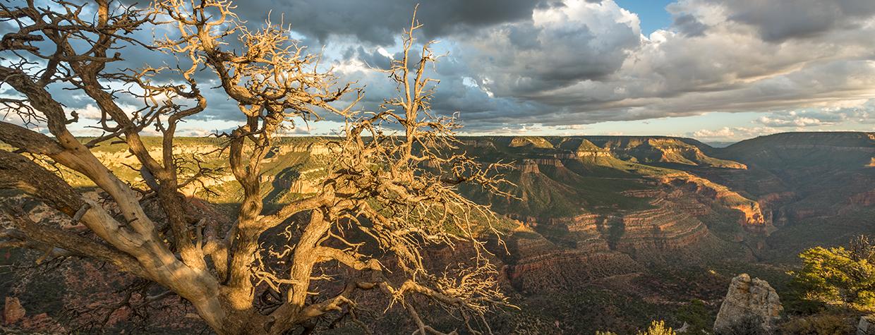
When you’re trekking to some attractions on the Grand Canyon’s North Rim — from Bright Angel Point, an easy quarter-mile walk from Grand Canyon Lodge, to Cape Royal, at the end of a paved road — there’s no mistaking where you are. The Canyon is everywhere, and every break in the rocks or trees offers a different glimpse of the natural wonder. Crazy Jug Point, west of the developed North Rim area on the Kaibab National Forest, is different: Until the last mile, you’ll have a hard time knowing you’re on your way to one of the Canyon’s most scenic and least visited overlooks. But this 32.4-mile journey, which includes mining history and miles upon miles of unspoiled forest, is spectacular in its own way.
That journey begins at Jacob Lake Inn, which has been providing services on the Kaibab Plateau for more than a century. From there, go south on State Route 67 and turn right onto Forest Road 461, a wide, smooth gravel path lined with tall ponderosa pines. You’ll soon pass the turnoff to the pond for which the community of Jacob Lake is named; it and the historic ranger station across the road are worth a pit stop before you continue west.
As the road climbs, you’ll enter an area scarred by the Mangum Fire, which burned more than 70,000 acres in 2020. Then, at Mile 4.7, bear left at an unmarked “Y” intersection to stay on FR 461 as it descends through burned trees and plentiful new growth. A mile later, turn right onto Forest Road 462, which continues downhill through Warm Springs Canyon, a deep, steep-walled gorge where the fire’s effects are less prominent.
You’ll come to a short stretch of pavement at the mouth of the canyon, then turn left onto Forest Road 22, which initially traverses a landscape of piñon pines, junipers and sagebrush. At Mile 9.1, a pullout on the right leads to the former copper mining town of Ryan, which dates to the early 1900s and even had its own post office for a short time; explore the site on foot to see scattered evidence of its human history. Back on FR 22, continue south through Nail Canyon, where sloping, pine-covered walls cradle a series of verdant meadows. For a longer stay in this area, book a night at Big Springs Cabins, a U.S. Forest Service site at Mile 15.6.
Past the cabins, the road winds through ponderosas and aspen groves until Mile 20.6, when you’ll turn right onto Forest Road 425. This road passes more aspens and another piñon-juniper landscape before diving back into the pines, and at Mile 30.7, you’ll bear right at two successive “Y” intersections to take Forest Road 292 toward the Canyon’s rim. Here, you’ll understand why this drive requires a high-clearance vehicle: The road is narrow, rutted and extremely rocky in parts. Take it easy on the gas pedal, as this isn’t a great place to blow a tire. It is, however, a great place to finally see glimpses of the Canyon through the trees.
Your last turn comes at Mile 32.2, when you’ll go left onto Forest Road 292B and make the short trek to a parking area. A rock-lined path leads from there to Crazy Jug Point, which supposedly got its name from a jug-shaped rock near the overlook. Other views include Steamboat Mountain to the south, Great Thumb Mesa to the southwest and Parissawampitts Canyon to the east. It’s a panorama you’ll likely be sharing only with chirping birds and buzzing insects, so take it all in. After a journey like this one, you’ll want to stay awhile and enjoy the payoff before starting the return trip.
tour guide
Note: Mileages are approximate.
Length: 32.4 miles one way (from Jacob Lake Inn)
Directions: From Jacob Lake Inn, go south on State Route 67 (the North Rim Parkway) for 0.2 miles to Forest Road 461. Turn right (west) onto FR 461 and continue 4.5 miles to a “Y” intersection. Bear left to stay on FR 461 and continue 1 mile to Forest Road 462. Turn right onto FR 462 and continue 3.1 miles to Forest Road 22. Turn left onto FR 22 and continue 11.8 miles to Forest Road 425. Turn right onto FR 425 and continue 10.1 miles to a “Y” intersection. Bear right, onto Forest Road 292, and continue 0.2 miles to another “Y” intersection. Bear right to stay on FR 292 and continue 1.3 miles to Forest Road 292B. Turn left onto FR 292B and continue 0.2 miles to the Crazy Jug Point parking area, then follow the trail about 200 feet to the overlook.
Vehicle requirements: A high-clearance vehicle, such as an SUV or truck, is required, but four-wheel-drive is not necessary in good weather.
Warning: Back-road travel can be hazardous, so be aware of weather and road conditions. Carry plenty of water. Don’t travel alone, and let someone know where you are going and when you plan to return.
Information: North Kaibab Ranger District, 928-643-7395 or fs.usda.gov/kaibab; Big Springs Cabins, recreation.gov (reservations)
Travelers in Arizona can visit az511.gov or dial 511 to get information on road closures, construction, delays, weather and more.

