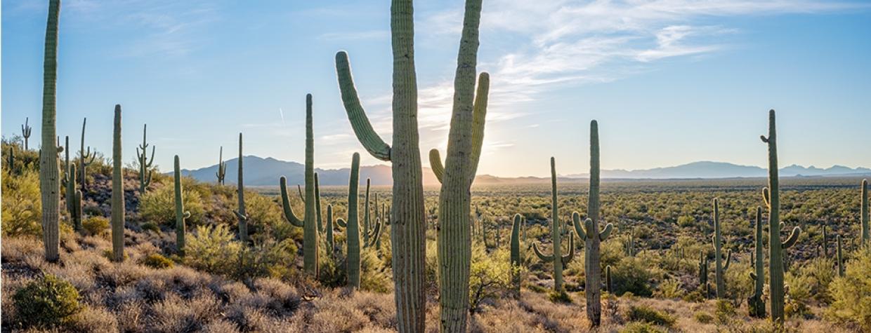
Sonoran Desert, San Pedro River
It’s too bad Tom Mix was in such a hurry. In the fall of 1940, the Western film star was south of Florence, driving down what now is State Route 79, when he came upon a washed-out bridge and couldn’t stop in time. The resulting crash took his life, and a roadside memorial now honors an actor who “served to better fix memories of the Old West in the minds of living men.”
Freeman Road, which starts on SR 79 a few miles south of the Mix memorial, conjures a different kind of memory. This wide, smooth dirt route traverses a Sonoran Desert landscape virtually unchanged from when Mix took his fateful final ride, with large saguaros and other desert flora making for a pleasant half-day trip from the Phoenix area.
From SR 79, head east on Freeman Road, which passes through a mix of public and private land. Among the chain fruit chollas and mesquites are numerous tall, thin saguaros, many of them sporting a dozen or more arms. To the east is Black Mountain, an aptly named 5,577-foot peak that’s among Arizona’s 100 highest mountains in terms of topographic prominence.
Within a few miles, prickly pears become abundant among the other cactuses, and if you make this drive in the spring, you’ll see them sporting their colorful blooms. A few miles later, you’ll pass 3,963-foot Coyote Peak on the left. Hundreds of saguaros guard this mountain’s southern slopes, and if you have binoculars handy, you can get a closer look at a true saguaro forest. The road next curves east, then southeast, and dips through several washes before climbing into a cluster of low, rounded buttes.
At this point, you’ll notice the saguaros have disappeared — a result of the increase in elevation. Large, prominent yuccas, which are more suited to this altitude, take their place along the road as you pass a section of jumbled volcanic boulders. Nineteen miles into the drive, you’ll reach a trailhead for the Arizona Trail; this spot provides access to Passage 14 (Black Hills) and Passage 15 (Tortilla Mountains) of the 800-mile hiking route.
Freeman Road next cuts through a hilly area where the saguaros return to the hillsides above the road. There are excellent views of the mountain ranges on San Carlos Apache Tribe land to the northeast as you roll downhill, toward the San Pedro River. You’ll get back on pavement at Mile 30, just before taking a right onto Camino Rio, which parallels the cottonwood-shaded waterway — a haven for migrating birds, and one of the last undammed major rivers in the American Southwest.
After a half-mile on Camino Rio, bearing left at a “Y” intersection puts you on San Pedro Road, on which you’ll enter a vibrant riparian area before reaching a shallow river crossing. Most of the year, the San Pedro is only a trickle here and can be navigated in a sedan, but an SUV is your safest bet. Past the crossing, continue into the small community of Dudleyville, population 1,000 or so, before turning right onto Dudleyville Road, which will take you to State Route 77.
From here, head south to Oracle and Tucson, or north to Globe, Superior and the Phoenix area. Either way, take your time. If you ask us, there are enough roadside memorials already.
Note: Mileages are approximate.
Length: 32.3 miles one way (from State Route 79)
Directions: From Florence, go south on State Route 79 for 21 miles to Freeman Road. Turn left (east) onto Freeman Road and continue 30 miles to Camino Rio. Turn right onto Camino Rio and continue 0.5 miles to a “Y” intersection. Bear left, onto San Pedro Road, and continue 0.8 miles to Dudleyville Road. Turn right onto Dudleyville Road and continue 1 mile to State Route 77.
Vehicle requirements: A high-clearance vehicle, such as an SUV or truck, is recommended, but the route is passable in a standard sedan in good weather and if the San Pedro River is low.
Warning: Back-road travel can be dangerous, so be aware of weather and road conditions. Carry plenty of water. Don’t travel alone, and let someone know where you are going and when you plan to return.
Information: Arizona Trail Association, 602-252-4794 or aztrail.org

