
Arizona has its share of deceptively named roads. The Senator Highway — which in places barely qualifies as a road, let alone a highway — is one of them. Another is the Swift Trail, which climbs into Eastern Arizona’s Pinaleño Mountains. And while this steep, winding road requires patience and careful driving, the panoramic views, varied flora and cool breezes at the top make it an essential drive, especially as an escape from the summer heat.
From U.S. Route 191 south of Safford, head southwest on the Swift Trail (State Route 366), which actually is named for T.T. Swift, the first supervisor of the Coronado National Forest. Mount Graham, the Pinaleños’ highest point (10,696 feet), is visible to the right as you travel the paved road toward the mountains’ northeast flank. The road begins climbing after
3.5 miles, then offers an excellent view of the Safford area at the first of several roadside pullouts. By Mile 6.5, you’ll reach an elevation of 5,000 feet, where agaves and prickly pear cactuses thrive.
The views to the northeast continue as you navigate numerous hairpin turns. By Mile 9, you’ll be at 6,000 feet and start seeing more piñon pines along the road and on hillsides. After crossing a bridge over a canyon filled with cottonwoods and sycamores, you’ll start another steep climb and soon find yourself at 7,000 feet, amid tall ponderosa pines. Don’t miss the pullout at Mile 12.7, which offers the best view of the drive. So far.
At Mile 15, you’ll be up to 8,000 feet and in a diverse mix of spruce, firs and ponderosas. Soon after, you’ll round a bend onto the south side of the range, opening up incredible views that include the Galiuro Mountains to the west, the Winchesters to the southwest and the distant Santa Catalinas, along with Fort Grant and the broad Sulphur Springs Valley just below. Be sure to pull over before pondering the view — there are no guardrails, and it’s a long way down.
Past this point, you’ll see significant evidence of the 2017 Frye Fire, which burned 48,000 acres in the Pinaleños. Thankfully, most of the fire burned at low intensity, and the forest’s trees and grasses are already bouncing back. Just past a heavier burn area, at Mile 21.5, the pavement ends, and while the remaining stretch of dirt road is navigable in almost any car, an SUV will give you the most comfort.
Just after the start of the unpaved section, you’ll start seeing aspens amid the ponderosas, then travel through a patchwork of burned and unburned sections, along with a couple of culverts that direct creeks under the road. The aspens increase in number before you arrive at the Columbine Work Center, a forest administrative site built in the 1930s and listed on the National Register of Historic Places in 1993. If you’re lucky, you might see a Mount Graham red squirrel, an endangered subspecies found only in these mountains, skittering around.
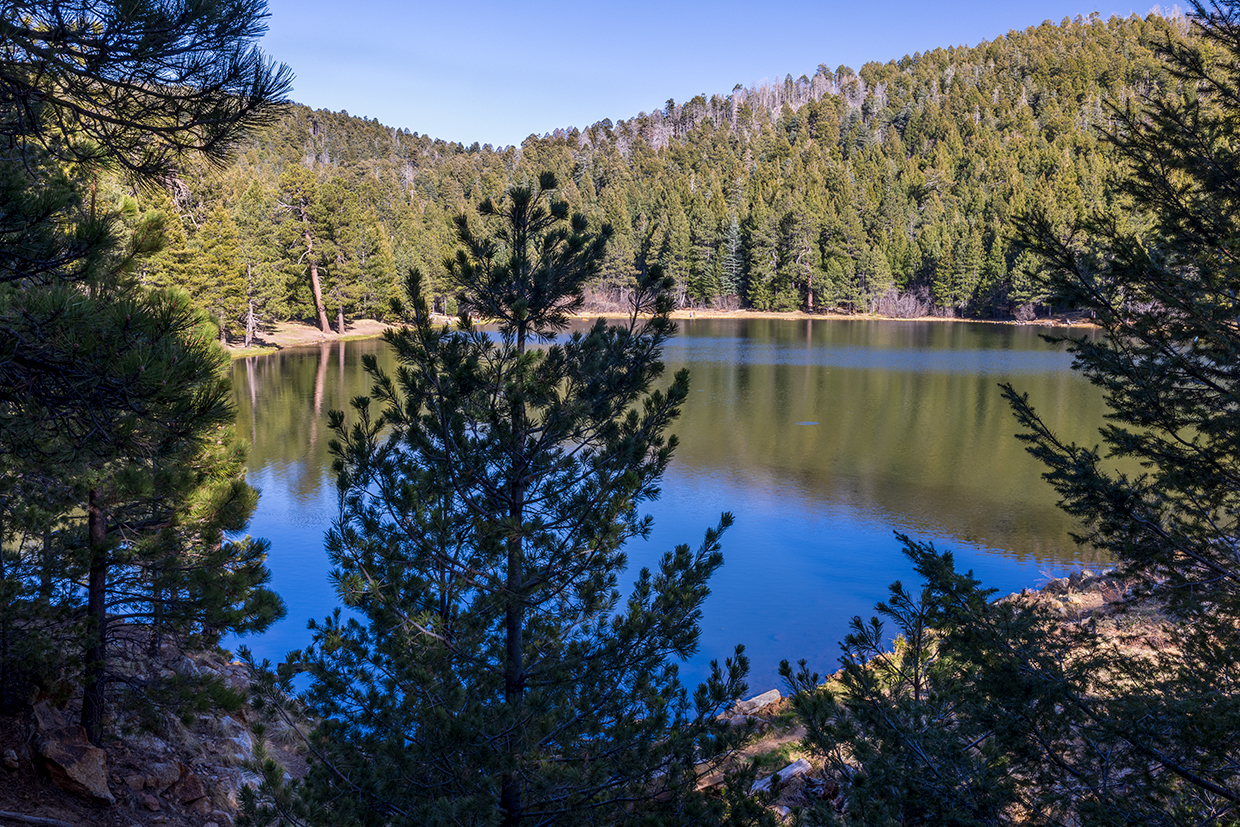
Here, 28.2 miles in, SR 366 officially ends, but a drive this beautiful deserves a big finale. Continue straight, onto Forest Road 803, for more panoramas — especially around Mile 30 — and a historical marker at Chesley Flat, named for a family who homesteaded here in the late 1800s. At Mile 32.8, turn left onto Forest Road 287 for a short drive to Riggs Lake, a small, quiet reservoir that’s ringed by ponderosas and stocked with trout during the summer. It’s a good place to dip your feet in the cold water or meander around the lake, which sits at an elevation of 8,741 feet. Like the road that leads here, there’s no hurry. And that’s just fine.
tour guide
Note: Mileages are approximate.
Length: 33.2 miles one way (from U.S. Route 191)
Directions: From Safford, go south on U.S. Route 191 for 7.3 miles to State Route 366 (the Swift Trail). Turn right (southwest) onto SR 366, which later becomes Forest Road 803, and continue 32.8 miles to Forest
Road 287. Turn left onto FR 287 and continue 0.4 miles to Riggs Lake.
Vehicle requirements: None in good weather, but a high-clearance vehicle, such as an SUV or truck, is recommended for the unpaved section.
Special consideration: A day-use pass, available at Coronado National Forest offices and online, is required at Riggs Lake. Other fees apply at campgrounds along the road.
Warning: Back-road travel can be hazardous, so be aware of weather and road conditions. Carry plenty of water. Don’t travel alone, and let someone know where you are going and when you plan to return.
Information: Safford Ranger District, 928-428-4150 or fs.usda.gov/coronado
Travelers in Arizona can visit az511.gov or dial 511 to get information on road closures, construction, delays, weather and more.