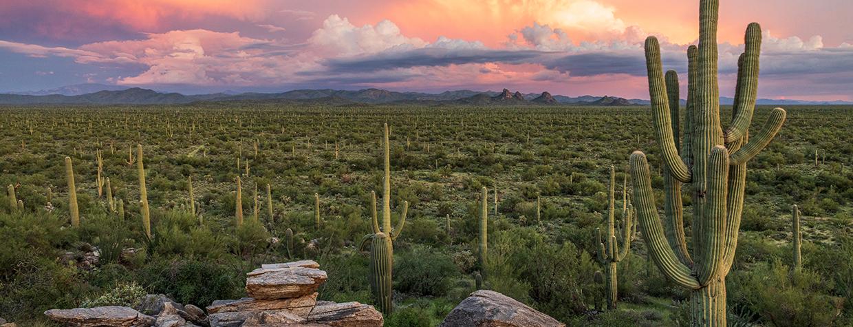
There are countless scenic routes in Arizona just waiting to be discovered, but these days, a newly acces-sible drive doesn’t often just materialize on the map. Yet that’s what happened in 2008, when Pinal County finished a multi-year project to pave Park Link Drive, a key connection between Interstate 10 and State Route 79 (the Pinal Pioneer Parkway) northwest of Tucson. It was thought the pavement would spur development along the road, but so far, that hasn’t happened. Instead, this pleasant 18-mile drive offers up-close looks at desert flora, along with distant views of Picacho Peak and some lesser-known ranges.
From SR 79 about 14 miles southeast of the Tom Mix Memorial, head west on Park Link Drive, which begins in a thick stand of chollas and mesquites. Behind you, to the northeast, is 5,581-foot Black Mountain, a hiking destination on account of it being one of Arizona’s 100 most prominent peaks. And as you head west, you’ll see some other peaks, including the distant Silver Bell Mountains. Ragged Top, an aptly named volcanic plug that formed about 22 million years ago, is on the north side of this range, and it appears straight ahead around Mile 4.
By now, the road has curved past a small range called the Suizo Mountains, and from here, saguaros become more plentiful. Around Mile 6, views of Picacho Peak and the rest of the Picacho Mountains, which sit on opposite sides of I-10, open up on the right side of the road. Closer to the road is a smaller, cone-shaped butte called The Huerfano (Spanish for “orphan,” a nod to its isolation). A pullout on the right at Mile 6.5 is a nice place to enjoy the thick forest of large saguaros, chollas and prickly pears.
A few miles past the pullout, the road gets curvier as it dips through a series of washes. Here, the saguaros seem taller and thinner than earlier in the drive, owing to rainfall and temperature patterns in this part of the desert. A long, low-slung mountain called Desert Peak is on the left at Mile 11, and a couple of miles later, you’ll get some more good views of the Picachos, which are topped by 4,488-foot Newman Peak, a major challenge for hikers.
From here, the saguaros mostly disappear, and a couple of miles later, the chollas follow suit. Soon, you’ll be rolling through a flat, sandy landscape filled with creosote bushes and a few isolated saguaros. But if you make this drive in the spring, you could be treated to a colorful display, depending on the previous year’s rainfall. Wildflower hunters say Park Link Drive’s varied elevation — from east to west, it drops from 3,300 feet to 1,900 feet — makes it an excellent place to see wide swaths of lupines, along with Mexican goldpoppies, globemallows, penstemons and more.
The road curves again at Mile 16.5, and you’ll soon see truck traffic on I-10. Just past a cattle guard and a set of train tracks, Park Link Drive ends at the interstate’s frontage road. There’s no highway interchange here, but you can turn left to head toward Tucson or right to visit Picacho Peak State Park on the way to Phoenix. If you’re really lucky, another opportunity for a scenic desert drive might appear along the way.
tour guide
Note: Mileages are approximate.
Length: 18 miles one way (from State Route 79)
Directions: From Florence, go southeast on State Route 79 (the Pinal Pioneer Parkway) for 32 miles to Park Link Drive. Turn right (west) onto Park Link Drive and continue 18 miles to the Interstate 10 frontage road.
Vehicle requirements: None in good weather. Although the road is paved, it crosses several washes, so don’t attempt the drive after recent heavy rain or if rain is in the forecast.

