
State Route 78 is Scarlett Johansson before Lost in Translation. Or, if you prefer, Ryan Gosling before The Notebook. That tortured metaphor is a roundabout way of saying that SR 78, in Arizona’s far eastern reaches, is the most beautiful road you’ve probably never heard of. This 34.2-mile drive, which extends into New Mexico, features everything from vibrant grasslands to mountain vistas, with a little roadside history along the way.
From its intersection with U.S. Route 191 in Three Way, SR 78 heads northeast through a grassy plain surrounded by distant mountains, including Red Hill, a pyramid-shaped butte on the left. A few miles past the Greenlee County Airport, the road begins climbing a series of rounded hills dotted with scrub vegetation, prickly pear cactuses and a few scraggly yuccas. Straight ahead is the drive’s destination: the Big Lue Mountains, a small range at the southeastern edge of the Apache-Sitgreaves National Forests. Among the Big Lues’ big summits is 6,103-foot Palace Peak, which you’ll pass on the right at Mile 7.
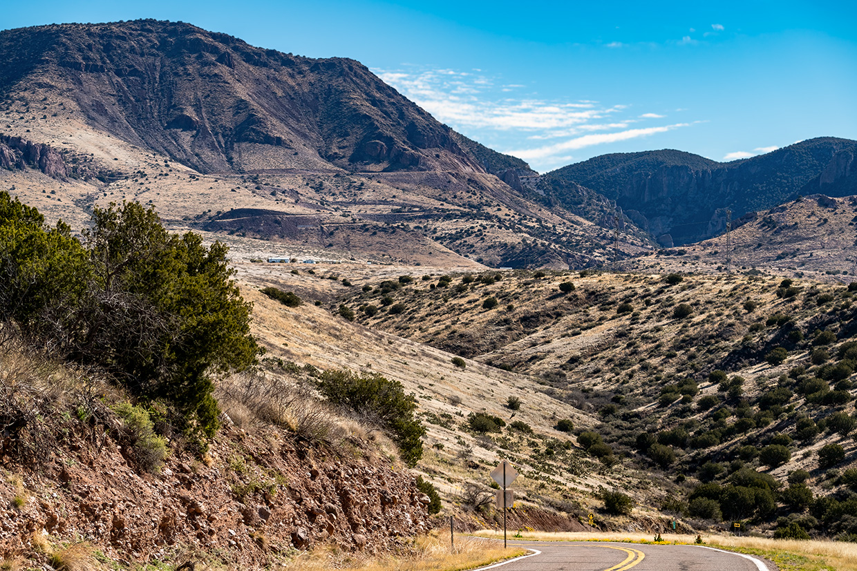
Next, the road descends into a more vegetated area full of Arizona sycamores before winding around two hairpin turns and entering Black Jack Canyon. Juniper-studded hills are visible on both sides of the road, which enters the Apache-Sitgreaves at Mile 10.5. From here, you’ll navigate a series of tight turns as SR 78 winds into the mountains. Take advantage of the numerous pullouts to enjoy the panoramas, and keep an eye out for the area’s bird life, which includes plumbeous vireos, ash-throated flycatchers and hepatic tanagers.
Around Mile 13, on the right, you’ll pass the remains of an Arizona oddity. The previous, unpaved version of SR 78 passed through a tunnel blasted through this rock. The tunnel, which came to be known as the Needle’s Eye, had to be demolished when the road was modernized in the 1970s. Just past what’s left of it is the best pullout of the drive — one that offers an excellent view of greenery-covered Maverick Hill (7,487 feet) and nearby sheer cliffs.
A section of tall ponderosa pines and oaks is next up, and while these trees stick around for only a couple of miles, they reappear at Mile 16.5. In this stretch, you’ll also see a few aspen groves near Coal Creek Campground. By Mile 19, you’ll be back in a landscape of junipers, smaller oaks and a few big piñon pines as you cross into New Mexico, where the road carries the same number. A sign at the state line explains that New Mexico’s stretch of the road is named for Curley Traynor, a rancher who helped get the route fully paved.
From here, the road descends into a landscape of grassy hills, large junipers and a handful of cows as it passes through the tiny community of Mule Creek and offers views of the Mogollon Mountains to the northeast. The drive ends at its intersection with U.S. Route 180, and if you’ve got all day, the highway will take you north to Alpine or south to Interstate 10. But going back the way you came is an excellent option, too. After all, you never know when SR 78 will become a star. And you should get to know it before it hits the big time.
tour guide
Note: Mileages are approximate.
Length: 34.2 miles one way (from U.S. Route 191)
Directions: From Clifton, go south on U.S. Route 191 for 9 miles to State Route 78 in Three Way. Turn left (northeast) onto SR 78, which turns into New Mexico State Road 78, and continue 34.2 miles to U.S. Route 180 in New Mexico.
Vehicle requirements: None
Warning: Back-road travel can be hazardous, so be aware of weather and road conditions. Carry plenty of water. Don’t travel alone, and let someone know where you are going and when you plan to return.
Information: Clifton Ranger District, 928-687-8600 or fs.usda.gov/asnf