
What’s the highest mountain in Grand Canyon National Park? Your first guess might be Point Imperial (8,803 feet), but that’s an overlook, not a mountain. The answer is Saddle Mountain (8,419 feet), which forms part of the park boundary in the Marble Canyon section of the gorge. And a forested drive to the overlook named for this peak will give you a look at it — and much more.
The drive begins on State Route 67 (the North Rim Parkway), which leads from Jacob Lake to the park’s North Rim developed area. Just south of Kaibab Lodge and DeMotte Campground, head east on Forest Road 611, which quickly turns to gravel as it crosses a wide meadow and winds uphill into the forest. Before long, tall aspens, ponderosa pines and firs line both sides of the road, which is rough in spots but suitable for most vehicles in good weather.
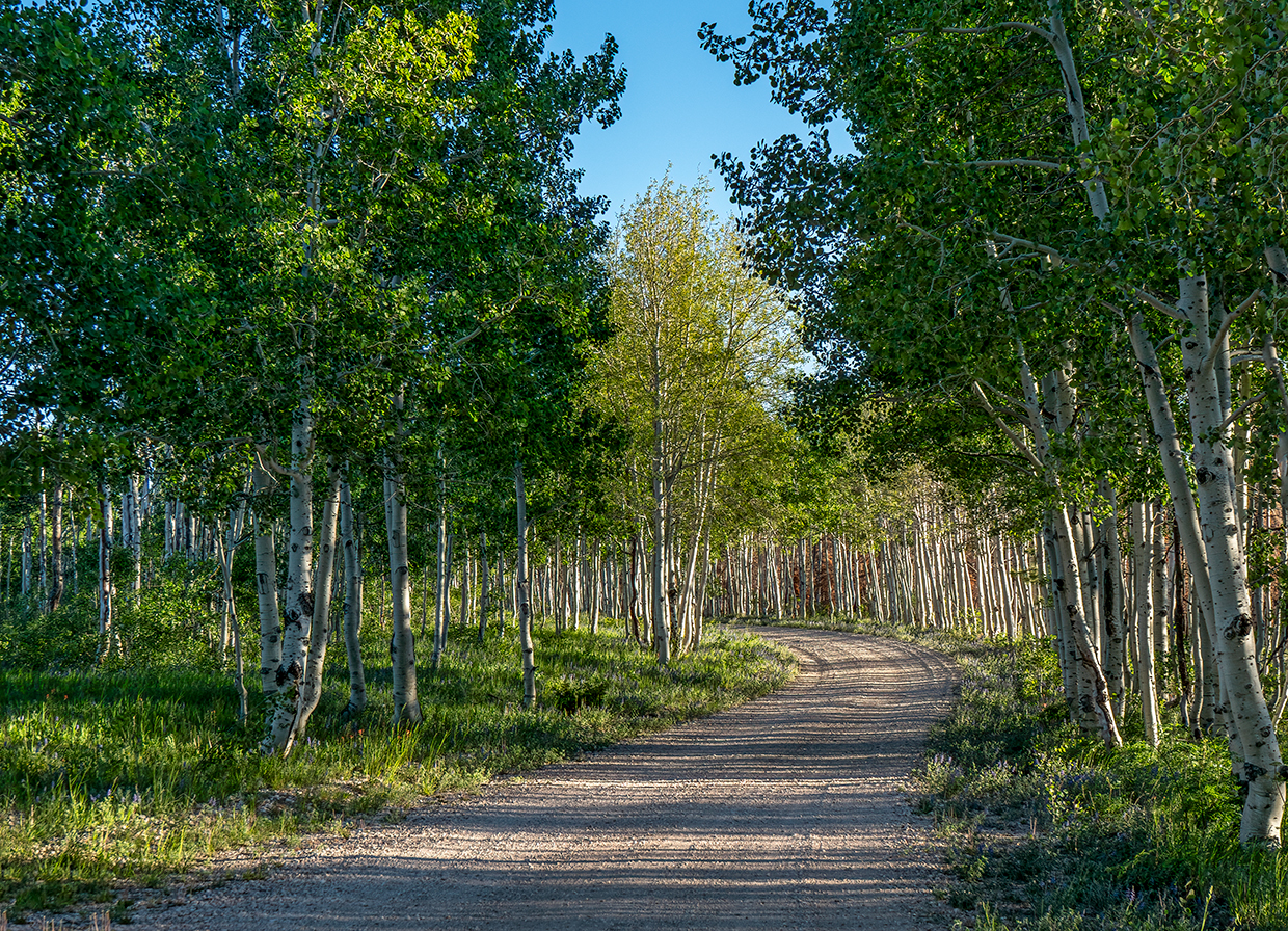
After 1.3 miles, you’ll reach an intersection with Forest Road 610 and turn right, toward the Saddle Mountain Trailhead. This stretch of the route is dominated by aspens, but you’ll also see plenty of tall, thin ponderosas, their lower limbs pruned by decades of naturally occurring forest fires. A bit later, Douglas-firs and other evergreens join the scenery, as do a few clearings where you might see mule deer or wild turkeys.
What you might not see are the North Rim’s bison, which migrated to this area in the 1990s. To protect archaeological sites, natural resources and park ecosystems, the National Park Service is reducing the size of the bison herd via relocation and hunting. Nearly 300 bison have been removed since 2019; as of January 2022, there are an estimated 216 bison remaining. If you do spot them, consider yourself lucky — but keep your distance.
The road straightens out after 6.5 miles, heading due east as it skirts the national park boundary. A mile and a half later, you’ll come to a turnoff for Forest Road 219, which heads north to Marble Viewpoint, another spectacular overlook. A half-mile past the turnoff, you’ll get a quick glimpse of the Canyon through the aspens on the left side of the road.
For the next few miles, aspens line the road on both sides, forming the Kaibab Plateau’s version of the magnolia-canopied driveway at Augusta National. The road gets a bit rougher around Mile 10 as it descends toward the rim of the Canyon, and tall ponderosas rejoin the party around Mile 12.5. From there, it’s less than a mile to the overlook.
Here, a deep canyon offers a long view of Marble Canyon’s purple- and pink-hued walls. As for Saddle Mountain, you might think it’s the peak right in front of you, but that’s an unnamed mountain unofficially known as Peak 8881. The summit of Saddle Mountain, named for its saddle-like profile, is behind it, and a short, steep hike from the overlook will take you to a better view of it. (Hiking farther will eventually take you to the Nankoweap Trail, one of the most challenging hikes in the Grand Canyon.)
The panorama here will make you want to linger, and several dispersed campsites will let you do just that. It’s all part of the allure of visiting the highest mountain in Grand Canyon National Park.
tour guide
Note: Mileages are approximate.
Length: 13.4 miles one way (from State Route 67)
Directions: From Jacob Lake, go south on State Route 67 for 26.3 miles to Forest Road 611. Turn left (east) onto FR 611 and continue 1.3 miles to Forest Road 610. Turn right onto FR 610 and continue 12.1 miles to Saddle Mountain Overlook.
Vehicle requirements: A high-clearance vehicle, such as an SUV or truck, is recommended, but the road is passable in most cars in good weather. Fallen trees sometimes block the road, so check with the Kaibab National Forest (see below) before making the trip.
Warning: Back-road travel can be hazardous, so be aware of weather and road conditions. Carry plenty of water. Don’t travel alone, and let someone know where you are going and when you plan to return.
Information: North Kaibab Ranger District, 928-643-7395 or fs.usda.gov/kaibab
Travelers in Arizona can visit az511.gov or dial 511 to get information on road closures, construction, delays, weather and more.