
At one time, Prescott was the capital city of Arizona. There are many reasons it was moved to Phoenix. The Groom Creek area just south of town wasn’t among them. Named for Bob Groom, a Kentucky native who served in the Territorial Legislature, the area was settled by prospectors who were mining placer gold along Groom and Lynx creeks. By the early 1890s, the mining had expanded to the surrounding area, with approximately 500 men working various mines from the top of Spruce Mountain down to the junction of Groom Creek and the Hassayampa River.
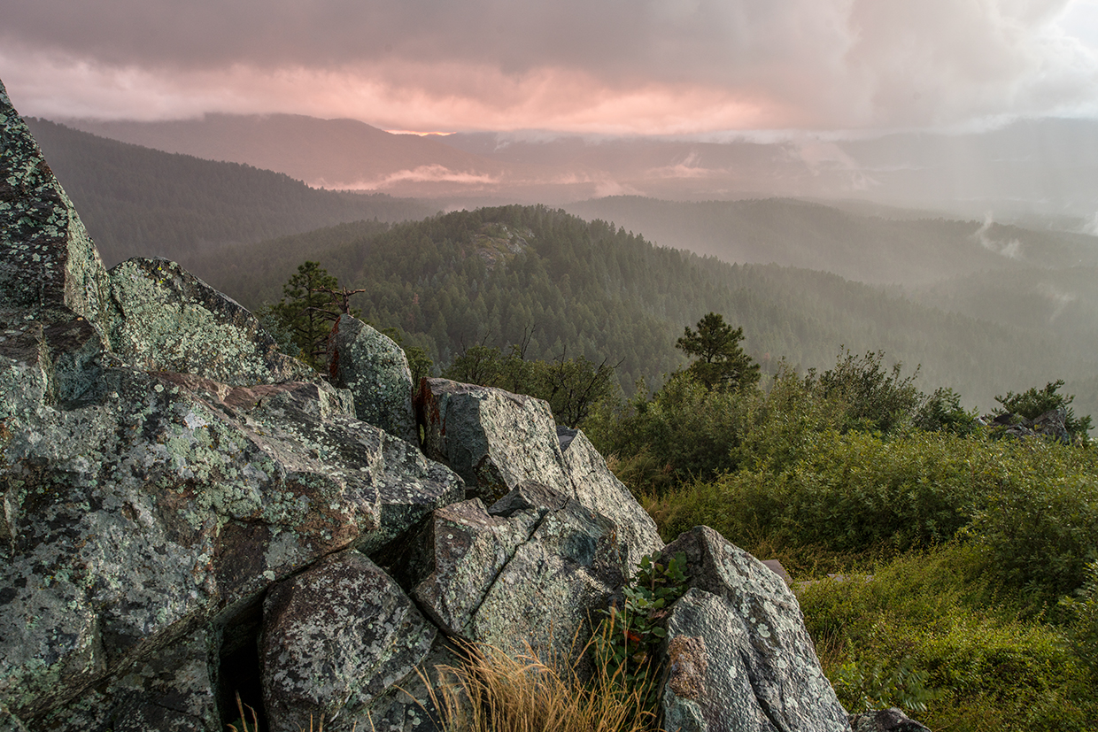
Today, the Groom Creek recreation area is one of Prescott’s points of pride. There’s a lot there, including several campgrounds, the Spruce Mountain Picnic Site, the Groom Creek bouldering area, a group picnic site at the historic Groom Creek Schoolhouse (built in 1902), a horse camp and almost 20 established hiking trails. One of the most popular is the Groom Creek Loop. Along with a pretty good workout, the loop offers more than its share of scenery, especially from the top of Spruce Mountain, from which you can see Crown King, Prescott and, on a clear day, the San Francisco Peaks northwest of Flagstaff.
From the trailhead, the loop, which is marked Trail No. 307, veers left along a soft path — it’ll feel like you’re walking on sand. For the first few minutes, it parallels Forest Road 52, but the road fades away as you begin the 1,200-foot climb toward the top. Moving uphill, beware of downhill mountain bikers. They tend to fly. Watch for horses, too. Because of its proximity to Prescott, this trail is popular with a wide range of outdoors enthusiasts. Remember, bikers yield to hikers and horses, and hikers yield to horses.
About 15 minutes into the hike, you’ll come to a boulder the size of a small motor home. Its girth is impressive, and so is the vertical crack that splits it in two. Looking around the rock, you’ll notice that the forest isn’t as dense as others you might have hiked. That’s because it’s made up mostly of alligator junipers, oaks and a smattering of ponderosa pines. You’ll also see some firs as you get higher up the mountain. What you won’t see are spruce trees. The tree for which the summit is named doesn’t grow in this forest. What the early settlers thought were spruce trees are actually white firs.
Continuing on, the trail gets rocky and eventually leads to an intersection that can be a little confusing. Follow the arrow for Trail No. 307 and you’ll be headed in the right direction. Spruce Mountain is about an hour from this point, and for most of those 60 minutes, the terrain remains the same. At the top of the mountain, you’ll arrive at the Spruce Mountain Picnic Site, the highest recreation site on the Prescott National Forest. In addition to picnic tables and fire pits, the area is home to the Spruce Mountain Lookout, which was constructed in 1936 and added to the National Historic Lookout Register in 2003. Although the tower is there year-round, the rangers who occupy it are not. During the summer fire season, when the tower is in use, hikers are encouraged to climb up and say hello.
The views are great, but the lesson in forest ecology is equally impressive. Among other things, you’ll learn that one of the reasons this forest isn’t as thick as some is because of bark beetles. In 2002 and 2003, the insects killed approximately 18 million ponderosas in Arizona, including large swaths on Spruce Mountain. A couple of years later, as part of a fire management program, many living trees and most of the beetle-killed trees were removed from this area. The action was intended to reduce the risk of both forest fires and beetle epidemics. So far, so good, but time will tell.
From the picnic tables, the Groom Creek Loop begins its downhill run. One of the first things you’ll see is an alligator juniper that’s at least 6 feet in diameter. Grab a photo, and then follow the trail through the forest of ponderosas and firs to where it intersects the Isabella Trail, a short 1.3-mile route. There will be other intersections, too, and most are adequately marked, but some are not. Don’t head off in any direction until you know for sure where you’re going.
The rest of the route winds down the mountain, through a small ravine and back to the trailhead. Standing there, in the shade of the tall pines, it’s hard to imagine that downtown Prescott is just a few miles away. In a city with a long list of high points, Trail No. 307 is near the top.
trail guide
Length: 8.7-mile loop
Difficulty: Moderate
Elevation: 6,400 to 7,693 feet
Trailhead GPS: N 34˚28.134', W 112˚26.280'
Directions: From Prescott, go east on Gurley Street to Mount Vernon Avenue (Senator Highway/County Road 56). Turn right onto Mount Vernon Avenue and continue 6.4 miles to the trailhead, which is on the left side of the road.
Vehicle Requirements: None
Dogs Allowed: Yes (on a leash)
Horses Allowed: Yes
USGS Map: Groom Creek
Information: Bradshaw Ranger District, 928-443-8000 or fs.usda.gov/prescott