
As a mountain range, it’s hard to stand out in Southern Arizona, where the Santa Catalinas, Santa Ritas, Huachucas and Chiricahuas harbor an embarrassment of riches. The Whetstone Mountains aren’t indigent when
it comes to natural wonder, but they’re not as well known as the royalty that surrounds them.
One reason for that is scale. The Whetstones, a dry and rugged fault-block mountain range, are only 15 miles long. In addition, the only roads into the range are a handful of pitted, four-wheel-drive routes that lead to some of the lower canyons. There aren’t any roads at all to the higher elevations. And the only established hike is the Guindani Trail. It’s the only one, but one is all you need.
From the trailhead, which is located at Kartchner Caverns State Park, a well-marked “connector trail” heads west into a high-desert grassland. Within a few minutes, it leaves the park and enters the Coronado National Forest. Mesquites, agaves, prickly pears and barrel cactuses are the dominant species in the early going. About 10 minutes beyond the boundary, the connector trail arrives at a loop. Like any loop, the choice of direction is yours, but the views are more impressive and the grade is more forgiving from a clockwise perspective.
The ascent at the outset is minimal, but that’ll change. Meantime, the trail winds through a magnificent grove of ocotillos. Also known as “flaming swords” and “Jacob’s staffs,” ocotillos can live to be 100 and reach heights of up to 20 feet. Some of the swords on this loop come close to that.
Continuing up, about 20 minutes in, the trail arrives at its first switchback. As it zigs to the left, you’ll see the park’s visitors center below. And farther out, to the northeast, the Dragoon Mountains. After a few more switchbacks, a rusty old dam can be seen to the south. It’s the last sign of civilization as the route follows a ridge that leads to a saddle with postcard views of Middle Canyon.
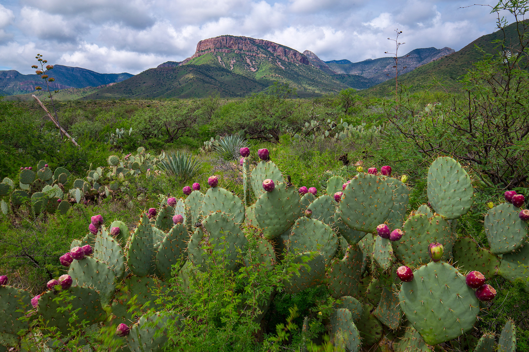
In the heart of the canyon is a rich riparian community of cottonwoods and willows that attracts a range of wildlife, including black bears, mountain lions and white-tailed deer. The Whetstones are also home to the endangered Mexican spotted owl. It’s unlikely you’ll see one of those, but from a small saddle about 40 minutes in, you will see a panorama of surrounding peaks that rise above 7,000 feet. The highest, to the southwest, is Apache Peak (7,711 feet).
Just beyond the saddle, the trail passes through a gate and makes a slight descent. The respite is brief. Five minutes later, it begins a steep climb on a straight line. After another five minutes, it makes a sharp switch to the northeast. This, too, is a steep grind that leads to another saddle, which is the high point (5,619 feet) of the hike. From there, you’ll have a bird’s-eye view of the Whetstone range, which gets its name from a deposit of novaculite, a hard, dense, fine-grained siliceous rock that’s used in making whetstones.
In addition to that, the range is known for its Wild West history — it’s where Wyatt Earp shot and killed Curly Bill Brocius — and its dinosaur bones. The latter were discovered in 1994 by a group of amateur fossil hunters. The dinosaur, which is known today as Sonorasaurus thompsoni, was the first to be found in Southern Arizona.
From the second saddle, the trail begins a steep descent into the gorgeous expanse of Guindani Canyon. Along the way, it passes through an oak-juniper woodland that includes some tall pines and waves of manzanitas. It’s a quick drop to the bottom, where the trail arrives at a riparian wash. Three minutes later, it intersects the Cottonwood Saddle Trail. Keep right and continue downstream as the trail parallels the wash for another 40 minutes to the end of the loop. From there, it’s a quick trip back to the starting point for the only established trailhead in the Whetstone Mountains. There’s only one, but one is all you need.
Length: 4.16 miles round-trip
Difficulty: Moderate
Elevation: 4,709 to 5,619 feet
Trailhead GPS: N 31˚50.131', W 110˚21.393'
Directions: From Interstate 10 west of Benson, go south on State Route 90 for 8.8 miles to Kartchner Caverns State Park. From there, follow the park road for 1.1 miles to the Guindani Trailhead.
Special Consideration: Arizona State Parks and Trails fees apply.
Vehicle Requirements: None
Dogs Allowed: Yes (on a leash)
Horses Allowed: No
USGS Maps: Apache Peak, McGrew Spring
Information: Kartchner Caverns State Park, 520-586-4100 or azstateparks.com/kartchner; Sierra Vista Ranger District, 520-378-0311 or fs.usda.gov/coronado