
The debate about the “north” and the “south” usually centers on Mid-Atlantic battlefields, but sometimes, it spills over into Arizona, too. In particular, as it relates to the two rims of the Grand Canyon. “Which is better?” readers ask. “The North Rim or the South Rim?” (Hint: They’re both spectacular.)
There are two sides to South Mountain, too, but there’s no debate about which end is best for an inner-city escape. Although you won’t be alone on the south side, you will have more separation than you would on the other side. That’s because the access points on the south side are used primarily as trailheads — no picnic areas or restrooms or ramadas to attract crowds. The westernmost trailhead on the south end is the launch point for the Pyramid Trail.
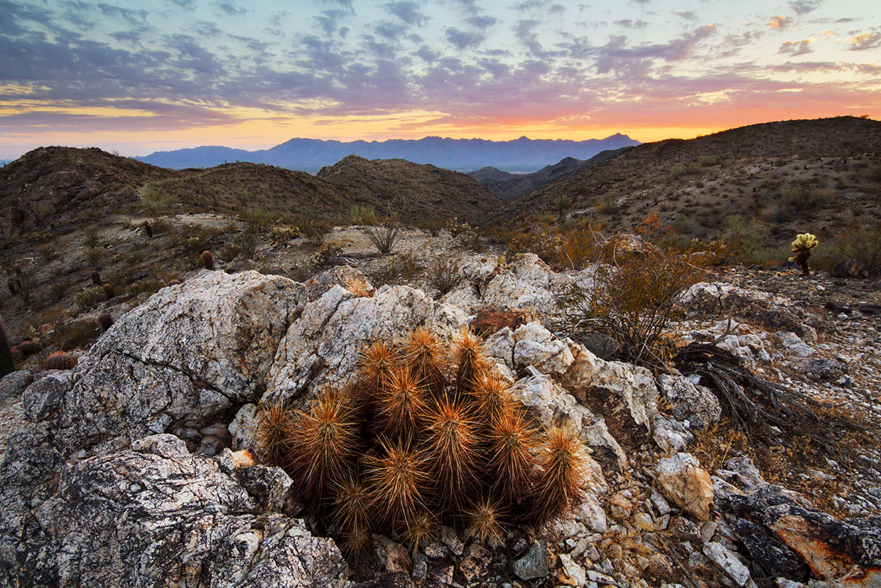
It’s one of the best hikes in the park, but before you put it on your calendar, you should know that it’s not an extremist like so many of the other trails in Arizona. There’s no tundra at the top, no alpine forest along the way and no waterfalls to boast about on your Instagram feed. Like the late Charlie Watts, the Pyramid Trail is well dressed but understated. Even compared with other Sonoran Desert hikes, such as those in the Superstition Mountains or Sabino Canyon, it’s a trail without flair. What it does offer is an accessible and invigorating climb through a pristine landscape of scattered saguaros, creosotes, chollas and paloverdes.
From the trailhead, the well-worn path drops into and out of a small wash, and then veers northeast onto the wide-open south flank of the Gila Range. You’ll immediately notice some yellow “Area Closed” signs on either side of the trail. They’re the resident sentries put in place to help protect the soil and wildlife. “Don’t Be a Trailblazer,” the signs warn. Please heed the warnings.
Just beyond the wash, the Pyramid Trail comes to an intersection with the Bursera Trail — they’re two of the 29 routes in the park. The trails are well marked with steel signposts; however, the post for the Pyramid Trail can be confusing because it’s marked with a white “P” in a purple box. It looks like it might indicate the way to a parking area. That’s not the case. It’s the compass for this hike. Follow it.
Continuing on, the trail turns right into a thicket of trees and then shifts the other direction to begin what at first is an intermediate ascent toward Telegraph Pass. Mesquites join the mix. You might see a mountain biker, too. Like most of the trails in South Mountain Park, this one attracts hikers, bikers and horseback riders.
After about 25 minutes of overall hiking, the trail drops into a deep wash and stays there for about 100 yards before emerging on the other side. The ascent is still gradual at this point, but after another football field, you’ll come to the switchbacks that eat up most of the 1,100 feet of elevation gain on this relatively short hike. Overall, the switches are reasonable — not too long, not too short. But they will get your attention. Drink plenty of water. Pace yourself. And soon you’ll be standing on a small summit (2,203 feet) that you’ll think is the end of the route. It’s not. But it is a high point that offers a good look in every direction.
If you’re short on time, the peak is an ideal place to turn around — the round-trip distance is about 4 miles. However, if time allows, the trail continues down the north side of the small peak and onto a narrow ridge. From there, the homestretch is a series of gradual ups and downs that lead to an intersection with the National Trail, which is the turnaround point for this hike and the dividing line between the north and south sides of South Mountain.
Down below, on the north side, you’ll see Telegraph Pass Road. It’s the main artery through the park, which was built by the Civilian Conservation Corps between 1933 and 1940. Much of their handiwork remains, including the lookout at Telegraph Pass. History, nature, hiking trails … South Mountain Park is a mecca for outdoors enthusiasts. And, like the Grand Canyon, both sides are spectacular.
Trail Guide
Length: 6.2 miles round-trip
Difficulty: Moderate
Elevation: 1,260 to 2,333 feet
Trailhead GPS: N 33˚18.209', W 112˚06.072'
Directions: From Interstate 10 near Ahwatukee Foothills, go west on Chandler Boulevard for 7.7 miles to 19th Avenue and turn right. The trailhead parking area is on the immediate left.
Vehicle Requirements: None
Dogs Allowed: Yes (on a leash), but not when the temperature exceeds 100 degrees.
Horses Allowed: Yes
USGS Map: Lone Butte
Information: South Mountain Park Ranger Office, 602-262-7393 or phoenix.gov/parks/trails