
LAURENCE PARENT
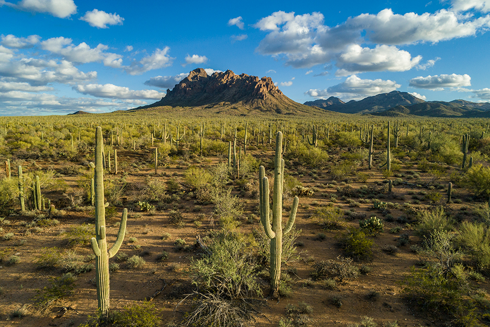
Ragged Top rises from a sea of saguaro cactuses at Ironwood Forest National Monument, northwest of Tucson. The rhyolite peak, a popular climbing destination, is a textbook example of a volcanic plug, formed when magma hardens in a vent on an active volcano — as happened here about 22 million years ago.
TED GRUSSING
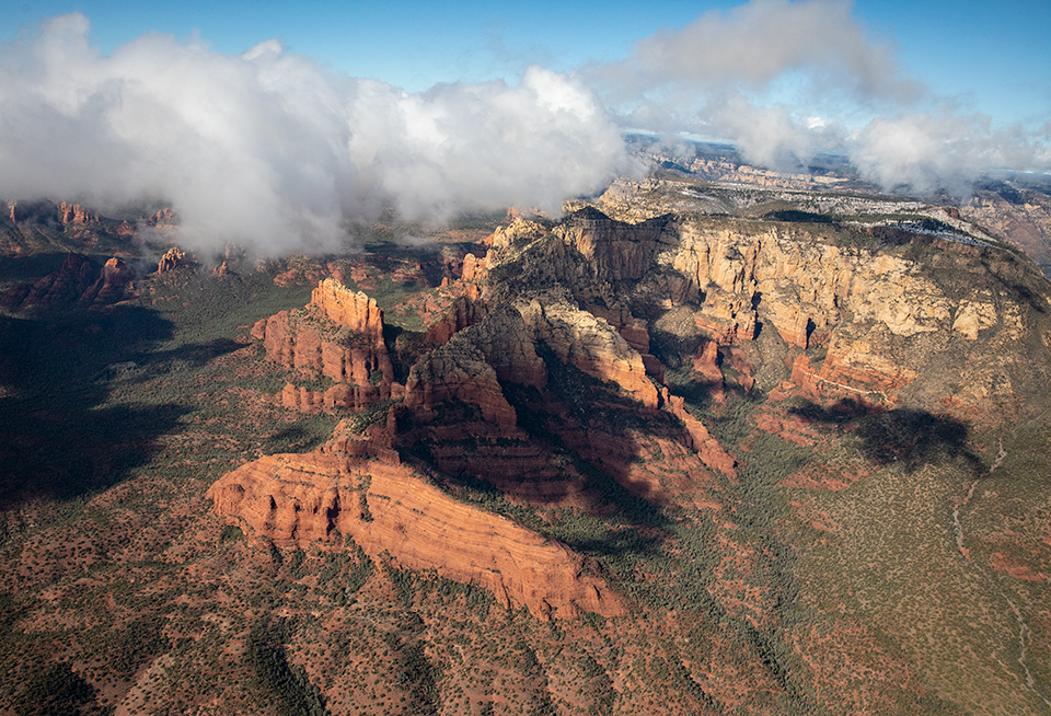
Scattered clouds cast shadows on the layered sandstone buttes of Red Rock Country. Steamboat Rock is in the foreground, and behind it is Wilson Mountain. These formations are northeast of Sedona, on the west side of State Route 89A.
LARRY LINDAHL

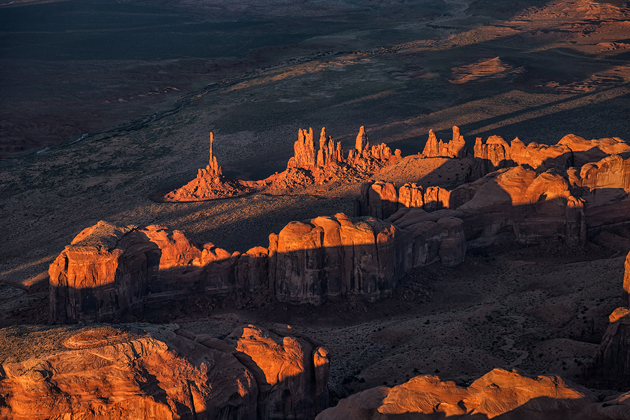
Long shadows form on the Totem Pole and Yei Bichei, two of Monument Valley’s best-known sandstone formations, at sunset. Spanning a section of Northeastern Arizona and Southeastern Utah, Monument Valley Navajo Tribal Park covers nearly 92,000 acres of the Navajo Nation.
MICHAEL WILSON
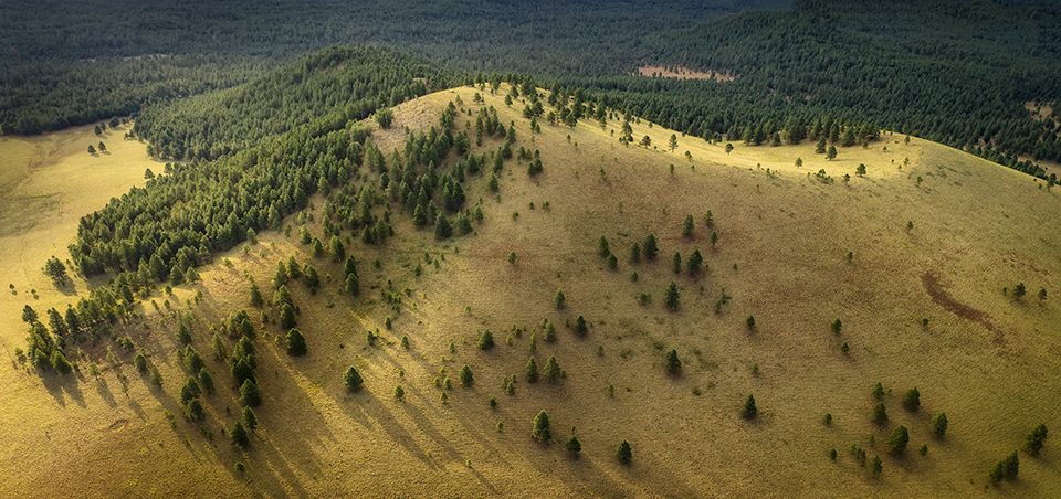
At sunrise, evergreens cast long shadows on a rounded hill near Flagstaff. This part of Northern Arizona is known for its abundant ponderosa pines, part of the largest contiguous tract of those trees found anywhere in the world.
RUSTY CHILDRESS
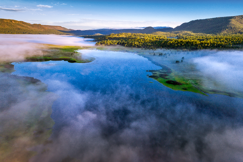
Low clouds linger over Luna Lake, an impoundment of the San Francisco River in Eastern Arizona’s White Mountains. The 75-acre lake, near the town of Alpine, is known for its campsites, wildlife watching and trout fishing.
RICHARD JACKSON
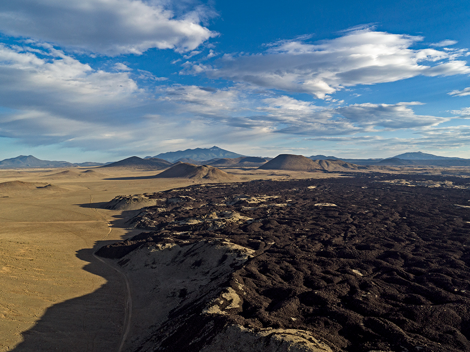
The sprawling lava flow from SP Crater (middle ground, right of center) covers the landscape north of the distant San Francisco Peaks. The cinder cone volcano’s name is a sanitized version of one bestowed by a rancher who thought it and its lava flow resembled an overturned chamber pot. Recently, golden eagles nested at the summit of SP Crater.
FOLLOW THE RULES
As a relatively new technology, drone photography is exciting — but photographers need to know and follow the rules regarding when and where these devices can be used. Drones are prohibited at National Park Service sites, in federally designated wilderness areas, near airports, at sites deemed “national security sensitive” (including military bases, nuclear power plants and national landmarks such as Hoover Dam) and at major sporting events. Additionally, drones cannot be flown near wildfires or other emergency situations. In other settings, such as national forests, drones are allowed but are subject to altitude limits and other regulations. Before you invest in a drone, contact the governing agencies of the places you plan to photograph to ensure you know the rules. For more information about recreational and commercial drone flights, visit the Federal Aviation Administration’s Unmanned Aircraft Systems page at faa.gov/uas.