There are many scenic back roads in the White Mountains. One of our favorites is Forest Road 116, which winds along
the West Fork of the Black River and up toward Big Lake. It’s not the only road, though. There’s an entire
network in the woods that leads to some of the most beautiful places in Arizona.
A Portfolio Edited by Jeff Kida and Keith Whitney
Photograph by Claire Curran
Laurence Parent
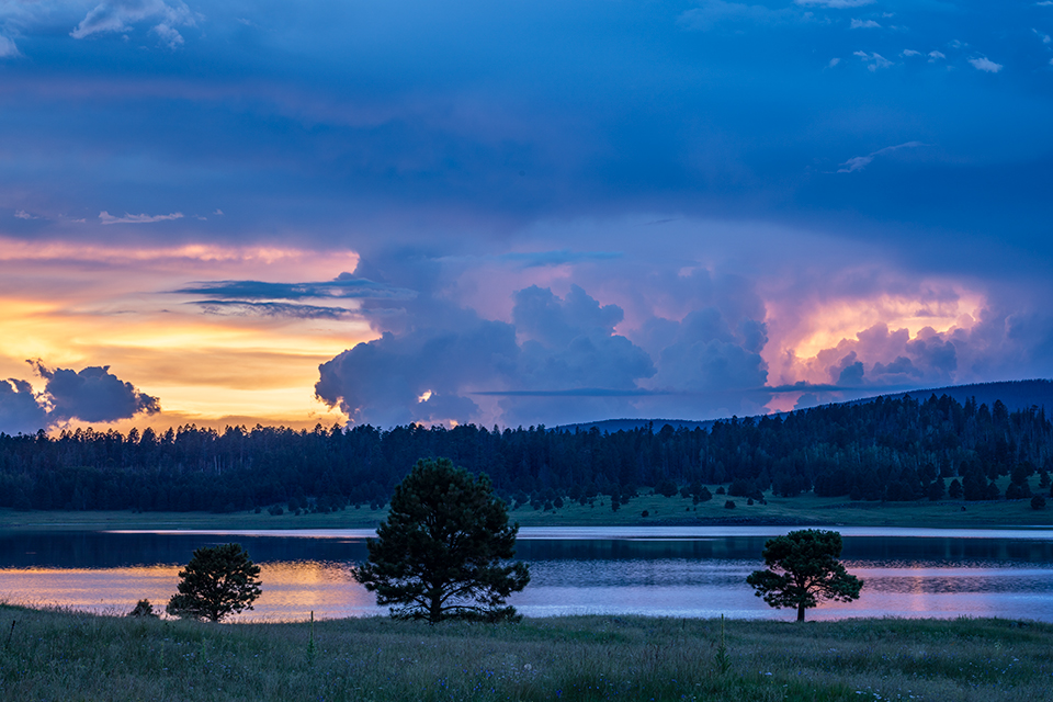
A thunderstorm forms near Big Lake, one of the largest reservoirs in the White Mountains, at sunset. A popular boating and fishing destination, Big Lake is just south of the intersection of state routes 261 and 273. | SONY ALPHA 7R III, 0.6 SEC, F/16, ISO 100, 108 MM LENS
Claire Curran
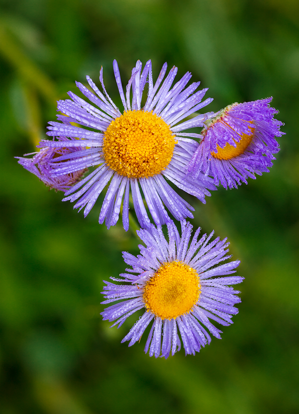
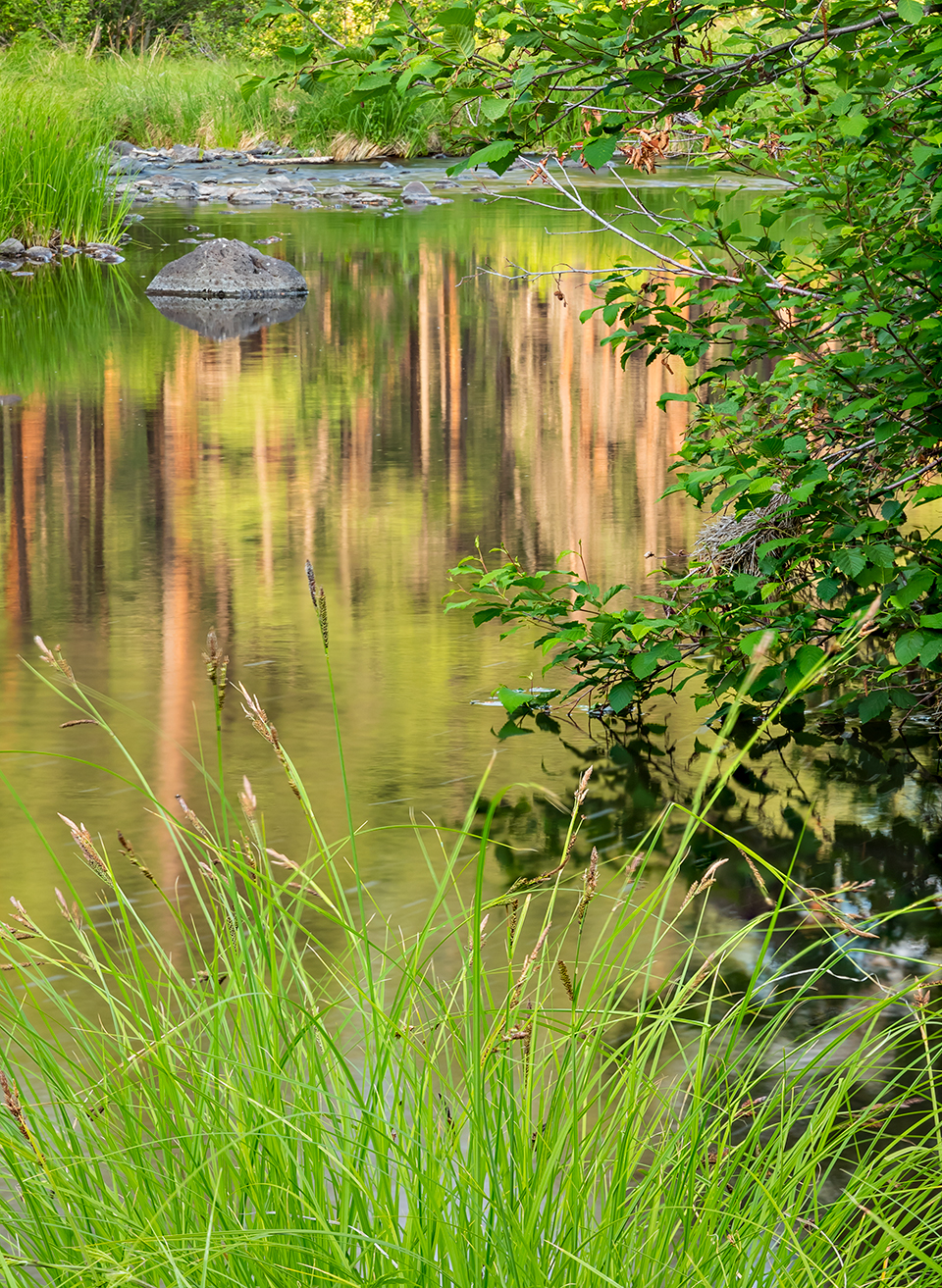
Fleabane (genus Erigeron) flowers bloom along the West Fork of the Black River. A drive on well-maintained forest roads 26, 24 and 25, starting and ending at U.S. Route 191, will take you across both of the Black River’s forks and the main course of the waterway. | CANON EOS 5DS R, 1/10 SEC, F/6.3, ISO 100, 90 MM LENS
Larry Lindahl
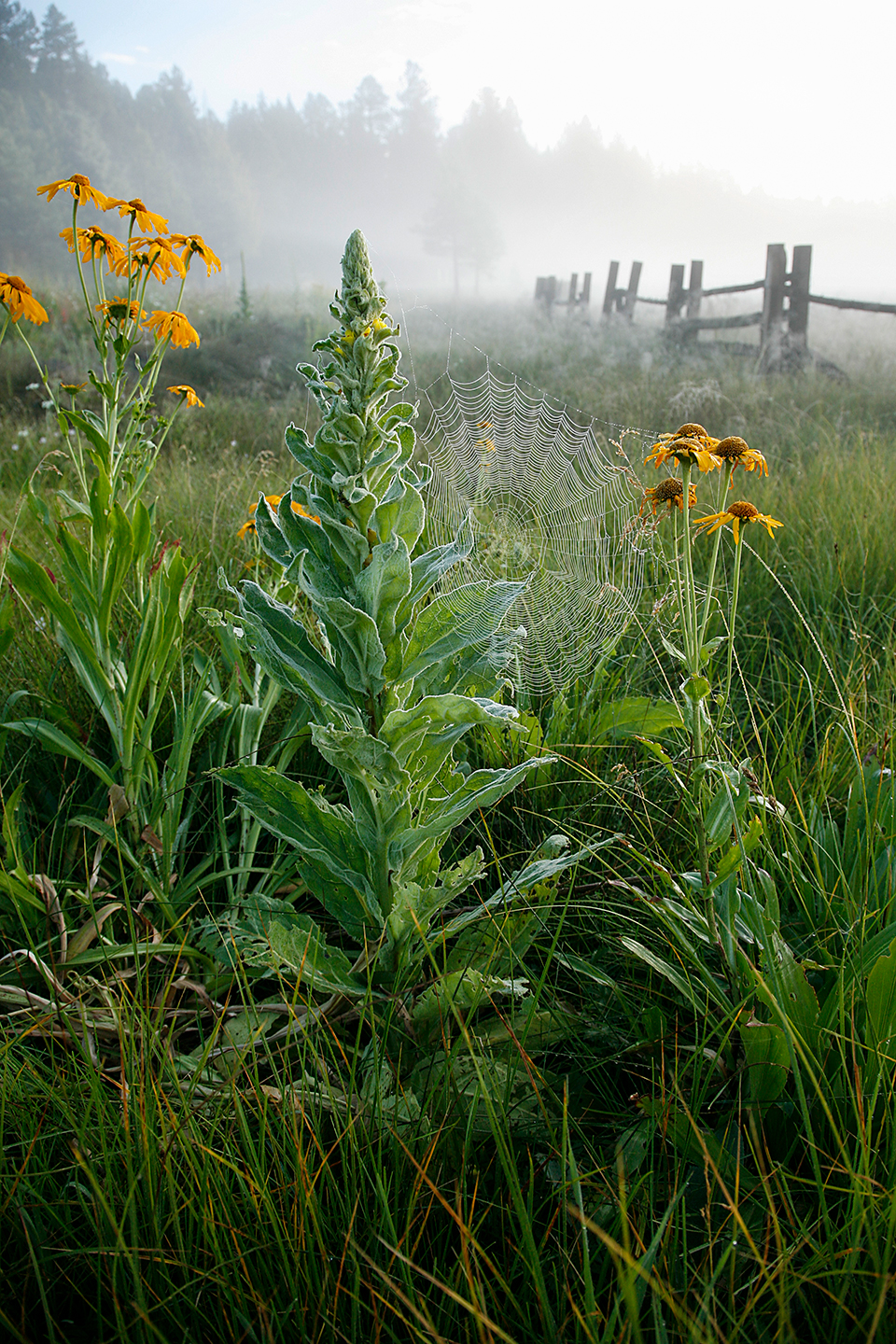
Orange sneezeweeds (Hymenoxys hoopesii) and a mullein plant cradle a dewy spiderweb in fog-shrouded Hannagan Meadow. This clearing
is one of many attractions along the section of U.S. Route 191 better known as the Coronado Trail. | CANON EOS 5D, 1/100 SEC, F/6.3,
ISO 320, 24 MM LENS
Derek von Briesen
The East Fork of the Black River nourishes abundant riparian foliage in summer. Daily high temperatures in the 70s and 80s make the White Mountains a popular destination during Arizona’s hottest months. | CANON EOS 5DS R, 0.6 SEC, F/16, ISO 100, 70 MM LENS
Joel Hazelton
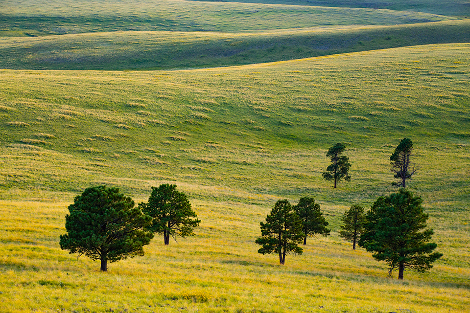
Evening light illuminates one of the region’s evergreen-dotted meadows, as viewed from the slope of Wahl Knoll. One of many rounded volcanic hills in the White Mountains, Wahl Knoll is on the west side of SR 261 about halfway between State Route 260 and Crescent Lake. | CANON EOS 6D, 1/15 SEC, F/10, ISO 400, 118 MM LENS
Joel Hazelton
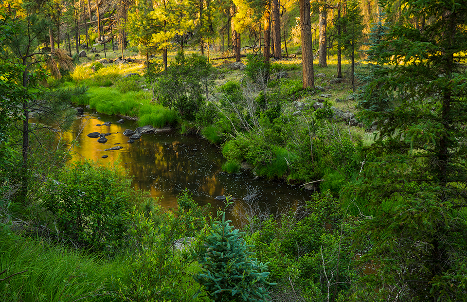
Lush vegetation, including tall ponderosa pines, thrives along the Black River in morning light. The Black River eventually merges with
the White River to form the Salt River, which supplies a significant portion of the Phoenix area’s water. | CANON EOS 6D, 0.6 SEC,
F/16, ISO 100, 56 MM LENS
Laurence Parent
Lee Valley Lake mirrors aquatic grasses and a nearby dense forest of evergreens and aspens. At 9,423 feet, this 35-acre lake is Arizona’s highest-elevation reservoir. It’s just off SR 273 northwest of Crescent Lake. | SONY ALPHA 7R III, 1/10 SEC, F/18, ISO 200, 71 MM LENS
Claire Curran
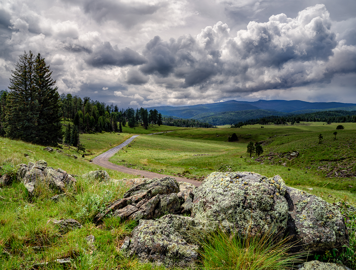
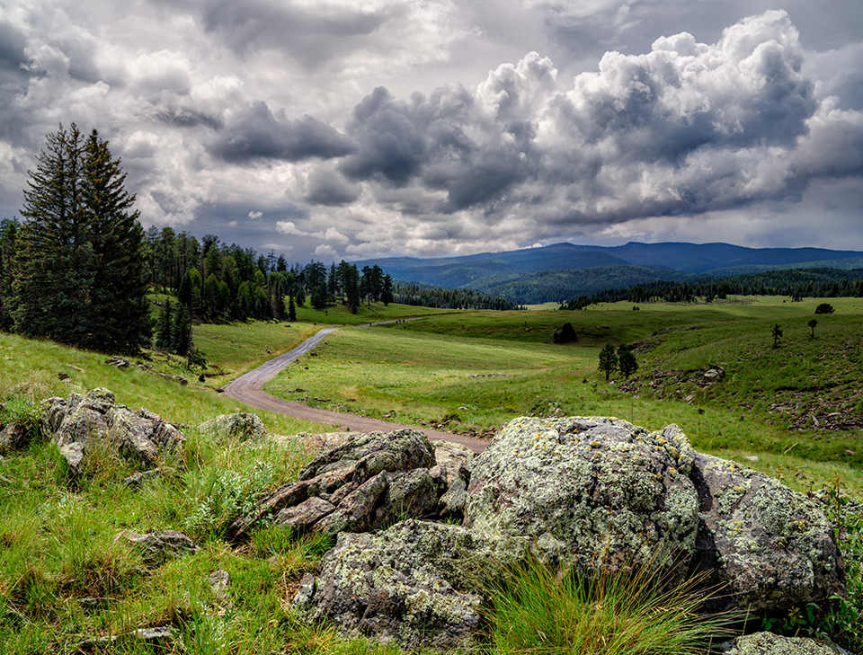
Forest Road 116 meanders past evergreens and lichen-covered boulders as monsoon storm clouds gather over the White Mountains of Eastern Arizona. FR 116, which is just west of Big Lake and suitable for most vehicles in good weather, can be accessed via State Route 273, which runs southeast from State Route 260. | FUJIFILM GFX100S, 1/100 SEC, F/16, ISO 100, 43.3 MM LENS