
There’s a reason they call State Route 87 the Beeline Highway: This well-traveled route is basically a straight shot from the Phoenix area to the Mogollon Rim city of Payson. For those looking for a more roundabout path, there’s Forest Road 414, which traverses gorgeous Tonto National Forest terrain southwest of Payson and offers lovely views of the nearby Mazatzal Mountains. And in good weather, it won’t add much time to your trip.
Reset your trip odometer on SR 87 at the northernmost turnoff for Rye, a community south of Payson with a population of about 100. After you make the turn, immediately turn right onto the paved H Bar Ranch Road, which parallels the Beeline for a half-mile before reaching FR 414. Desert scrub vegetation, including yuccas and prickly pear cactuses, lines this dirt road as it winds gently uphill, and you’ll get expansive views of the Mazatzals, topped by 7,888-foot Mazatzal Peak, to the west.
At Mile 2.7, you’ll reach a “T” intersection and turn left to stay on FR 414, which curves to the south and into a juniper-filled area. A mile later, you’ll crest a hill and see abundant foliage along a creek to the west. At a wide wash at Mile 4, follow the sign to remain on FR 414, which is easy to follow from this point on.
Cottonwoods and Arizona sycamores dominate the view at an intermittent creek crossing at Mile 4.8, and there are more sycamores, easily identified by their large leaves and mottled bark, on the road ahead. Soon, you’ll be back in a forest of junipers and piñon pines, but between miles 6 and 7 are more crossings and an interesting mix of evergreens, tall sycamores and a few cottonwoods. The road here is a bit rocky, and while it’s navigable in most vehicles in good weather, you’ll be more comfortable in a high-clearance ride.
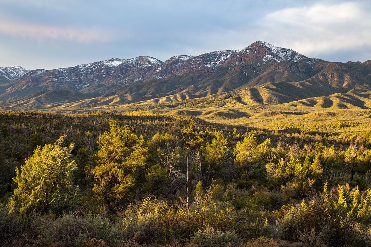
Past another crossing, the road climbs again, and damage from a long-ago wildfire is visible amid a thick forest of young junipers. You’ll soon see tall piñon pines along the road as it climbs and gets a bit rougher. And as you crest a hill around Mile 10, you’ll get an excellent view of the Mogollon Rim to the northeast. This escarpment, which forms the southern edge of the Colorado Plateau, is one of Arizona’s defining geographical features.
Next up is a section of thick vegetation, with piñons, junipers, agaves and yuccas crowding the roadside. FR 414 then begins a winding descent into more arid terrain before climbing into the piñons and junipers again. You’ll now be headed east, with openings in the vegetation providing a good look at the White Hills to the northwest.
At Mile 14, the road reaches an intersection with Forest Road 193 and turns north for its final stretch. Before long, you’ll come to Doll Baby Ranch Road, a pleasant and mostly paved route that meanders back to Payson, crossing a couple of washes along the way. Eventually, this road becomes Main Street and takes you through Payson’s historic district. If it’s open, the Ox Bow Saloon, which has been there since 1933, is an ideal place to stop for a cold beverage or a hearty meal. And when you’re done in town, you can make a Beeline back to Phoenix.
tour guide
Note: Mileages are approximate.
Length: 20.5 miles one way (from State Route 87)
Directions: From State Route 87 in Rye, go west at the northernmost turnoff (just south of Mile Marker 241), then immediately turn right onto H Bar Ranch Road and continue 0.5 miles to Forest Road 414. Turn right onto FR 414 and continue 14.7 miles to Doll Baby Ranch Road. Turn right onto Doll Baby Ranch Road and continue 5.3 miles to SR 87 in Payson.
Vehicle requirements: A high-clearance vehicle, such as an SUV or truck, is recommended. Do not attempt the drive after recent heavy rain or if rain is in the forecast.
Warning: Back-road travel can be hazardous, so be aware of weather and road conditions. Carry plenty of water. Don’t travel alone, and let someone know where you are going and when you plan to return.
Information: Payson Ranger District, 928-474-7900 or fs.usda.gov/tonto