
In the McDowell Mountains in the middle of March, the sun rises at 6:37 a.m. If your chronotype is that of a lark, you have a shot at capturing that special moment from the summit of Sunrise Peak, which can be reached from the aptly named Sunrise Trail. It takes about an hour to get there, so you’d have to hit the trail by 5:30 a.m. And, for obvious reasons, you’d have to hike with a headlamp. But the payoff for the extra effort is a front-row seat to the start of the day.
From the trailhead at the east end of Via Linda in North Scottsdale, the rocky single track begins as a gradual ascent that won’t let up much until the top. Although you’ll pass a few high-end homes in the early going, this spectacular trail is a showpiece for the McDowell Sonoran Preserve, an urban Eden that protects thousands of acres of lush desert landscape.
In a world where so much of Mother Nature’s most beautiful handiwork has been bulldozed, this preserve stands as a prime example of what can happen when a municipality, with the support of its citizenry, takes on the challenge of protecting something worth protecting.
The preserve got its start in 1991, when a small group of Scottsdale citizens formed the McDowell Sonoran Conservancy. Their goal was to advocate for the land and persuade the city to protect it. When the first parcel was acquired in 1994, the conservancy became its steward.
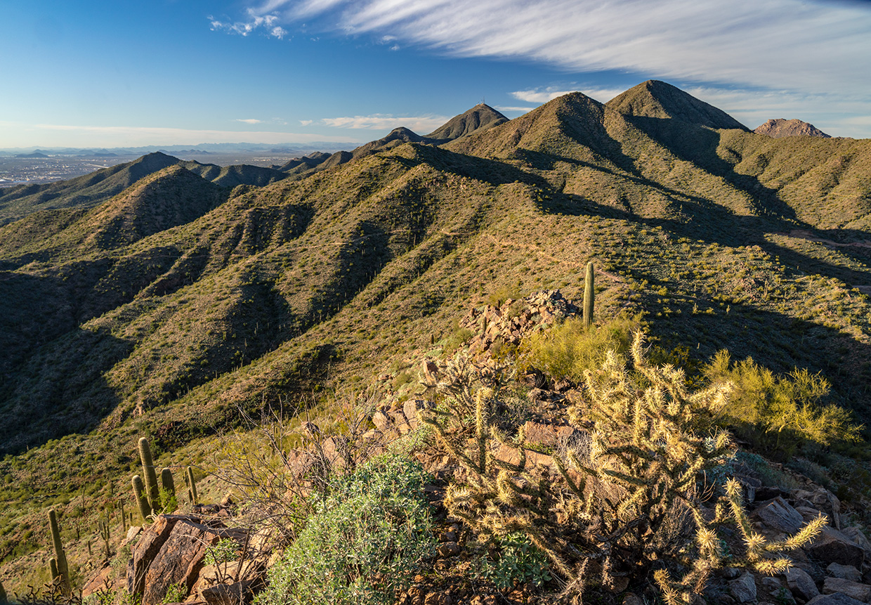
Today, the preserve measures 30,580 acres, making it the third-largest city park in the United States. And within its boundaries are 417 plant species, including saguaros, buckhorn chollas, jojoba, soaptree yuccas, desert senna and velvet mesquites. There are animals, too. Almost 600 species. Desert tortoises, coyotes and mule deer are on the list, and so are several rare birds, such as bald eagles, golden eagles, peregrine falcons, purple martins and gilded flickers. You might see any of those things on this trail, or on one of the many other trails in the preserve — in all, there are more than 225 miles of hiking trails. This hike is one of the best.
After a couple of minutes on it, you’ll come to an old barbed-wire fence. A relic from the days when these mountains were used for running cattle. A few minutes later, you’ll get your first good glimpse of the Four Peaks, the most identifiable landmark on the eastern horizon. In the winter, and sometimes even in the spring, Browns Peak (7,641 feet) and its three unnamed neighbors will be covered with snow. Chocolate marble cake with a layer of fondant.
Moving on, the trail shifts downhill briefly before reverting back to a climb. The grade, though, is never extreme. Although you’ll scramble more than
1,100 feet along the way, you don’t feel the elevation burn on this hike that you do on steeper trails, like those on Camelback Mountain and Piestewa Peak. That’s because the switchbacks are long. And there aren’t very many of them.
The first shows up about a half-hour in, as the trail winds clockwise around a small peak to the Sunrise Scenic View. The wayside faces west and offers a distant look at much of metropolitan Phoenix. From this point, it’s 0.8 miles to the summit. As you make the final ascent, the surrounding boulders become more pronounced — the setting is reminiscent of what you see along the Beeline Highway — and the clusters of saguaros grow thicker. The trail gets a little steeper, too, until you arrive at a small saddle.
From there, it’s a quarter-mile to the top. If you time it right and hit the summit by sunrise, you’ll be glad you did — the Four Peaks are even more impressive under an orange spotlight. But you don’t have to be an early bird to enjoy the views. The 360-degree panorama is spectacular any time of day.
trail guide
Length: 3.7 miles round-trip
Difficulty: Strenuous
Elevation: 1,960 to 3,069 feet
Trailhead GPS: N 33˚35.774', W 111˚46.094'
Directions: From State Route 101 in North Scottsdale, go east on Shea Boulevard for 2.1 miles to Via Linda. Turn left onto Via Linda and continue 5.2 miles to the trailhead at 145th Street.
Vehicle Requirements: None
Dogs Allowed: Yes (on a leash)
Horses Allowed: Yes
USGS Map: McDowell Peak
Information: McDowell Sonoran Conservancy, 480-998-7971 or mcdowellsonoran.org