There’s so much to see along the Coronado Trail — the steep, twisting 120-mile jaunt between the Eastern Arizona towns of Springerville and Clifton — that most travelers stay near the pavement of U.S. Route 191, of which the Coronado Trail is a part. But beyond the pines and overlooks of the National Scenic Byway is Upper Eagle Creek Road, and if you’ve got time for a 22-mile detour, the rewards include seldom-seen views, cool creek water and plenty of shade for a summer day.
From U.S. 191 north of Clifton, in the Apache-Sitgreaves National Forests, head west on Upper Eagle Creek Road, which is also signed as Forest Road 217 and County Road 67018. Junipers and scrub oaks line the road as it rolls downhill, and within a couple of miles, prickly pear cactuses and yuccas appear at the lower elevations. You’ll pass Gold Gulch, a steep, tree-filled canyon, on the left.
The road then cuts across a hillside dotted with agaves and thistles, and at Mile 4.5, you’ll come to a clearing where volcanic rock outcrops loom over a regiment of Arizona sycamores. Past another riparian area, a sign warns that a bridge is out, so you’ll detour across a creek — the first of several such crossings on the route, which are why a high-clearance vehicle is required. This crossing is usually dry, but if water is running at any of them, be sure you know the depth and your vehicle’s capabilities before venturing across.
Past the crossing, the road climbs, offering a look at pristine, juniper-dotted hills via a pullout on the left at Mile 6. To the southwest is 6,975-foot Turtle Mountain, and on a clear day, you might even see 10,696-foot Mount Graham in the distance. Views of more grassy hills soon open up on the right, and after another creek crossing, at the mouth of Big Dry Canyon at Mile 9.2, the road turns to the north.
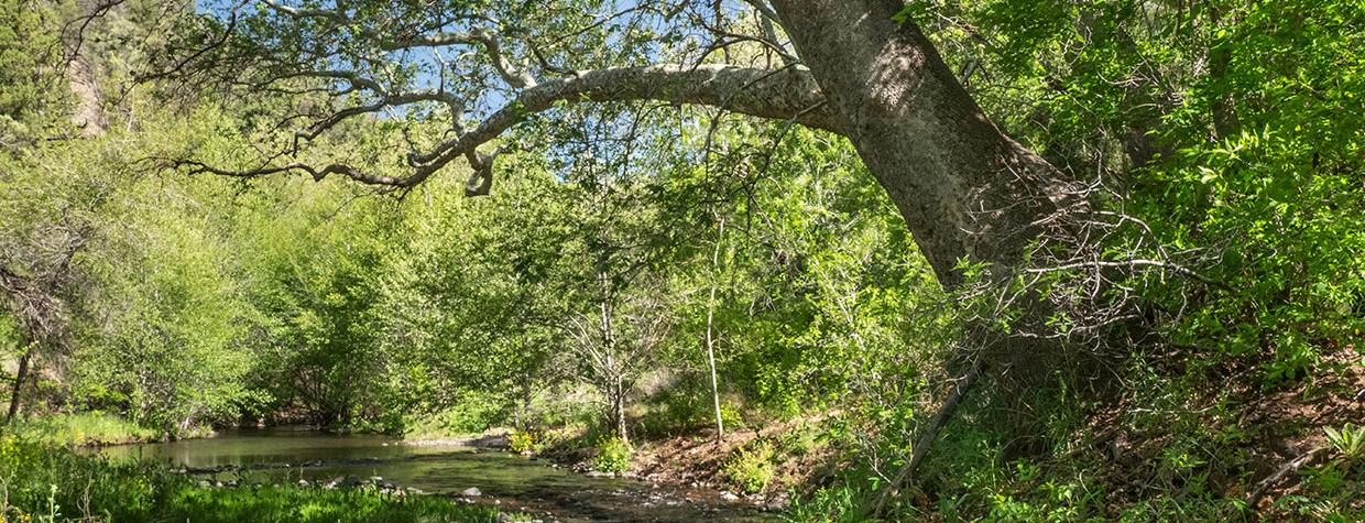
This stretch is where Eagle Creek makes its appearance, and the waterway, which is lined with tall cottonwoods and sycamores, parallels the road on the left for a few miles. You’ll pass an old homestead, a more modern ranch and a trailhead for the Eagle National Recreation Trail, along with a short, rough side road to the tin-roofed Eagle Creek School. All of it is cradled in a broad valley formed by low-slung buttes to the west and rolling hills to the east.
Just past Mile 14, you’ll reach the first of three crossings of Eagle Creek itself. Roll down the windows to enjoy the sound of the burbling creek as you meander past several old homesteads and a few newer dwellings. The second crossing, at Mile 16.5, leads you into a thick riparian area nourished by the creek, and on a hot day, you’ll be glad the cottonwoods, sycamores and occasional pines are keeping you out of the sun.
The final crossing is at Mile 19.2 and comes near the end of a parcel of private land. You’ll make one more climb, which offers an overlook of Middle Prong Creek on the left, before descending back down to another riparian area along Eagle Creek. The road dead-ends at Honeymoon Campground, where the combination of running creek water and tall trees helps keep the temperature down in the summer. It’s an ideal place to pitch a tent or stretch your legs before retracing your path back to the highway. If you can motivate yourself to get out of the shade, that is.
tour guide
Note: Mileages are approximate.
Length: 22 miles one way (from U.S. Route 191)
Directions: From Clifton, go north on U.S. Route 191 for 29 miles to Upper Eagle Creek Road (Forest Road 217/County Road 67018). Turn left (west) onto Upper Eagle Creek Road and continue 22 miles to Honeymoon Campground.
Vehicle requirements: A high-clearance vehicle, such as an SUV or truck, is required, but four-wheel-drive is not necessary in good weather. The route features several creek crossings, so do not attempt the drive after recent heavy rain or if rain is in the forecast.
Special consideration: There is no fee to camp at Honeymoon Campground, and campsites are available on a first-come, first-served basis.
Warning: Back-road travel can be hazardous, so be aware of weather and road conditions. Carry plenty of water. Don’t travel alone, and let someone know where you are going and when you plan to return.
Information: Clifton Ranger District, 928-687-8600 or fs.usda.gov/asnf
Travelers in Arizona can visit az511.gov or dial 511 to get information on road closures, construction, delays, weather and more.

