

Nutrioso Loop
White Mountains
Nutria and oso are Spanish for “otter” and “bear,” respectively. But there aren’t any otters around the community of Nutrioso, northwest of Alpine, so it’s thought that Spanish explorers in the 1700s misidentified a beaver they’d killed as an otter. (There might have been a bear involved, too.) Regardless, the name stuck, and today, Nutrioso boasts a population of a few dozen. It’s also the starting point for a loop drive that showcases some of the best views in Eastern Arizona’s White Mountains.
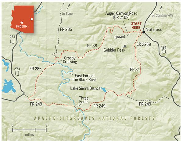
Head west on Auger Canyon Road (County Road 2108) from U.S. Route 191, better known as the Coronado Trail. On the left, you’ll see the first of many idyllic clearings ringed by ponderosa pines, with Gobbler Peak (8,914 feet) looming farther south. Initially paved, the road curves into more ponderosas and past Nutrioso Reservoir, which may or may not be dry. At a “Y” intersection a mile in, bear left to stay on CR 2108, which transitions to a smooth, wide gravel route suitable for most vehicles.

Tall ponderosas crowd the roadway, and you’ll pass several ranch properties thriving beneath a set of angular peaks. When you cross a cattle guard at Mile 3.2, you’ll enter the Apache-Sitgreaves National Forests and the road will become Forest Road 88, which is slightly narrower and rougher. This road quickly climbs into the mountains, and on the left, you’ll get an expansive view of the area you just traversed.
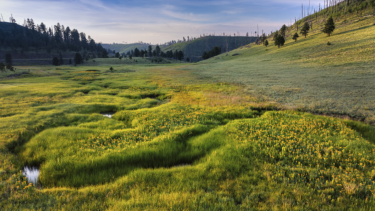
Past numerous copses of young aspens, you’ll skirt the edge of Rogers Reservoir at Mile 5.6, then pass through a pair of long, narrow meadows surrounded by more aspens and evergreens. But those clearings are dwarfed by the one you’ll pass on the left starting at Mile 10. It’s a typical White Mountains meadow — rolling, verdant and seemingly endless — and you’ll get a different perspective of it when you turn left onto Forest Road 285 at Mile 11.5.
Another good road, FR 285 rolls downhill for a half-mile to Crosby Crossing, on the East Fork of the Black River, before climbing back into the tall aspens and evergreens. More sections of alpine meadows and dry lake beds are next, and during a subsequent downhill stretch, a hillside straight ahead glows with the leaves of young aspens that have sprung up since the 2011 Wallow Fire. At the base of that hill, turn left onto paved Forest Road 249 (Three Forks Road), which offers a pleasant meander through more meadows and new aspen groves.
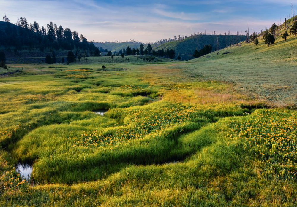
At Mile 24, you’ll bisect another large clearing, then pass Lake Sierra Blanca on the left; formerly stocked with rainbow trout, this reservoir now is home only to the unfortunately named fathead minnow. A couple of miles later, turn left onto Forest Road 81, which is the most challenging of the four roads on this loop. You won’t need four-wheel-drive, but high clearance is a must for this road’s ruts and rocky sections.
FR 81 climbs for a mile and a half, then crests a hill to give you a view of a deep, narrow valley. You’ll then gradually descend to the floor of that valley, passing young aspens and oaks along the way. The road smooths and widens considerably when it enters another residential area around Mile 32; here, it becomes County Road 2269, which merges with CR 2108 near the start of the drive. Now back on pavement, you can take U.S. 191 north to Eagar and Springerville or south to Alpine. Just keep an eye out for otters — by which we mean beavers. (Maybe keep an eye out for bears, too.)
ADDITIONAL READING: For more adventure, pick up a copy of our book Arizona Highways Scenic Drives, which features 40 of the state's most beautiful back roads. To order, visit www.shoparizonahighways.com/100scenicdrives.
Tour Guide
Note: Mileages are approximate.
Length: 34.7-mile loop (from U.S. Route 191)
Directions: From U.S. Route 191 in Nutrioso, go west on Auger Canyon Road (County Road 2108), which later becomes Forest Road 88, for 11.5 miles to Forest Road 285. Turn left onto FR 285 and continue 5 miles to Forest Road 249 (Three Forks Road). Turn left onto FR 249 and continue 10.5 miles to Forest Road 81. Turn left onto FR 81, which later becomes County Road 2269, and continue 7.7 miles back to the starting point of the loop.
Vehicle Requirements: None in good weather for the first three legs of the loop. FR 81 requires a high-clearance vehicle, such as an SUV or truck; you can bypass this road by continuing east on FR 249, then taking U.S. 191 north to the starting point.
Warning: Back-road travel can be hazardous, so be aware of weather and road conditions. Carry plenty of water. Don’t travel alone, and let someone know where you are going and when you plan to return.
Information: Alpine Ranger District, 928-339-5000 or www.fs.usda.gov/asnf
Travelers in Arizona can visit www.az511.gov or dial 511 to get information on road closures, construction, delays, weather and more.