
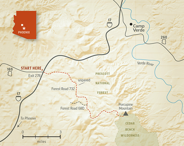
Not many Arizonans are familiar with Porcupine Mountain, partly because until recently, this Central Arizona peak had a different name — one that was highly offensive to Indigenous people. In 2022, the federal Board on Geographic Names rechristened the peak based on a suggestion from the Yavapai-Apache Nation, whose name for it is Das Zine Das Dahe, or “Where the Porcupine Sits.” The name changed, but the views from the top of Porcupine Mountain have not, and they make a fitting reward at the end of this 10.5-mile drive.
First, a word of caution: Unlike many of the drives we publish, this one isn’t for every car — or every driver. If you don’t have a sturdy four-wheel-drive vehicle, don’t try it. If your vehicle isn’t equipped with all-terrain tires, you should probably stay home. And if you’re not confident in your ability to navigate a steep, rutted road without guardrails, just enjoy the photos and descriptions you’re looking at now. This is a challenging trek.
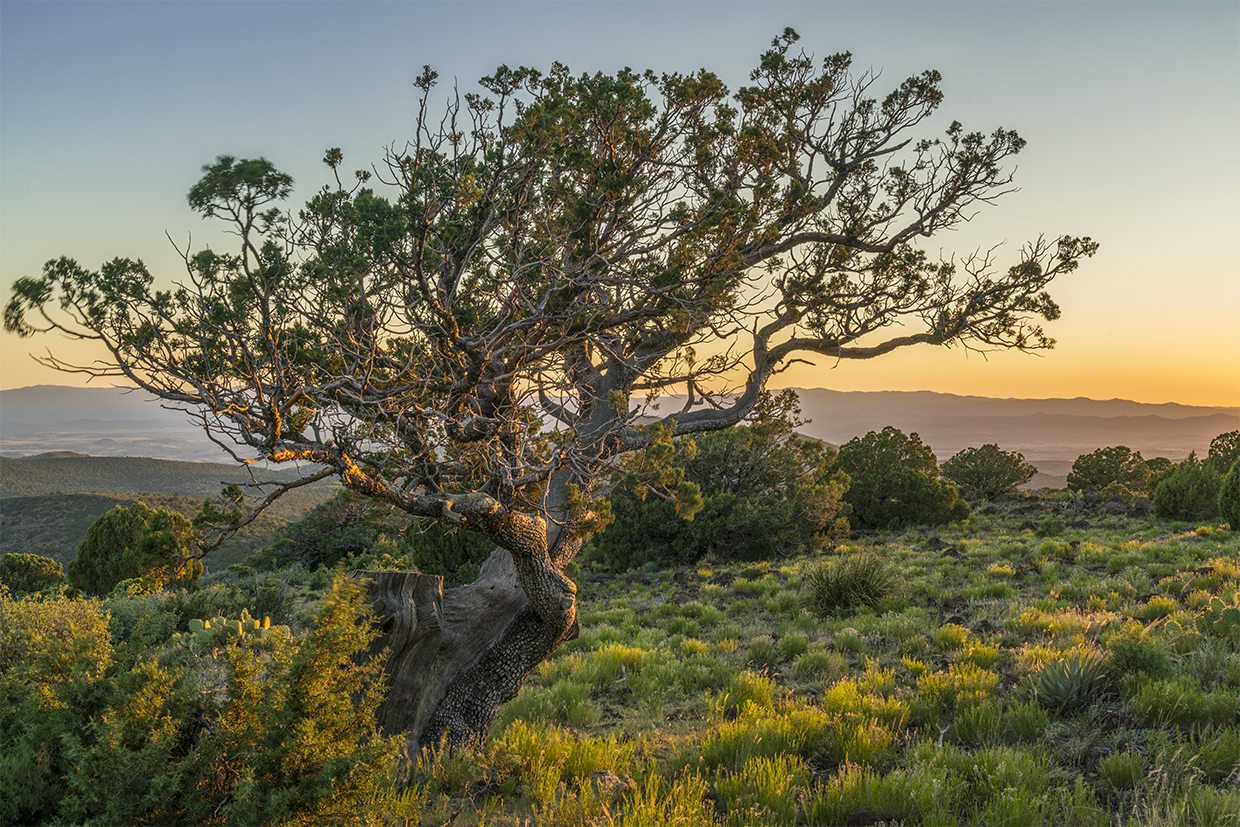
If none of that dissuades you, start your drive at Exit 278 on Interstate 17. Going west would take you to historic Dewey-Humboldt via State Route 169; instead, head east, where the road becomes Forest Road 732, a dirt route that begins a gradual climb into verdant hills of junipers and piñon pines. It soon narrows as it dips into a forest of rounded junipers, a constant presence in this part of the Prescott National Forest.
At Mile 2, you’ll crest a hill, then descend into a shallow valley dotted with a few houses and ranch properties. The road gets rougher as you cross a series of washes where you’ll see larger trees, including Arizona sycamores, thriving amid lichen-covered boulders. The road then climbs a bit and gets even rougher, and on a clear day, you’ll get a glimpse, straight ahead, of the mountains into which you’re headed.
You’ll come to a “Y” intersection at Mile 5; bear right to stay on FR 732. Just after that is a “T” intersection with Forest Road 68D, and you’ll again stay on FR 732, this time by turning left. The next mile and a half is the biggest challenge of the drive, as you navigate a very steep section that’s littered with deep ruts and sharp rocks. To add to the drama, there’s a steep drop on the right. Take it slow and keep your eyes on the road, even though the view into the
canyon below is spectacular.
Next, the road levels out for a bit before climbing again, and you’ll pass several hillside clearings full of windblown grasses, prickly pear cactuses and agaves. It’s a pattern you’ll encounter over the next several miles, with short, steep sections giving way to wider, flatter areas where you can relax a bit. But not too much. It’s still a long way down.
The final stretch features a series of switchbacks, and the sharp curves will give you and your passengers a different perspective on your surroundings. Tall junipers loom over the road just before you reach the 6,526-foot summit of Porcupine Mountain, where you’ll find several automated communications towers.
From here, the views include the Cedar Bench Wilderness just below you and the Verde Valley, including the town of Camp Verde, farther down. On the horizon, you’ll see Mazatzal Peak to the southeast and, if it’s clear enough, the San Francisco Peaks to the north. Enjoy your time at the summit and get ready for the return trip, which requires just as much patience and caution as the ascent. This mountain has a way of demanding your attention. No matter what you call it.
Tour Guide
Note: Mileages are approximate.
Length: 10.5 miles one way (from Interstate 17)
Directions: From Exit 278 on Interstate 17, go east on Forest Road 732 for 10.5 miles to the summit of Porcupine Mountain. (Note: At press time, FR 732 was mislabeled on Google Maps as Forest Road 68D; this is a nearby, but different, road.)
Vehicle Requirements: A high-clearance, four-wheel-drive vehicle, such as an SUV or truck, is required. All-terrain tires and technical four-wheel-drive experience are highly recommended. The route crosses several washes, so do not attempt it after recent heavy rain or if rain is in the forecast.
Warning: Back-road travel can be hazardous, so be aware of weather and road conditions. Carry plenty of water. Don’t travel alone, and let someone know where you are going and when you plan to return.
Information: Verde Ranger District, 928-567-4121 or www.fs.usda.gov/r03/prescott
Travelers in Arizona can visit www.az511.gov or dial 511 to get information on road closures, construction, delays, weather and more.