
For most people driving to the South Rim of Grand Canyon National Park, Red Butte is a signal they’ve almost arrived. But the Kaibab National Forest landmark once served the same purpose for air travelers. This 14.2-mile loop, an ideal side trip during a South Rim visit, offers a peek at a mostly forgotten chapter of the Canyon’s history and a closer look at the butte itself.
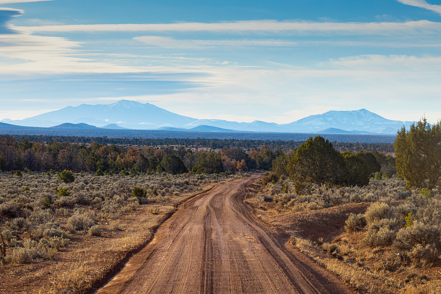
From State Route 64 south of Tusayan, head east on Forest Road 305, a well-maintained dirt route. Almost immediately, you’ll see a small stone structure on the left side of the road. More on that in a minute. For now, continue east as the road rolls through a landscape of piñon pines and junipers. On the right is Red Butte, a sombrero-shaped mountain that rises from the generally flat landscape of the Coconino Plateau.
At the intersection at Mile 1.8, continue ahead to take Forest Road 305A. Immediately after that, bear right onto Forest Road 2726, which isn’t well marked — look for a stock tank and an old corral.
This rutted, rocky side road leads a half-mile to the Red Butte Aerodrome, the Canyon’s first significant airport facility.
In 1925, pioneering Canyon photographer Emery Kolb built a rudimentary airstrip just outside the park boundary, but it failed to attract air traffic. Two years later, Scenic Airways won approval to build this airport, and when completed, the site featured a hangar, two unpaved airstrips, a lodge and cabins. Charles Lindbergh landed at the airport in 1928, and Amelia Earhart did the same in 1935. After Scenic fell victim to the Great Depression, other entities, including Grand Canyon Airlines, offered sightseeing flights at the airport for decades. It became obsolete when Grand Canyon National Park Airport opened in Tusayan in 1965.
Today, the Red Butte Aerodrome is listed on the National Register of Historic Places, and it features the decaying hangar, the airstrips, a cistern and a barn added when the site was part of the Ten-X Ranch. Just north of the hangar are a bungalow-style duplex and a root cellar — the lodge burned down in the 1990s. And the stone structure you passed earlier once displayed the airport’s entrance sign. Please observe all “No Trespassing” signs on buildings.
When you’re done exploring the site, backtrack to the first intersection and bear left to take FR 305 south; a half-mile later, bear left again to stay on FR 305, which alternates between piñon-juniper stands and sagebrush-carpeted meadows. Around Mile 5, you’ll get an excellent view of the San Francisco Peaks to the southeast, and that panorama later expands to include Sunset Crater on the left and Kendrick Peak on the right.
At Mile 6.9, continue forward at yet another intersection to take Forest Road 320, which passes Red Butte’s south face and offers a look at the exposed sandstone near the summit. The butte is a remnant of overlying rock layers that once covered this plateau, from 240 million-year-old Moenkopi Formation at the base to a 9 million-year-old basalt lava cap at the top. After you turn right onto Forest Road 340 at Mile 9.3, you’ll pass a side road that leads to the Red Butte Trailhead, where you can hike a short, relatively steep trail to the lookout tower at the summit.
Continue on FR 340 to complete the loop back at FR 305, then take that road back to SR 64, on which you can fly south to Williams or north to the Canyon. Metaphorically speaking.
tour guide
Note: Mileages are approximate.
Length: 14.2-mile loop (from State Route 64)
Directions: From Tusayan, go south on State Route 64 for 9 miles to Forest Road 305. Turn left (east) onto FR 305 and continue 1.8 miles to a “T” intersection. Stay straight, onto Forest Road 305A, and continue 0.1 miles to a “Y” intersection. Bear right, onto Forest Road 2726, and continue 0.5 miles to the Red Butte Aerodrome. Backtrack 0.6 miles to the first intersection, then bear left onto FR 305 and continue 0.5 miles to another “Y” intersection. Bear left to stay on FR 305 and continue 3.6 miles to yet another intersection. Stay straight, onto Forest Road 320, and continue 2.4 miles to Forest Road 340. Turn right onto FR 340 and continue 2.5 miles back to FR 305. Stay straight onto FR 305 and continue 2.2 miles back to SR 64.
Vehicle requirements: A high-clearance vehicle, such as an SUV or truck, is recommended, but four-wheel-drive is not necessary in good weather.
Warning: Back-road travel can be hazardous, so be aware of weather and road conditions. Carry plenty of water. Don’t travel alone, and let someone know where you are going and when you plan to return.
Information: Tusayan Ranger District, 928-638-2443 or fs.usda.gov/kaibab
Travelers in Arizona can visit az511.gov or dial 511 to get information on road closures, construction, delays, weather and more.