
When you start this drive amid a thick forest of ponderosa pines, you’ll find it hard to believe that you’ll soon be peering into one of Arizona’s largest canyons. But Sycamore Canyon, despite its size, has a way of surprising you. Although a wildfire raged in the canyon this summer, the view from Sycamore Point is as spectacular as ever — and there’s plenty to enjoy along the way.
From Interstate 40 east of Williams, head south on Garland Prairie Road, which offers a view of Bill Williams Mountain to the southwest. Past a set of train tracks, bear left at a “Y” intersection to stay on Garland Prairie Road, which parallels the tracks as it passes tall ponderosas on both sides of the road. At Mile 3.8, you’ll come to another “Y” and bear left again to stay on what now is Forest Road 141.
Just past that intersection, the road traverses McDougal Flat, a ponderosa-lined clearing with an excellent view of the San Francisco Peaks to the northeast, before heading back into the forest. A few miles later, turn right onto Forest Road 109, a gravel route that’s slightly rougher than the wide dirt path you’ve been following.
Past a few more meadows and many more ponderosas, you’ll reach a pair of trailheads for the Sycamore Rim Trail, an 11-mile loop created in the 1970s so hikers could explore this area’s unique combination of streams, cliffs and deep canyons. The second trailhead, at Mile 11.3, is near Sycamore Falls, a seasonal waterfall that’s popular with rock climbers and Instagrammers. And a quarter-mile farther, on the right, is the road to Sunflower Flat Wildlife Area — a 160-acre marsh, managed by the Arizona Game and Fish Department, that attracts elk and numerous migratory bird species.
White Horse Lake, an idyllic reservoir known for its camping, fishing and hiking opportunities, is the next stop, at Mile 13. A half-mile later, turn left onto Forest Road 12. Another lovely meadow is on the left side of this road, just past a row of pines; then, as the road narrows and begins to descend, pines and oaks close in. At Mile 18.4, you’ll make the last turn of this trip, a left onto Forest Road 110.
This final road gets rougher and narrower as it navigates the plateau leading to Sycamore Point. Alligator junipers begin to replace the pines, and by Mile 21, you’ll be in a verdant grassland dotted with piñon pines, junipers and agaves. Savor it by slowing down and keeping an eye out for ruts — there’s a real doozy at Mile 21.5. This road is a popular bike route as well, so be sure to share it with any cyclists you encounter.
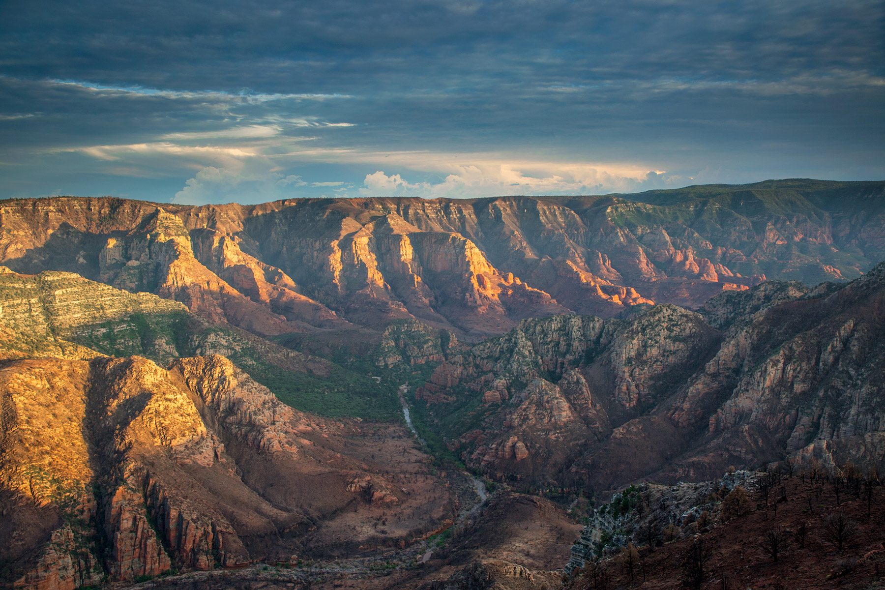
At Mile 23, the road splits and forms a loop; bear right and continue a quarter-mile to the Sycamore Point parking area. From here, steep cliffs lead into the enormous Sycamore Canyon, and you’ll see the aftermath of the Rafael Fire, which burned 78,000 acres in and around the canyon in June and July. But the burn doesn’t detract from the view, which includes the Peaks to the north, Mingus Mountain to the south and still-verdant sections at the bottom of the canyon. It’s enough to make you linger — and wonder what other surprises you’ll encounter on your way back to civilization.
Note: Mileages are approximate.
Length: 23.2 miles one way (from Interstate 40)
Directions: From Williams, go east on Interstate 40 for 1.6 miles to Garland Prairie Road (Exit 167). Turn right (south) onto Garland Prairie Road, which turns into Forest Road 141, and continue 7.9 miles to Forest Road 109. Turn right onto FR 109 and continue 5.6 miles to Forest Road 12. Turn left onto FR 12 (follow the sign for Sycamore Point) and continue 4.9 miles to Forest Road 110. Turn left onto FR 110 and continue 4.8 miles to Sycamore Point.
Vehicle requirements: A high-clearance vehicle, such as an SUV or truck, is required, but four-wheel-drive is not necessary in good weather.
Warning: Back-road travel can be hazardous, so be aware of weather and road conditions. Carry plenty of water. Don’t travel alone, and let someone know where you are going and when you plan to return.
Information: Williams Ranger District, 928-635-5600 or fs.usda.gov/kaibab; Chino Valley Ranger District, 928-443-8000 or fs.usda.gov/prescott